States of Venezuela
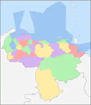
The Bolivarian Republic of Venezuela is a federation made up of twenty-three states (Spanish: estados), a Capital District (Spanish: Distrito Capital) and the Federal Dependencies (Spanish: Dependencias Federales), which consist of many islands and islets in the Caribbean Sea.[1] Venezuela also claims the Guayana Esequiba territory which comprises six districts in the independent nation of Guyana.
| States, Federal Dependencies and Capital District Estados, Dependencias Federales y Distrito Capital (Spanish) | |
|---|---|
 | |
| Category | Federated state |
| Location | Bolivarian Republic of Venezuela |
| Number |
|
| Populations | 146,480 (Amazonas) – 3,704,404 (Zulia) |
| Areas | 1,100 km2 (440 sq mi) (Nueva Esparta) – 240,000 km2 (92,000 sq mi) (Bolívar) |
| Government | |
| Subdivisions |
|
 |
|---|
|
|
The states and territories of Venezuela are usually organized into regions (Spanish: regiones), although these regions are mostly geographical entities rather than administrative entities.
Historical states
Prior to the Federal War (1859–1863), the country was divided into provinces rather than states (see Provinces of Venezuela). The victorious forces were supposed to grant more autonomy to the individual states, but this was not implemented.
From 1863 to the early 1900s there were numerous territorial changes, including the merger and splitting of states, but from then until the 1990s the states were left unchanged. States that existed during this time included Guzmán Blanco State (1873–1889). Originally a renamed Aragua State, in 1881 the states of Miranda, Guárico, Nueva Esparta and the Vargas department of the Federal District were merged into the state. This was part of a territorial reorganisation reducing the number of states from 20 to 9, which was reversed in 1901.
The 1990s saw the creation of three new states: Delta Amacuro (1991), Amazonas (1994), and Vargas (1998).
Regions
Venezuela's territory is generally divided into nine geographical regions, which are mostly used for geographical, cultural and planning purposes but do not have active administrative bodies.
| Region | Spanish | States |
|---|---|---|
| Andean | Andina | Mérida, Táchira, Trujillo |
| Capital | Capital | Caracas (Capital District), La Guaira (Vargas), Miranda |
| Central | Centro | Aragua, Carabobo |
| Central-Western | Centro-Occidente | Falcón, Lara, Yaracuy |
| Guayana | Guayana | Amazonas, Bolívar, Delta Amacuro |
| Insular | Insular | Nueva Esparta, Federal Dependencies |
| Los Llanos | Los Llanos | Apure, Barinas, Cojedes, Guárico, Portuguesa |
| Eastern | Oriental | Anzoátegui, Monagas, Sucre |
| Zulian | Zulia | Zulia |
States
Below is a list of the 23 states of Venezuela. The states are listed along with their correspondent emblems, data and location.
| Flag | State | Capital | Largest city | Population
(2020)[2] |
Population (2011) |
Area (km2) |
Density per km2 (2020) | Density per km2 (2011) | Region | Map |
|---|---|---|---|---|---|---|---|---|---|---|
| Amazonas | Puerto Ayacucho | 180,000 | 146,480 | 180,145 | 0.99 | 0.81 | Guayana |  | ||
| Anzoátegui | Barcelona | 1,550,000 | 1,469,747 | 43,300 | 35.79 | 33.94 | Eastern |  | ||
| Apure | San Fernando de Apure | 560,000 | 459,025 | 76,500 | 7.32 | 6.00 | Llanos |  | ||
| Aragua | Maracay | 1,630,000 | 1,630,308 | 7,014 | 232.39 | 232.44 | Central |  | ||
| Barinas | Barinas | 820,000 | 816,264 | 35,200 | 23.29 | 23.19 | Andean |  | ||
| Bolívar | Ciudad Bolívar | Ciudad Guayana | 1,720,000 | 1,410,964 | 238,000 | 7.22 | 5.93 | Guayana |  | |
| Carabobo | Valencia | 2,220,000 | 2,245,744 | 4,650 | 477.41 | 482.96 | Central |  | ||
| Cojedes | San Carlos | 330,000 | 323,165 | 14,800 | 22.29 | 21.84 | Central | 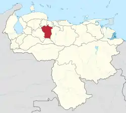 | ||
| Delta Amacuro | Tucupita | 190,000 | 167,676 | 40,200 | 4.72 | 4.17 | Guayana | 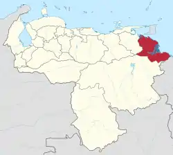 | ||
| Falcón | Coro | Punto Fijo | 980,000 | 902,847 | 24,800 | 39.51 | 36.41 | Central-Western | 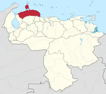 | |
| Guárico | San Juan de los Morros | Calabozo | 820,000 | 747,739 | 64,986 | 12.61 | 11.51 | Llanos | 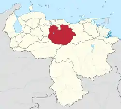 | |
| Lara | Barquisimeto | 1,850,000 | 1,774,867 | 19,800 | 93.43 | 89.64 | Central-Western |  | ||
| Mérida | Mérida | 870,000 | 828,592 | 11,300 | 76.99 | 73.33 | Andean | 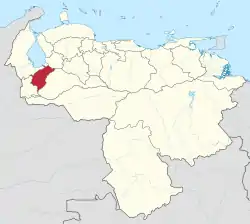 | ||
| Miranda | Los Teques | 2,940,000 | 2,675,165 | 7,950 | 369.81 | 336.50 | Capital | 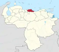 | ||
| Monagas | Maturín | 920,000 | 905,443 | 28,930 | 31.80 | 31.30 | Eastern | 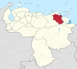 | ||
| Nueva Esparta | La Asunción | Porlamar | 570,000 | 491,610 | 1,150 | 495.65 | 427.90 | Insular | 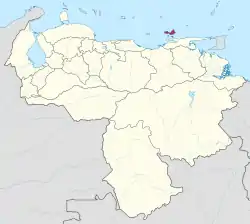 | |
| Portuguesa | Guanare | 920,000 | 876,496 | 15,200 | 60.52 | 57.66 | Central-Western | 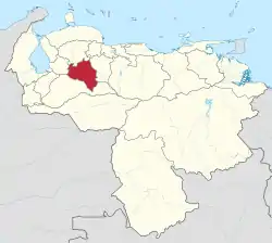 | ||
| Sucre | Cumaná | 980,000 | 896,291 | 11,800 | 83.05 | 75.96 | Eastern | 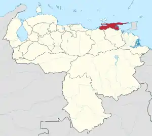 | ||
| Táchira | San Cristóbal | 1,020,000 | 1,168,908 | 11,100 | 91.89 | 105.31 | Andean | 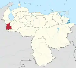 | ||
| Trujillo | Trujillo | Valera | 760,000 | 686,367 | 7,400 | 102.70 | 92.75 | Andean |  | |
| La Guaira | La Guaira | Catia La Mar | 340,000 | 352,920 | 1,496 | 227.27 | 235.91 | Capital | 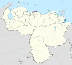 | |
| Yaracuy | San Felipe | 660,000 | 600,852 | 7,100 | 92.95 | 84.63 | Central-Western | 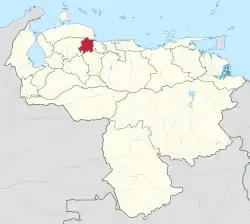 | ||
| Zulia | Maracaibo | 3,800,000 | 3,704,404 | 63,100 | 60.22 | 58.71 | Zulian | 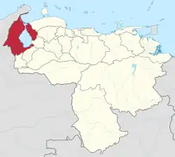 | ||
By Human Development Index
| Rank | State | HDI (2021)[3] | |||||||
|---|---|---|---|---|---|---|---|---|---|
| High human development | |||||||||
| 1 | 0.737 | ||||||||
| 2 | 0.724 | ||||||||
| 3 | 0.718 | ||||||||
| 4 | 0.713 | ||||||||
| 5 | 0.712 | ||||||||
| 7 | 0.703 | ||||||||
| Medium human development | |||||||||
| 8 | 0.695 | ||||||||
| – | 0.691 | ||||||||
| 9 | 0.689 | ||||||||
| 10 | 0.682 | ||||||||
| 11 | 0.681 | ||||||||
| 12 | 0.679 | ||||||||
| 13 | 0.677 | ||||||||
| 14 | 0.676 | ||||||||
| 15 | 0.672 | ||||||||
| 16 | 0.671 | ||||||||
| 17 | 0.668 | ||||||||
| 18 | 0.660 | ||||||||
| 20 | 0.657 | ||||||||
| 21 | 0.653 | ||||||||
| 22 | 0.638 | ||||||||
| 23 | 0.637 | ||||||||
| 24 | 0.619 | ||||||||
Special status areas
| Flag | State | Capital | Population (2011) |
Area (km2) |
Region | Map |
|---|---|---|---|---|---|---|
| Capital District | Caracas | 1,943,901 | 433 | Capital | .svg.png.webp) | |
| Federal Dependencies | Los Roques | 2,155 | 342 | Insular | .svg.png.webp) |
State name etymologies
Several states are named for historical figures:
- Anzoátegui for José Antonio Anzoátegui
- Bolívar for Simón Bolívar
- Falcón for Juan Crisóstomo Falcón
- Lara for Jacinto Lara
- Miranda for Francisco de Miranda
- Monagas for José Tadeo Monagas and José Gregorio Monagas
- Sucre for Antonio José de Sucre
- Vargas for José María Vargas
Several states are named for natural features:
- Amazonas is named for the Amazon rainforest
- Apure is named for the Apure River
- Aragua for the Aragua River
- Cojedes for the Cojedes River
- Delta Amacuro for the river delta of the Orinoco River, and for the Amacuro River
- Guárico for the Guárico River
- Portuguesa for the Portuguesa River
- Táchira for the Táchira River
- Yaracuy for the Yaracuy River
Other naming origins:
- Barinas, named after the indigenous ethnic group in the area [4]
- Carabobo, named for an ethnic village
- Caracas, named for the Caracas indigenous group
- Mérida, for the capital city, Mérida, itself named for Mérida in Spain
- Nueva Esparta ("New Sparta") is named for the heroism shown by its inhabitants during the Venezuelan War of Independence, deemed similar to that of the Spartan soldiers of Ancient Greece.
- Trujillo, for the capital city, Trujillo, itself named for Trujillo in Spain
- Zulia's name stems from a vocal transliteration from the Chibcha language, the name they called an exotic blue-flowered plant known as "Edging Lobelia" (Lobelia erinus); also for the Zulia River.
See also
References
- "List of States in Venezuela with Latitude and Longitude - States in Venezuela with Latitude Longitude, Popular Places in Venezuela with Lat Long, List of States in Venezuela with Latitude and Longitude, Latitude and Longitude of State Capitals of Venezuela, State wise Latitude and Longitude of Venezuela States - distancelatlong.com". www.distancelatlong.com. Retrieved 2021-12-14.
- "Population in Venezuela by state 2020". Statista. Retrieved 2022-11-16.
- "Sub-national HDI - Area Database - Global Data Lab". hdi.globaldatalab.org. Retrieved 2021-07-28.
- Simón, Pedro (1992). Noticias historiales de Venezuela. Caracas, Venezuela: Biblioteca Ayacucho. p. 128. ISBN 980-276-210-5.
Bibliography
- Some information was retrieved from the Venezuelan National Institute of Statistics.
External links
| Capital District | ||
|---|---|---|
| States | ||
| Federal Dependencies | ||
| Regions | ||
| Claimed | ||
| Related topics | ||