List of waterfalls in West Virginia
There are about 275 waterfalls in the U.S. state of West Virginia.

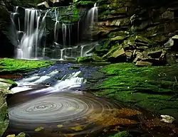
Blackwater Falls in Tucker County
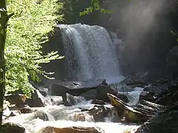
Falls of Hills Creek (Lower) in Pocahontas County
Cathedral Falls in Fayette County.
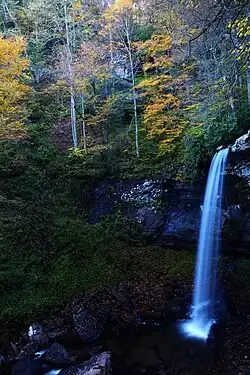
Elakala Falls in Tucker County
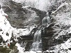
Douglas Falls in Tucker County
Surface waterfalls
| Name | Height | Coordinates | USGS Map | GNIS ID |
|---|---|---|---|---|
| Black Fork Falls | 20 ft (6.1 m) | ????? | ????? | ????? |
| Blackwater Falls | 57 to 63 ft (17 to 19 m) | 39.113889°N 79.483333°W | Blackwater Falls | 1550380 |
| Brush Creek Falls | 25 ft (7.6 m) | ????? | ????? | ????? |
| Cathedral Falls | 60 ft (18 m) | 38.15444 N 81.1788 W | ????? | ????? |
| Douglas Falls | 35 ft (11 m) | ????? | ????? | ????? |
| Elakala Falls (3rd fall) | 40 ft (12 m) | ????? | ????? | ????? |
| Falling Spring Run Falls | 40 ft (12 m) | ????? | ????? | ????? |
| High Falls of Cheat | 15 to 18 ft (4.6 to 5.5 m) | 38.772500°N 79.777222°W | Beverly East | 1551426 |
| Jordan Run Falls | 25 to 30 ft (7.6 to 9.1 m) | 38.994131°N 79.266189°W | Hopeville | 1551612 |
| Kanawha Falls | 15 to 21 ft (4.6 to 6.4 m) | 38.151111°N 81.212222°W | Gauley Bridge | 1556129 |
| Hills Creek Falls (Lower) | 63 to 65 ft (19 to 20 m) | 38.173611°N 80.335000°W | Lobelia | 1551095 |
| Mill Creek Falls | 20 ft (6.1 m) | ????? | ????? | ????? |
| Pendleton Falls | 20 ft (6.1 m) [fall] 150 ft (46 m) [cascade] | ????? | ????? | ????? |
| Pipestem Falls | 15 ft (4.6 m) | ????? | ????? | ????? |
| Sandstone Falls | 15 to 25 ft (4.6 to 7.6 m) | ????? | ????? | ????? |
| Valley Falls | 20 ft (6.1 m) | 39.386735°N 80.087832°W | ????? | ????? |
| Wonder Falls | 15 ft (4.6 m) | 39.496331°N 79.644476°W | ????? | ????? |
Underground waterfalls
Many of the state's subterranean waterfalls far exceed the surface falls in height.
| Name | Height | Coordinates | USGS Map | GNIS ID |
|---|---|---|---|---|
| Suicide Falls (Cass Cave)[1][2] | 139 ft (42 m) | ????? | ????? | ????? |
| Monster Falls (Friars Hole Cave)[3] | 103 to 105 ft (31 to 32 m) | ????? | ????? | ????? |
See also
References
Citations
- Dasher, George R., Editor (2000), The Caves of East-Central West Virginia: The Guidebook of the National Speleological Society's 2000 Convention; West Virginia Speleological Survey, Bulletin #14, pg 171.
- Mohr, Charles E. (1964), “Exploring America Underground”, National Geographic Magazine; Vol. 125, No. 6 (June issue), pp 803–837. (Includes photo [2-page spread] of the falls).
- Dasher, Op. cit., pg 169.
Further reading
- Adams, Kevin (2002), Waterfalls of Virginia and West Virginia: A Hiking and Photography Guide; Menasha Ridge Press.
- Rehbein, Ed and Randall Sanger (2011), West Virginia Waterfalls: The New River Gorge; Terra Alta, West Virginia: Headline Books, Inc. [Photographs]
- Hartigan, Rick (2017), West Virginia Waterfalls, Nature Trek Publishing, LLC, [Directory with directions, GPS, maps, & photographs]
External links
- West Virginia WaterFalls (Map) @ Great Lakes Waterfalls & Beyond
- West Virginia Waterfalls (Map) @ West Virginia Waterfalls website. http://wvwaterfalls.com/
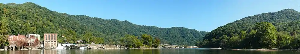
Kanawha Falls on the Kanawha River at Glen Ferris, West Virginia.
This article is issued from Wikipedia. The text is licensed under Creative Commons - Attribution - Sharealike. Additional terms may apply for the media files.