Long Prairie, Minnesota
Long Prairie is a town in Todd County, Minnesota, United States. The population was 3,458 at the 2010 census.[5] By the 2020 Decennial Census the population had grown to 3,661.[6] It is the county seat.[7] and the oldest town in the County.

City of Long Prairie | |
|---|---|
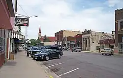 Central Avenue in downtown Long Prairie in 2007 | |
| Motto: "Expanding Our Horizons" | |
 | |
| Coordinates: 45°58′29″N 94°51′56″W | |
| Country | United States |
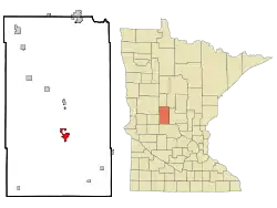
| State | Minnesota |
| County | Todd |
| Government | |
| • Mayor | Jodi Dixon[1] |
| Area | |
| • Total | 2.82 sq mi (7.31 km2) |
| • Land | 2.75 sq mi (7.11 km2) |
| • Water | 0.08 sq mi (0.20 km2) |
| Elevation | 1,303 ft (397 m) |
| Population (2020) | |
| • Total | 3,661 |
| • Density | 1,333.21/sq mi (514.71/km2) |
| Time zone | UTC−6 (CST) |
| • Summer (DST) | UTC−5 (CDT) |
| ZIP code | 56347 |
| Area code | 320 |
| FIPS code | 27-38060[4] |
| GNIS feature ID | 2395758[3] |
| Website | www.longprairie.net |
History

Long Prairie's history dates back to the time when the land was inhabited first by the Sioux/Dakota and then Anishinaabe/ Ojibwe Native American tribes. In 1845, the U.S. government selected the location known as Long Prairie as a site for a USA Indian agency.[8] An 1846 treaty with the Winnebago briefly resettled the nation in what is now Long Prairie, from the Neutral Ground in northeast Iowa to which they had been removed in the 1830s as white settlers colonized their ancestral lands in Wisconsin and Illinois.[9][10] A subsequent treaty in 1855 again resettled the Hochunk in southern Minnesota.[11]
Long Prairie was platted in 1867, and named after the Long Prairie River.[12] There is a United State Geological Survey stream flow monitoring gauge in the river in Long Prairie.[13]


Geography
According to the United States Census Bureau, the city has a total area of 2.67 square miles (6.92 km2); 2.61 square miles (6.76 km2) is land and 0.06 square miles (0.16 km2) is water.[14] The Long Prairie River, flowing North, goes through the city. Lake Charlotte borders it on the South[15] Venewitz Creek flows from Lake Charlotte and joins the Long Prairie River in the town. Long Prairie is located in the North Central Hardwood Forest Region of Central Minnesota.[16]
U.S. Highway 71 and Minnesota State Highways 27 and 287 are three of the main routes in the city. Todd County Roads 5 and 38 originate in the town.
Long Prairie has a warm-summer humid continental climate (Koppen Dfb) with cold winters and generally warm summers.
Government
Jodi Dixon is the town's mayor as of 2023. The mayor serves a two year term. City Council members serve a four year term and are David Wright, Lilah Gripne, Jim Kreemer, and Clint Kreuger. The town's Administrator is Ted Grey.[17] Long Prairie is in Minnesota Senate District 11 and Minnesota House of Representatives District 11B. It is in US Congressional District 7. The town is in Todd County Commissioner District 3 which also includes Long Prairie and Reynolds townships.[18]
Parks
Long Prairie's park system is overseen by a 7-member park board. Meetings are held the first Monday of each month at 6:00 p.m. at City Hall.The following is a listing of the city parks:
Soldier's Field - lighted softball field and outdoor skating rink
Westside Park - playground & lighted soccer field
Locke Park - playground and oak grove
Water Tower Hill – scenic view of downtown and the fairgrounds and winter sledding
Lake Charlotte Park - swimming beach, volleyball, basketball court, softball field, picnic shelters, mosaic and mural on beach house, playground area and disc golf course
Harmony Park – walking paths, three mosaic art projects, soccer field and in winter, weather permitting, ice skating on the pond.
Riverside Park –historical walk with WPA ruins, paths, river access for fishing and bird watching.[19]
Industry and media
Long Prairie is a food processing center with major food processing employers such as Dan's Prize, Long Prairie Packing, Minnesota Fresh, and Day Break Foods operating plants in the town.[20] The Long Prairie Leader, which publishes a monthly Spanish publication, is the weekly newspaper.[21] KEYL/KXDL operates an AM and FM radio station in Long Prairie and the surrounding area.[22]
UFO Sighting
On October 23, 1965 James Townsend, a reporter for KEYL radio, had a close encounter with a UFO and three “creatures” about 7:15 p.m. Townsend's sighting took place on a blacktop road about four miles east of Long Prairie, as he was driving his 1956 model car around a curve in the road. He said that as he came around the curve, he saw an upright, rocket-like object straddling the road. It was about 30 or 40 feet high and about 10 feet in diameter, “and seemed to be resting on legs or fins,” he said. “My car engine stalled, the lights and radio went out, and I slammed on my brakes. I stopped about 20 feet in front of it."[23]
| Climate data for Long Prairie, Minnesota 1981-2010 normals | |||||||||||||
|---|---|---|---|---|---|---|---|---|---|---|---|---|---|
| Month | Jan | Feb | Mar | Apr | May | Jun | Jul | Aug | Sep | Oct | Nov | Dec | Year |
| Record high °F (°C) | 57 (14) |
59 (15) |
83 (28) |
95 (35) |
96 (36) |
101 (38) |
105 (41) |
104 (40) |
100 (38) |
90 (32) |
76 (24) |
71 (22) |
102 (39) |
| Average high °F (°C) | 18.2 (−7.7) |
24.2 (−4.3) |
36.2 (2.3) |
53.8 (12.1) |
66.4 (19.1) |
75.6 (24.2) |
80.3 (26.8) |
78.2 (25.7) |
68.4 (20.2) |
54.5 (12.5) |
36.8 (2.7) |
21.4 (−5.9) |
51.2 (10.6) |
| Daily mean °F (°C) | 9.0 (−12.8) |
14.2 (−9.9) |
26.4 (−3.1) |
41.8 (5.4) |
54.4 (12.4) |
64.8 (18.2) |
69.1 (20.6) |
66.9 (19.4) |
57.1 (13.9) |
44.2 (6.8) |
28.6 (−1.9) |
13.5 (−10.3) |
40.8 (4.9) |
| Average low °F (°C) | −0.3 (−17.9) |
4.3 (−15.4) |
16.6 (−8.6) |
29.8 (−1.2) |
42.5 (5.8) |
54.1 (12.3) |
57.9 (14.4) |
55.6 (13.1) |
45.9 (7.7) |
33.8 (1.0) |
20.4 (−6.4) |
5.7 (−14.6) |
28 (−2) |
| Record low °F (°C) | −45 (−43) |
−44 (−42) |
−37 (−38) |
−7 (−22) |
14 (−10) |
29 (−2) |
35 (2) |
28 (−2) |
16 (−9) |
3 (−16) |
−32 (−36) |
−39 (−39) |
−45 (−43) |
| Average precipitation inches (mm) | 1.06 (27) |
0.94 (24) |
1.85 (47) |
2.69 (68) |
3.12 (79) |
4.57 (116) |
3.93 (100) |
3.23 (82) |
3.48 (88) |
2.89 (73) |
1.59 (40) |
0.99 (25) |
30.34 (769) |
| Source: w2.weather.gov/climate/xmacis.php?wfo=mpx | |||||||||||||
Demographics
| Census | Pop. | Note | %± |
|---|---|---|---|
| 1880 | 220 | — | |
| 1900 | 1,885 | — | |
| 1910 | 1,250 | −33.7% | |
| 1920 | 1,346 | 7.7% | |
| 1930 | 1,854 | 37.7% | |
| 1940 | 2,311 | 24.6% | |
| 1950 | 2,443 | 5.7% | |
| 1960 | 2,414 | −1.2% | |
| 1970 | 2,416 | 0.1% | |
| 1980 | 2,859 | 18.3% | |
| 1990 | 2,786 | −2.6% | |
| 2000 | 3,040 | 9.1% | |
| 2010 | 3,458 | 13.8% | |
| 2020 | 3,661 | 5.9% | |
| U.S. Decennial Census | |||
2010 census
As of the census[24] of 2010, there were 3,458 people, 1,290 households, and 816 families living in the city. The population density was 1,324.9 inhabitants per square mile (511.5/km2). There were 1,391 housing units at an average density of 533.0 per square mile (205.8/km2). The racial makeup of the city was 81.8% White, 1.0% African American, 0.6% Native American, 0.6% Asian, 1.2% Pacific Islander, 12.7% from other races, and 2.1% from two or more races. Hispanic or Latino of any race were 29.9% of the population. As of October 2021, 57% of Long Prairie-Grey Eagle students identified as Hispanic or Latino.[25]
There were 1,290 households, of which 33.6% had children under the age of 18 living with them, 48.7% were married couples living together, 9.8% had a female householder with no husband present, 4.8% had a male householder with no wife present, and 36.7% were non-families. 32.7% of all households were made up of individuals, and 18.1% had someone living alone who was 65 years of age or older. The average household size was 2.58 and the average family size was 3.29.
The median age in the city was 34.1 years. 27.8% of residents were under the age of 18; 9.6% were between the ages of 18 and 24; 24.2% were from 25 to 44; 20.3% were from 45 to 64; and 18% were 65 years of age or older. The gender makeup of the city was 48.4% male and 51.6% female.
2000 census
At the 2000 census,[4] there were 3,040 people, 1,229 households and 769 families living in the city. The population density was 1,285.2 inhabitants per square mile (496.2/km2). There were 1,334 housing units at an average density of 564.0 per square mile (217.8/km2). The racial makeup of the city was 93.06% White, 0.07% African American, 1.74% Native American, 0.10% Asian, 0.03% Pacific Islander, 4.28% from other races, and 0.72% from two or more races. Hispanic or Latino of any race were 9.38% of the population.
There were 1,229 households, of which 29.6% had children under the age of 18 living with them, 48.6% were married couples living together, 9.8% had a female householder with no husband present, and 37.4% were non-families. 33.2% of all households were made up of individuals, and 19.1% had someone living alone who was 65 years of age or older. The average household size was about 2.36 and the average family size was 3.01.
25.4% of residents were under the age of 18, 9.2% from 18 to 24, 24.5% from 25 to 44, 19.8% from 45 to 64, and 21.2% who were 65 years of age or older. The median age was 38 years. For every 100 females, there were 88.0 males. For every 100 females age 18 and over, there were 85.1 males.
The median household income was $28,237, and the median family income was $35,699. Males had a median income of $31,359 versus $20,152 for females. The per capita income for the city was $14,386. About 13.8% of families and 16.4% of the population were below the poverty line, including 23.1% of those under age 18 and 13.5% of those age 65 or over.
Notable people
- Tom Barnard, former host of the KQRS Morning Show, and voiceover artist. Born in Long Prairie.
- Barry Bennett, former NFL defensive lineman
- Charles P. Davis, United States Army soldier awarded the Medal of Honor for actions during the Philippine–American War
- Jodi Huisentruit, television news anchor in Iowa who disappeared in 1995 and was later declared dead
- Jacob Wetterling, Eleven-year-old boy abducted and murdered on October 22, 1989. Born in Long Prairie.
References
- "City Officials". Long Prairie, MN. City of Long Prairie, MN. Retrieved June 6, 2021.
- "2020 U.S. Gazetteer Files". United States Census Bureau. Retrieved July 24, 2022.
- U.S. Geological Survey Geographic Names Information System: Long Prairie, Minnesota
- "American FactFinder". United States Census Bureau. Archived from the original on February 12, 2020. Retrieved January 31, 2008.
- "2010 Census Redistricting Data (Public Law 94-171) Summary File". American FactFinder. U.S. Census Bureau, 2010 Census. Retrieved April 23, 2011.
- Bureau, US Census. "Minnesota's Population at 5,706,494 in 2020, Up 7.6% Since 2010". Census.gov. Retrieved July 17, 2023.
- "Find a County". National Association of Counties. Retrieved June 7, 2011.
- "Ho-Chunk timeline". Ho-Chunk Nation, Wisconsin. Archived from the original on November 11, 2013. Retrieved August 28, 2012.
- "Ho-Chunk and Long Prairie, 1846–1855 | MNopedia". www.mnopedia.org. Retrieved June 13, 2020.
- "Treaty with The Winnebago - 1846". www.firstpeople.us. Retrieved June 13, 2020.
- "Treaty with The Winnebago - 1855". www.firstpeople.us. Retrieved June 13, 2020.
- Upham, Warren (1920). Minnesota Geographic Names: Their Origin and Historic Significance. Minnesota Historical Society. p. 545.
- "USGS WaterWatch -- Streamflow conditions". waterwatch.usgs.gov. Retrieved October 1, 2023.
- "US Gazetteer files 2010". United States Census Bureau. Archived from the original on February 20, 2011. Retrieved November 13, 2012.
- Minnesota Atlas & Gazetteer. Yarmouth, Me.: DeLorme. 1994. p. 45. ISBN 0-89933-222-6.
- Sandy, John H. (2022). "Long Prairie River Region: Natural Environment and Land Use". Red River Nature Research Institute. Retrieved May 16, 2023.
- www.goldenshovelagency.com, -Golden Shovel Agency. "Long Prairie City Officials". www.longprairie.net. Retrieved September 9, 2023.
- "Todd County Minnesota". Todd County Minnesota. Retrieved September 23, 2023.
- www.goldenshovelagency.com, -Golden Shovel Agency. "Long Prairie, MN Parks and Recreation". www.longprairie.net. Retrieved October 22, 2023.
- www.goldenshovelagency.com, -Golden Shovel Agency. "Long Prairie, MN: Leading Employers". www.longprairie.net. Retrieved September 17, 2023.
- "Long Prairie Leader". lpleader.com. Retrieved October 15, 2023.
- "KXDL/KEYL - Hot Rod Radio and Hometown Radio - Long Prairie, MN". www.kxdlhotrodradio.com. Retrieved October 15, 2023.
- Johnmooner-chief (January 22, 2023). "Alien Creature Close Encounter In Minnesota". Medium. Retrieved October 22, 2023.
- "American FactFinder". United States Census Bureau. Archived from the original on February 12, 2020. Retrieved November 13, 2012.
- King, Tim (June 10, 2022). "Blue America, Red America is not always what you think | Opinion". Minnesota Reformer. Retrieved July 29, 2023.
External links
- City Website
- Long Prairie – Visitor Information site
- Long Prairie / Grey Eagle Schools site
- Prairie Fest Community Festival
- Feshir, Reham, In Long Prairie, immigrants helped avert town's decline. MRP News, November 15, 2015
Municipalities and communities of Todd County, Minnesota, United States | ||
|---|---|---|
| Cities | 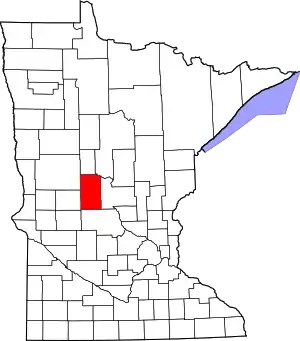 Map of Minnesota highlighting Todd County | |
| Townships | ||
| Unincorporated communities | ||
| Footnotes | ‡This populated place also has portions in an adjacent county or counties | |