Märkische Höhe
Märkische Höhe is a municipality in the district Märkisch-Oderland, in Brandenburg, Germany.
Märkische Höhe | |
|---|---|
 Church | |
Location of Märkische Höhe within Märkisch-Oderland district 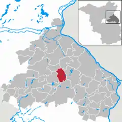 | |
 Märkische Höhe 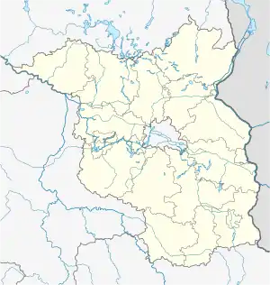 Märkische Höhe | |
| Coordinates: 52°37′30″N 14°07′30″E | |
| Country | Germany |
| State | Brandenburg |
| District | Märkisch-Oderland |
| Municipal assoc. | Märkische Schweiz |
| Subdivisions | 3 Ortsteile |
| Government | |
| • Mayor (2019–24) | Stefan Neumann[1] |
| Area | |
| • Total | 34.27 km2 (13.23 sq mi) |
| Elevation | 46 m (151 ft) |
| Population (2021-12-31)[2] | |
| • Total | 606 |
| • Density | 18/km2 (46/sq mi) |
| Time zone | UTC+01:00 (CET) |
| • Summer (DST) | UTC+02:00 (CEST) |
| Postal codes | 15377 |
| Dialling codes | 033437 |
| Vehicle registration | MOL |
Demography
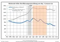
Development of population since 1875 within the current boundaries (Blue line: Population; Dotted line: Comparison to population development of Brandenburg state; Grey background: Time of Nazi rule; Red background: Time of communist rule)
|
|
References
- Landkreis Märkisch-Oderland Wahl der Bürgermeisterin / des Bürgermeisters, accessed 1 July 2021.
- "Bevölkerungsentwicklung und Flächen der kreisfreien Städte, Landkreise und Gemeinden im Land Brandenburg 2021" (PDF). Amt für Statistik Berlin-Brandenburg (in German). June 2022.
- Detailed data sources are to be found in the Wikimedia Commons.Population Projection Brandenburg at Wikimedia Commons
External links
![]() Media related to Märkische Höhe at Wikimedia Commons
Media related to Märkische Höhe at Wikimedia Commons
This article is issued from Wikipedia. The text is licensed under Creative Commons - Attribution - Sharealike. Additional terms may apply for the media files.