Madaripur District
Madaripur (Bengali: মাদারীপুর), being a part of the Dhaka Division, is a district in central Bangladesh.[4]
Madaripur
মাদারীপুর | |
|---|---|
| Madaripur District | |
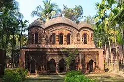 Madaripur Rajaram Mondir | |
| Nickname: New City (নতুন শহর) | |
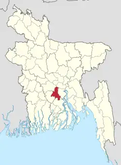 Location of Madaripur District in Bangladesh | |
Expandable map of Madaripur District | |
| Coordinates: 23.17°N 90.10°E | |
| Country | |
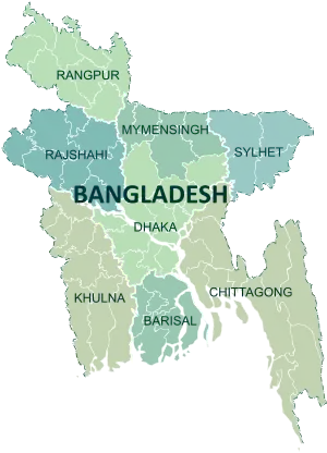
| Division | Dhaka Division |
| Named for | Sufi Syed Madar |
| Seat | Madaripur |
| Government | |
| • Deputy Commissioner | Rahima Khaton |
| • District Council Chairman | Munir Chowdhury [1] |
| Area | |
| • Total | 1,144.96 km2 (442.07 sq mi) |
| Population (2022 census)[2] | |
| • Total | 1,293,027 |
| • Density | 1,100/km2 (2,900/sq mi) |
| Demonym(s) | Madaripuri, Bangali |
| Time zone | UTC+06:00 (BST) |
| Postal code | 7900 |
| Geographical area codes | 0661 |
| Geocode | BD.DA.MD |
| ISO 3166 code | BD-36 |
| HDI (2018) | 0.649[3] medium · 3rd of 21 |
| Website | www |
History
Madaripur subdivision was established in 1854 under the district of Bakerganj. In 1873 it was separated from Bakerganj and annexed to Faridpur district. Madaripur subdivision was turned into a district in 1984. Madaripur district was named after the Sufi saint Sayed Badiuddin Ahmed Zinda Shah Madar (d. 1434 CE).
Administrative areas
Madaripur district has 3 Parliamentary seats, 5 Upazilas, 5 Police Stations, 4 Municipalities, 59 Union Parishads, 1062 Villages and 479 Mouzas.[5]
Parliamentary seats
Upazilas and Thanas
Madaripur is divided into 5 Upazilas / Thanas[4]
Municipalities
- Madaripur Municipality
- Kalkini Municipality
- Rajoir Municipality
- Shibchar Municipality
- Dasar Municipality
Demographics
| Year | Pop. | ±% p.a. |
|---|---|---|
| 1974 | 807,404 | — |
| 1981 | 943,126 | +2.24% |
| 1991 | 1,069,176 | +1.26% |
| 2001 | 1,146,349 | +0.70% |
| 2011 | 1,165,952 | +0.17% |
| 2022 | 1,293,027 | +0.94% |
| Sources:[2][7] | ||
According to the 2022 Census of Bangladesh, Madaripur District had 313,274 households and a population of 1,293,027, 24.4% of whom lived in urban areas. The population density was 1,149 people per km2. The literacy rate (age 7 and over) was 74.8%, compared to the national average of 74.7%.[2]
| Religion | Population (1941)[8]: 100–101 | Percentage (1941) | Population (2011)[7] | Percentage (2011) |
|---|---|---|---|---|
| Islam |
442,755 | 70.49% | 1,023,702 | 87.80% |
| Hinduism |
184,309 | 29.34% | 141,097 | 12.10% |
| Others [lower-alpha 2] | 1,047 | 0.17% | 1,153 | 0.10% |
| Total Population | 628,111 | 100% | 1,165,952 | 100% |
Muslims make up 87.80% of the population, while Hindus are 12.10%. The Hindu population has decreased from 1991 to 2011.
Administration
Education
The total number of educational institutions in Madaripur District is 213.
- College: 21 (including 3 government)
- Boheratola Mohila College
- Borhamganj Government College
- Government Sufia Mohila College
- Madaripur Govt College
- Nurul Amin University College
- Shekh Hasina Women's Degree College
- Shibchar Nandokumar High School and College
- Syed Abul Hossain University College, Kalkini, Madaripur.
- Secondary school: 138
- Tatibari Islamia High school
- Kalikapur High School
- Ishibpur High School
- Krokchar High School
- Hossenpur High School
- Birmohon High School
- Algi High School
- G.C. Academy
- Madaripur Public High School
- Shohid Baccu High School
- Shamsun Nahar Bhuiyan Girls High School
- Kulpoddi High School
- Khatia High School
- Panchar High School
- Madborerchar High School
- Bakhorerkandi High School
- Dr. Saleha Selim High School
- United Islamia Government High School
- Don-van Government Girls High School
- Madrasa: 69
- Shatbaria Nur-E- Mohammad(s) Dakhil Madrasha
- Purbohosnabad Hatemia Dakhil Madrasah
- Mithapur Nurani Madrasha
- Chorgobindopur Alim Madrasha
- Uttar Chorgobindopur Mia Dakhil Madrasha
- Madaripur Ahmodia Kamil Madrasha
- Bahadurpur Shariatia Alia Kamil (MA) Madrasah
- Asapat Dakhil Madrasha
Notable residents
- Shah Madar
- Alaol
- Ava Alam
- Nargis Akhter
- Mohammad Asaduzzaman
- Haji Shariatullah
- Mohsin Uddin Dudu Mia
- Ambica Charan Mazumdar
- Pulin Behari Das
- Chittapriya Ray Chaudhuri
- Panchanan Chakraborty
- Swami Pranavananda
- Gostha Pal
- Zohra Begum Kazi
- Phani Bhushan Majumder
- Fazlur Rahman Khan
- Padma Devi
- Sunil Gangopadhyay
- Basudeb Dasgupta
- Syed Abul Hossain
- Shajahan Khan
- AFM Bahauddin Nasim
- Mohammad Nizamuddin Ahmed
- A. B. M. Khairul Haque
Rivers
There are about 10 rivers in Madaripur district. They are -
- Padma River,
- Arial Khan River,
- Kumar Upper River,
- Kumar Lower River,
- Visarkanda-Bagda River,
- Torquee River,
- Palrodi River
- Palang River,
- Madaripur Beel Route River and
- The Mayankata River.
.jpg.webp)
Place of interest
- Shah Madar (RA) Dargah Sharif,
- The Shrine of Sufi Amir Shah (RA),
- Algi Kazibari Mosque - Bahadurpur,
- Raja Ram Mandir - Khalia,
- Jhaoudi Giri - Jhaoudi,
- Auliapur Neelkuthi - Chilarchar,
- Mithapur Zamindar Bari - Mithapur
- Pranab Math - Bajitpur,
- Mather Bazaar Math - Khoajpur,
- Khalia Shanti Kendra - Khalia,
- Parboter Bagan - Mastofapur,
- Madaripur Shakuni Lake,
- Senapati Dighi - Amaratola & Khatial,
- Charmuguria Eco-Park,
- Narayan Mandir - Panichatra,
- Kulpadi Zamindar Bari and Weather office.
See also
Notes
- Madaripur, Rajair, Kalkini and Sibchar thanas of Faridpur district
- Including Jainism, Christianity, Buddhism, Zoroastrianism, Judaism, Ad-Dharmis, or not stated
References
- madaripur.gov.bd
- Population and Housing Census 2022: Preliminary Report. Bangladesh Bureau of Statistics. August 2022. pp. viii, 29, 38, 45. ISBN 978-984-35-2977-0.
- "Sub-national HDI - Area Database - Global Data Lab". hdi.globaldatalab.org. Retrieved 2020-03-18.
- Shahidul Haq (2012). "Madaripur District". In Sirajul Islam and Ahmed A. Jamal (ed.). Banglapedia: National Encyclopedia of Bangladesh (Second ed.). Asiatic Society of Bangladesh.
- "Madaripur district at a glance". Madaripur District. Retrieved 2019-08-03.
- "Bangladesh adds three new Upazilas". bdnews24.com. Retrieved 2022-06-27.
- "Bangladesh Population and Housing Census 2011 Zila Report – Madaripur" (PDF). bbs.gov.bd. Bangladesh Bureau of Statistics.
- "Census of India, 1941 Volume VI Bengal Province" (PDF). Retrieved 13 August 2022.
- "AL men appointed administrators". The Daily Star. 16 December 2011. Retrieved 2017-05-18.
- "মাদারীপুর জেলা".