Madison County, Kentucky
Madison County is a county located in the central part of the U.S. state of Kentucky. At the 2020 census, its population was 92,701.[1] Its county seat is Richmond.[2] The county is named for Virginia statesman James Madison, who later became the fourth President of the United States.[3]
Madison County | |
|---|---|
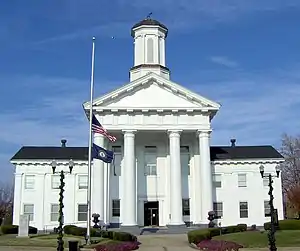
 Madison County Courthouse in Richmond | |
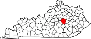
 Location within the U.S. state of Kentucky | |
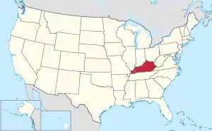
 Kentucky's location within the U.S. | |
| Coordinates: 37°43′N 84°17′W | |
| Country | |
| State | |
| Founded | December 15, 1785 |
| Named for | James Madison |
| Seat | Richmond |
| Largest city | Richmond |
| Area | |
| • Total | 443 sq mi (1,150 km2) |
| • Land | 437 sq mi (1,130 km2) |
| • Water | 6.0 sq mi (16 km2) 1.3% |
| Population (2020) | |
| • Total | 92,701 |
| • Estimate (2022) | 95,187 |
| • Density | 210/sq mi (81/km2) |
| Time zone | UTC−5 (Eastern) |
| • Summer (DST) | UTC−4 (EDT) |
| Congressional district | 6th |
| Website | www |
The county is part of the Richmond-Berea, KY Micropolitan Statistical Area which is also included in the Lexington–Fayette–Richmond–Frankfort, KY Combined Statistical Area.
Madison County is considered a moist county, meaning that although the county prohibits the sale of alcoholic beverages (and is thus a dry county), it contains a city where retail alcohol sales are allowed. Nevertheless, two of the county's 19 precincts are completely dry.[4] Alcohol can also be sold by the drink in Berea,[5] Richmond, and at Arlington and The Bull golf clubs. In 2023, the county voted to become wet.[6]
Madison County is home to Eastern Kentucky University, Berea College, and historic Boone Tavern.[7] Famous pioneer Daniel Boone lived in Madison County and built Fort Boonesborough, now a state historic site.
History
Indian trader John Findley, Daniel Boone, and four others first came into the area that is now Madison County in 1769 on a hunting and exploring expedition. In 1774, the Transylvania Company, led by Judge Richard Henderson of North Carolina, purchased 20,000,000 acres (8,100,000 ha) of land west of the Appalachians (including present-day Madison County) from the Cherokee Nation. Daniel Boone was hired to cut a trail through the Cumberland Gap and establish a settlement on the Kentucky River. The settlement at Fort Boonesborough began in April 1775.
In 1785, Madison County was established from a portion of Lincoln County, Virginia.[8][9]
Geography
According to the United States Census Bureau, the county has a total area of 443 square miles (1,150 km2), of which 437 square miles (1,130 km2) is land and 6.0 square miles (16 km2) (1.3%) is water.[10]
Major highways
Adjacent counties
- Fayette County (north)
- Clark County (northeast)
- Estill County (east)
- Jackson County (southeast)
- Rockcastle County (south)
- Garrard County (southwest)
- Jessamine County (northwest)
Demographics
| Census | Pop. | Note | %± |
|---|---|---|---|
| 1790 | 5,772 | — | |
| 1800 | 10,490 | 81.7% | |
| 1810 | 15,540 | 48.1% | |
| 1820 | 15,954 | 2.7% | |
| 1830 | 18,751 | 17.5% | |
| 1840 | 16,355 | −12.8% | |
| 1850 | 15,727 | −3.8% | |
| 1860 | 17,207 | 9.4% | |
| 1870 | 19,543 | 13.6% | |
| 1880 | 22,052 | 12.8% | |
| 1890 | 24,348 | 10.4% | |
| 1900 | 25,607 | 5.2% | |
| 1910 | 26,951 | 5.2% | |
| 1920 | 26,284 | −2.5% | |
| 1930 | 27,621 | 5.1% | |
| 1940 | 28,541 | 3.3% | |
| 1950 | 31,179 | 9.2% | |
| 1960 | 33,482 | 7.4% | |
| 1970 | 42,730 | 27.6% | |
| 1980 | 53,352 | 24.9% | |
| 1990 | 57,508 | 7.8% | |
| 2000 | 70,872 | 23.2% | |
| 2010 | 82,916 | 17.0% | |
| 2020 | 92,701 | 11.8% | |
| 2022 (est.) | 95,187 | [11] | 2.7% |
| U.S. Decennial Census[12] 1790-1960[13] 1900-1990[14] 1990-2000[15] 2010-2020[1] | |||
As of the census[16] of 2000, there were 70,872 people, 27,152 households, and 18,218 families residing in the county. The population density was 161 per square mile (62/km2). There were 29,595 housing units at an average density of 67 per square mile (26/km2). The racial makeup of the county was 93.01% White, 4.44% Black or African American, 0.28% Native American, 0.72% Asian, 0.02% Pacific Islander, 0.34% from other races, and 1.19% from two or more races. 0.97% of the population were Hispanics or Latinos of any race.
There were 27,152 households, out of which 31.50% had children under the age of 18 living with them, 53.10% were married couples living together, 10.70% had a female householder with no husband present, and 32.90% were non-families. 25.20% of all households were made up of individuals, and 7.60% had someone living alone who was 65 years of age or older. The average household size was 2.42 and the average family size was 2.90.
By age, 21.90% were under 18, 18.80% from 18 to 24, 29.40% from 25 to 44, 20.10% from 45 to 64, and 9.80% 65 or older. The median age was 31 years. Both the relatively large 18-to-24 population and the relatively low median age can be explained by the presence of Eastern Kentucky University, and to a considerably lesser extent Berea College. For every 100 females, there were 93.30 males. For every 100 females age 18 and over, there were 90.20 males.
The median income for a household in the county was $32,861, and the median income for a family was $41,383. Males had a median income of $31,974 versus $22,487 for females. The per capita income for the county was $16,790. About 12.00% of families and 16.80% of the population were below the poverty line, including 17.80% of those under age 18 and 17.10% of those age 65 or over.
Government
The Madison County courthouse is located at 135 W Irvine Street in Richmond.
   County Judge-Executive: Reagan Taylor
   County Clerk: Kenny Barger
   Sheriff: Mike Coyle
   Coroner: Jimmy Cornelison
   Jailer: Steve Tussey
   County Attorney: Jennie Haymond
   Circuit Clerk: David M. Fernandez
   County Property Valuation Administrator (PVA): Billy Ackerman
   County Surveyor: Stuart W. Spencer
Elections
| Year | Republican | Democratic | Third party | |||
|---|---|---|---|---|---|---|
| No. | % | No. | % | No. | % | |
| 2020 | 27,356 | 62.23% | 15,581 | 35.45% | 1,020 | 2.32% |
| 2016 | 23,431 | 62.70% | 11,793 | 31.56% | 2,147 | 5.75% |
| 2012 | 21,128 | 63.41% | 11,512 | 34.55% | 682 | 2.05% |
| 2008 | 19,694 | 60.53% | 12,392 | 38.09% | 451 | 1.39% |
| 2004 | 18,922 | 61.62% | 11,525 | 37.53% | 260 | 0.85% |
| 2000 | 13,682 | 57.81% | 9,309 | 39.33% | 675 | 2.85% |
| 1996 | 9,212 | 48.23% | 8,142 | 42.62% | 1,748 | 9.15% |
| 1992 | 8,719 | 43.94% | 8,005 | 40.35% | 3,117 | 15.71% |
| 1988 | 9,958 | 59.39% | 6,672 | 39.79% | 136 | 0.81% |
| 1984 | 11,309 | 63.09% | 6,509 | 36.31% | 108 | 0.60% |
| 1980 | 8,437 | 47.74% | 8,208 | 46.45% | 1,026 | 5.81% |
| 1976 | 6,581 | 46.63% | 7,299 | 51.71% | 234 | 1.66% |
| 1972 | 8,659 | 65.60% | 4,328 | 32.79% | 212 | 1.61% |
| 1968 | 5,325 | 44.83% | 3,884 | 32.70% | 2,669 | 22.47% |
| 1964 | 4,266 | 38.09% | 6,877 | 61.40% | 57 | 0.51% |
| 1960 | 6,692 | 54.35% | 5,621 | 45.65% | 0 | 0.00% |
| 1956 | 5,955 | 50.85% | 5,670 | 48.42% | 85 | 0.73% |
| 1952 | 5,886 | 49.82% | 5,901 | 49.94% | 28 | 0.24% |
| 1948 | 4,619 | 44.63% | 5,344 | 51.64% | 386 | 3.73% |
| 1944 | 5,468 | 48.36% | 5,769 | 51.02% | 70 | 0.62% |
| 1940 | 5,789 | 46.91% | 6,484 | 52.54% | 67 | 0.54% |
| 1936 | 6,034 | 48.76% | 6,259 | 50.58% | 82 | 0.66% |
| 1932 | 5,811 | 45.10% | 6,957 | 54.00% | 116 | 0.90% |
| 1928 | 6,325 | 57.03% | 4,736 | 42.71% | 29 | 0.26% |
| 1924 | 5,276 | 51.26% | 4,895 | 47.56% | 121 | 1.18% |
| 1920 | 6,012 | 51.21% | 5,647 | 48.10% | 80 | 0.68% |
| 1916 | 3,017 | 47.56% | 3,295 | 51.94% | 32 | 0.50% |
| 1912 | 2,094 | 34.67% | 2,992 | 49.54% | 953 | 15.78% |
Education
Schools
Madison County is served by two school districts:[18]
- Madison County Schools, currently consisting of 10 elementary, 5 middle, and 2 high schools.
- Berea Independent Schools, currently consisting of 1 elementary, 1 middle, and 1 high school.
The county is also served by Model Laboratory School which is part of Eastern Kentucky University.
Colleges and universities
- Eastern Kentucky University, located in Richmond
- Berea College, located in Berea
- National College of Business & Technology, located in Richmond
Communities
- Baldwin
- Berea
- Bighill
- Boonesborough
- Buggytown
- Dreyfus
- Kingston
- Kirksville
- Million
- Moberly
- Richmond (county seat)
- Round Hill
- Ruthton
- Speedwell
- Valley View
- Waco
Economy
Military
The Blue Grass Army Depot is located just south of Richmond.
Notable people
- Frances Estill Beauchamp (1860–1923), temperance activist, social reformer, lecturer
- Daniel S. Bentley (1850–1916), American minister, writer, newspaper founder[19]
- Daniel Boone - American frontiersman and explorer of Kentucky.
- Kit Carson - Christopher Houston Carson (December 24, 1809 – May 23, 1868), better known as Kit Carson, was an American frontiersman.
- Mary Kavanaugh Eagle (1854–1903), American activist, clubwoman, book editor.
- Lonnie Napier (1940–2023) – former representative for House District 36 in the Kentucky House of Representatives.
Sister communities
.svg.png.webp) Hokuto City, Yamanashi, Japan (since 1990)
Hokuto City, Yamanashi, Japan (since 1990)
References
- "State & County QuickFacts". United States Census Bureau. Retrieved June 29, 2022.
- "Find a County". National Association of Counties. Archived from the original on May 31, 2011. Retrieved June 7, 2011.
- The Register of the Kentucky State Historical Society, Volume 1. Kentucky State Historical Society. 1903. pp. 36.
- Lanier, Yvette (August 1, 2007). "Berea votes down alcohol sales again". Lexington Herald-Leader. Retrieved August 1, 2007.
- "Berea prepares for future with alcohol sales". Richmond Register. Retrieved January 13, 2016.
- "Madison County is wet, what's next?". Retrieved July 27, 2023.
- Foust, Michele. "200-year-old Kentucky pottery business a sight to see ", Atlanta Journal-Constitution, February 25, 2007. Retrieved on February 23, 2009.
- Collins, Lewis (1882). Collins' Historical Sketches of Kentucky: History of Kentucky, Volume 2. Collins & Company. p. 26.
- "Madison County". The Kentucky Encyclopedia. 2000. Archived from the original on July 17, 2019. Retrieved August 23, 2014.
- "2010 Census Gazetteer Files". United States Census Bureau. August 22, 2012. Archived from the original on August 12, 2014. Retrieved August 17, 2014.
- "Annual Estimates of the Resident Population for Counties: April 1, 2020 to July 1, 2022". United States Census Bureau. Retrieved April 2, 2023.
- "U.S. Decennial Census". United States Census Bureau. Retrieved August 17, 2014.
- "Historical Census Browser". University of Virginia Library. Retrieved August 17, 2014.
- "Population of Counties by Decennial Census: 1900 to 1990". United States Census Bureau. Retrieved August 17, 2014.
- "Census 2000 PHC-T-4. Ranking Tables for Counties: 1990 and 2000" (PDF). United States Census Bureau. Archived (PDF) from the original on March 27, 2010. Retrieved August 17, 2014.
- "U.S. Census website". United States Census Bureau. Retrieved January 31, 2008.
- Leip, David. "Dave Leip's Atlas of U.S. Presidential Elections". uselectionatlas.org. Retrieved July 4, 2018.
- "2020 CENSUS - SCHOOL DISTRICT REFERENCE MAP: Madison County, KY" (PDF). U.S. Census Bureau. Archived (PDF) from the original on July 26, 2022. Retrieved July 25, 2022. - Text list - For more detailed boundaries of the independent school districts see: "Appendix B: Maps Of Independent School Districts In Operation In FY 2014-FY 2015 Using 2005 Tax District Boundaries – Berea ISD" (PDF). Research Report No. 415 – Kentucky's Independent School Districts: A Primer. Frankfort, KY: Office of Education Accountability, Legislative Research Commission. September 15, 2015. p. 93 (PDF p. 107/174). Archived (PDF) from the original on December 10, 2020.
- "Bentley, Daniel S." Notable Kentucky African Americans Database, University of Kentucky. Retrieved February 5, 2023.