Maitenbeth
Maitenbeth is a municipality in the district of Mühldorf in Bavaria in Germany.
Maitenbeth | |
|---|---|
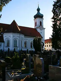 Saint Agatha Church | |
 Coat of arms | |
Location of Maitenbeth within Mühldorf am Inn district 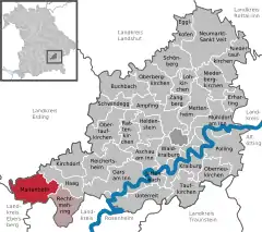 | |
 Maitenbeth 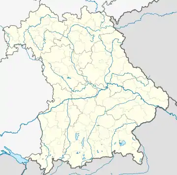 Maitenbeth | |
| Coordinates: 48°09′00″N 12°05′30″E | |
| Country | Germany |
| State | Bavaria |
| Admin. region | Oberbayern |
| District | Mühldorf am Inn |
| Municipal assoc. | Maitenbeth |
| Subdivisions | 58 Ortsteile |
| Government | |
| • Mayor (2020–26) | Thomas Stark[1] |
| Area | |
| • Total | 30.94 km2 (11.95 sq mi) |
| Elevation | 609 m (1,998 ft) |
| Population (2022-12-31)[2] | |
| • Total | 2,071 |
| • Density | 67/km2 (170/sq mi) |
| Time zone | UTC+01:00 (CET) |
| • Summer (DST) | UTC+02:00 (CEST) |
| Postal codes | 83558 |
| Dialling codes | 08076 |
| Vehicle registration | MÜ |
| Website | www.maitenbeth.de |
Maitenbeth consists of 58 official localities:[3]
|
|
|
|
References
- Liste der ersten Bürgermeister/Oberbürgermeister in kreisangehörigen Gemeinden, Bayerisches Landesamt für Statistik, 15 July 2021.
- Genesis Online-Datenbank des Bayerischen Landesamtes für Statistik Tabelle 12411-003r Fortschreibung des Bevölkerungsstandes: Gemeinden, Stichtag (Einwohnerzahlen auf Grundlage des Zensus 2011)
- "Bayerische Landesbibliothek Online (BLO)".
This article is issued from Wikipedia. The text is licensed under Creative Commons - Attribution - Sharealike. Additional terms may apply for the media files.