Makena, Hawaii
Makena is a census-designated place (CDP) in Maui County, Hawaiʻi, United States. As of the 2020 census, it had a population of 196,[2] up from 99 in 2010.[3] Prior to 2010, the area was part of the Wailea-Makena census-designated place.
Makena, Hawaii | |
|---|---|
 Makena State Park, "Big Beach" side | |
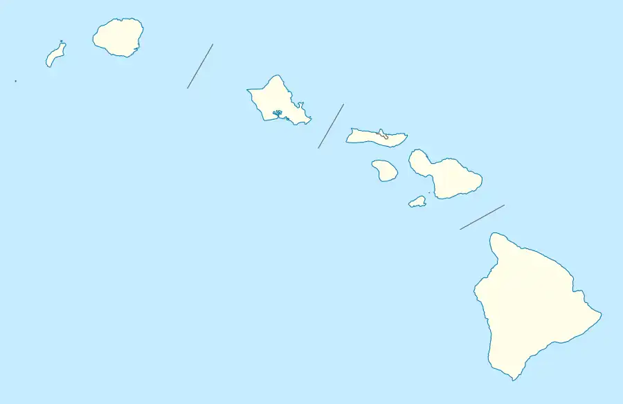 Makena Location in Hawaii | |
| Coordinates: 20°39′14″N 156°26′25″W | |
| Country | United States |
| State | Hawaii |
| County | Maui |
| Area | |
| • Total | 11.54 sq mi (29.89 km2) |
| • Land | 9.47 sq mi (24.53 km2) |
| • Water | 2.07 sq mi (5.36 km2) |
| Elevation | 20 ft (6 m) |
| Population | |
| • Total | 196 |
| • Density | 20.70/sq mi (7.99/km2) |
| Time zone | UTC-10 (Hawaii-Aleutian) |
| ZIP Code | 96753 (Wailea) |
| Area code | 808 |
| FIPS code | 15-48350 |
Geography
.jpg.webp)
Makena Beach on Maui, Hawaii
Makena is located on the south side of the island of Maui at 20°39′14″N 156°26′25″W (20.6539, -156.4403).[4] It is bordered to the north by Wailea and to the west by the Pacific Ocean. Road access is only available from the north, by Makena Road.
According to the United States Census Bureau, the CDP has a total area of 11.5 square miles (29.9 km2), of which 9.5 square miles (24.5 km2) are land and 2.1 square miles (5.4 km2), or 17.93%, are water.[1]
Climate
| Climate data for Makena, Hawaii (Makena Golf Course) 1991–2020 normals, extremes 1982–present | |||||||||||||
|---|---|---|---|---|---|---|---|---|---|---|---|---|---|
| Month | Jan | Feb | Mar | Apr | May | Jun | Jul | Aug | Sep | Oct | Nov | Dec | Year |
| Record high °F (°C) | 90 (32) |
87 (31) |
89 (32) |
89 (32) |
90 (32) |
91 (33) |
93 (34) |
94 (34) |
94 (34) |
94 (34) |
95 (35) |
91 (33) |
95 (35) |
| Average high °F (°C) | 80.1 (26.7) |
79.9 (26.6) |
81.2 (27.3) |
83.1 (28.4) |
84.3 (29.1) |
85.9 (29.9) |
87.1 (30.6) |
87.3 (30.7) |
86.8 (30.4) |
86.1 (30.1) |
83.4 (28.6) |
81.2 (27.3) |
83.9 (28.8) |
| Daily mean °F (°C) | 71.8 (22.1) |
71.4 (21.9) |
72.3 (22.4) |
73.8 (23.2) |
75.0 (23.9) |
76.8 (24.9) |
78.1 (25.6) |
78.3 (25.7) |
78.0 (25.6) |
77.2 (25.1) |
75.1 (23.9) |
73.0 (22.8) |
75.1 (23.9) |
| Average low °F (°C) | 63.5 (17.5) |
63.0 (17.2) |
63.5 (17.5) |
64.5 (18.1) |
65.8 (18.8) |
67.8 (19.9) |
69.1 (20.6) |
69.2 (20.7) |
69.1 (20.6) |
68.4 (20.2) |
66.9 (19.4) |
64.8 (18.2) |
66.3 (19.1) |
| Record low °F (°C) | 54 (12) |
54 (12) |
54 (12) |
58 (14) |
54 (12) |
62 (17) |
62 (17) |
62 (17) |
61 (16) |
61 (16) |
56 (13) |
57 (14) |
54 (12) |
| Average rainfall inches (mm) | 2.48 (63) |
1.28 (33) |
1.99 (51) |
0.75 (19) |
1.08 (27) |
0.38 (9.7) |
0.77 (20) |
1.21 (31) |
1.11 (28) |
1.55 (39) |
1.24 (31) |
1.85 (47) |
15.70 (399) |
| Average rainy days (≥ 0.01 in) | 5.5 | 4.6 | 4.9 | 3.2 | 3.9 | 2.0 | 3.3 | 2.7 | 5.0 | 2.9 | 4.2 | 4.9 | 47.1 |
| Source: NOAA[5][6] | |||||||||||||
See also
- List of beaches in Hawaii#Maui
- Makena Beach & Golf Resort - A hotel/ resort in the Makena area.
References
- "2022 U.S. Gazetteer Files: Hawaii". United States Census Bureau. Retrieved February 2, 2023.
- "P1. Race – Makena CDP, Hawaii: 2020 DEC Redistricting Data (PL 94-171)". U.S. Census Bureau. Retrieved February 2, 2023.
- "Profile of General Population and Housing Characteristics: 2010 Demographic Profile Data (DP-1): Makena CDP, Hawaii". United States Census Bureau. Retrieved December 29, 2011.
- "US Gazetteer files: 2010, 2000, and 1990". United States Census Bureau. 2011-02-12. Retrieved 2011-04-23.
- "NowData - NOAA Online Weather Data". National Oceanic and Atmospheric Administration. Retrieved September 13, 2021.
- "Station: Makena Golf Crs 249.1, HI". U.S. Climate Normals 2020: U.S. Monthly Climate Normals (1991-2020). National Oceanic and Atmospheric Administration. Retrieved September 13, 2021.
- "Census of Population and Housing". Census.gov. Retrieved June 4, 2016.
External links
 Media related to Makena, Hawaii at Wikimedia Commons
- Daily newspaper
Islands, municipalities, and communities of Maui County, Hawaii, United States | ||
|---|---|---|
| CDPs |  Map of Hawaii highlighting Maui County | |
| Other communities | ||
| Footnotes | ‡This populated place also has portions in an adjacent county or counties | |
This article is issued from Wikipedia. The text is licensed under Creative Commons - Attribution - Sharealike. Additional terms may apply for the media files.