Mangalore, Victoria
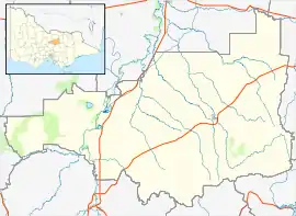
Mangalore is a locality in the state of Victoria, Australia. The town is the Shire of Strathbogie local government area, 2 hours north of Melbourne.[2] It was served by the Mangalore Railway Station, and is currently served by the Mangalore Airport. It is accessible by road along the Goulburn Valley Highway and Hume Highway.[3]
| Mangalore Victoria | |
|---|---|
 Mangalore Hotel | |
 Mangalore | |
| Coordinates | 36°53′18″S 145°11′3″E |
| Population | 182 (2016 census)[1] |
| Established | 1860s |
| Postcode(s) | 3663 |
| LGA(s) | |
| State electorate(s) | Euroa |
| Federal division(s) | Nicholls |
Climate
| Climate data for Mangalore Airport (temperatures 1959–present; rainfall 1957–present) | |||||||||||||
|---|---|---|---|---|---|---|---|---|---|---|---|---|---|
| Month | Jan | Feb | Mar | Apr | May | Jun | Jul | Aug | Sep | Oct | Nov | Dec | Year |
| Record high °C (°F) | 44.6 (112.3) |
46.1 (115.0) |
39.9 (103.8) |
35.5 (95.9) |
28.4 (83.1) |
21.7 (71.1) |
22.0 (71.6) |
26.5 (79.7) |
29.7 (85.5) |
36.3 (97.3) |
41.0 (105.8) |
42.6 (108.7) |
46.1 (115.0) |
| Average high °C (°F) | 29.8 (85.6) |
29.3 (84.7) |
26.2 (79.2) |
21.4 (70.5) |
16.7 (62.1) |
13.5 (56.3) |
12.5 (54.5) |
14.1 (57.4) |
16.8 (62.2) |
20.5 (68.9) |
24.4 (75.9) |
27.1 (80.8) |
21.0 (69.8) |
| Average low °C (°F) | 14.2 (57.6) |
14.3 (57.7) |
12.3 (54.1) |
8.6 (47.5) |
6.1 (43.0) |
4.0 (39.2) |
3.2 (37.8) |
3.9 (39.0) |
5.3 (41.5) |
7.2 (45.0) |
9.9 (49.8) |
11.9 (53.4) |
8.4 (47.1) |
| Record low °C (°F) | 2.6 (36.7) |
3.5 (38.3) |
1.5 (34.7) |
−1.1 (30.0) |
−4.1 (24.6) |
−5.0 (23.0) |
−5.6 (21.9) |
−3.8 (25.2) |
−3.6 (25.5) |
−2.2 (28.0) |
0.0 (32.0) |
1.3 (34.3) |
−5.6 (21.9) |
| Average rainfall mm (inches) | 41.1 (1.62) |
34.9 (1.37) |
35.7 (1.41) |
39.3 (1.55) |
53.0 (2.09) |
52.8 (2.08) |
57.9 (2.28) |
61.5 (2.42) |
55.8 (2.20) |
45.7 (1.80) |
47.9 (1.89) |
39.8 (1.57) |
568.3 (22.37) |
| Average rainy days | 5.0 | 4.8 | 6.0 | 7.0 | 10.4 | 12.4 | 15.0 | 14.5 | 11.5 | 10.0 | 7.9 | 7.0 | 111.5 |
| Average afternoon relative humidity (%) | 34 | 36 | 39 | 46 | 60 | 69 | 69 | 63 | 56 | 48 | 41 | 35 | 50 |
| Source: Bureau of Meteorology[4] | |||||||||||||
References
- Australian Bureau of Statistics (27 June 2017). "Mangalore (State Suburb)". 2016 Census QuickStats. Retrieved 25 August 2020.
- "Pilot killed in light plane crash near Mt Hotham". Victoria. Herald Sun. 24 October 2013. Retrieved 13 January 2014.
- Seach, Melissa (12 January 2014). "Police nab speeding driver in Mangalore". Victoria Police News. Retrieved 13 January 2014.
- "Mangalore Airport". Bureau of Meteorology. Retrieved 17 May 2017.
External links
![]() Media related to Mangalore, Victoria at Wikimedia Commons
Media related to Mangalore, Victoria at Wikimedia Commons
This article is issued from Wikipedia. The text is licensed under Creative Commons - Attribution - Sharealike. Additional terms may apply for the media files.
