Manghera
Manghera is a village in Fatehabad District, Haryana. It is 21.2 kilometers from the main town Tohana, 40 kilometers from Fatehabad and 161 km from the state capital of Chandigarh.
Manghera
Pannu | |
|---|---|
village | |
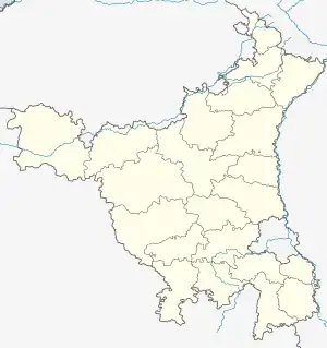
 Manghera Location in Haryana, India  Manghera Manghera (India) | |
| Coordinates: 29.636525°N 75.700698°E | |
| Country | |
| State | Haryana |
| District | Fatehabad |
| Government | |
| • Type | Democracy |
| Population | |
| • Total | 1,177 |
| Languages | |
| • Official | Punjabi,Haryanvi |
| Time zone | UTC+5:30 (IST) |
| PIN | 125106 (Dharsul Kalan) |
| Telephone code | 01692 |
| ISO 3166 code | IN-HR |
| Vehicle registration | HR,23 |
| Nearest city = kullan | Fatehabad |
| Sex ratio | 631:546 ♂/♀ |
| Lok Sabha constituency | Fatehabad and Adampur |
| Website | haryana |
Neighbouring Villages
| Village | Distance (in km) |
|---|---|
| Laherian | 2.5 km |
| Nanheri | 4.5 km |
| Kunal | 5 km |
| Tibbi | 5.8 km |
| Dharsul Khurd | 6.2 km |
| Bhuna | 0.2 km |
| Ratia | 14.2 km |
| Jakhal | 18.7 km |
| Tohana | 21.2 km |
| Amani | |
| Baliawala | |
| Bhemewala | |
| Chander Kalan | |
| Chander Khurd | |
| Chelewal | |
| Bosti |
Schools in Manghera
- Government primary school Manghera
Colleges nearby Manghera
- Apex polytechnic college
- Surya College of Education
- JBRD College, Uklana
References
External links
- "Haryana Panchayat". Haryana Panchayat. 22 April 1994. Archived from the original on 7 June 2010. Retrieved 6 May 2012.
- "Map Of Manghera(195), Manghera(195) Maps, Manghera(195) Village Map". IndiaMapped.com. Retrieved 6 May 2012.
- "Satellite Map Of Village Manghera(195), Manghera(195) Village Satellite Map". Googlesatellitemaps.co.in. Retrieved 6 May 2012.
- "Pin Code of Manghera, Manghera Pin code, Zip code of Manghera, Manghera Zip code, Postal code of Manghera, Manghera Postal code". Pincodesofindia.com. Retrieved 6 May 2012.
This article is issued from Wikipedia. The text is licensed under Creative Commons - Attribution - Sharealike. Additional terms may apply for the media files.