Mark Township, Defiance County, Ohio
Mark Township is one of the twelve townships of Defiance County, Ohio, United States. The 2020 census found 902 people in the township.
Mark Township, Defiance County, Ohio | |
|---|---|
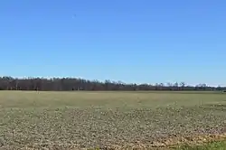 Along Openlander Road southwest of Sherwood | |
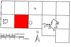 Location of Mark Township in Defiance County | |
| Coordinates: 41°17′28″N 84°37′45″W | |
| Country | United States |
| State | Ohio |
| County | Defiance |
| Area | |
| • Total | 36.6 sq mi (94.9 km2) |
| • Land | 36.6 sq mi (94.9 km2) |
| • Water | 0.0 sq mi (0.0 km2) |
| Elevation | 725 ft (221 m) |
| Population | |
| • Total | 902 |
| • Density | 25/sq mi (9.5/km2) |
| Time zone | UTC-5 (Eastern (EST)) |
| • Summer (DST) | UTC-4 (EDT) |
| FIPS code | 39-47852[3] |
| GNIS feature ID | 1086035[1] |
Geography
Located in the southwestern part of the county, it borders the following townships:
- Farmer Township - north
- Washington Township - northeast corner
- Delaware Township - east
- Emerald Township, Paulding County - southeast corner
- Crane Township, Paulding County - south
- Carryall Township, Paulding County - southwest corner
- Hicksville Township - west
- Milford Township - northwest corner
No municipalities are located in Mark Township, although the unincorporated community of Mark Center is located in the township's center.
Name and history
Mark Township was established in 1851, and named for Mark Kenton, an early settler.[4] It is the only Mark Township statewide.[5]
Government
The township is governed by a three-member board of trustees, who are elected in November of odd-numbered years to a four-year term beginning on the following January 1. Two are elected in the year after the presidential election and one is elected in the year before it. There is also an elected township fiscal officer,[6] who serves a four-year term beginning on April 1 of the year after the election, which is held in November of the year before the presidential election. Vacancies in the fiscal officership or on the board of trustees are filled by the remaining trustees.
Transportation
The most important highway in Mark Township is State Route 18, which travels from east to west through the center of the township.[7]
References
- "US Board on Geographic Names". United States Geological Survey. October 25, 2007. Retrieved January 31, 2008.
- "Mark township, Defiance County, Ohio - Census Bureau Profile". United States Census Bureau. Retrieved June 21, 2023.
- "U.S. Census website". United States Census Bureau. Retrieved January 31, 2008.
- History of Defiance County, Ohio: Containing a History of the County ; Its Townships, Towns, Etc. ; Military Record ; Portraits of Early Settlers and Prominent Men ; Farm Views ; Personal Reminiscences, Etc. Warner, Beers. 1883. p. 317.
- "Detailed map of Ohio" (PDF). United States Census Bureau. 2000. Retrieved February 16, 2007.
- §503.24, §505.01, and §507.01 of the Ohio Revised Code. Accessed 4/30/2009.
- DeLorme. Ohio Atlas & Gazetteer. 7th ed. Yarmouth: DeLorme, 2004, p. 34. ISBN 0-89933-281-1.
External links
Municipalities and communities of Defiance County, Ohio, United States | ||
|---|---|---|
| City | 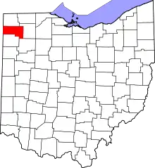 Map of Ohio highlighting Defiance County | |
| Villages | ||
| Townships | ||
| CDP | ||
| Unincorporated communities | ||
| Ghost towns | ||