Matthews, Georgia
Matthews is a census-designated place and unincorporated community in Jefferson County, Georgia, United States. Its population was 146 as of the 2020 census. Georgia State Route 88 passes through the community.
Matthews, Georgia | |
|---|---|
 Matthews  Matthews | |
| Coordinates: 33°12′40″N 82°18′27″W | |
| Country | United States |
| State | Georgia |
| County | Jefferson |
| Area | |
| • Total | 3.53 sq mi (9.15 km2) |
| • Land | 3.52 sq mi (9.12 km2) |
| • Water | 0.01 sq mi (0.03 km2) |
| Elevation | 390 ft (120 m) |
| Population (2020) | |
| • Total | 146 |
| • Density | 41.47/sq mi (16.01/km2) |
| Time zone | UTC-5 (Eastern (EST)) |
| • Summer (DST) | UTC-4 (EDT) |
| ZIP code | 30818[2] |
| Area code | 706 |
| GNIS feature ID | 332331[3] |
References
- "2020 U.S. Gazetteer Files". United States Census Bureau. Retrieved December 18, 2021.
- United States Postal Service. "USPS - Look Up a ZIP Code". Retrieved January 3, 2015.
- "Matthews". Geographic Names Information System. United States Geological Survey, United States Department of the Interior.
- "Census of Population and Housing". Census.gov. Retrieved June 4, 2016.
Municipalities and communities of Jefferson County, Georgia, United States | ||
|---|---|---|
| Cities | 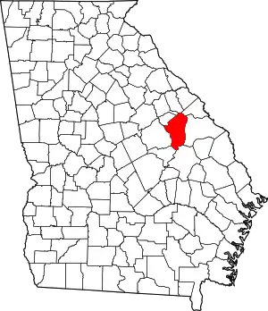 Map of Georgia highlighting Jefferson County | |
| Town | ||
| CDP | ||
| Unincorporated communities | ||
| Footnotes | ‡This populated place also has portions in an adjacent county or counties | |
This article is issued from Wikipedia. The text is licensed under Creative Commons - Attribution - Sharealike. Additional terms may apply for the media files.