Mayaro, California
Mayaro, California | |
|---|---|
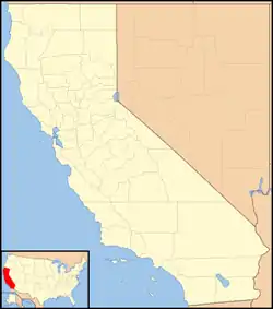 Mayaro, California Location in California  Mayaro, California Mayaro, California (the United States) | |
| Coordinates: 39°49′27″N 121°25′20″W | |
| Country | United States |
| State | California |
| County | Butte County |
| Elevation | 1,522 ft (464 m) |
Mayaro is an unincorporated community in Butte County, California. It lies at an elevation of 1522 feet (464 m) and is located at 39°49′27″N 121°25′20″W. A post office operated at Mayaro from 1930 to 1956.[2]
References
- U.S. Geological Survey Geographic Names Information System: Mayaro, California
- Durham, David L. (1998). California's Geographic Names: A Gazetteer of Historic and Modern Names of the State. Clovis, Calif.: Word Dancer Press. p. 275. ISBN 1-884995-14-4.
External links
Municipalities and communities of Butte County, California, United States | ||
|---|---|---|
| Cities and towns | 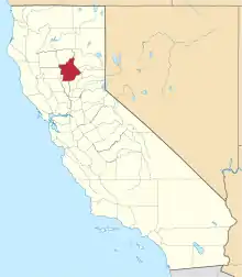 Butte County map | |
| CDPs | ||
| Unincorporated communities |
| |
| Ghost towns |
| |
| Footnotes | ‡This populated place also has portions in an adjacent county or counties | |
This article is issued from Wikipedia. The text is licensed under Creative Commons - Attribution - Sharealike. Additional terms may apply for the media files.