Mchinga
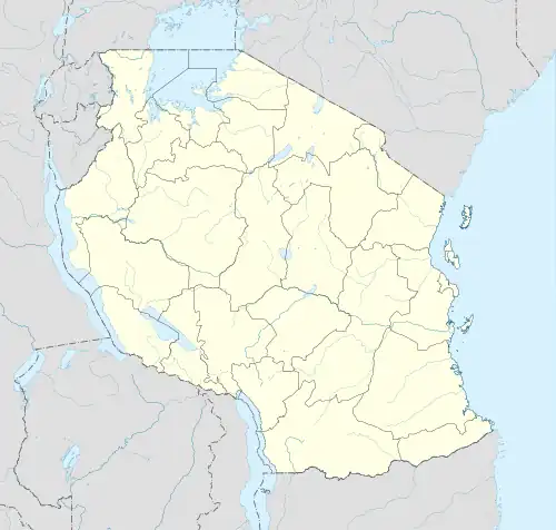
Mchinga is an administrative ward in Lindi District of Lindi Region in Tanzania. The ward covers an area of 136.6 km2 (52.7 sq mi),[1] and has an average elevation of 45 m (148 ft).[2] According to the 2012 census, the ward has a total population of 6,063.[3]
Mchinga
| |
|---|---|
| Kata ya Mchinga, Wilaya ya Lindi | |
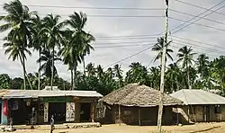 Mchinga Scene in Lindi District | |
 Mchinga | |
| Coordinates: 9°44′21.48″S 39°42′58.68″E | |
| Country | |
| Region | Lindi Region |
| District | Lindi District |
| Area | |
| • Total | 36.4 km2 (14.1 sq mi) |
| Elevation | 45 m (148 ft) |
| Population (2012) | |
| • Total | 6,063 |
| • Density | 170/km2 (430/sq mi) |
| Ethnic groups | |
| • Settler | Swahili |
| • Native | Machinga people |
| Tanzanian Postal Code | 65205 |

Backroads of Mchinga Ward, Lindi District
References
- "Tanzania:Coastal Zone Tanzania (Districts and Wards) – Population Statistics, Charts and Map".
- "Mchinga Elevation".
- "2012 Population and Housing Census General Report" (PDF). Government of Tanzania. Retrieved 2022-06-11.
This article is issued from Wikipedia. The text is licensed under Creative Commons - Attribution - Sharealike. Additional terms may apply for the media files.