Meers, Oklahoma
Meers is an unincorporated community located on State Highway 115 in Comanche County, Oklahoma, United States, in the foothills of the Wichita Mountains. In 1901, Meers was founded as a gold prospecting town where it was named in honor of mine operator Andrew J. Meers from Cherokee County, Georgia.
Meers, Oklahoma | |
|---|---|
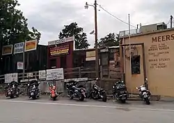 The Meers Store | |
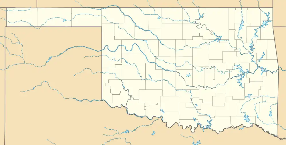 Meers Location within the state of Oklahoma  Meers Meers (the United States) | |
| Coordinates: 34°46′58″N 98°34′44″W[1] | |
| Country | United States |
| State | Oklahoma |
| County | Comanche |
| Elevation | 1,460 ft (450 m) |
| Time zone | UTC-6 (Central (CST)) |
| • Summer (DST) | UTC-5 (CDT) |
| ZIP codes | 73558 |
| FIPS code | 40-47500 |
| GNIS feature ID | 1100624[1] |
The only remaining structure of the original town is the Meers Store & Restaurant, which Food Network named as the best hamburger joint in Oklahoma and one of the best in the United States, largely due to its signature MeersBurger.[2]
The Meers Store also served as the area post office from March 12, 1902, until February, 1989.[3] Currently, area residents have Lawton mailing addresses.
Geological formation of Southwest Oklahoma
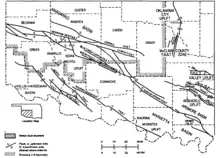
Meers is defined by a geological displacement or planar fracture known as the Meers Fault.[4] The northwestern Meers fault and the southeastern Meers fault lines are geologically situated in the central lowlands.[5]
In 1985, in order to monitor a seismic event, the Oklahoma Geological Survey installed a seismograph in the Meers Store.[6][7]
Spanish prospectors in the Wichita Mountains
Wichita Mountains region is believed to have captivated the first Spanish conquistadors in the 16th century, 17th century, and 18th century. The epoch was defined by the geographical exploration of North America as accomplished by the Spanish Empire.
The Spanish colonization of the Americas revealed substantial developments with the establishment of the territorial entities known as New Spain and Spanish Texas.[8] The Red River of the South was explored by the Spaniards during the 18th century by the exemplary events chronicled at Spanish Fort, Texas.[9][10]
_L_M_van_Loo.jpg.webp)
The Spanish Empire explored native kingdoms specifically for gold mining and silver mining collectively in light of the Spanish royal crown's decree.[11][12] A regal order chartering expeditionary campaigns to collect geological and mineral surveys on distant coasts and continents. The Spanish Empire's exploratory caravans were possessed by the tales of the earlier explorers who exalted the New World's mythic lands. A dominion located in the northern Terra incognita conceptualized by a covetous euphoria for the Iberian Peninsula horde beseeching the Seven Cities of Gold.[13][14]
The group eleven elements were an alluring earthly possession serving as a periodic element for the crown jewels. The mineral ore forged as a coinage metal or milled coinage for the currency of Spain and Spanish America authentically illustrated by the Spanish escudo. The precious metals were mutually considered a barter and medium of exchange for cultural diplomacy and greetings with native kingdoms.
.jpg.webp)
In 1955, a primitive mill, recognized as an arrastra, was discovered 2 miles (3.2 km) south of Meers near Meers Road or Oklahoma State Highway 115.[15] The 16th-century mill, situated to close proximity of Cedar Creek, was considered to be of Spanish design and origin.[16] The arrastra permitted comminution of earth elements being gold and silver essentially scaling the metallics for protracted overland passages. The fragmentation process formed a suitable ductile element for conveyance by pack saddle routing the Lower Rio Grande Valley climactically transitioning to the Gulf Coastal Plain of the Sierra Madre Oriental for the prized transfer at the port of Veracruz ― San Juan de Ulúa ― treasure port for Spanish Main.[17]
The transition metals encompassed an overland journey of the New World to Spanish galleons of the Spanish treasure fleet in St. Augustine, Florida ― Castillo de San Marcos ― subsequently anchoring Spain's medieval ships in Havana and Spanish Wells for mustering seafaring provisions and supplies.[18] The spanish cargo fleets ― 1715 Treasure Fleet ― continued the nautical voyage with winds sustaining the transatlantic crossing to the Old World in anticipation of the King's treasure homecoming in Cartagena, Spain.[19]
Listing as National Register of Historic Places
The Meers Store was listed on the National Register of Historic Places in 1978 as Meers Mining Camp, since it was the only surviving relic of the community's gold rush days.[20][21]
References
- U.S. Geological Survey Geographic Names Information System: Meers, Oklahoma
- Food Network Top American Restaurants: Bon Appetit Picks the Best.
- Shirk, George H. (1952). "First Post Offices Within the Boundaries of Oklahoma". The Chronicles of Oklahoma. Oklahoma Historical Society. 30 (1 - Spring 1952): 79, 38–104. LCCN 23027299. OCLC 655582328.
- Luza, Kenneth V. "Earthquakes". The Encyclopedia of Oklahoma History and Culture. Oklahoma Historical Society.
- "Southeastern Meers Fault". Southeastern Section (Class A) ~ Fault ID No. 1031b. U.S. Geological Survey.
- Oklahoma Geological Survey Seismograph Stations Archived 2007-04-16 at the Wayback Machine. (accessed February 14, 2007)
- Meers, Oklahoma Quaternary Fault. (accessed October 5, 2012)
- "Conquistadors: Searching for Gold and Glory and Finding Something Else". Story of Texas - Campfire Stories. Bullock Texas State History Museum.
- Morrell, Lea Anne. "Spanish Fort, TX". Handbook of Texas Online. Texas State Historical Association.
- Jelks, Edward B. "Spanish Fort Sites". Handbook of Texas Online. Texas State Historical Association.
- Young, Otis E. (1965). "The Spanish Tradition in Gold and Silver Mining". Arizona and the West. Journal of the Southwest. 7 (4): 299–314. JSTOR 40167137.
- Chaudhuri, Kirti N. (October 1994). "Precious Metals and Mining in the New World: 1500–1800". European Review. Cambridge University Press. 2 (4): 261–270. doi:10.1017/S1062798700001186. S2CID 143538025.
- Lewis, Tom; Richter, Sara Jane. "Coronado Expedition". The Encyclopedia of Oklahoma History and Culture. Oklahoma Historical Society.
- Chipman, Donald E. "Seven Cities of Cibola". Handbook of Texas Online. Texas State Historical Association.
- Hollon, W. Eugene (1956). "A Spanish "Arrastra" in the Wichita Mountains". The Chronicles of Oklahoma. Oklahoma Historical Society. 34 (4 - Winter 1956-57): 443–455. LCCN 23027299. OCLC 655582328.
- Cedar Creek in Geonames.org (cc-by)
- Cartwright, Mark. "Treasure Ports of the Spanish Main". World History Encyclopedia. World History Foundation ~ World History Publishing.
- Popple, Henry (1733). "Gulf of Mexico, Bay of Campeche" [Map of the British Empire in America with the French and Spanish settlements]. LOC Maps. United States Library of Congress. LCCN 2009582407.
- Cartwright, Mark. "The Gold of the Conquistadors". World History Encyclopedia. World History Foundation ~ World History Publishing.
- "Meers Mining Camp ~ 78002230". National Register Digital Assets. National Park Service. January 20, 1978.
- "NRHP nomination for Meers Mining Camp". National Park Service. U.S. Department of Interior. Retrieved November 3, 2017.
Bibliography
- Allen, Iva Williams (1954). "Early Days in Meers". The Chronicles of Oklahoma. Oklahoma Historical Society. 32 (3 - Autumn 1954): 278–289. LCCN 23027299. OCLC 655582328.
- Wilson, Steve (1976). Oklahoma Treasures and Treasure Tales. Norman, Oklahoma: University of Oklahoma Press. ISBN 978-0806121741. OCLC 1137911.
- Hale, Duane K. (1981). "Gold in Oklahoma: The Last Great Gold Excitement in the Trans-Mississippi West, 1889-1918". The Chronicles of Oklahoma. Oklahoma Historical Society. 59 (3 - Fall 1981): 304–319. LCCN 23027299. OCLC 655582328.
- Wilson, Steve (1982). Dauntless Gold Seekers of the Wichitas [Drill Bits, Picks, and Shovels: A History of Mineral Resources in Oklahoma]. The Gateway to Oklahoma History. Oklahoma City, Oklahoma: Oklahoma Historical Society. pp. 132–161. ISBN 0941498247. LCCN 82-81962. OCLC 982029050.
- Everett, Dianna. "European Exploration". The Encyclopedia of Oklahoma History and Culture. Oklahoma Historical Society.
- Weaver, Bobby D. "Gold". The Encyclopedia of Oklahoma History and Culture. Oklahoma Historical Society.
- Shirk, George H. (January 1, 1987). Oklahoma Place Names. Norman, Oklahoma: University of Oklahoma Press. ISBN 978-0806120287. OCLC 15805183.
Historical Video Archive
| ☆ Back In Time: The Lost Gold of Oklahoma on YouTube |
| ☆ The Coronado Expedition : Coronado National Memorial on YouTube |
External links
- "Arrastra Site ~ Wichita Mountains Wildlife Refuge" [National Register of Historic Places Inventory - Nomination Form for Federal Properties]. U.S. National Park Service. U.S. Department of the Interior. May 11, 1981.
- "Arrastra Site ~ Wichita Mountains Wildlife Refuge - NRIS No. 81000455". U.S. National Park Service. U.S. Department of the Interior. May 11, 1981.
- "Meers General Store". Jim Argo Collection ~ Gateway to Oklahoma History. Oklahoma Historical Society.
Municipalities and communities of Comanche County, Oklahoma, United States | ||
|---|---|---|
| Cities | 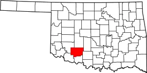 Comanche County map | |
| Towns | ||
| CDPs | ||
| Other communities | ||
| Footnotes | ‡This populated place also has portions in an adjacent county or counties | |
| Cache |
| |
|---|---|---|
| Elgin |
| |
| Fort Sill |
| |
| Indiahoma |
| |
| Lawton |
| |
| Medicine Park |
| |
| Meers | ||