Mentawai Islands Regency
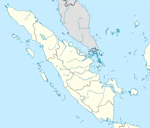
The Mentawai Islands Regency are a regency of West Sumatra Province which consists of a chain of about a hundred islands and islets approximately 150 kilometres (93 miles) off the western coast of Sumatra in Indonesia. They cover a land area of 6,033.76 km2 and had a population of 76,173 at the 2010 Census[3] and 87,623 at the 2020 Census;[4] the official estimate as at mid 2022 was 89,401 - comprising 46,431 males and 42,970 females.[1] Siberut at 3,838.25 square kilometres (1,482 square miles) is the largest of the islands. The other major islands are Sipura (or Sipora), North Pagai (Pagai Utara), and South Pagai (Pagai Selatan). The islands lie off the Sumatran coast, across the Mentawai Strait. The indigenous inhabitants of the islands are known as the Mentawai people. The Mentawai Islands have become a noted destination for surfing,[5] with over 40 boats offering surf charters to international guests.[6]
Mentawai Islands Regency
Kabupaten Kepulauan Mentawai | |
|---|---|
|
Coat of arms | |
| Motto(s): Musara Kasimaeru (Together for Goodness) | |
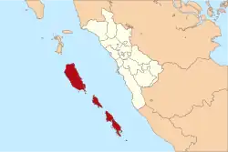 Location within West Sumatra | |
| Coordinates: 2°11′S 99°39′E | |
| Country | Indonesia |
| Province | West Sumatra |
| Regency seat | Tua Pejat |
| Government | |
| • Acting Regent | Martinus Dahlan |
| • Vice Regent | Vacant |
| Area | |
| • Total | 6,033.76 km2 (2,329.65 sq mi) |
| Population (2023 estimate)[1] | |
| • Total | 92,122 |
| • Density | 15/km2 (40/sq mi) |
| Demographics | |
| • Religion | Christianity 79,94% - Protestanism 49% - Catholicism 30,94% Islam 19,56% |
| Time zone | UTC+7 (Indonesia Western Standard Time) |
| Area code | (+62) 759 |
| Website | mentawaikab.go.id |

Administrative districts


The Mentawai Islands have been administered as a regency within the West Sumatra (Sumatera Barat) province since 1999. The regency seat is Tua Pejat, on the island of Sipora. Padang, the capital of the province, lies on the Sumatran mainland opposite Siberut. The regency is divided into ten districts (kecamatan), tabulated below from south to north with their areas and their populations at the 2010 Census[3] and the 2020 Census,[4] together with the official estimates as at mid 2022.[1] The table also includes the locations of the district administrative centres, the number of villages (all classed as rural desa) and the number of named offshore islands in each district, and its post code.
| Name of District (kecamatan) | English Name | Area in km2 | Pop'n 2010 Census | Pop'n 2020 Census | Pop'n mid 2022 Estimate | Admin centre | No. of villages | No. of islands | Post code |
|---|---|---|---|---|---|---|---|---|---|
| Pagai Selatan | South Pagai | 851.28 | 8,782 | 9,373 | 9,421 | Bulasat | 4 | 31 | 25391 |
| Sikakap (a) | Central Pagai | 312.60 | 9,531 | 10,219 | 10,280 | Taikako | 3 | 8 | 25399 |
| Pagai Utara | North Pagai | 371.25 | 5,212 | 6,031 | 6,157 | Saumanganya | 3 | 9 | 25390 |
| Sipora Selatan | South Sipora | 348.33 | 8,460 | 9,812 | 10,022 | Sioban | 7 | 3 | 25392 |
| Sipora Utara | North Sipora | 272.40 | 9,097 | 11,968 | 12,528 | Sido Makmur | 6 | 12 | 25398 |
| Siberut Selatan | South Siberut | 328.00 | 8,446 | 9,933 | 10,173 | Muara Siberut | 5 | 1 | 25397 |
| Siberut Barat Daya | Southwest Siberut | 1,013.83 | 6,069 | 7,058 | 7,213 | Pasakiat Taileleu | 3 | 17 | 25393 |
| Siberut Tengah | Central Siberut | 589.75 | 6,069 | 7,089 | 7,251 | Saibi Samukop | 3 | 5 | 25396 |
| Siberut Utara | North Siberut | 782.68 | 7,774 | 8,337 | 8,387 | Muara Sikabaluan | 6 | 4 | 25395 |
| Siberut Barat | West Siberut | 1,163.64 | 6,733 | 7,803 | 7,969 | Simalegi | 3 | 1 | 25394 |
| Totals | 6,033,76 | 76,173 | 87,623 | 89,401 | Tuapejat | 43 | 111 |
Note: (a) Sikakap District covers the northern part of South Pagai Island and the southern part of North Pagai Island, plus some intervening small islands. Of the three desa, Matobek is entirely on North Pagai Island, while Sikakap and Taikato are mainly on North Pagai Island but each includes areas on South Pagai as well as the intervening small islands.
Villages
Administrative villages (desa) listed for each district:[7]
| District | Villages |
|---|---|
| Pagai Selatan | Bulasat, Makalo, Malakopa (Malakopak), Sinaka (Sinakak) |
| Sikakap | Matobe (Matobek), Sikakap, Taikako |
| Pagai Utara | Betumonga, Saumanganya (Saumanganyak), Silabu |
| Sipora Selatan | Beriulou, Bosua, Mara, Matobe (Matobek), Nemnemleleu (Nem-Nem Leleu), Saureinu (Saureinuk), Sioban |
| Sipora Utara | Betumonga (Beutomonga), Bukit Pamewa, Gosooinan (Goisooinan), Sido Makmur, Sipora Jaya, Tuapejat |
| Siberut Selatan | Madobag (Madobak Ugai), Maileppet/Maleppet, Matotonan, Muara/Muaro Siberut, Muntei |
| Siberut Barat Daya | Katurai/Katurei, Pasakiat Taileleu (Pasakiat Taleleu), Sagulubbeg (Sagulubek / Sagalubeg / Sagalubbek) |
| Siberut Tengah | Cimpungan, Saibi Muara (Saibi Samukop/Samokop), Saliguma |
| Siberut Utara | Bojakan, Malancan (Malancang), Mongan Poula/Paula, Muara/Muaro Sikabaluan, Sirilogui, Sotboyak |
| Siberut Barat | Sigapokna, Simalegi/Simaligi, Simatalu Sipokak |
Tourism
Surfing
Macaronis was first discovered in 1980 by pioneer surf discoverers Chris Goodnow, Scott Wakefield and Tony Fitzpatrick, who originally named the break ‘P-Land’ on their first visit (after Pasangan Bay / Pagai Islands). Amazingly, and considering the remote location, P-Land may in fact have been the first wave surfed in the Mentawai Islands.
Lances Right was discovered a full 10 years later, while Chris, Scott, and Tony continued to keep their discovery a secret. They returned in 1981 with friend Tim Annand, and again on a boat trip in the 90’s.
[8]
[9]
[10]
[11]
The first photos of the surf breaks in the Mentawais area were leaked after a surf trip in 1992 aboard the MV Indies Trader, with professional surfers Ross Clarke-Jones, Tom Carroll, and Martin Potter.[12] Ever since then, the Mentawai Islands have been well on the radar of surf travellers around the world. At the West of Sumatra, the Mentawai Islands have the most consistent surf breaks in Indonesia making it one of the preferred choices for serious surfers. The tropical waters surrounding the islands offer year-round waves up to 15 ft (4.5 m).[13][14]
Ecology


The islands have been separated from Sumatra since the mid-Pleistocene period, which has allowed at least twenty endemic species to develop amongst its flora and fauna. This includes six endemic primates: the Kloss's gibbon (Hylobates klossii), Mentawai macaque (Macaca pagensis), Siberut macaque (Macaca siberu), Mentawai langur (Presbytis potenziani), Siberut langur (Presbytis siberu), and pig-tailed langur (Simias concolor). They are highly endangered due to logging, unsustainable hunting, and conversion of rainforest to palm oil plantations.[15] Some areas of the Mentawai Islands rainforest ecoregion are protected, such as the Siberut National Park. Red junglefowl, the Asian palm civet and crab-eating macaque are also native.[16]
Seismic activity

The Mentawai Islands lie above the Sunda megathrust, a seismically active zone responsible for many great earthquakes. This megathrust runs along the southwestern side of Sumatra island, forming the interface between the Eurasian Plate and Indo-Australian Plate.
Earthquake and tsunami activity has been high since the 2004 Indian Ocean earthquake. In 1833, the region was hit with an earthquake, possibly similar in size to the 2004 Indian Ocean earthquake;[17] another large earthquake struck in 1797. On October 25, 2010, an earthquake in southern Sumatra led to a deadly tsunami that devastated villages in South and North Pagai.[18] On March 3, 2016, an earthquake of 7.8 magnitude occurred off the Indian Ocean, a few hundred kilometres from Mentawai islands, as a result of strike-slip faulting within the oceanic lithosphere of the Indo-Australia plate.[19]
See also
- Mentawai ethnic group
- Mentawai Festival
Notes
- Badan Pusat Statistik, Jakarta, 2023, Kabupaten Kepulauan Mentawai Dalam Angka 2023 (Katalog-BPS 1102001.1309)
- "Penduduk Menurut Wilayah dan Agama yang Dianut Provinsi Sumatera Barat". sp2010.bps.go.id. Retrieved 2021-07-26.
- Biro Pusat Statistik, Jakarta, 2011.
- Badan Pusat Statistik, Jakarta, 2021.
- "SURFAID". SURFAID. Archived from the original on May 17, 2014. Retrieved May 3, 2017.
- "Every Surf Charter Boat in the Mentawais | 41 Boats with Photos and Info". Indies Trader. Retrieved 2019-05-05.
- "Daftar Desa & Kelurahan di Kabupaten Kepulauan Mentawai". www.nomor.net. Kode Pos Indonesia. 2020. Retrieved 2020-02-25.
- "Finding-Macaronis-Part1". www.swellnet.com. Retrieved 2023-05-10.
- "Finding-Macaronis-Part2". www.swellnet.com. Retrieved 2023-05-10.
- "Finding-Macaronis-Part3". www.swellnet.com. Retrieved 2023-05-10.
- "Original P-Land Discoverers Reunion". www.macaronisresort.com. Retrieved 2023-05-10.
- "Mentawai". www.surfindonesia.com. Retrieved 2020-12-18.
- "Top 10 Place to Surf in Indonesia". allindonesiatravel. Retrieved 2020-12-18.
- "15 Surfing Destination". indonesia.travel. Retrieved 2020-12-18.
- Whittaker, D. 2006. A conservation action plan for the Mentawai primates. Primate Conservation 20: 95–105.
- "Mentawai Islands rain forests". Terrestrial Ecoregions. World Wildlife Fund.
- "INDONESIA - THE GREAT EARTHQUAKE AND TSUNAMI OF 1833 OFF THE COAST OF CENTRAL SUMATRA - Dr. George Pararas-Carayannis". www.DrGeorgePC.com. Retrieved May 3, 2017.
- "Indonesia Earthquake and Tsunami Kill 113, Merapi Volcano Eruptions Hours Later". News article. politiktimes.com. October 26, 2010. Archived from the original on November 5, 2010. Retrieved October 26, 2010.
- "M7.8 – Southwest of Sumatra, Indonesia". Retrieved March 2, 2016.
