Merrimack Valley Transit
Merrimack Valley Transit, formerly known as Merrimack Valley Regional Transit Authority is a public, non-profit organization in Massachusetts, United States, charged with providing public transportation to an area consisting of the cities and towns of Amesbury, Andover, Boxford, Georgetown, Groveland, Haverhill, Lawrence, Merrimac, Methuen, Newbury, Newburyport, North Andover, Rowley, Salisbury and West Newbury, as well as a seasonal service to the popular nearby summer destination of Hampton Beach, New Hampshire.[1]
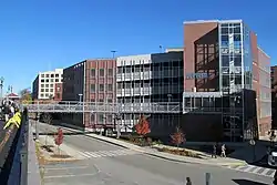 MVRTA garage at Haverhill station | |
| Headquarters | 85 Railroad Avenue Haverhill, Massachusetts |
|---|---|
| Service area | Northeast Massachusetts |
| Service type | Bus service, paratransit |
| Alliance | MBTA, LRTA |
| Routes | 25 |
| Destinations | Lawrence, Haverhill, Methuen, Andover, North Andover |
| Fleet | Gillig, Motor Coach Industries |
| Operator | First Transit |
| Website | mvrta.com |
MEVA provides fixed route bus services and paratransit services within its area, together with services to Lowell. MEVA's buses provide interchange with commuter lines of the Massachusetts Bay Transportation Authority (MBTA) at Andover Station, Haverhill station, Lawrence station, Lowell station and Newburyport station.[2]
MEVA started operation in 1976, having been created under Chapter 161B of the Massachusetts General Laws. Since 1983, operation of the MEVA has been subcontracted to First Transit, a subsidiary of the United Kingdom based FirstGroup.[3][4]
As of March 1, 2022 all local routes are free.
Routes
MEVA operates routes in northeastern Massachusetts.
References
- "About MARTA". Massachusetts State Association of Regional Transit Authorities. Archived from the original on May 13, 2008. Retrieved 2008-05-14.
- "Home page". Merrimack Valley Regional Transit Authority.
- "Merrimack Valley Regional Transit Authority". First Transit. Archived from the original on 2008-01-06. Retrieved 2008-05-19.
- "Massachusetts Bay Transportation Authority, Regional Transit Authorities Coordination and Efficiencies Report" (PDF). Massachusetts Executive Office of Transportation. Archived from the original (PDF) on 2008-05-27. Retrieved 2008-05-06.