Mignanego
Mignanego is a comune (municipality) of the Metropolitan City of Genoa in the Italian region Liguria, located about 11 kilometres (7 mi) north of Genoa in the northeastern part of the Val Polcevera valley.
Mignanego | |
|---|---|
| Comune di Mignanego | |
.jpg.webp) | |
 Coat of arms | |
.svg.png.webp) | |
Location of Mignanego | |
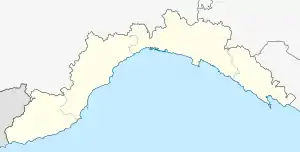
 Mignanego Location of Mignanego in Italy  Mignanego Mignanego (Liguria) | |
| Coordinates: 44°31′N 8°55′E | |
| Country | Italy |
| Region | Liguria |
| Metropolitan city | Genoa (GE) |
| Founded | 1861 |
| Frazioni | Fumeri, Giovi, Montanesi, Paveto |
| Government | |
| • Mayor | Maria Grazia Grondona[1] |
| Area | |
| • Total | 18.4 km2 (7.1 sq mi) |
| Elevation | 150 m (490 ft) |
| Population (31 December 2009)[3] | |
| • Total | 3,727 |
| • Density | 200/km2 (520/sq mi) |
| Demonym | Mignaneghesi |
| Time zone | UTC+1 (CET) |
| • Summer (DST) | UTC+2 (CEST) |
| Postal code | 16018 |
| Dialing code | 010 |
| ISTAT code | 010035 |
| Website | Official website |
Geography
Mignanego borders the following municipalities: Busalla, Campomorone, Fraconalto, Genoa, Savignone, Serra Riccò and Voltaggio (this one in the Province of Alessandria, Piedmont).
It counts 4 (frazioni): Fumeri, Giovi, Montanesi, and Paveto [4] as well as 8 località: Barriera, Costagiutta, Migliarina, Pile, Ponte dell'Acqua, Ponterosso, Vetrerie, and Vittoria. Vetrerie is the most populated village and the municipal seat; it is sometimes identified simply as Mignanego.
References
- Comune di Mignanego. "Portale istituzionale del Comune di Mignanego - Amministrazione Comunale". eCOMUNE Cloud. Retrieved 21 May 2019.
- "Superficie di Comuni Province e Regioni italiane al 9 ottobre 2011". Italian National Institute of Statistics. Retrieved 16 March 2019.
- "Popolazione Residente al 1° Gennaio 2018". Italian National Institute of Statistics. Retrieved 16 March 2019.
- Metropolitan City of Genoa. "Mignanego". Retrieved 20 May 2019.
This article is issued from Wikipedia. The text is licensed under Creative Commons - Attribution - Sharealike. Additional terms may apply for the media files.