Millsfield, New Hampshire
Millsfield is a township in Coös County, New Hampshire, United States. It is part of the Berlin, NH–VT Micropolitan Statistical Area. The population was 25 at the 2020 census.[2]
Millsfield, New Hampshire | |
|---|---|
 Hills in Dixville from New Hampshire Route 26 in Millsfield | |
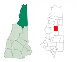
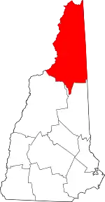
 Location in Coös County, New Hampshire | |
| Coordinates: 44°45′54″N 71°16′14″W | |
| Country | United States |
| State | New Hampshire |
| County | Coös |
| Area | |
| • Total | 45.2 sq mi (117.1 km2) |
| • Land | 44.8 sq mi (116.1 km2) |
| • Water | 0.4 sq mi (1.0 km2) 0.89% |
| Elevation | 2,030 ft (620 m) |
| Population (2020)[2] | |
| • Total | 25 |
| • Density | 0.6/sq mi (0.22/km2) |
| Time zone | UTC-5 (Eastern) |
| • Summer (DST) | UTC-4 (Eastern) |
| Area code | 603 |
| FIPS code | 33-007-48260 |
| GNIS feature ID | 873667 |
In New Hampshire, locations, grants, townships (which are different from towns), and purchases are unincorporated portions of a county which are not part of any town and have limited self-government (if any, as many are uninhabited).
History
In 1774, Millsfield was granted to George Boyd and others and contained about 23,200 acres (94 km2). It was named in honor of Sir Thomas Mills.[3] In 1952, Millsfield was organized for voting purposes.
Geography
According to the United States Census Bureau, the township has a total area of 45.2 square miles (117.1 km2), of which 44.8 square miles (116.1 km2) are land and 0.4 square miles (1.0 km2), or 0.89%, are water.[1] Millsfield Pond is in the center of the township. The outlet, Millsfield Pond Brook, flows northeast to Clear Stream at the eastern boundary of the township. Clear Stream, which crosses the northeast corner of the township, is an east-flowing tributary of the Androscoggin River. The southeast part of the township also drains to the Androscoggin River, via Newell Brook and the outlet of Moose Pond. The southwest part of the township is drained by Phillips Brook, a south-flowing tributary of the Upper Ammonoosuc River and part of the Connecticut River watershed.
Millsfield is bordered to the west by Erving's Location and Odell, to the north by Dixville, to the east by Errol, and to the south by Dummer.
New Hampshire Route 26 crosses the northeast part of Millsfield, following Clear Stream. To the northwest it leads over Dixville Notch to Colebrook, while to the southeast it leads into Errol and then continues to the Maine border. Millsfield has the only road that leads to Erving's Location, an uninhabited township. The road goes to the north of Mount Kelsey, the highest point in Millsfield at 3,472 feet (1,058 m) above sea level.
Politics
New Hampshire law allows towns with fewer than 100 residents to open the polls at midnight and close them as soon as all registered voters have cast their ballots.[4] Beginning in 2016, Millsfield became the third town in New Hampshire with midnight voting.
Election results
Boldfaced names indicate the ultimate nationwide winner of each contest:
2016
| Dem. primary: (3 votes)[5] | Rep. primary: (17 votes)[6] | General election: (21 votes)[7] |
|---|---|---|
| Hillary Clinton - 2 | Ted Cruz - 9 | Donald Trump - 16 |
| Bernie Sanders - 1 | Donald Trump - 3 | Hillary Clinton - 4 |
| John Kasich - 1 | Bernie Sanders - 1 | |
| Jeb Bush - 1 | ||
| Carly Fiorina - 1 | ||
| Chris Christie - 1 | ||
| Rand Paul - 1 |
In July 2016 residents voted[8] to seek incorporation as a town. Legislative action will be required to implement this process.
2020
| Dem. primary: (5 votes)[9] | Rep. primary: (17 votes)[9] | General election: (21 votes)[10] |
|---|---|---|
| Amy Klobuchar - 2 | Donald Trump - 16 | Donald Trump - 16 |
| Joe Biden - 1 | Bill Weld - 1 | Joe Biden - 5 |
| Pete Buttigieg - 1 | ||
| Bernie Sanders - 1 |
Demographics
| Census | Pop. | Note | %± |
|---|---|---|---|
| 1830 | 33 | — | |
| 1840 | 12 | −63.6% | |
| 1860 | 15 | — | |
| 1870 | 28 | 86.7% | |
| 1880 | 62 | 121.4% | |
| 1890 | 62 | 0.0% | |
| 1900 | 41 | −33.9% | |
| 1910 | 12 | −70.7% | |
| 1920 | 45 | 275.0% | |
| 1930 | 33 | −26.7% | |
| 1940 | 34 | 3.0% | |
| 1950 | 16 | −52.9% | |
| 1960 | 7 | −56.2% | |
| 1970 | 18 | 157.1% | |
| 1980 | 7 | −61.1% | |
| 1990 | 21 | 200.0% | |
| 2000 | 22 | 4.8% | |
| 2010 | 23 | 4.5% | |
| 2020 | 25 | 8.7% | |
| U.S. Decennial Census[2][11] | |||
As of the 2000 census,[12] there were 22 people, 8 households, and 5 families residing in the township. The population density was 0.5 inhabitants per square mile (0.19/km2). There were 62 housing units at an average density of 1.4 per square mile (0.54/km2). The racial makeup of the township was 100.00% White.
There were 8 households, out of which 12.5% (one) had children under the age of 18 living with them, 37.5% (three) were married couples living together, 25.0% (two) had a female householder with no husband present, and 37.5% (three) were non-families. 37.5% (three) of all households were made up of individuals, and 25.0% had someone living alone who was 65 years of age or older. The average household size was 2.75 and the average family size was 3.80.
In the township the population was spread out, with 13.6% (three) under the age of 18, 9.1% (two) from 18 to 24, 22.7% (five) from 25 to 44, 9.1% (two) from 45 to 64, and 45.5% (10) who were 65 years of age or older. The median age was 52 years. For every 100 females, there were 37.5 males. For every 100 females age 18 and over, there were 46.2 males.
The median income for a household in the township was $59,375, and the median income for a family was $59,375. Males had a median income of $38,750 versus $0 for females. The per capita income for the township was $13,063. None of the population or the families were below the poverty line.
References
- "2021 U.S. Gazetteer Files – New Hampshire". United States Census Bureau. Retrieved November 17, 2021.
- "Millsfield township, Coos County, New Hampshire: 2020 DEC Redistricting Data (PL 94-171)". U.S. Census Bureau. Retrieved November 17, 2021.
- Gannett, Henry (1905). The Origin of Certain Place Names in the United States. U.S. Government Printing Office. p. 209.
- Canfield, Clarke (January 8, 2008). "McCain, Obama, get early votes in N.H. villages". The Boston Globe. Associated Press. Archived from the original on November 2, 2008. Retrieved January 8, 2008.
- Leip, David. "2016 Presidential Democratic Primary Election Results - Coos County, NH". Dave Leip's Atlas of U.S. Presidential Elections. Retrieved July 1, 2020.
- Leip, David. "2016 Presidential Republican Primary Election Results - Coos County, NH". Dave Leip's Atlas of U.S. Presidential Elections. Retrieved July 1, 2020.
- "Who Is Winning US Election: Dixville Notch, Hart's Location, Millsfield Vote Counts In". IB Times. Retrieved November 8, 2016.
- "Millsfield voters decide to incorporate as a town | New Hampshire". UnionLeader.com. Retrieved November 26, 2016.
- "Midnight voting in 2020 New Hampshire Primary show Amy Klobuchar, Donald Trump leading". WMUR. February 11, 2020.
- Associated Press (November 3, 2020). "2 tiny New Hampshire towns cast first 2020 Election Day votes". WBNS-TV. Retrieved November 3, 2020.
- "Census of Population and Housing". Census.gov. Retrieved June 4, 2016.
- "U.S. Census website". United States Census Bureau. Retrieved January 31, 2008.
