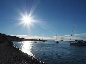
Moncks Bay
Moncks Bay is a south-eastern suburb of Christchurch, New Zealand.
Moncks Bay | |
|---|---|
 A sunny afternoon in Moncks Bay | |
| Coordinates: 43.567°S 172.743°E | |
| Country | New Zealand |
| City | Christchurch |
| Local authority | Christchurch City Council |
| Electoral ward | Heathcote |
| Area | |
| • Land | 57 ha (141 acres) |
| Population (2018 Census)[2] | |
| • Total | 486 |
| (Avon Heathcote Estuary) | ||
| Redcliffs |
|
Clifton |
| Port Hills |
The first European owner of 100 acres (40 ha) in Moncks Bay was George Heath, who arrived in Lyttelton in March 1851 on the Isabella Hercus. He also had 500 acres (200 ha) of land on the hills behind. Heath sold the land to William McCormack in 1860; McCormacks Bay in the adjacent suburb Mount Pleasant is named for his brother. Moncks Bay changed owner again in 1868, and was purchased in 1869 by John Stanley Monck, after whom the area was named.[3][4] Monck increased his land holdings up the hill by purchasing adjacent property from Dr Alfred Charles Barker (50 acres or 20 hectares) and in 1882, he acquired land from the estate of Alfred Watson that brought his holdings in Redcliffs to a total of about 300 acres (120 ha).[5]
Demographics
Moncks Bay is part of the Clifton Hill SA2 statistical area.[6]
| Year | Pop. | ±% p.a. |
|---|---|---|
| 2006 | 465 | — |
| 2013 | 483 | +0.54% |
| 2018 | 486 | +0.12% |
| Source: [2] | ||
Moncks Bay, comprising the SA1 statistical areas of 7026568–570, covers 0.57 km2 (0.22 sq mi).[1] It had a population of 486 at the 2018 New Zealand census, an increase of 3 people (0.6%) since the 2013 census, and an increase of 21 people (4.5%) since the 2006 census. There were 198 households. There were 228 males and 255 females, giving a sex ratio of 0.89 males per female, with 105 people (21.6%) aged under 15 years, 63 (13.0%) aged 15 to 29, 204 (42.0%) aged 30 to 64, and 114 (23.5%) aged 65 or older.
Ethnicities were 95.7% European/Pākehā, 6.8% Māori, 0.6% Pacific peoples, 3.7% Asian, and 0.6% other ethnicities (totals add to more than 100% since people could identify with multiple ethnicities).
Although some people objected to giving their religion, 54.3% had no religion, 38.3% were Christian and 1.9% had other religions.
Of those at least 15 years old, 162 (42.5%) people had a bachelor or higher degree, and 33 (8.7%) people had no formal qualifications. The employment status of those at least 15 was that 174 (45.7%) people were employed full-time, 75 (19.7%) were part-time, and 9 (2.4%) were unemployed.[2]
Notes
- "ArcGIS Web Application". statsnz.maps.arcgis.com. Retrieved 10 October 2021.
- "Statistical area 1 dataset for 2018 Census". Statistics New Zealand. March 2020. 7026568, 7026569 and 7026570.
- Ogilvie 2009, p. 69.
- Harper, Margaret (20 February 2014). "Christchurch Place Names: A - M" (PDF). Christchurch City Libraries. p. 155. Retrieved 1 March 2014.
- Ogilvie 2009, p. 70.
- 2018 Census place summary: Clifton Hill
References
- Ogilvie, Gordon (2009). The Port Hills of Christchurch (2nd ed.). Christchurch: Phillips & King Publishers. ISBN 978-0-9583315-6-2.