Mongnai State
Mongnai, also known as Möngnai, Mone, Mōng Nai or Monē,[1] was a Shan state in what is today Burma. It belonged to the Eastern Division of the Southern Shan States.[1] Its capital was Mongnai town.[2]
| Mongnai | |||||||
|---|---|---|---|---|---|---|---|
| State of the Shan States | |||||||
| bf. 1800–1959 | |||||||
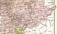 Möng Nai State in an Imperial Gazetteer of India map | |||||||
| Capital | Mong Nai | ||||||
| Area | |||||||
• 1901 | 5,129 km2 (1,980 sq mi) | ||||||
| Population | |||||||
• 1901 | 44252 | ||||||
| History | |||||||
| History | |||||||
• State founded | bf. 1800 | ||||||
• Abdication of the last Saopha | 1959 | ||||||
| |||||||

The Gate at Mongnai in a picture by Sir James George Scott.
History
Möngnai state was founded before 1800. According to tradition a predecessor state named Saturambha had existed previously in the area.[3]
Mongnai included the substates of Kengtawng[1] and Kenghkam. The latter was annexed in 1882.
Rulers (title Myoza)
- c. 1802 – 1848: Maung Shwe Paw
- 1848–1850: Maung Yit
- 1850–1851: U Po Ka
- 1852: U Shwe Kyu
Rulers (title Saopha)
Ritual style Kambawsa Rahta Mahawunthiri Pawara Thudamaraza.[4]
Saophas:
- 1312–1339: Khun Khrua
- 1567–1568: Hso Hpoek Hpa
- 1568–1585: Sao Piam Hpa
- 1585–1631: Sao Möng Hkam
- 1631–1675: Sao Hla Hkam (son of Saopha of Momeik)
- 1675–1678: Sao Kyam Hkam (son of Sao Hla Hkam)
- 1678–1704: Sao Hso Hom (son of Sao Kyam Hkam)
- 1704–1728: Sao Hkun Arn (son of Sao Hseua Hom)
- 1728–1746: Sao Hso Hkam (son of Sao Hkun Arn)
- 1746–1772: Shwe Myat Noe (son of Sao Hso Hkam)
- 1772–1790: Shwe Myat Kyaw (son of Shwe Myat Noe)
- 1790–1811: Hkun Shwe Wa (son of Shwe Myat Kyaw)
- 1811–1842: Hkun Hsen Kyung (son of Sao Maha Hpom Saopha of Kyaingtong)
- 1842–1852: Hkun Nu Nom (son of Hkun Kyung)
- 1852–1875: Hkun Hpo On (son of Hkun Nu Nom)
- 1875–1882: Hkun Kyi (1st time) the uncle of Hkun Hpo On
- 1882–1888: Twet Nga Lu (usurper) (d. 1888)
- 1888–1914: Hkun Kyi (2nd time) the uncle of Hkun Hpo On
- 6 May 1914 – 1928: Hkun Kyaw Sam
- 1928–1949: Hkun Kyaw Ho
- 1949–1958: Sao Pyea (last Saopha of Mone')
References
- Chisholm, Hugh, ed. (1911). . Encyclopædia Britannica. Vol. 18 (11th ed.). Cambridge University Press. p. 710.
- Imperial Gazetteer of India, v. 17, p. 405.
- Ben Cahoon (2000). "World Statesmen.org: Shan and Karenni States of Burma". Retrieved 21 December 2010.
- "WHKMLA : History of the Shan States". 18 May 2010. Retrieved 21 December 2010.
External links
This article is issued from Wikipedia. The text is licensed under Creative Commons - Attribution - Sharealike. Additional terms may apply for the media files.