Rural Municipality of Montcalm
Montcalm (French: Municipalité rurale de Montcalm) is a rural municipality (RM) in the province of Manitoba in Western Canada. The Canada 2016 Census reported a population of 1,260 persons, a decrease from the 1,309 reported in the 2011 Census.
Rural Municipality of Montcalm | |
|---|---|
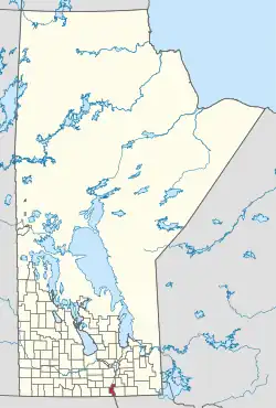 Location of the RM of Montcalm in Manitoba | |
| Coordinates: 49°10′39″N 97°19′29″W | |
| Country | Canada |
| Province | Manitoba |
| Area | |
| • Land | 468.04 km2 (180.71 sq mi) |
| Population | |
| • Total | 1,260 |
| Time zone | UTC-6 (CST) |
| • Summer (DST) | UTC-5 (CDT) |
| Area codes | 204 and 431 |
Geography
The RM has an area of 469.41 km2 (181.24 sq mi).
The Canada–United States border opposite Pembina County, North Dakota forms a small part of Montcalm's southern boundary; there is no direct road link between the RM and county. The Roseau River Anishinabe First Nation is situated between Montcalm and the neighbouring Municipality of Emerson – Franklin. Montcalm also borders the municipalities of Rhineland, De Salaberry, and Morris, as well as the eastern edge of the Town of Morris. The Red River of the North flows northward though the eastern part of Montcalm.
Most of the St. Joseph Wind Farm lies within the RM.
Communities
- Letellier
- St. Jean Baptiste
- St. Joseph
- Ste. Elizabeth
Demographics
In the 2021 Census of Population conducted by Statistics Canada, Montcalm had a population of 1,278 living in 490 of its 524 total private dwellings, a change of 1.4% from its 2016 population of 1,260. With a land area of 468.25 km2 (180.79 sq mi), it had a population density of 2.7/km2 (7.1/sq mi) in 2021.[2]
See also
References
- "Population and dwelling counts, for Canada, provinces and territories, and census subdivisions (municipalities), 2016 and 2011 censuses – 100% data (Manitoba)". Statistics Canada. February 7, 2018. Retrieved January 15, 2022.
- "Population and dwelling counts: Canada, provinces and territories, and census subdivisions (municipalities), Manitoba". Statistics Canada. February 9, 2022. Retrieved February 20, 2022.
External links
Places adjacent to Rural Municipality of Montcalm | |
|---|---|
| Cities |  | ||
|---|---|---|---|
| Towns |
| ||
| Rural municipalities |
| ||
| Unincorporated communities | |||