Municipality of Roblin
The Municipality of Roblin is a rural municipality (RM) in the Parkland Region of Manitoba, Canada.
Municipality of Roblin
Municipality of Hillsburg – Roblin – Shell River (January to March 2015) | |
|---|---|
| Nickname: Jewel of the Parkland | |
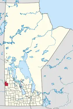 Location of the Municipality of Roblin in Manitoba | |
| Coordinates: 51.22897°N 101.35187°W | |
| Country | Canada |
| Province | Manitoba |
| Region | Parkland |
| Incorporated (amalgamated) | January 1, 2015[1] |
| Government | |
| • Head of Council | Robert Misko |
| Area | |
| • Land | 1,690.73 km2 (652.79 sq mi) |
| Population (2016) | |
| • Total | 3,214 |
| Time zone | UTC-6 (CST) |
| • Summer (DST) | UTC-5 (CDT) |
| Postal code | R0L 1P0 |
| Website | Official website |
Roblin station is located in the municipality.
History
The RM was incorporated as the Municipality of Hillsburg – Roblin – Shell River on January 1, 2015 via the amalgamation of the RMs of Hillsburg and Shell River and the Town of Roblin.[1] It was formed as a requirement of The Municipal Amalgamations Act, which required that municipalities with a population less than 1,000 amalgamate with one or more neighbouring municipalities by 2015.[2] The Government of Manitoba initiated these amalgamations in order for municipalities to meet the 1997 minimum population requirement of 1,000 to incorporate a municipality.[3]
The Manitoba government changed the name of the Municipality of Hillsburg – Roblin – Shell River to the Municipality of Roblin on March 30, 2015. The current Municipality of Roblin has no connection to the former Rural Municipality of Roblin in the Pembina Valley Region.[4]
Communities
- Bield
- Boggy Creek
- Deepdale
- Makaroff
- Merridale
- Roblin (unincorporated urban community)
- San Clara
- Shevlin
- Shortdale
- Tummel
- Walkerburn
- Zelena
Demographics
In the 2021 Census of Population conducted by Statistics Canada, Hillsburg-Roblin-Shell River had a population of 3,089 living in 1,406 of its 1,638 total private dwellings, a change of -3.9% from its 2016 population of 3,214. With a land area of 1,694.95 km2 (654.42 sq mi), it had a population density of 1.8/km2 (4.7/sq mi) in 2021.[5]
References
- "The Municipal Amalgamations Act (C.C.S.M. c. M235): Rural Municipality of Hillsburg, Town of Roblin and Rural Municipality of Shell River Amalgamation Regulation" (PDF). Government of Manitoba. Retrieved October 4, 2014.
- "The Municipal Amalgamations Act (C.C.S.M. c. M235)". Government of Manitoba. October 2, 2014. Retrieved October 4, 2014.
- "Speech from the Throne: At the Opening of the Second Session of the 40th Legislature of the Province of Manitoba". Government of Manitoba. November 19, 2012. Retrieved October 4, 2014.
- "The Municipal Act: Municipal Status and Boundaries Regulation, amendment" (PDF). Government of Manitoba. March 30, 2015. Retrieved June 2, 2020.
- "Population and dwelling counts: Canada, provinces and territories, and census subdivisions (municipalities), Manitoba". Statistics Canada. February 9, 2022. Retrieved February 20, 2022.
External links
Places adjacent to Municipality of Roblin | |
|---|---|
| Towns |
|  | ||
|---|---|---|---|---|
| Villages |
| |||
| Rural municipalities |
| |||
| First Nations | ||||
| Indian reserves | ||||
| Unincorporated communities | ||||