Monte Incudine massif
The Monte Incudine massif (French: Massif du Monte Incudine) is a chain of mountains in the south of the island of Corsica, France. It takes its name from Monte Incudine, the highest peak.
| Monte Incudine massif | |
|---|---|
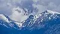 Tintinnaghja and Bocca d'Asinau | |
| Highest point | |
| Peak | Monte Incudine |
| Elevation | 2,134 m (7,001 ft) |
| Coordinates | 41°50′57″N 9°12′26″E |
| Geography | |
| |
| Location | Corsica, France |
Location
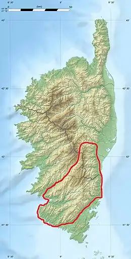
The Monte Incudine massif is the southernmost of the four largest blocks of mountains in Corsica, the others being (from north to south), the Monte Cinto massif, monte Rotondo massif and Monte Renoso massif.[1] These massifs form the Corse cristalline, mainly composed of magmatic rocks such as granites, granulites, porphyries and rhyolites. The Monte Incudine massif dominates the Sartenais and extends south to the Cagna mountain.[2]
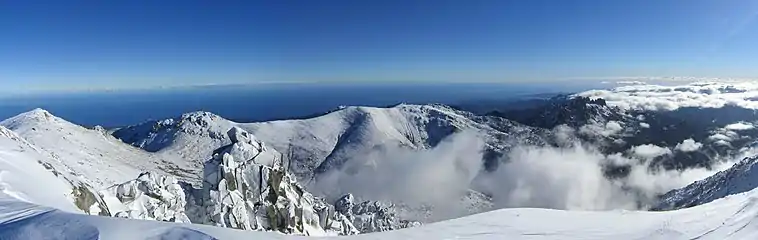 Panorama of the eastern sector of the Alcudina (from left to right ː Bucca d'Asinau, Punta Muvrariccia, Punta di U Furnellu, Bavedda)
Peaks
The main peaks are,
| Name | Elevation | Prominence | ||
|---|---|---|---|---|
| meters | feet | meters | feet | |
| Monte Incudine | 2,134 | 7,001 | 0 | 0 |
| Punta Scarachiana | 2,128 | 6,982 | 0 | 0 |
| Cappella | 2,041 | 6,696 | 0 | 0 |
| Punta di Tintennaja | 2,018 | 6,621 | 0 | 0 |
| Monte Furmicula | 1,981 | 6,499 | 0 | 0 |
| Punta di u Furnellu | 1,902 | 6,240 | 0 | 0 |
| Punta Muvrareccia | 1,899 | 6,230 | 0 | 0 |
| Aiguilles de Bavella | 1,857 | 6,093 | 0 | 0 |
| Punta Velaco | 1,483 | 4,865 | 0 | 0 |
| Monte San Petru | 1,400 | 4,600 | 0 | 0 |
| Cagna | 1,371 | 4,498 | 0 | 0 |
| Punta di a Vacca Morta | 1,316 | 4,318 | 0 | 0 |
Sources
- Grande région écologique K Corse (PDF) (in French), IGN Agences de l'Eau, 2011, retrieved 2021-12-14
- "Massif du Monte Incudine en France", The Outsiders (in French), retrieved 2021-12-14
Landforms of the Corse-du-Sud department | ||
|---|---|---|
| Massifs | | |
| Peaks | ||
| Passes | ||
| ||
Landforms of the Haute-Corse department | ||
|---|---|---|
| Massifs |  | |
| Peaks | ||
| Passes |
| |
| ||
This article is issued from Wikipedia. The text is licensed under Creative Commons - Attribution - Sharealike. Additional terms may apply for the media files.