Montezuma, Georgia
Montezuma is a city in Macon County, Georgia (ZIP code 31063). The population was 3,047 at the 2020 census,[2] down from 3,460 in 2010. It is home to the armory of Bravo Company, 648th Engineers of the Georgia Army National Guard.
Montezuma, Georgia | |
|---|---|
 Montezuma City Hall in Montezuma | |
| Motto(s): "Great future, rich past" | |
 Location in Macon County and the state of Georgia | |
| Coordinates: 32°18′10″N 84°1′38″W | |
| Country | United States |
| State | Georgia |
| County | Macon |
| Area | |
| • Total | 4.63 sq mi (12.00 km2) |
| • Land | 4.57 sq mi (11.82 km2) |
| • Water | 0.07 sq mi (0.18 km2) |
| Elevation | 364 ft (111 m) |
| Population | |
| • Total | 3,047 |
| • Density | 667.47/sq mi (257.73/km2) |
| Time zone | UTC-5 (Eastern (EST)) |
| • Summer (DST) | UTC-4 (EDT) |
| ZIP code | 31063 |
| Area code | 478 |
| FIPS code | 13-52304[3] |
| GNIS feature ID | 0332410[4] |
| Website | www |
History
Montezuma had its start in 1851, when the railroad was extended to that point.[5] The city was named after the famous Aztec leader by soldiers returning from the Mexican–American War.[6] It was incorporated in 1854.[7]
Montezuma is home to a thriving Mennonite community, founded when 10 to 15 Mennonite families moved from Virginia in the 1950s.[8]
Geography
Montezuma is in south-central Macon County, on the east side of the Flint River. It is bordered to the west across the river by Oglethorpe, the Macon county seat. Several state highways converge in Montezuma. State Route 26 (Walnut Street) passes through the south side of the city, leading east 35 miles (56 km) to Hawkinsville and west past Oglethorpe 18 miles (29 km) to Ellaville. State Route 90 passes through the center of Montezuma, leading southeast 21 miles (34 km) to Vienna and northwest 20 miles (32 km) to Rupert. State Route 49 also passes through the city center, leading northeast 13 miles (21 km) to Marshallville and southwest 11 miles (18 km) to Andersonville.
According to the United States Census Bureau, the city has a total area of 4.6 square miles (12 km2), of which 0.07 square miles (0.18 km2), or 1.49%, are water.[1]
Demographics
| Census | Pop. | Note | %± |
|---|---|---|---|
| 1880 | 440 | — | |
| 1890 | 706 | 60.5% | |
| 1900 | 903 | 27.9% | |
| 1910 | 1,630 | 80.5% | |
| 1920 | 1,827 | 12.1% | |
| 1930 | 2,284 | 25.0% | |
| 1940 | 2,346 | 2.7% | |
| 1950 | 2,921 | 24.5% | |
| 1960 | 3,744 | 28.2% | |
| 1970 | 4,125 | 10.2% | |
| 1980 | 4,830 | 17.1% | |
| 1990 | 4,506 | −6.7% | |
| 2000 | 3,999 | −11.3% | |
| 2010 | 3,460 | −13.5% | |
| 2020 | 3,047 | −11.9% | |
| U.S. Decennial Census[9] | |||
2020 census
| Race | Num. | Perc. |
|---|---|---|
| White (non-Hispanic) | 609 | 19.99% |
| Black or African American (non-Hispanic) | 2,175 | 71.38% |
| Native American | 2 | 0.07% |
| Asian | 91 | 2.99% |
| Pacific Islander | 2 | 0.07% |
| Other/Mixed | 46 | 1.51% |
| Hispanic or Latino | 122 | 4.0% |
As of the 2020 United States census, there were 3,047 people, 1,276 households, and 898 families residing in the city.
2000 census
As of the census[3] of 2000, there were 3,999 people, 1,501 households, and 1,050 families residing in the city. The population density was 887.9 inhabitants per square mile (342.8/km2). There were 1,673 housing units at an average density of 371.5 per square mile (143.4/km2). The racial makeup of the city was 28.03% White, 69.84% African American, 0.20% Native American, 0.38% Asian, 0.70% from other races, and 0.85% from two or more races. Hispanic or Latino of any race were 1.40% of the population.
There were 1,501 households, out of which 34.3% had children under the age of 18 living with them, 36.7% were married couples living together, 29.8% had a female householder with no husband present, and 30.0% were non-families. 27.4% of all households were made up of individuals, and 13.1% had someone living alone who was 65 years of age or older. The average household size was 2.60 and the average family size was 3.20.
In the city, the population was spread out, with 29.1% under the age of 18, 9.8% from 18 to 24, 24.1% from 25 to 44, 22.3% from 45 to 64, and 14.8% who were 65 years of age or older. The median age was 36 years. For every 100 females, there were 81.7 males. For every 100 females age 18 and over, there were 74.7 males. The median income for a household in the city was $23,022, and the median income for a family was $27,469. Males had a median income of $26,226 versus $16,995 for females. The per capita income for the city was $12,168. About 21.8% of families and 25.6% of the population were below the poverty line, including 45.1% of those under age 18 and 17.1% of those age 65 or over.
Education
Education is provided by the Macon County School District. Macon County Middle School, and Macon County High School, are both located in Montezuma.[11][12]
Notable people
- Jim Colzie, baseball player in the Negro leagues[13]
- J. Griffen Greene, educator
References
- "2022 U.S. Gazetteer Files: Georgia". United States Census Bureau. Retrieved January 19, 2023.
- "P1. Race – Montezuma city, Georgia: 2020 DEC Redistricting Data (PL 94-171)". U.S. Census Bureau. Retrieved January 19, 2023.
- "U.S. Census website". United States Census Bureau. Retrieved January 31, 2008.
- "US Board on Geographic Names". United States Geological Survey. October 25, 2007. Retrieved January 31, 2008.
- Krakow, Kenneth K. (1975). Georgia Place-Names: Their History and Origins (PDF). Macon, GA: Winship Press. p. 150. ISBN 0-915430-00-2.
- "New Georgia Encyclopedia: Macon County". www.georgiaencyclopedia.org. Archived from the original on October 21, 2012.
- Acts Passed by the General Assembly of Georgia. J. Johnston. 1854. p. 232.
- Watson, Stephanie; Lisa Wojna (2008). Weird, Wacky, and Wild Georgia Trivia. Blue Bike Books. p. 59. ISBN 978-1-897278-44-4.
- "Census of Population and Housing". Census.gov. Retrieved June 4, 2015.
- "Explore Census Data". data.census.gov. Retrieved December 18, 2021.
- "Macon County Middle School". Macon County School District. Retrieved April 20, 2021.
- "Macon County High School". Macon County School District. Retrieved April 20, 2021.
- "Negro Leagues Baseball eMuseum: Personal Profiles: James Colzie". www.nlbemuseum.com. Retrieved August 20, 2020.
External links
Municipalities and communities of Macon County, Georgia, United States | ||
|---|---|---|
| Cities | 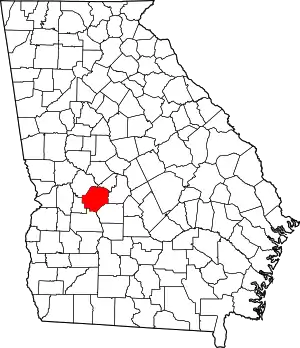 Map of Georgia highlighting Macon County | |
| Unincorporated communities | ||