Shire of Mornington Peninsula
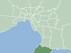
The Shire of Mornington Peninsula is a local government area in southeastern Metropolitan Melbourne, Victoria, Australia. It is located to the south of the Melbourne City Centre. It has an area of 724 square kilometres and in June 2018 it had a population of 165,822.[1]
| Mornington Peninsula Shire Victoria | |||||||||||||||
|---|---|---|---|---|---|---|---|---|---|---|---|---|---|---|---|
 | |||||||||||||||
| Population | 168,948 (2021)[1] (40th) | ||||||||||||||
| • Density | 233.35/km2 (604.4/sq mi) | ||||||||||||||
| Established | 1994 | ||||||||||||||
| Area | 724 km2 (279.5 sq mi)[1] | ||||||||||||||
| Mayor | Cr Steve Holland | ||||||||||||||
| Council seat | Rosebud | ||||||||||||||
| Region | Greater Melbourne | ||||||||||||||
| State electorate(s) | |||||||||||||||
| Federal division(s) | |||||||||||||||
 | |||||||||||||||
| Website | Mornington Peninsula Shire | ||||||||||||||
| |||||||||||||||
History
The Mornington Peninsula Shire came into existence on 15 December 1994 when the state government amalgamated the previous Shires of Flinders, Hastings and Mornington.[2]
On August 13, 2019, the Shire voted to declare a climate emergency in response to other similar declarations from councils around Australia.
The Shire abolished the 150-year-old tradition of reciting a prayer before Council meetings in December 2020. According to the Australian National Secular Lobby, the Shire was the first council or parliament to be removed from their list of government institutions that impose prayers on elected representatives”.[3]
Council
Electoral representation
The Mornington Peninsula Shire is split into six wards and eleven Councillors. The six wards are Briars, Cerberus, Nepean, Red Hill, Seawinds and Watson.[4] The current council, as of December 2020, is:[5]
| Ward | Party | Councillor | Notes | |
|---|---|---|---|---|
| Briars | Independent | Despi O'Connor | ||
| Liberal | Steve Holland | Mayor | ||
| Independent | Anthony Marsh | |||
| Cerberus | Independent | Lisa Dixon | ||
| Nepean | Independent | Susan Bissinger | Elected at recount | |
| Independent | Sarah Race | |||
| Red Hill | Independent | David Gill | ||
| Seawinds | Liberal | Antonella Celi | ||
| Independent | Kerri McCafferty | |||
| Liberal | Debra Mar | Deputy Mayor | ||
| Watson | Independent | Kate Roper | Elected at recount | |
Townships and localities
The 2021 census, the shire had a population of 168,948 up from 154,999 in the 2016 census[6]
| Population | ||
|---|---|---|
| Locality | 2016 | 2021 |
| Arthurs Seat | 394 | 414 |
| Balnarring | 2,270 | 2,371 |
| Balnarring Beach | 418 | 471 |
| Baxter | 2,162 | 2,166 |
| Bittern | 3,705 | 4,276 |
| Blairgowrie | 2,313 | 2,786 |
| Boneo | 354 | 314 |
| Cape Schanck | 446 | 569 |
| Capel Sound | * | 5,246 |
| Crib Point | 3,183 | 3,343 |
| Dromana | 5,803 | 6,626 |
| Fingal | 529 | 637 |
| Flinders | 905 | 1,130 |
| Hastings | 9,609 | 10,369 |
| HMAS Cerberus | 1,040 | 1,124 |
| Main Ridge | 416 | 453 |
| McCrae | 2,823 | 3,311 |
| Merricks | 190 | 184 |
| Merricks Beach | 127 | 157 |
| Merricks North | 426 | 423 |
| Moorooduc | 1,098 | 1,004 |
| Mornington | 23,989 | 25,759 |
| Mount Eliza | 17,888 | 18,734 |
| Mount Martha | 18,548 | 19,846 |
| Pearcedale^ | 3,821 | 3,867 |
| Point Leo | 158 | 178 |
| Portsea | 510 | 787 |
| Red Hill | 924 | 1,009 |
| Red Hill South | 603 | 708 |
| Rosebud | 13,195 | 14,381 |
| Rye | 8,416 | 9,438 |
| Safety Beach | 4,821 | 6,328 |
| Shoreham | 608 | 679 |
| Somers | 1,667 | 1,857 |
| Somerville | 11,336 | 11,767 |
| Sorrento | 1,592 | 2,013 |
| St Andrews Beach | 889 | 974 |
| Tootgarook | 2,869 | 3,178 |
| Tuerong | 354 | 357 |
| Tyabb | 3,338 | 3,449 |
^ - Territory divided with another LGA
* - Not noted in 2016 Census
See also
- List of Melbourne suburbs, for other Melbourne suburbs and municipalities
- Mornington Peninsula and Western Port Biosphere Reserve
References
- "3218.0 – Regional Population Growth, Australia, 2017–18: Population Estimates by Local Government Area (ASGS 2018), Mornington Peninsula Shire has three offices throughout Frankston and Mornington 2017 to 2018". Australian Bureau of Statistics. Australian Bureau of Statistics. 27 March 2019. Retrieved 25 October 2019. Estimated resident population, 30 June 2018.
- "Hastings". Victorian Places. Retrieved 9 August 2020.
- McCullough, Cameron (14 December 2020). "God purged from council 'prayer'". Mornington Peninsula News. Retrieved 22 December 2020.
- "Our Wards". Mornington Peninsula Shire. Retrieved 9 August 2020.
- "Our Councillors - Mornington Peninsula Shire". www.mornpen.vic.gov.au.
- "Census | Australian Bureau of Statistics". www.abs.gov.au. 11 January 2023.
External links
 Media related to Shire of Mornington Peninsula at Wikimedia Commons
- Mornington Peninsula Shire web site
- Metlink local public transport map
- Link to Land Victoria interactive maps
Localities in the Shire of Mornington Peninsula | ||
|---|---|---|
| City | | |
| Town |
| |
| Locality | ||
^ - Territory divided with another LGA | ||