Mount Borgeson
Mount Borgeson (72°12′S 99°0′W) is a peak 5 nautical miles (9 km) east-southeast of Smith Peak in the Walker Mountains of Thurston Island. It was first delineated from air photos taken by U.S. Navy Operation Highjump, 1946–47, and named by the Advisory Committee on Antarctic Names for Warren T. Borgeson, a topographic engineer with the U.S. Navy Bellingshausen Sea Expedition, who established geodetic control points in this area in February 1960.[1]
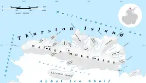
Map of Thurston Island.
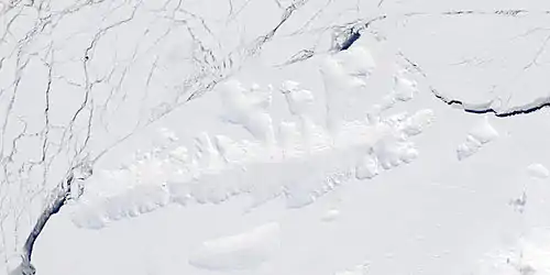
Satellite image of Thurston Island.
See also
Maps
- Thurston Island – Jones Mountains. 1:500000 Antarctica Sketch Map. US Geological Survey, 1967.
- Antarctic Digital Database (ADD). Scale 1:250000 topographic map of Antarctica. Scientific Committee on Antarctic Research (SCAR). Since 1993, regularly upgraded and updated.
References
- "Borgeson, Mount". Geographic Names Information System. United States Geological Survey, United States Department of the Interior. Retrieved 3 August 2011.
![]() This article incorporates public domain material from "Borgeson, Mount". Geographic Names Information System. United States Geological Survey.
This article incorporates public domain material from "Borgeson, Mount". Geographic Names Information System. United States Geological Survey.
.svg.png.webp)
This article is issued from Wikipedia. The text is licensed under Creative Commons - Attribution - Sharealike. Additional terms may apply for the media files.