Mount Koroyanitu
Mount Koroyanitu, also known as Mount Evans is the third highest peak in Fiji and located in the Evans Ranges in the Western Division of the island of Viti Levu. It is 1195 meters or 3920 feet high. Koroyanitu in Fijian means "Village of the Devil".[2]
| Mount Koroyanitu | |
|---|---|
| Mount Evans | |
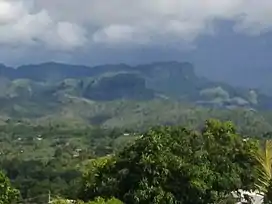 Mount Koroyanitu (the taller one) | |
| Highest point | |
| Elevation | 1,195 m (3,921 ft)[1] |
| Coordinates | 17°40′03″S 177°34′24″E[1] |
| Geography | |
 Mount Koroyanitu | |
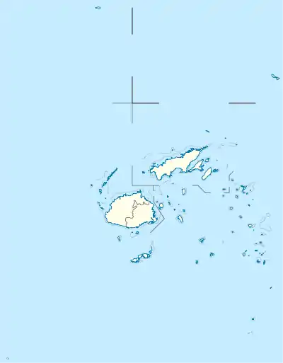
| Country | Fiji |
| Division | Western Division |
| Protected area | Koroyanitu Heritage Park |
| Cities | Nadi and Lautoka |
| Biome | Fiji tropical dry forests |
It lies between the two main towns of Fiji's west namely Nadi and Lautoka.
A 17,100 hectares (42,000 acres) area covering Mount Koroyanitu and the Vaturu Dam catchment is the Koroyanitu/Vaturu Important Bird Area. It supports a population of vulnerable Shy Ground-dove and near threatened Masked shining parrot.[3]
The Koroyanitu Heritage Park covers the mountain and surrounding area, protecting an area of 35 km2. It was created in 1989, and is managed by the community in Ba, which lies northeast of the mountain.[4]
References
- "Topographic map of Koroyanitu". opentopomap.org. Retrieved 2023-08-13.
- "Nadi Sabeto River Valley". Archived from the original on 2012-06-30.
- "BirdLife Data Zone: Koroyanitu / Vaturu". datazone.birdlife.org. Retrieved 30 May 2017.
- "Koroyanitu Heritage Park". Protected Planet. Retrieved 28 May 2021.