Mount Popov
Mount Popov (Bulgarian: Попов връх, romanized: Popov vrah, IPA: [poˈpɔv ˈvrɤx]) is the broad ice-covered peak with precipitous rocky slopes rising to 1248 m[1] in eastern Bigla Ridge on Heros Peninsula, Foyn Coast on the Antarctic Peninsula. It surmounts Beaglehole Glacier to the west and Cabinet Inlet to the northeast.
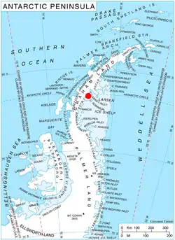
Location of Heros Peninsula in Graham Land, Antarctic Peninsula.
The feature is named after Todor Popov, physician at St. Kliment Ohridski Base during the 1996/97 and 1997/98 seasons.
Location
Mount Popov is located at 66°31′35″S 63°55′24″W, which is 12.3 km southwest of Balder Point, 8.96 km northwest of Spur Point and 13.3 km northeast of Varad Point. British mapping in 1974.
Maps
- British Antarctic Territory: Graham Land. Scale 1:250000 topographic map. BAS 250 Series, Sheet SQ 19–20. London, 1974.
- Antarctic Digital Database (ADD). Scale 1:250000 topographic map of Antarctica. Scientific Committee on Antarctic Research (SCAR). Since 1993, regularly upgraded and updated.
Notes
- Reference Elevation Model of Antarctica. Polar Geospatial Center. University of Minnesota, 2019
References
- Mount Popov. SCAR Composite Antarctic Gazetteer.
- Bulgarian Antarctic Gazetteer. Antarctic Place-names Commission. (details in Bulgarian, basic data in English)
External links
- Mount Popov. Copernix satellite image
This article includes information from the Antarctic Place-names Commission of Bulgaria which is used with permission.
This article is issued from Wikipedia. The text is licensed under Creative Commons - Attribution - Sharealike. Additional terms may apply for the media files.