NUTS statistical regions of Portugal
The Nomenclature of Territorial Units for Statistics (NUTS) is developed by Eurostat, and employed in both Portugal and the entire European Union for statistical purposes. The NUTS branch extends from NUTS1, NUTS2 and NUTS3 regions, with the complementary LAU (Local Administrative Units) sub-categorization being used to differentiate the local areas, of trans-national importance.
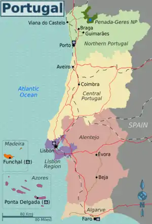
Developed by Eurostat and implemented in 1998, the Nomenclature of Territorial Units for Statistics (NUTS) regions, which comprises three levels of the Portuguese territory, are instrumental in European Union's Structural Fund delivery mechanisms.[1][2] The standard was developed by the European Union and extensively used by national governments, Eurostat and other EU bodies for statistical and policy matters.[3][4] Until 4 November 2002, the Sistema Estatístico Nacional (SEN) used a NUTS codification system that was distinct from the Eurostat system. With the enactment of Decree Law 244/2002 (5 November 2002), published in the Diário da República, this system was abandoned in order to harmonize the national system with that of Eurostat.
Subdivisions
The NUTS system subdivides the nation into three levels: NUTS I, NUTS II and NUTS III. In some European partners, as is the case with Portugal, a complementary hierarchy, respectively LAU I and LAU II (posteriorly referred to as NUTS IV and NUTS V) is employed. The LAU, or Local Administrative Units, in the Portuguese context pertains to the 308 municipalities (LAU I) and 3092 civil parishes (LAU II) respectively. In the broadest sense, the NUTS hierarchy, while they may follow some of the borders (municipal or parish) diverge in their delineation.
| Subdivision | No. | Description |
|---|---|---|
| NUTS 1: National | 3 | Continental Portugal, the Azores and Madeira |
| NUTS 2: Regions | 7 | Regional Coordination Commissions and Autonomous Regions |
| NUTS 3: Subregion | 25 | Administrative, Statistical and Autonomous Regions |
Changes NUTS 2-3 (1986—2013)
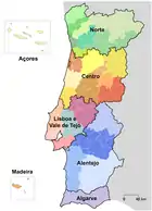 1986
1986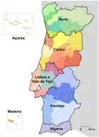 1989
1989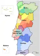 1999
1999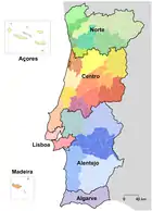 2002
2002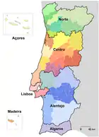 2010
2010 2013
2013
NUTS I
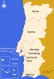
The first and broadest subdivision of Portugal is between continental Portugal and the two autonomous regions of the Azores and Madeira.
NUTS II
Although the districts are still the most socially relevant subdivision, their function is being phased in favour of locally oriented regional units, and regions are growing in importance. Portugal is divided into five regions, administered by the Commissions for Coordination and Regional Development (Portuguese: Comissões de Cooperação e Desenvolvimento Regional) in continental Portugal, plus the two autonomous regions that are their own NUTS II regions.
NUTS III
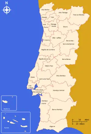
The seven regions of Portugal are likewise subdivided into 25 subregions (Portuguese: subregiões) that, from 2015, represent the 2 metropolitan areas, the 21 intermunicipal communities and the 2 autonomous regions. Therefore, since the 2013 revision (enforced in 2015), the Portuguese subregions have a statutory and administrative relevance.[5]
The two autonomous regions (Portuguese: regiões autónomas) in the Atlantic, correspond to their own NUTS I, II and III categories.
NUTS Codes[6]
Code NUTS 1 Code NUTS 2 Code NUTS 3 PT1 Continente PT11 Norte PT111 Alto Minho PT112 Cávado PT119 Ave PT11A Área Metropolitana do Porto PT11B Alto Tâmega PT11C Tâmega e Sousa PT11D Douro PT11E Terras de Trás-os-Montes PT15 Algarve PT150 Algarve PT16 Centro PT16B Oeste PT16D Região de Aveiro PT16E Região de Coimbra PT16F Região de Leiria PT16G Viseu Dão-Lafões PT16H Beira Baixa PT16I Médio Tejo PT16J Beiras e Serra da Estrela PT17 Área Metropolitana de Lisboa PT170 Área Metropolitana de Lisboa PT18 Alentejo PT181 Alentejo Litoral PT184 Baixo Alentejo PT185 Lezíria do Tejo PT186 Alto Alentejo PT187 Alentejo Central PT2 Região Autónoma dos Açores PT20 Região Autónoma dos Açores PT200 Região Autónoma dos Açores PT3 Região Autónoma da Madeira PT30 Região Autónoma da Madeira PT300 Região Autónoma da Madeira
LAUs
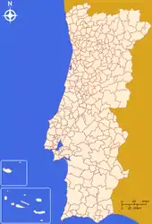
Municipalities and civil parishes were at NUTS IV and V levels, but these nomenclature units have been abolished and substituted by LAUs: the municipality is classified as LAU 1, while the civil parish is LAU level 2. Below the NUTS levels, the two LAU (Local Administrative Unit) levels are:
| Sudvision | No. | Description |
|---|---|---|
| LAU 1 | 308 | Municipalities |
| LAU 2 | 3092 | Civil Parishes |
The LAU codes of Portugal can be downloaded at: Eurostat![]()
See also
References
- The NUTS system was approved by Community Legislation in 1998, but only entered into function in 2003 through enacting regulations.
- University of Coimbra (2010), p.2
- Instituto Nacional de Estatística (Portuguese language) Archived 2007-03-16 at the Wayback Machine – Nomenclatura das Unidades Territoriais para fins Estatísticos 2002, accessed May 2006
- de Informação Geográfica (Portuguese language) – Biblioteca de Mapas Administrativos, accessed May 2006
- 2013 Apresentação INE NUTS (in Portuguese)
- COMMISSION REGULATION (EU) No 868/2014 http://eur-lex.europa.eu/legal-content/EN/TXT/PDF/?uri=OJ:L:2014:241:FULL&from=PT
Sources
- Hierarchical list of the Nomenclature of territorial units for statistics - NUTS and the Statistical regions of Europe
- Overview map of EU Countries - NUTS level 1
- Correspondence between the NUTS levels and the national administrative units
- List of current NUTS codes
- Regions of Portugal, Statoids.com
- Municipalities of Portugal, Statoids.com
- Regiões de Portugal, LOCAL.PT