Nadeau Township, Michigan
Nadeau Township is a civil township of Menominee County in the U.S. state of Michigan. The population was 1,090 at the 2020 census.[2]
Nadeau Township, Michigan | |
|---|---|
 Village of Carney along U.S. Route 41 | |
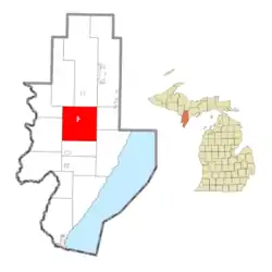 Location within Menominee County (red) and the state of Michigan; administered village of Carney in pink | |
 Nadeau Township  Nadeau Township | |
| Coordinates: 45°34′48″N 87°33′48″W | |
| Country | United States |
| State | Michigan |
| County | Menominee |
| Area | |
| • Total | 80.86 sq mi (209.4 km2) |
| • Land | 80.80 sq mi (209.3 km2) |
| • Water | 0.06 sq mi (0.2 km2) |
| Elevation | 778 ft (237 m) |
| Population | |
| • Total | 1,090 |
| • Density | 13.5/sq mi (5.2/km2) |
| Time zone | UTC-6 (Central (CST)) |
| • Summer (DST) | UTC-5 (CDT) |
| ZIP Codes | |
| Area code | 906 |
| FIPS code | 26-109-56440[3] |
| GNIS feature ID | 1626787[4] |
| Website | nadeautownship |
Communities
- Carney is a village within the township. The Carney ZIP code, 49812, serves most of the northern part of the township.[5]
- Nadeau is an unincorporated community in the township north of Carney on US 41 at 45°36′32″N 87°33′10″W.[6] Both the community and the township were named after Bruno (Barney) Nadeau, who owned the first farm in the area. The Chicago and North Western Railway built a station in 1878. A post office named "Nadean" was established on May 29, 1878, with Bruno (Barney) Nadeau as the first postmaster. The misspelled name of the post office was not corrected until February 20, 1890.[7][8] The Nadeau post office, with ZIP code 49863, provides service for a small area surrounding the community.[9]
Geography
Nadeau Township is in central Menominee County, 7 miles (11 km) south of Powers and 34 miles (55 km) north of Menominee, the county seat. U.S. Route 41 crosses the township, passing through Carney and connecting Powers and Menominee.
According to the U.S. Census Bureau, the township has a total area of 80.9 square miles (210 km2), of which 0.1 square miles (0.3 km2), or 0.07%, is water.[1]
Demographics
| Census | Pop. | Note | %± |
|---|---|---|---|
| 1890 | 1,525 | — | |
| 1900 | 2,003 | 31.3% | |
| 1910 | 1,918 | −4.2% | |
| 1920 | 1,861 | −3.0% | |
| 1930 | 1,525 | −18.1% | |
| 1940 | 1,680 | 10.2% | |
| 1950 | 1,572 | −6.4% | |
| 1960 | 1,403 | −10.8% | |
| 1970 | 1,084 | −22.7% | |
| 1980 | 1,219 | 12.5% | |
| 1990 | 1,161 | −4.8% | |
| 2000 | 1,160 | −0.1% | |
| 2010 | 1,161 | 0.1% | |
| 2020 | 1,090 | −6.1% | |
| U.S. Decennial Census[10] | |||
As of the census[3] of 2000, there were 1,160 people, 480 households, and 314 families residing in the township. The population density was 14.4 per square mile (5.6/km2). There were 710 housing units at an average density of 8.8 per square mile (3.4/km2). The racial makeup of the township was 98.28% White, 0.09% African American, 0.60% Native American, 0.17% Asian, 0.09% from other races, and 0.78% from two or more races. Hispanic or Latino of any race were 0.69% of the population.
There were 480 households, out of which 29.4% had children under the age of 18 living with them, 53.1% were married couples living together, 8.1% had a female householder with no husband present, and 34.4% were non-families. 31.5% of all households were made up of individuals, and 15.4% had someone living alone who was 65 years of age or older. The average household size was 2.41 and the average family size was 3.03.
In the township the population was spread out, with 25.5% under the age of 18, 7.2% from 18 to 24, 26.2% from 25 to 44, 26.2% from 45 to 64, and 14.8% who were 65 years of age or older. The median age was 40 years. For every 100 females, there were 99.3 males. For every 100 females age 18 and over, there were 103.8 males.
The median income for a household in the township was $29,375, and the median income for a family was $36,932. Males had a median income of $29,236 versus $22,396 for females. The per capita income for the township was $15,983. About 8.8% of families and 11.6% of the population were below the poverty line, including 17.0% of those under age 18 and 9.0% of those age 65 or over.
References
- "2023 U.S. Gazetteer Files: Michigan". United States Census Bureau. Retrieved October 16, 2023.
- "P1. Race – Nadeau township, Michigan: 2020 DEC Redistricting Data (PL 94-171)". U.S. Census Bureau. Retrieved October 16, 2023.
- "U.S. Census website". United States Census Bureau. Retrieved January 31, 2008.
- U.S. Geological Survey Geographic Names Information System: Nadeau Township, Michigan
- 49812 5-Digit ZCTA, 498 3-Digit ZCTA - Reference Map - American FactFinder, U.S. Census Bureau, 2000 census
- U.S. Geological Survey Geographic Names Information System: Nadeau, Michigan
- Romig, Walter (1986) [1973]. Michigan Place Names. Detroit, Michigan: Wayne State University Press. ISBN 0-8143-1838-X.
- U.S. Geological Survey Geographic Names Information System: Nadeau Post Office
- 49863 5-Digit ZCTA, 498 3-Digit ZCTA - Reference Map - American FactFinder, U.S. Census Bureau, 2000 census
- "Decennial Census Official Publications". U.S. Census Bureau. Retrieved October 16, 2023.
External links
Municipalities and communities of Menominee County, Michigan, United States | ||
|---|---|---|
| Cities |  Map of Michigan highlighting Menominee County.svg | |
| Villages | ||
| Civil townships | ||
| CDP | ||
| Other communities | ||
| Indian reservation | ||
| Footnotes | ‡This populated place also has portions in an adjacent county or counties | |