Nagoyajo Station
Nagoyajo Station (名古屋城駅, Nagoyajō-eki, lit. "Nagoya Castle Station") is an underground metro station located in Naka-ku, Nagoya, Aichi Prefecture, Japan operated by the Nagoya Municipal Subway.[2] It is located 4.3 rail kilometers from the terminus of the Meijō Line at Kanayama Station. This station provides access to its namesake, Nagoya City Hall, as well as Aichi Prefectural Government Office, Nagoya City Archives, Nagoya Noh Theatre and Nagoya Castle.
M07 Nagoyajo Station 名古屋城駅 | |||||||||||
|---|---|---|---|---|---|---|---|---|---|---|---|
 | |||||||||||
| General information | |||||||||||
| Location | Sannomaru 3-1-1, Naka, Nagoya, Aichi (名古屋市中区三の丸三丁目1-1) Japan | ||||||||||
| Operated by | |||||||||||
| Line(s) | |||||||||||
| Connections |
| ||||||||||
| Other information | |||||||||||
| Station code | M07 | ||||||||||
| History | |||||||||||
| Opened | 15 October 1965 | ||||||||||
| Passengers | |||||||||||
| 2008 | 7,076,285[1] | ||||||||||
| Services | |||||||||||
| |||||||||||
The station was previously called Shiyakusho Station (市役所駅, Shiyakusho-eki, lit. "City Hall Station") and its name was changed on 4 January 2023.[3]
History
The station was opened on 15 October 1965.[4]
Lines
.svg.png.webp) Nagoya Municipal Subway
Nagoya Municipal Subway
.svg.png.webp) Meijō Line (Station number: M07)
Meijō Line (Station number: M07)
Layout
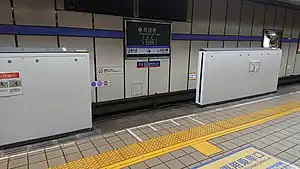
Shiyakusho Station has one underground island platform.
Entrance No. 7 has a wooden traditional design that imitates the Komaimon gate of Nagoya Castle.
At the end of the northern exits is a large map of Nagoya Castle during the Edo period. This castle map was produced by the Institute for Cultural Environment Planning Co., Ltd. by Naitō Akira (内藤昌) and Suzuki Norio (鈴木 規夫).[5]
Platforms
| 1 | ■ Meijō Line | For Sakae, Kanayama, Aratama-bashi, and Nagoyakō |
| 2 | ■ Meijō Line | For Ōzone and Motoyama |
References
- 平成21年版名古屋市統計年鑑 11.運輸・通信 [Nagoya Statistics for Year 21 of the Heisei Era, 11 Transportation and Communication] (in Japanese). Nagoya City. Retrieved 1 December 2010.
- 市役所 [Shiyakusho] (in Japanese). Transportation Bureau City of Nagoya. Retrieved 19 November 2010.
- "Subway Station Name Change" (PDF). Transportation Bureau, City of Nagoya. 4 January 2023.
- 佐藤, 信之 (19 June 2004), 地下鉄の歴史首都圏・中部・近畿圏 (in Japanese), グランプリ出版, ISBN 4-87687-260-0
- "名古屋城のマップ – 名古屋城天守閣を木造で復元し、旧町名の復活を目指す会".
External links
- Shiyakusho Station official web site (in Japanese)
35°10′53.5259″N 136°54′19.36″E