List of National Historic Landmarks in Wyoming
The list of National Historic Landmarks in Wyoming contains the landmarks designated by the U.S. Federal Government located in the U.S. state of Wyoming. There are 27 National Historic Landmarks (NHLs) in Wyoming. The first designated were two on December 19, 1960; the latest was on December 23, 2016.
| [1] | Landmark name | Image | Date designated[2] | Location | County | Description |
|---|---|---|---|---|---|---|
| 1 | Ames Monument |  Ames Monument |
October 31, 2016 (#72001296) |
Sherman 41°07′52″N 105°23′53″W |
Albany | A pivotal and highly significant work in the career of Henry Hobson Richardson.[3] |
| 2 | Expedition Island | 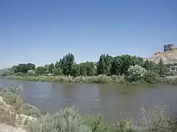 Expedition Island |
October 18, 1968 (#68000056) |
Green River 41°31′23″N 109°28′16″W |
Sweetwater | Expedition Island is a park in Green River, Wyoming that marks the area where Major John Wesley Powell started an expedition down the Green River and Colorado River in 1871. |
| 3 | Fort D.A. Russell | .jpg.webp) Fort D.A. Russell |
May 15, 1975 (#69000191) |
Cheyenne 41°09′59″N 104°51′46″W |
Laramie | In 1867, the fort was established to protect workers for the Union Pacific Railroad. In 1871, it was base to the Pawnee scout battalion.[4] |
| 4 | Fort Phil Kearny and Associated Sites | 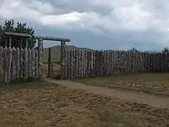 Fort Phil Kearny and Associated Sites |
December 19, 1960 (#66000756) |
Story 44°31′56″N 106°49′35″W |
Johnson | Fort Phil Kearny was an outpost of the United States Army that existed in the late 1860s in present-day northeastern Wyoming along the Bozeman Trail.[5] |
| 5 | Fort Yellowstone | Fort Yellowstone |
July 31, 2003 (#03001032) |
Yellowstone National Park 44°58′30″N 110°41′53″W |
Park | Fort Yellowstone is a former United States Army base created in 1888 to guard the park. It became administrative headquarters of Yellowstone National Park.[6] |
| 6 | Heart Mountain Relocation Center | 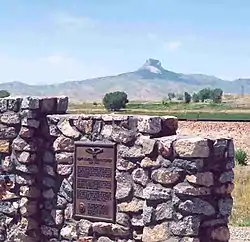 Heart Mountain Relocation Center |
September 20, 2006 (#85003167) |
Ralston 44°40′18″N 108°56′47″W |
Park | An internment camp for Japanese-Americans during World War II |
| 7 | Hell Gap Paleoindian Site (48GO305) | December 23, 2016 (#100000877) |
Guernsey vicinity 42°24′30″N 104°38′22″W |
Goshen | ||
| 8 | Horner site | January 20, 1961 (#66000758) |
Cody 44°33′21″N 108°59′39″W |
Park | Non-public archaeological site yielding evidence of a flint tool culture, with occupation dating back to 5000 BC.[7] | |
| 9 | Independence Rock |  Independence Rock |
January 20, 1961 (#66000757) |
Casper 42°29′37″N 107°07′46″W |
Natrona | Independence Rock is a large granite rock, approximately 130 ft (40 m) high, which served as a landmark on the Oregon Trail and California Trail in southwestern Natrona County.[8] |
| 10 | Jackson Lake Lodge |  Jackson Lake Lodge |
July 31, 2003 (#03001039) |
Grand Teton National Park 43°52′39″N 110°34′36″W |
Teton | Designed by architect Gilbert Stanley Underwood and completed in 1955, the lodge built in International style represents a break from the traditional rustic style of architecture used by the National Park Service. |
| 11 | Lake Guernsey State Park | .jpg.webp) Lake Guernsey State Park |
September 25, 1997 (#80004051) |
Guernsey 42°18′14″N 104°46′10″W |
Platte | Model Civilian Conservation Corps-built state park buildings and structures |
| 12 | Lake Hotel | 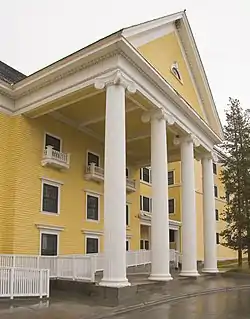 Lake Hotel |
February 27, 2015 (#91000637) |
North side of Lake Yellowstone St., Yellowstone National Park 44°32′59″N 110°24′00″W |
Teton | |
| 13 | Medicine Mountain | 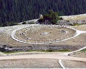 Medicine Mountain |
August 29, 1970 (#69000184) |
Lovell 44°49′32″N 107°55′15″W |
Big Horn | Site of a native American medicine wheel, used for healing and religious purposes |
| 14 | Murie Ranch Historic District | 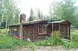 Murie Ranch Historic District |
February 17, 2006 (#98001039) |
Grand Teton National Park[9] 43°39′02″N 110°43′37″W |
Teton | A group of several cabins in Grand Teton National Park that were owned by naturalist Olaus Murie, his wife Margaret Murie and scientist Adolph Murie and his wife Louise in the 1940s. |
| 15 | Norris, Madison, and Fishing Bridge Museums | 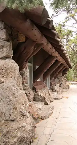 Norris, Madison, and Fishing Bridge Museums |
May 28, 1987 (#87001445) |
Yellowstone National Park 44°43′27″N 110°42′21″W |
Teton and Park | Three "trailside museums" in National Park Service Rustic style within Yellowstone National Park |
| 16 | Obsidian Cliff |  Obsidian Cliff |
June 19, 1996 (#96000973) |
Yellowstone National Park 44°49′08″N 110°43′40″W |
Park | An exposure of obsidian (volcanic glass). It was a notable source of lithic materials for prehistoric peoples. |
| 17 | Old Faithful Inn | 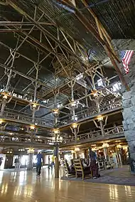 Old Faithful Inn |
May 28, 1987 (#73000226) |
Yellowstone National Park 44°27′28″N 110°49′49″W |
Teton | National Park Service architecture |
| 18 | Oregon Trail Ruts | 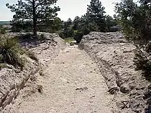 Oregon Trail Ruts |
May 23, 1966 (#66000761) |
Guernsey 42°15′22″N 104°44′58″W |
Platte | One half mile long section of Oregon Trail, worn 2–6 feet into sandstone ridge |
| 19 | J. C. Penney Historic District |  J. C. Penney Historic District |
June 2, 1978 (#78002830) |
Kemmerer 41°47′41″N 110°32′09″W |
Lincoln | Buildings associated with James Cash Penney's founding of J. C. Penney department store chain here. |
| 20 | Sheridan Inn | .jpg.webp) Sheridan Inn |
January 29, 1964 (#66000762) |
Sheridan 44°48′25″N 106°57′12″W |
Sheridan | Inn operated by Buffalo Bill Cody |
| 21 | South Pass |  South Pass |
January 20, 1961 (#66000754) |
South Pass City 42°22′12″N 108°54′49″W |
Fremont | This was the easiest crossing point of the Continental Divide during the 19th century, serving American pioneers, fur traders, and miners. The access it offered to the Pacific Northwest greatly strengthened the U.S. claim to that region. |
| 22 | Tom Sun Ranch |  Tom Sun Ranch |
December 19, 1960 (#66000753) |
Casper 42°26′36″N 107°13′06″W |
Carbon and Natrona | Tom Sun Ranch was a typical medium-sized ranching operation of the open range period in the 1870s-80s. Tom Sun was a French-Canadian cattleman and frontiersman. |
| 23 | Swan Land and Cattle Company Headquarters | .jpg.webp) Swan Land and Cattle Company Headquarters |
July 19, 1964 (#66000760) |
Chugwater 41°45′17″N 104°49′10″W |
Platte | The surviving buildings include the ranchhouse, barn, and commissary, for this company organized in Scotland in 1883.[10] |
| 24 | Union Pacific Railroad Depot | .jpg.webp) Union Pacific Railroad Depot |
February 15, 2006 (#73001934) |
Cheyenne 41°07′54″N 104°48′51″W |
Laramie | Railroad depot and related buildings. |
| 25 | Upper Green River Rendezvous Site | 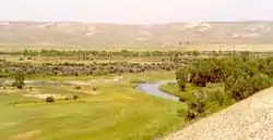 Upper Green River Rendezvous Site |
November 5, 1961 (#66000763) |
Daniel 42°52′21″N 110°02′20″W |
Sublette | Location of several Rocky Mountain Rendezvous, a 1,200 acres (490 ha) site on the Green River |
| 26 | Wapiti Ranger Station | 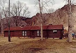 Wapiti Ranger Station |
May 23, 1963 (#66000759) |
Wapiti 44°27′50″N 109°36′58″W |
Park | First U.S. Forest Service ranger station |
| 27 | Wyoming State Capitol | 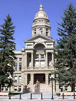 Wyoming State Capitol |
May 4, 1987 (#73001935) |
Cheyenne 41°08′23″N 104°49′12″W |
Laramie | Current state capitol building |
See also
References
- Numbers represent an alphabetical ordering by significant words. Various colorings, defined here, differentiate National Historic Landmarks and historic districts from other NRHP buildings, structures, sites or objects.
- The eight-digit number below each date is the number assigned to each location in the National Register Information System database, which can be viewed by clicking the number.
- "Secretary Jewell, Director Jarvis Announce 10 New National Historic Landmarks Illustrating America's Diverse History, Culture". Department of the Interior. November 2, 2016. Retrieved November 3, 2016.
- NPS webpage, March 2009: NPS-gov-842 Archived 2006-06-26 at the Wayback Machine.
- NPS webpage, March 2009: NPS-gov-565 Archived 2007-03-12 at the Wayback Machine.
- NPS webpage, March 2009: NPS-gov-32** Archived 2012-07-28 at the Wayback Machine.
- NPS webpage, March 2009: NPS-gov-567 Archived 2006-06-26 at the Wayback Machine.
- NPS webpage, March 2009: NPS-gov-566 Archived 2009-04-03 at the Wayback Machine.
- National Park Service (2007). "Murie Ranch - National Park Week: National Register of Historic Places Celebrates National Park". Retrieved December 16, 2007.
- NPS webpage, March 2009: NPS-gov-569 Archived 2006-06-26 at the Wayback Machine.
External links
Wikimedia Commons has media related to National Historic Landmarks in Wyoming.
This article is issued from Wikipedia. The text is licensed under Creative Commons - Attribution - Sharealike. Additional terms may apply for the media files.