National Register of Historic Places listings in Hartford, Connecticut
This is a list of properties on the National Register of Historic Places in Hartford, Connecticut.
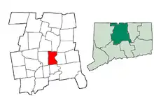
This is intended to be a complete list of the properties and districts on the National Register of Historic Places in Hartford, Connecticut, United States. The locations of National Register properties and districts for which the latitude and longitude coordinates are included below, may be seen in various online maps.[1]
There are more than 400 properties and districts listed on the National Register in Hartford County, including 21 National Historic Landmarks. The city of Hartford is the location of 142 of these properties and districts, including 7 National Historic Landmarks; they are listed here, while the other properties and districts in the remaining parts of the county, including 14 National Historic Landmarks, are listed separately. Eight properties and districts straddle the border between Hartford and other municipalities in the county; they appear on multiple lists.
Altogether, as of 2005, about 20 percent of the properties in the city, including more than 4,000 buildings, were listed as historic properties or included in historic districts.[2][3]
|
Fairfield (city of Bridgeport) (town of Greenwich) (city of Stamford) | Hartford (city of Hartford) (town of Southington) (town of West Hartford) (town of Windsor) | Litchfield | Middlesex (city of Middletown) | New Haven (city of New Haven) | New London | Tolland | Windham |
This National Park Service list is complete through NPS recent listings posted October 20, 2023.[4]
Current listings
| [5] | Name on the Register[6] | Image | Date listed[7] | Location | Neighborhood | Description |
|---|---|---|---|---|---|---|
| 1 | Aetna Diner | August 18, 2021 (#100006804) |
267 Farmington Ave. 41°46′03″N 72°41′51″W |
Asylum Hill | ||
| 2 | Allen Place–Lincoln Street Historic District |  Allen Place–Lincoln Street Historic District |
August 28, 2003 (#03000815) |
Roughly bounded by Madison St., Washington St., Vernon St., and Zion Hill Cemetery 41°45′11″N 72°41′08″W |
Frog Hollow and Barry Square | |
| 3 | Ambassador Apartments | 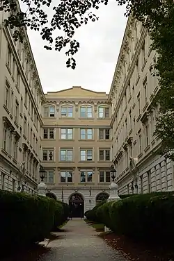 Ambassador Apartments |
October 16, 2008 (#08000859) |
206–210 Farmington Ave. 41°46′04″N 72°41′40″W |
Asylum Hill | |
| 4 | Ann Street Historic District | 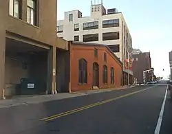 Ann Street Historic District |
November 28, 1983 (#83003514) |
Allyn, Ann, Asylum, Church, Hicks, and Pearl Sts. 41°46′03″N 72°40′42″W |
Downtown | The district is primarily composed of 19th-century brick mercantile buildings and contains 22 contributing and 3 non-contributing properties. Some of the more significant buildings are the Sport and Medical Science Academy building, and the Central Fire Station of the Hartford Fire Department. |
| 5 | Apartment at 49–51 Spring Street | 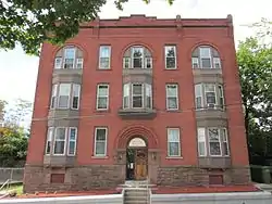 Apartment at 49–51 Spring Street |
March 31, 1983 (#83001255) |
49–51 Spring St. 41°46′10″N 72°41′04″W |
Asylum Hill | |
| 6 | Asylum Avenue District | 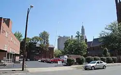 Asylum Avenue District |
November 29, 1979 (#79002672) |
Asylum and Farmington Aves. and Sigourney St. 41°46′10″N 72°41′36″W |
Asylum Hill | |
| 7 | A. Everett Austin House | 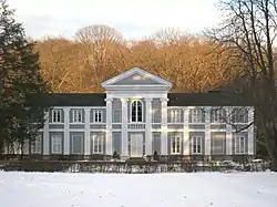 A. Everett Austin House |
April 19, 1994 (#94001189) |
130 Scarborough St. 41°46′51″N 72°42′33″W |
West End | Social hotspot and home of innovative Wadsworth Atheneum director Arthur Everett Austin, Jr. |
| 8 | B.P.O. Elks Lodge | 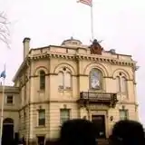 B.P.O. Elks Lodge |
December 23, 1984 (#84000753) |
34 Prospect St. 41°45′49″N 72°40′20″W |
Downtown | An Elks building |
| 9 | Lucius Barbour House | 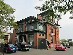 Lucius Barbour House |
August 21, 1979 (#79002629) |
130 Washington St. 41°45′30″N 72°40′56″W |
Frog Hollow | |
| 10 | Boce W. Barlow Jr. House | 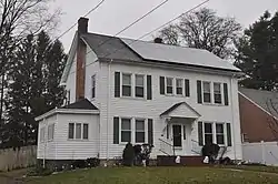 Boce W. Barlow Jr. House |
July 31, 1994 (#94000767) |
31 Canterbury St. 41°47′19″N 72°41′53″W |
Blue Hills | |
| 11 | Henry Barnard House | 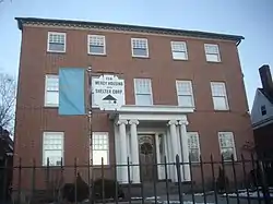 Henry Barnard House |
October 15, 1966 (#66000803) |
118 Main St. 41°45′24″N 72°40′32″W |
South Green | Home of educator instrumental in the development of the American public school system. |
| 12 | Batterson Block | 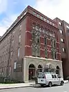 Batterson Block |
December 23, 1984 (#84000758) |
26–28 High St. 41°46′05″N 72°40′50″W |
Downtown | |
| 13 | Beth Hamedrash Hagodol Synagogue | 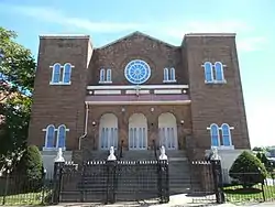 Beth Hamedrash Hagodol Synagogue |
May 11, 1995 (#95000577) |
370 Garden St. 41°46′44″N 72°41′06″W |
Clay-Arsenal | |
| 14 | Buckingham Square District |  Buckingham Square District |
June 5, 1977 (#77001404) |
Main and Buckingham St., Linden Pl., and Capitol Ave.; also 248-250 Hudson St. 41°45′37″N 72°40′35″W |
Downtown | Hudson St. addresses represent a boundary increase, added on November 30, 1982 |
| 15 | Building at 136–138 Collins Street |  Building at 136–138 Collins Street |
November 29, 1979 (#79002681) |
136–138 Collins St. 41°46′22″N 72°41′19″W |
Asylum Hill | |
| 16 | Building at 142 Collins Street |  Building at 142 Collins Street |
November 29, 1979 (#79002680) |
142 Collins St. 41°46′18″N 72°41′20″W |
Asylum Hill | |
| 17 | Building at 83–85 Sigourney Street | %252C_Hartford%252C_Hartford_County%252C_CT_HABS_CONN%252C2-HARF%252C10-2.tif.jpg.webp) Building at 83–85 Sigourney Street |
November 29, 1979 (#79002679) |
83–85 Sigourney St. 41°45′59″N 72°41′33″W |
Asylum Hill | Demolished. |
| 18 | Bulkeley Bridge |  Bulkeley Bridge |
December 10, 1993 (#93001347) |
Interstate 84 over the Connecticut River 41°46′09″N 72°39′58″W |
Downtown | Extends into other parts of Hartford County (East Hartford) |
| 19 | Amos Bull House | 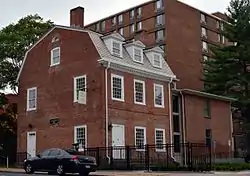 Amos Bull House |
November 8, 1968 (#68000039) |
59 S. Prospect St. 41°45′37″N 72°40′25″W |
Downtown | |
| 20 | Bushnell Park |  Bushnell Park |
October 22, 1970 (#70000692) |
Bounded by Elm, Jewell, and Trinity Sts. 41°45′54″N 72°40′46″W |
Downtown | |
| 21 | Butler-McCook Homestead | 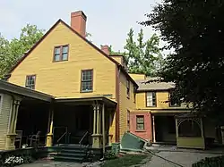 Butler-McCook Homestead |
March 11, 1971 (#71000907) |
396 Main St. 41°45′39″N 72°40′29″W |
Downtown | |
| 22 | Marietta Canty House | 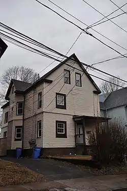 Marietta Canty House |
December 15, 2000 (#00001536) |
61 Mahl Ave. 41°46′54″N 72°40′45″W |
Clay-Arsenal | |
| 23 | Capen-Clark Historic District | 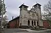 Capen-Clark Historic District |
April 27, 1982 (#82004402) |
Capen, Clark, Elmer, Barbour, Martin, and Main Sts. 41°47′11″N 72°40′42″W |
Northeast | |
| 24 | Capewell Horse Nail Company |  Capewell Horse Nail Company |
March 1, 2000 (#99000927) |
60–70 Popieluszko St. 41°45′28″N 72°40′20″W |
Sheldon-Charter Oak | |
| 25 | Cedar Hill Cemetery | 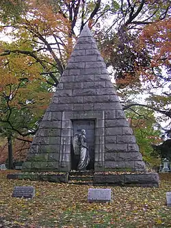 Cedar Hill Cemetery |
April 28, 1997 (#97000333) |
453 Fairfield Ave. 41°43′20″N 72°42′12″W |
Southwest | Extends into other parts of Hartford County (Newington and Wethersfield) |
| 26 | Charter Oak Bank Building | 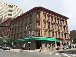 Charter Oak Bank Building |
October 11, 1978 (#78002873) |
114–124 Asylum St. 41°46′02″N 72°40′31″W |
Downtown | |
| 27 | Charter Oak Place |  Charter Oak Place |
January 20, 1978 (#78002884) |
7–40 Charter Oak Pl. 41°45′33″N 72°40′27″W |
Sheldon-Charter Oak | |
| 28 | Cheney Building | 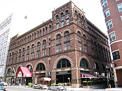 Cheney Building |
October 6, 1970 (#78002852) |
942 Main St. 41°46′04″N 72°40′23″W |
Downtown | |
| 29 | Chevry Lomday Mishnayes Synagogue | 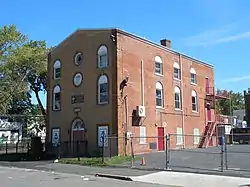 Chevry Lomday Mishnayes Synagogue |
May 11, 1995 (#95000575) |
148–150 Bedford St. 41°46′46″N 72°41′01″W |
Clay-Arsenal | |
| 30 | Children's Village of the Hartford Orphan Asylum |  Children's Village of the Hartford Orphan Asylum |
June 28, 1982 (#82004404) |
1680 Albany Ave. 41°47′11″N 72°42′37″W |
Blue Hills | |
| 31 | Christ Church |  Christ Church |
December 29, 1983 (#83003558) |
955 Main St. 41°46′06″N 72°40′27″W |
Downtown | One of the oldest Gothic revival churches in the United States. |
| 32 | Church of the Good Shepherd and Parish House |  Church of the Good Shepherd and Parish House |
February 20, 1975 (#75001925) |
155 Wyllys St. 41°45′26″N 72°40′09″W |
Sheldon-Charter Oak | |
| 33 | Clay Hill Historic District |  Clay Hill Historic District |
June 16, 1983 (#83001258) |
Roughly bounded by Main, Mather, Garden, and Walnut Sts. 41°46′33″N 72°40′53″W |
Clay-Arsenal | |
| 34 | Collins and Townley Streets District |  Collins and Townley Streets District |
November 29, 1979 (#79002676) |
Collins and Townley Sts. 41°46′20″N 72°41′44″W |
Asylum Hill | |
| 35 | Colt Industrial District | 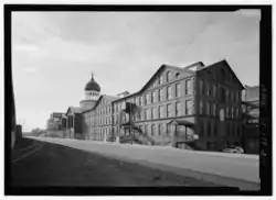 Colt Industrial District |
June 8, 1976 (#76001987) |
Roughly bounded by Wawarme, Wethersfield, Hendricxsen, Van Dyke Aves., Stonington, Masseek, Sequassen Sts., Vredendale Ave. 41°45′12″N 72°40′05″W |
Sheldon-Charter Oak | This industrial district includes the Colt Fire Arms factory complex, three manager houses, and worker housing; the second set of addresses represents a boundary increase. The entire district is included in the Coltsville Historic District, which was designated a National Historic Landmark District in 2008. |
| 36 | James B. Colt House | 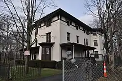 James B. Colt House |
April 14, 1975 (#75001926) |
154 Wethersfield Ave. 41°45′06″N 72°40′27″W |
Sheldon-Charter Oak | |
| 37 | Coltsville Historic District |  Coltsville Historic District |
November 13, 1966 (#66000802) |
Sheldon-Charter Oak neighborhood 41°45′14″N 72°40′29″W |
Sheldon-Charter Oak | Includes Armsmear, Colt Armory, Colt Park, and other properties related to Samuel Colt. |
| 38 | Congress Street |  Congress Street |
October 6, 1975 (#75001927) |
Both sides of Congress St. from Wyllys to Morris Sts.; also 54, 56, and 58 Maple Ave. 41°45′16″N 72°40′34″W |
South Green | Maple Ave. addresses represent a boundary increase, added on July 24, 1992 |
| 39 | Connecticut State Capitol | 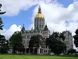 Connecticut State Capitol |
December 30, 1970 (#70000834) |
Capitol Ave. 41°45′51″N 72°40′58″W |
Downtown | Designed by Richard Upjohn in Gothic and French Renaissance styles topped by gold leaf dome |
| 40 | Connecticut State Library and Supreme Court Building | 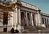 Connecticut State Library and Supreme Court Building |
June 4, 1981 (#81000535) |
231 Capitol Ave. 41°45′45″N 72°41′01″W |
Downtown | |
| 41 | Connecticut Statehouse |  Connecticut Statehouse |
October 15, 1966 (#66000878) |
Main St. at Central Row 41°45′58″N 72°40′23″W |
Downtown | Federal style building by Charles Bulfinch |
| 42 | Day House | 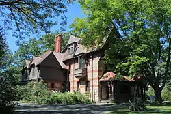 Day House |
April 16, 1971 (#71000909) |
77 Forest St. 41°46′03″N 72°42′02″W |
Asylum Hill | Also known as the Chamberlin-Burr Day House, it is the headquarters of the Harriet Beecher Stowe Center |
| 43 | Calvin Day House | 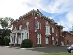 Calvin Day House |
December 18, 1978 (#78002872) |
105 Spring St. 41°46′16″N 72°41′03″W |
Asylum Hill | |
| 44 | Day-Taylor House | 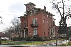 Day-Taylor House |
April 14, 1975 (#75001930) |
81 Wethersfield Ave. 41°45′14″N 72°40′32″W |
South Green | |
| 45 | Department Store Historic District | Department Store Historic District |
March 23, 1995 (#95000284) |
884–956 Main St. and 36 Talcott St. 41°46′05″N 72°40′22″W |
Downtown | This historic district includes the Sage-Allen Building, built in 1898. This department store building, which has been restored, now contains both retail space and luxury apartments. As part of the restoration project, an adjacent 1960s building was given a new historically sensitive façade to make it more compatible with its neighbor.[8] |
| 46 | Dillon Building | 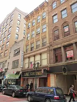 Dillon Building |
February 11, 1982 (#82004407) |
69–71 Pratt St. 41°46′02″N 72°40′30″W |
Downtown | |
| 47 | Downtown North Historic District | 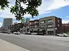 Downtown North Historic District |
May 6, 2004 (#04000390) |
Roughly Ann, Atlant, Ely, High, Main, and Pleasant Sts. 41°46′19″N 72°40′38″W |
Downtown | A predominantly residential area located around Main Street and High Street north of Interstate 84 and south of the Amtrak railroad tracks; a diverse variety of Mid-19th Century Revival and Late Victorian styles of architecture are represented.[6][9][10] |
| 48 | Elizabeth Park | Elizabeth Park |
March 10, 1983 (#83001259) |
Asylum Ave. 41°46′20″N 72°43′04″W |
West End | Extends into West Hartford, elsewhere in Hartford County |
| 49 | Elm Street Historic District | 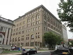 Elm Street Historic District |
June 28, 1984 (#84001003) |
71–166 Capitol Ave., 55–97 Elm St., 20–30 Trinity St. 41°45′44″N 72°40′48″W |
Downtown | Located in the vicinity of Trinity Street in front of the State Capitol. |
| 50 | Engine Company 1 Fire Station |  Engine Company 1 Fire Station |
March 2, 1989 (#89000025) |
197 Main St. and 36 John St. 41°45′29″N 72°40′35″W |
South Green | |
| 51 | Engine Company 15 Fire Station |  Engine Company 15 Fire Station |
March 2, 1989 (#89000023) |
8 Fairfield Ave. 41°44′31″N 72°41′32″W |
Barry Square | |
| 52 | Engine Company 16 Fire Station | 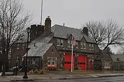 Engine Company 16 Fire Station |
March 2, 1989 (#89000021) |
636 Blue Hills Ave. 41°48′15″N 72°41′44″W |
Blue Hills | |
| 53 | Engine Company 2 Fire Station | 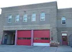 Engine Company 2 Fire Station |
March 2, 1989 (#89000022) |
1515 Main St. 41°46′30″N 72°40′39″W |
Clay-Arsenal | Second firehouse built for company, in 1910, uses Italian Renaissance Revival style unusual for firehouses. One of only two left in the city that were originally built to accommodate horses. |
| 54 | Engine Company 6 Fire Station | 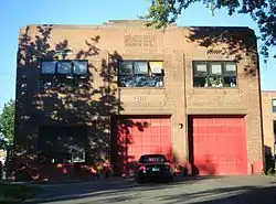 Engine Company 6 Fire Station |
March 2, 1989 (#89000020) |
34 Huyshope Ave. 41°45′26″N 72°39′59″W |
Sheldon-Charter Oak | |
| 55 | Engine Company 9 Fire Station | 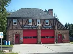 Engine Company 9 Fire Station |
March 2, 1989 (#89000024) |
655 New Britain Ave. 41°44′00″N 72°42′13″W |
Southwest | |
| 56 | Fairfield Avenue Historic District |  Fairfield Avenue Historic District |
July 19, 2011 (#11000435) |
Roughly along Fairfield Ave. from Trinity College to Cedar Hill Cemetery 41°44′06″N 72°41′34″W |
Barry Square and Southwest | |
| 57 | First Church of Christ and the Ancient Burying Ground | 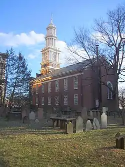 First Church of Christ and the Ancient Burying Ground |
December 5, 1972 (#72001324) |
60 Gold St. 41°45′52″N 72°40′26″W |
Downtown | |
| 58 | First National Bank Building | 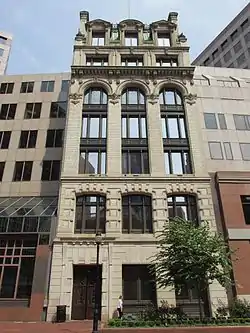 First National Bank Building |
December 23, 1984 (#84000766) |
50–58 State House Sq. 41°45′59″N 72°40′21″W |
Downtown | |
| 59 | Footguard Hall | 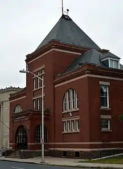 Footguard Hall |
December 23, 1984 (#84000771) |
159 High St. 41°46′14″N 72°40′47″W |
Downtown | |
| 60 | Fourth Congregational Church | 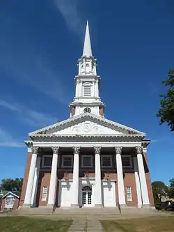 Fourth Congregational Church |
April 12, 1982 (#82004409) |
Albany Ave. and Vine St. 41°46′47″N 72°41′23″W |
Upper Albany | |
| 61 | Frog Hollow |  Frog Hollow |
April 11, 1979 (#79002635) |
Roughly bounded by Park River, Capitol Ave., Oak, Washington, and Madison Sts. and Park Terrace; also bounded by Park Terrace, Hillside Ave., and Hamilton and Summit Sts. 41°45′30″N 72°41′27″W |
Frog Hollow | Second set of addresses represents a boundary increase, added on March 1, 1984 |
| 62 | Goodwin Block | 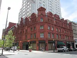 Goodwin Block |
March 26, 1976 (#76001990) |
219–257 Asylum St., 5–17 Hayes St., 210–228 Pearl St. 41°46′00″N 72°40′40″W |
Downtown | |
| 63 | Grandview Terrace Boulevard |  Grandview Terrace Boulevard |
December 27, 2002 (#02001624) |
Roughly along Grandview Terrace 41°44′02″N 72°41′25″W |
Barry Square | |
| 64 | Hartford Club | 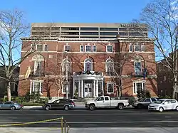 Hartford Club |
December 23, 1984 (#84000779) |
46 Prospect St. 41°45′51″N 72°40′19″W |
Downtown | |
| 65 | Hartford Electric Light Company Maple Avenue Sub-Station | 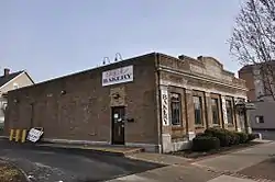 Hartford Electric Light Company Maple Avenue Sub-Station |
August 11, 2000 (#00000833) |
686 Maple Ave. 41°44′30″N 72°41′00″W |
Barry Square | |
| 66 | Hartford Golf Club Historic District |  Hartford Golf Club Historic District |
June 26, 1986 (#86001370) |
Roughly bounded by Simsbury Rd. and Bloomfield Ave., Northmoor Rd., Albany Ave., and Mohegan Dr. 41°47′33″N 72°43′31″W |
West End | Extends into West Hartford |
| 67 | Hartford National Bank and Trust | 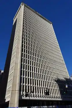 Hartford National Bank and Trust |
October 14, 2014 (#14000867) |
777 Main & 33 Asylum Sts. 41°45′59″N 72°40′25″W |
Now known as 777 Main Street | |
| 68 | Hartford Seminary Foundation | 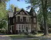 Hartford Seminary Foundation |
June 22, 1982 (#82004411) |
55 Elizabeth St. and 72-120 Sherman St. 41°46′15″N 72°42′26″W |
West End | Listing includes buildings now used by the University of Connecticut Law School as well as buildings still used by the seminary. |
| 69 | Hartford Special Machinery Company Complex | January 25, 2022 (#100007374) |
287 and 296 Homestead Ave. 41°46′47″N 72°42′00″W |
|||
| 70 | Hartford Union Station | 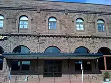 Hartford Union Station |
November 25, 1975 (#75001932) |
Union Pl. 41°46′07″N 72°40′56″W |
Downtown | 1889 Richardsonian Romanesque station rebuilt after 1914 fire. |
| 71 | High Street Historic District | 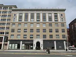 High Street Historic District |
July 8, 1998 (#98000850) |
402–418 Asylum St., 28 High St., and 175–189 Allyn St. 41°46′03″N 72°40′51″W |
Downtown | This district consists of three properties on the block of High Street between Allyn and Asylum Streets: the Judd and Root Building, the Batterson Block (each also listed separately), and the Capitol Building. |
| 72 | John and Isabella Hooker House | 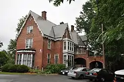 John and Isabella Hooker House |
November 29, 1979 (#79002678) |
140 Hawthorn St. 41°45′49″N 72°42′01″W |
Asylum Hill | |
| 73 | Hotel America | 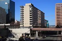 Hotel America |
September 7, 2012 (#12000359) |
5 Constitution Plaza 41°46′00″N 72°40′11″W |
Downtown Hartford | Later the Clarion; now luxury apartments |
| 74 | House at 140 and 144 Retreat Avenue | 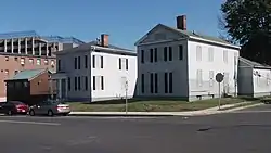 House at 140 and 144 Retreat Avenue |
February 25, 1982 (#82004412) |
140 and 144 Retreat Ave. 41°45′09″N 72°40′49″W |
South Green | |
| 75 | House at 36 Forest Street | 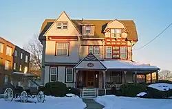 House at 36 Forest Street |
February 24, 1983 (#83001261) |
36 Forest St. 41°45′51″N 72°42′01″W |
Asylum Hill | Intact 1885 Shingle Style house is one of few 19th-century houses left on street |
| 76 | Hyde-St. John House | 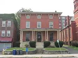 Hyde-St. John House |
October 6, 1977 (#77001422) |
25 Charter Oak Ave. 41°45′33″N 72°40′27″W |
Sheldon-Charter Oak | |
| 77 | Imlay and Laurel Streets District | 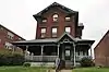 Imlay and Laurel Streets District |
November 29, 1979 (#79002675) |
Imlay, Laurel and Sigourney Sts. 41°45′57″N 72°41′46″W |
Asylum Hill | |
| 78 | Isham-Terry House | 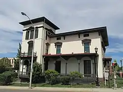 Isham-Terry House |
February 11, 1982 (#82004413) |
211 High St. 41°46′17″N 72°40′45″W |
Downtown | |
| 79 | James Pratt Funeral Service | 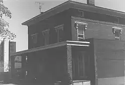 James Pratt Funeral Service |
November 29, 1979 (#79002677) |
69 Farmington Ave. 41°45′59″N 72°41′29″W |
Asylum Hill | Demolished.[11] |
| 80 | Jefferson-Seymour District | 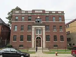 Jefferson-Seymour District |
May 4, 1979 (#79002661) |
Cedar, Wadsworth, Seymour and Jefferson Sts. 41°45′27″N 72°40′50″W |
South Green | |
| 81 | Wilfred X. Johnson House | 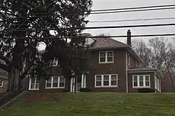 Wilfred X. Johnson House |
July 31, 1994 (#94000765) |
206 Tower Ave. 41°47′58″N 72°40′22″W |
Northeast | |
| 82 | Judd and Root Building | 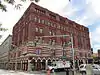 Judd and Root Building |
December 23, 1984 (#84000784) |
175–189 Allyn St. and 5–23 High St. 41°46′06″N 72°40′52″W |
Downtown | |
| 83 | Keney Tower | 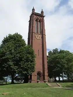 Keney Tower |
March 30, 1978 (#78002871) |
Main and Ely Sts. 41°46′23″N 72°40′36″W |
Downtown | |
| 84 | Laurel and Marshall Streets District | 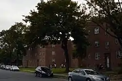 Laurel and Marshall Streets District |
November 29, 1979 (#79002673) |
Laurel, Marshall, and Case Sts., and Farmington Ave. 41°46′06″N 72°41′52″W |
Asylum Hill | |
| 85 | Lewis Street Block | 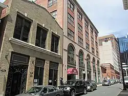 Lewis Street Block |
January 30, 1976 (#76001991) |
1–33, 24–36 Lewis St., 8–28 Trumbull St. 41°45′54″N 72°40′33″W |
Downtown | |
| 86 | William L. Linke House | 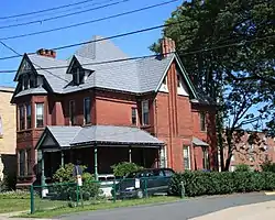 William L. Linke House |
February 24, 1983 (#83001262) |
174 Sigourney St. 41°46′18″N 72°41′34″W |
Asylum Hill | |
| 87 | Little Hollywood Historic District | 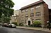 Little Hollywood Historic District |
April 29, 1982 (#82004423) |
Farmington Ave., Owen, Frederick and Denison Sts. 41°45′58″N 72°42′20″W |
West End | |
| 88 | Lyman House | 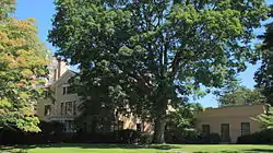 Lyman House |
October 31, 1975 (#75001938) |
22 Woodland St. 41°46′08″N 72°42′08″W |
Asylum Hill | |
| 89 | Main Street Historic District No. 2 | 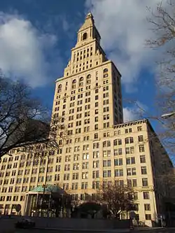 Main Street Historic District No. 2 |
December 23, 1984 (#84001272) |
W. Main, N. Central Row, E. Prospect Sts., and N. Atheneum Sq. 41°45′52″N 72°40′23″W |
Downtown | One city block, including the landmark Travelers Tower. |
| 90 | Mansuy and Smith Automobile Showroom Building | 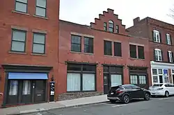 Mansuy and Smith Automobile Showroom Building |
December 20, 2016 (#16000867) |
38–42 Elm St. 41°45′44″N 72°40′31″W |
Downtown | |
| 91 | Mather Homestead | 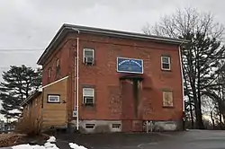 Mather Homestead |
April 29, 1982 (#82004426) |
2 Mahl Ave. 41°46′54″N 72°40′36″W |
Clay-Arsenal | |
| 92 | Metropolitan African Methodist Episcopal Zion Church | 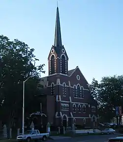 Metropolitan African Methodist Episcopal Zion Church |
July 22, 1994 (#94000769) |
2051 Main St. 41°46′58″N 72°40′37″W |
Clay-Arsenal | |
| 93 | Municipal Building | 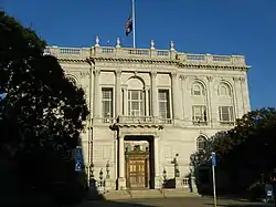 Municipal Building |
April 27, 1981 (#81000536) |
550 Main St. 41°45′45″N 72°40′26″W |
Downtown | Beaux-arts structure built with financial support from J. P. Morgan. |
| 94 | Myers and Gross Building | 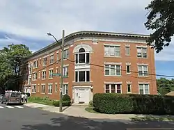 Myers and Gross Building |
March 31, 1983 (#83001263) |
2 Fraser Pl. 41°46′17″N 72°41′02″W |
Asylum Hill | |
| 95 | Neiditz Building | 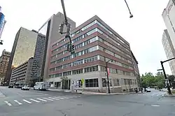 Neiditz Building |
May 28, 2020 (#100005238) |
111 Pearl St. 41°45′59″N 72°40′33″W |
Downtown | |
| 96 | Nook Farm and Woodland Street District | 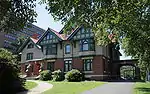 Nook Farm and Woodland Street District |
November 29, 1979 (#79002674) |
Woodland, Gillett, and Forest Sts., and Farmington Ave. 41°46′07″N 72°42′03″W |
Asylum Hill | |
| 97 | Northam Memorial Chapel and Gallup Memorial Gateway | .jpg.webp) Northam Memorial Chapel and Gallup Memorial Gateway |
June 29, 1982 (#82004428) |
453 Fairfield Ave. 41°43′36″N 72°41′30″W |
Southwest | |
| 98 | North-West School | 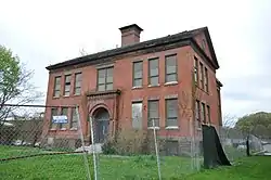 North-West School |
June 10, 2010 (#10000339) |
1240 Albany Ave. 41°46′57″N 72°41′48″W |
Upper Albany | |
| 99 | Old North Cemetery | 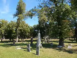 Old North Cemetery |
August 6, 1998 (#98000964) |
1821 Main St. 41°46′48″N 72°40′42″W |
Clay-Arsenal | |
| 100 | Oxford-Whitney Streets Historic District | 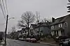 Oxford-Whitney Streets Historic District |
November 10, 2010 (#10000896) |
Fern St. (1 block), Oxford St. (4 blocks) and Whitney St. (1 block) 41°46′13″N 72°42′49″W |
West End | |
| 101 | Parkside Historic District |  Parkside Historic District |
May 31, 1984 (#84001048) |
176–230 Wethersfield Ave. 41°45′01″N 72°40′26″W |
Sheldon-Charter Oak | |
| 102 | Parkville Historic District | 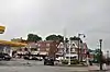 Parkville Historic District |
March 31, 2015 (#15000112) |
Roughly bounded by I-84, Park Hwy., Francis Ct., New Park & Sisson Aves. 41°45′13″N 72°42′28″W |
Parkville | |
| 103 | Perkins-Clark House | 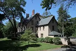 Perkins-Clark House |
December 14, 1978 (#78002870) |
49 Woodland St. 41°46′15″N 72°42′10″W |
Asylum Hill | |
| 104 | Phoenix Life Insurance Company Building |  Phoenix Life Insurance Company Building |
January 21, 2005 (#04001462) |
One American Row 41°45′55″N 72°40′14″W |
Downtown | The world's first two-sided building. |
| 105 | Polish National Home | 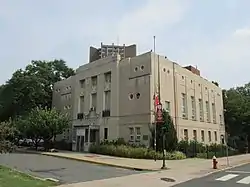 Polish National Home |
October 20, 1983 (#83003566) |
60 Charter Oak Ave. 41°45′33″N 72°40′18″W |
Sheldon-Charter Oak | |
| 106 | Arthur G. Pomeroy House | 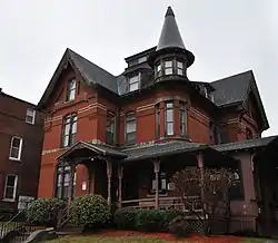 Arthur G. Pomeroy House |
February 4, 1982 (#82004429) |
490 Ann St. 41°46′19″N 72°40′39″W |
Downtown | |
| 107 | Pratt Street Historic District | 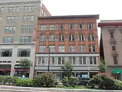 Pratt Street Historic District |
March 10, 1983 (#83001264) |
31–101 and 32–110 Pratt St.; 196–260 Trumbell St. 41°46′04″N 72°40′30″W |
Downtown | |
| 108 | Prospect Avenue Historic District | 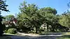 Prospect Avenue Historic District |
August 29, 1985 (#85001918) |
Roughly bounded by Albany Ave., N. Branch Park River, Elizabeth and Fern Sts., Prospect and Asylum Aves., and Sycamore Rd. 41°46′43″N 72°42′38″W |
West End | Extends into West Hartford, elsewhere in Hartford County |
| 109 | Royal Typewriter Company Building | 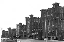 Royal Typewriter Company Building |
February 23, 1989 (#84003898) |
150 New Park Ave. 41°45′07″N 72°42′35″W |
Parkville | Demolished. |
| 110 | Saint Anthony Hall | 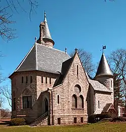 Saint Anthony Hall |
May 9, 1985 (#85001017) |
340 Summit St. 41°45′06″N 72°41′35″W |
Barry Square | |
| 111 | St. Paul's Methodist Episcopal Church | 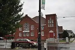 St. Paul's Methodist Episcopal Church |
August 2, 1984 (#84001051) |
1886–1906 Park St. 41°45′24″N 72°42′37″W |
Parkville | |
| 112 | Sts. Cyril and Methodius Church | 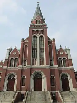 Sts. Cyril and Methodius Church |
June 30, 1983 (#83001254) |
63 Governor St. 41°45′29″N 72°40′23″W |
Sheldon-Charter Oak | |
| 113 | Second Church of Christ | 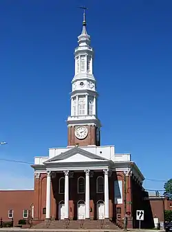 Second Church of Christ |
January 9, 1978 (#78002836) |
307 Main St. 41°45′35″N 72°40′32″W |
Downtown | |
| 114 | Sigourney Square District | 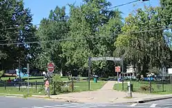 Sigourney Square District |
January 16, 1979 (#79002660) |
Sargeant, Ashley, and May Sts.; also 216-232 Garden St.; also 207 Garden St. 41°46′28″N 72°41′33″W |
Asylum Hill | Garden St. addresses represent boundary increases added December 21, 1983 and September 13, 2011 |
| 115 | Dr. Frank T. Simpson House | 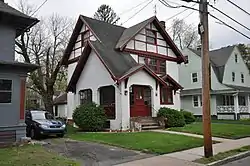 Dr. Frank T. Simpson House |
December 2, 1993 (#93001246) |
27 Keney Terr. 41°47′15″N 72°41′22″W |
Northeast | |
| 116 | Sisson-South Whitney Historic District | 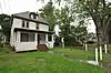 Sisson-South Whitney Historic District |
July 24, 2013 (#13000526) |
Roughly bounded by West Blvd., S. Whitney St., Farmington & Sisson Aves. 41°45′51″N 72°42′32″W |
West End | |
| 117 | South Green Historic District | 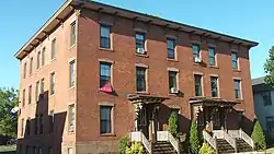 South Green Historic District |
November 17, 1977 (#02001453) |
Roughly along Wethersfield Ave., Alden and Morris Sts. 41°45′08″N 72°40′32″W |
South Green | |
| 118 | Southern New England Telephone Company Building | 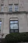 Southern New England Telephone Company Building |
May 12, 2004 (#04000417) |
55 Trumbull St. 41°45′56″N 72°40′36″W |
Downtown | 1930s Art Deco granite-and-limestone 12-story building facing Bushnell Park |
| 119 | Spencer House | 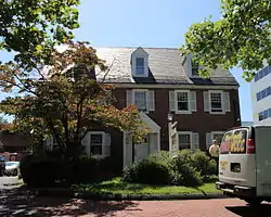 Spencer House |
February 24, 1983 (#83001265) |
1039 Asylum Ave. 41°46′18″N 72°42′00″W |
Asylum Hill | |
| 120 | Spring Grove Cemetery | 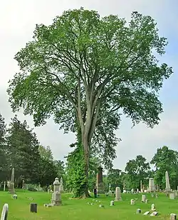 Spring Grove Cemetery |
January 20, 2011 (#08001203) |
2035 Main St. 41°46′57″N 72°40′34″W |
Clay-Arsenal | |
| 121 | Stackpole, Moore, and Tryon Building | 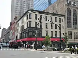 Stackpole, Moore, and Tryon Building |
October 19, 1978 (#78002869) |
105–115 Asylum St. 41°46′00″N 72°40′33″W |
Downtown | |
| 122 | State Arsenal and Armory | 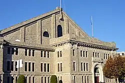 State Arsenal and Armory |
April 4, 1996 (#96000357) |
360 Broad St. 41°45′54″N 72°41′10″W |
Downtown | |
| 123 | Stone Bridge |  Stone Bridge |
March 28, 1985 (#85000793) |
500 Main St. 41°45′44″N 72°40′28″W |
Downtown | |
| 124 | Harriet Beecher Stowe House |  Harriet Beecher Stowe House |
October 6, 1970 (#70000710) |
73 Forest St. 41°45′54″N 72°42′01″W |
Asylum Hill | |
| 125 | M. Swift and Sons Company | 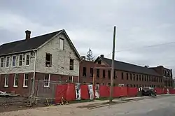 M. Swift and Sons Company |
July 24, 2013 (#13000527) |
10 & 60 Love Lane 41°47′31″N 72°40′52″W |
North End | |
| 126 | Temple Beth Israel | 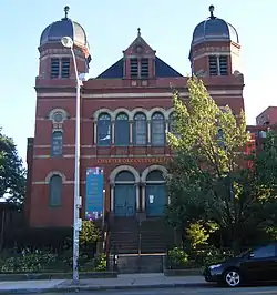 Temple Beth Israel |
December 1, 1978 (#78002868) |
21 Charter Oak Ave. 41°45′33″N 72°40′29″W |
Sheldon-Charter Oak | |
| 127 | Mark Twain House | 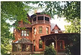 Mark Twain House |
October 15, 1966 (#66000884) |
351 Farmington Ave. 41°46′02″N 72°42′07″W |
Asylum Hill | Home of Mark Twain from 1871 to 1891. |
| 128 | U.S. Post Office and Federal Building | 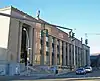 U.S. Post Office and Federal Building |
October 19, 1981 (#81000623) |
135–149 High St. 41°46′11″N 72°40′50″W |
Downtown | 1931 combination of post office, courthouse and federal office building |
| 129 | Underwood Computing Machine Company Factory | 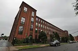 Underwood Computing Machine Company Factory |
November 12, 2010 (#10000895) |
56 Arbor St. 41°45′34″N 72°42′13″W |
Parkville | |
| 130 | Union Baptist Church | 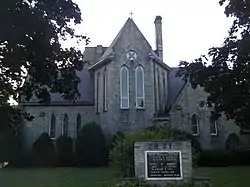 Union Baptist Church |
August 15, 1979 (#79002634) |
1913 and 1921 Main St. 41°46′52″N 72°40′37″W |
Clay-Arsenal | |
| 131 | Upper Albany Historic District | 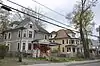 Upper Albany Historic District |
September 29, 1986 (#86003383) |
Roughly bounded by Holcomb St., Vine St., Homestead Ave., and Woodland and Ridgefield Sts. 41°47′09″N 72°41′26″W |
Upper Albany | |
| 132 | Vine Street Apartment Buildings | 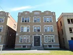 Vine Street Apartment Buildings |
February 14, 2012 (#12000002) |
4–48 Vine St 41°46′48″N 72°41′17″W |
Upper Albany | |
| 133 | Wadsworth Atheneum |  Wadsworth Atheneum |
October 6, 1970 (#70000709) |
25 Atheneum Sq. 41°45′48″N 72°40′26″W |
Downtown | |
| 134 | Washington Street School |  Washington Street School |
February 19, 1982 (#82004431) |
461 Washington St. 41°44′50″N 72°41′05″W |
Barry Square | |
| 135 | Watkinson Juvenile Asylum and Farm School |  Watkinson Juvenile Asylum and Farm School |
March 23, 1995 (#95000273) |
140, 180, and 190 Bloomfield Ave. 41°47′24″N 72°42′45″W |
Blue Hills | Extends into West Hartford. |
| 136 | Webster Memorial Building |  Webster Memorial Building |
April 12, 1982 (#82004433) |
36 Trumbull St. 41°45′55″N 72°40′35″W |
Downtown | |
| 137 | West Boulevard Historic District |  West Boulevard Historic District |
March 22, 2007 (#06000615) |
Roughly along Rodney St. and West Boulevard 41°45′41″N 72°42′38″W |
West End | |
| 138 | West End North Historic District |  West End North Historic District |
July 25, 1985 (#85001618) |
Roughly bounded by Farmington Ave., Lorraine, Elizabeth, and Highland Sts. 41°46′09″N 72°42′44″W |
West End | Extends into West Hartford |
| 139 | West End South Historic District | 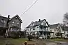 West End South Historic District |
April 11, 1985 (#85000763) |
Roughly bounded by Farmington Ave., Whitney and S. Whitney Sts., West Boulevard, and Prospect Ave. 41°45′47″N 72°42′52″W |
West End | Extends into West Hartford, elsewhere in Hartford County |
| 140 | Wethersfield Avenue Car Barn | 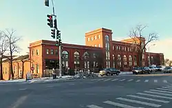 Wethersfield Avenue Car Barn |
November 28, 1983 (#83003569) |
331 Wethersfield Ave. 41°44′48″N 72°40′29″W |
Barry Square | |
| 141 | Widows' Home | 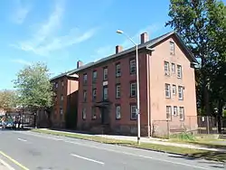 Widows' Home |
March 10, 1983 (#83001267) |
1846–1860 N. Main St. 41°46′49″N 72°40′34″W |
Clay-Arsenal | |
| 142 | Windsor Avenue Congregational Church | 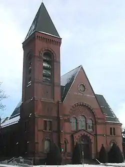 Windsor Avenue Congregational Church |
April 3, 1993 (#93000174) |
2030 Main St. 41°46′56″N 72°40′33″W |
Clay-Arsenal |
Former listings
| [5] | Name on the Register | Image | Date listed | Date removed | Location | Description |
|---|---|---|---|---|---|---|
| 1 | Capitol Building | Capitol Building |
December 23, 1984 (#84000761) | December 21, 1989 | 402–418 Asylum St. 41°46′04″N 72°40′51″W |
Removed due to owner objection. Now a contributing portion of the High Street Historic District. |
See also
References
- The latitude and longitude information provided in this table was derived originally from the National Register Information System, which has been found to be fairly accurate for about 99% of listings. Some locations in this table may have been corrected to current GPS standards.
- Landmark Historic Preservation Ordinance Adopted Archived 2011-07-26 at the Wayback Machine, Hartford Preservation Alliance Newsletter, Autumn 2005
- Hartford Preservation Ordinance Takes Effect! Archived 2011-07-26 at the Wayback Machine, Hartford Preservation Alliance Newsletter, Winter 2007
- National Park Service, United States Department of the Interior, "National Register of Historic Places: Weekly List Actions", retrieved October 20, 2023.
- Numbers represent an alphabetical ordering by significant words. Various colorings, defined here, differentiate National Historic Landmarks and historic districts from other NRHP buildings, structures, sites or objects.
- "National Register Information System". National Register of Historic Places. National Park Service. March 13, 2009.
- The eight-digit number below each date is the number assigned to each location in the National Register Information System database, which can be viewed by clicking the number.
- Connecticut Preservation Awards 2008 Archived 2011-07-25 at the Wayback Machine, Connecticut Trust for Historic Preservation
- New Listings on the National Register of Historic Places, Connecticut Trust for Historic Preservation, undated
- HPA Walking Tours, Hartford Preservation Alliance Newsletter Archived 2011-07-26 at the Wayback Machine, March 2005, page 4
- "Properties covered by Historic Preservation Ordinance, May 2017" (PDF). Hartford Preservation. Retrieved 2017-06-28.
| Lists by county |  | |
|---|---|---|
| Lists by city or town | ||
| Other lists | ||