National Register of Historic Places listings in Sonoma County, California
This is a list of the National Register of Historic Places listings in Sonoma County, California.

Location of Sonoma County in California
This is intended to be a complete list of the properties and districts on the National Register of Historic Places in Sonoma County, California, United States. Latitude and longitude coordinates are provided for many National Register properties and districts; these locations may be seen together in an online map.[1]
There are 74 properties and districts listed on the National Register in the county, including 6 National Historic Landmarks.
This National Park Service list is complete through NPS recent listings posted October 20, 2023.[2]
Current listings
| [3] | Name on the Register[4] | Image | Date listed[5] | Location | City or town | Description |
|---|---|---|---|---|---|---|
| 1 | Baker House | 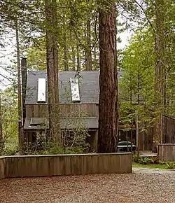 Baker House |
December 12, 2018 (#100003234) |
35292 Timber Ridge Rd. 38°41′30″N 123°25′13″W |
Sea Ranch | |
| 2 | Bodega Bay | 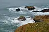 Bodega Bay |
December 18, 1973 (#73000461) |
Address Restricted |
Bodega Bay | |
| 3 | Buena Vista Winery | 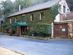 Buena Vista Winery |
July 24, 1986 (#86001902) |
18000 Old Winery Rd. 38°17′58″N 122°25′23″W |
Sonoma | Also known as Buena Vista Vineyards-Buena Vista Vinicultural Society |
| 4 | Luther Burbank House and Garden | 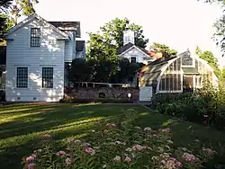 Luther Burbank House and Garden |
October 15, 1966 (#66000241) |
200 Santa Rosa Ave. 38°26′10″N 122°42′42″W |
Santa Rosa | |
| 5 | Nicholas Carriger Estate | 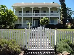 Nicholas Carriger Estate |
November 16, 2001 (#01001234) |
18880 Carriger Rd. 38°17′48″N 122°30′43″W |
Sonoma | 1850 home of early American settler, farmer and gold-mining magnate Nicholas Carriger[6] |
| 6 | Cloverdale Railroad Station | December 12, 1976 (#76000536) |
Railroad Ave. 38°48′14″N 123°00′41″W |
Cloverdale | Destroyed by fire September 25, 1991[7] | |
| 7 | Cnopius House | 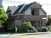 Cnopius House |
April 12, 1982 (#82002277) |
726 College Ave. 38°26′44″N 122°42′45″W |
Santa Rosa | |
| 8 | Comstock House | .jpg.webp) Comstock House |
January 27, 2012 (#11001053) |
767 Mendocino Ave. 38°26′52″N 122°43′05″W |
Santa Rosa | |
| 9 | Condominium 1 | Condominium 1 |
July 29, 2005 (#05000731) |
110–128 Sea Walk Dr. 38°40′45″N 123°25′40″W |
Sea Ranch | |
| 10 | Cunningham-Hembree Estate | 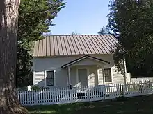 Cunningham-Hembree Estate |
July 9, 2018 (#100002638) |
9225 Foxwood Dr. 38°33′08″N 122°48′40″W |
Windsor | |
| 11 | De Turk Round Barn |  De Turk Round Barn |
April 21, 2004 (#04000334) |
819 Donahue St. 38°26′27″N 122°43′31″W |
Santa Rosa | |
| 12 | Dry Creek-Warm Springs Valleys Archeological District | December 9, 1977 (#77000350) |
Address Restricted |
Healdsburg vicinity | ||
| 13 | Duncan's Landing Site | Duncan's Landing Site |
November 12, 1971 (#71000206) |
Address Restricted |
Jenner | |
| 14 | Ellis-Martin House | 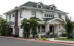 Ellis-Martin House |
October 4, 2006 (#06000915) |
1197 E. Washington St. 38°14′43″N 122°37′48″W |
Petaluma | |
| 15 | Flamingo Hotel | September 20, 2021 (#100006937) |
2777 4th St. 38°27′04″N 122°41′18″W |
Santa Rosa | ||
| 16 | Fort Ross |  Fort Ross |
October 15, 1966 (#66000239) |
Fort Ross State Historic Park 38°30′51″N 123°14′34″W |
Fort Ross | |
| 17 | Fort Ross Commander's House | 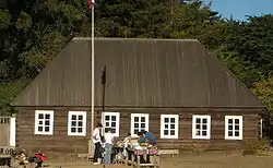 Fort Ross Commander's House |
April 15, 1970 (#70000150) |
Fort Ross State Historic Park 38°30′45″N 123°14′34″W |
Fort Ross | Also known as Rotchev House |
| 18 | Fort Ross Landing Historical and Archaeological District | April 7, 2023 (#100008442) |
Fort Ross State Historic Park 38°30′43″N 123°14′42″W |
Jenner vicinity | 830 acres (340 ha) of land and water at Fort Ross, including Rotchev House and wreck of SS Pomona.[8] | |
| 19 | Free Public Library of Petaluma | 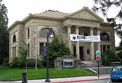 Free Public Library of Petaluma |
June 23, 1988 (#88000925) |
20 Fourth St. 38°13′57″N 122°38′24″W |
Petaluma | |
| 20 | Freestone Store | 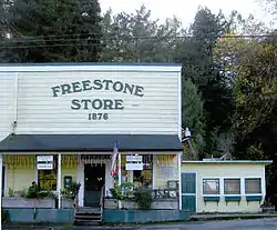 Freestone Store |
February 28, 2022 (#100007484) |
500 Bohemian Hwy. 38°22′24″N 122°55′06″W |
Freestone | |
| 21 | The Gables | 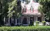 The Gables |
September 20, 1984 (#84001206) |
4257 Petaluma Hill Rd. 38°23′37″N 122°41′35″W |
Santa Rosa | |
| 22 | Geyserville Union School | October 24, 1979 (#79000558) |
Main St. 38°42′28″N 122°54′23″W |
Geyserville | Demolished in 1994[9] | |
| 23 | Glen Oaks Ranch | 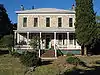 Glen Oaks Ranch |
October 21, 1994 (#94001223) |
13255 Sonoma Hwy. 38°22′14″N 122°30′47″W |
Glen Ellen | |
| 24 | Luther Burbank's Experimental Farm & Cottage (Gold Ridge Farm) | Luther Burbank's Experimental Farm & Cottage (Gold Ridge Farm) |
December 14, 1978 (#78000803) |
W of Sebastopol 38°23′51″N 122°50′01″W |
Sebastopol | |
| 25 | Gould-Shaw House | 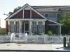 Gould-Shaw House |
September 10, 1992 (#92001244) |
215 N. Cloverdale Blvd. 38°48′25″N 123°01′03″W |
Cloverdale | |
| 26 | Guerneville Bridge |  Guerneville Bridge |
August 4, 1989 (#89000945) |
Rt. 116 over Russian River 38°30′04″N 122°59′40″W |
Guerneville | |
| 27 | Healdsburg Carnegie Library | 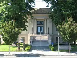 Healdsburg Carnegie Library |
July 6, 1988 (#88000924) |
221 Matheson St. 38°37′13″N 122°51′58″W |
Healdsburg | Carnegie library built in 1911, now the Healdsburg Museum |
| 28 | Healdsburg Memorial Bridge | .jpg.webp) Healdsburg Memorial Bridge |
April 14, 2011 (#11000214) |
Healdsburg Ave., junction of Front St. 38°36′14″N 122°51′36″W |
Healdsburg | Highway Bridges of California MPS |
| 29 | Hicks House | 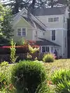 Hicks House |
July 21, 1987 (#87001157) |
3160 Hicks Rd. 38°26′14″N 122°51′54″W |
Graton | |
| 30 | Hinds Hotel | 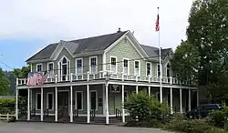 Hinds Hotel |
January 31, 1979 (#79000557) |
306 Bohemian Hwy. 38°22′20″N 122°54′53″W |
Freestone | |
| 31 | Hines House | 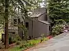 Hines House |
June 23, 2021 (#100006689) |
301 Chinquapin Ln. 38°41′31″N 123°25′30″W |
Sea Ranch | |
| 32 | William Hood House | 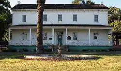 William Hood House |
February 6, 1998 (#97001658) |
7501 Sonoma Hwy 38°26′33″N 122°34′41″W |
Santa Rosa | |
| 33 | Hotel Chauvet | 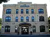 Hotel Chauvet |
February 15, 1990 (#90000117) |
13756 Arnold Dr. 38°21′44″N 122°31′34″W |
Glen Ellen | |
| 34 | Hotel La Rose | 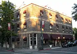 Hotel La Rose |
August 3, 1978 (#78000802) |
5th and Wilson Sts. 38°26′17″N 122°43′15″E |
Santa Rosa | Sturdy hotel built by four Italian stonemasons after 1906 San Francisco earthquake destroyed predecessor. |
| 35 | Knipp and Stengel Ranch Barn | 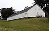 Knipp and Stengel Ranch Barn |
January 29, 1987 (#87000005) |
CA 1 38°42′57″N 123°27′17″W |
Sea Ranch | |
| 36 | James H. and Frances E. Laughlin House | 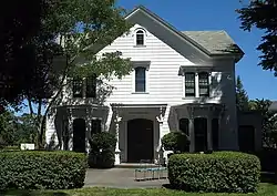 James H. and Frances E. Laughlin House |
April 26, 1979 (#79000563) |
SE of Windsor on Lone Redwood Rd. 38°30′46″N 122°47′02″W |
Windsor | |
| 37 | Llano Road Roadhouse | 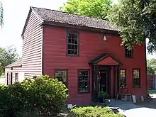 Llano Road Roadhouse |
May 22, 1978 (#78000804) |
4353 Gravenstein Hwy., S 38°21′29″N 122°46′04″W |
Sebastopol | |
| 38 | Jack London Ranch | 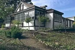 Jack London Ranch |
October 15, 1966 (#66000240) |
0.4 mi. W of Glen Ellen in Jack London Historical State Park 38°21′02″N 122°32′35″W |
Glen Ellen | |
| 39 | W. H. Lumsden House | 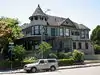 W. H. Lumsden House |
August 11, 1983 (#83001245) |
727 Mendocino Ave. 38°26′47″N 122°43′01″W |
Santa Rosa | |
| 40 | Madrona Manor | 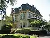 Madrona Manor |
April 2, 1987 (#87000573) |
1001 Westside Rd. 38°36′17″N 122°53′07″W |
Healdsburg vicinity | Also known as Madrona Knoll Rancho District |
| 41 | McDonald Mansion | 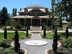 McDonald Mansion |
March 1, 1974 (#74000560) |
1015 McDonald Ave. 38°27′01″N 122°42′15″W |
Santa Rosa | |
| 42 | Norlina (shipwreck and remains) | September 30, 2022 (#100008248) |
Address Restricted |
Jenner vicinity | ||
| 43 | Old Petaluma Opera House | 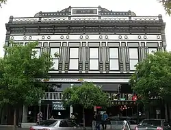 Old Petaluma Opera House |
December 22, 1978 (#78000801) |
147–149 Kentucky St. 38°14′06″N 122°38′31″W |
Petaluma | |
| 44 | Old Post Office |  Old Post Office |
November 16, 1979 (#79000559) |
425 7th St. 38°26′31″N 122°43′01″W |
Santa Rosa | Now home of the Sonoma County Museum |
| 45 | Orange Lawn | 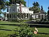 Orange Lawn |
June 9, 2008 (#08000529) |
645 Charles Van Damme Way 38°17′22″N 122°26′46″W |
Sonoma | |
| 46 | Park Apartments | 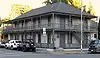 Park Apartments |
April 26, 1979 (#79000560) |
300 Santa Rosa Ave. 38°26′07″N 122°42′41″W |
Santa Rosa | |
| 47 | Petaluma Adobe |  Petaluma Adobe |
April 15, 1970 (#70000151) |
4 mi. E of Petaluma on Casa Grande Rd. 38°15′20″N 122°35′03″W |
Petaluma | |
| 48 | Petaluma and Santa Rosa Railway Powerhouse | Petaluma and Santa Rosa Railway Powerhouse |
July 23, 1991 (#91000918) |
238–258 Petaluma Ave. 38°24′05″N 122°49′19″W |
Sebastopol | |
| 49 | Petaluma Historic Commercial District | 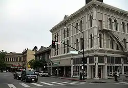 Petaluma Historic Commercial District |
March 31, 1995 (#95000354) |
Along Petaluma Blvd., between B and Prospect Sts. 38°14′03″N 122°38′25″W |
Petaluma | |
| 50 | Petaluma Silk Mill |  Petaluma Silk Mill |
March 6, 1986 (#86000386) |
420 Jefferson St. 38°14′10″N 122°37′51″W |
Petaluma | |
| 51 | Simon Pinschower House | 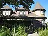 Simon Pinschower House |
February 25, 1982 (#82002276) |
302 N. Main St. 38°48′31″N 123°00′59″W |
Cloverdale | |
| 52 | Pond Farm Pottery Historic District |  Pond Farm Pottery Historic District |
June 17, 2014 (#14000307) |
17000 Armstrong Woods Road 38°33′08″N 123°00′00″W |
Guerneville | |
| 53 | Railroad Square District | 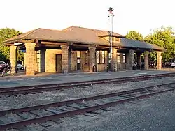 Railroad Square District |
April 20, 1979 (#79000561) |
Roughly bounded by 3rd, Davis, Wilson, and 6th Sts. and Santa Rosa Creek 38°26′14″N 122°43′13″W |
Santa Rosa | |
| 54 | The Ranch Site | July 14, 1971 (#71000205) |
Address Restricted |
Bodega Bay | ||
| 55 | Rosenberg's Department Store | 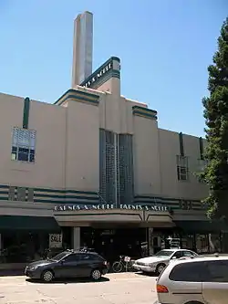 Rosenberg's Department Store |
December 29, 1994 (#94001497) |
700 Fourth St. 38°26′28″N 122°42′40″W |
Santa Rosa | |
| 56 | Salt Point Landing Historical and Archaeological District | April 11, 2022 (#100007268) |
Address Restricted |
Jenner vicinity | ||
| 57 | Salt Point State Park Archeological District | March 24, 1971 (#71000207) |
Address Restricted |
Salt Point State Park | ||
| 58 | Sebastopol Depot of the Petaluma and Santa Rosa Railway |  Sebastopol Depot of the Petaluma and Santa Rosa Railway |
February 16, 1996 (#96000109) |
261 S. Main St. 38°24′03″N 122°49′19″W |
Sebastopol | |
| 59 | Isaac E. Shaw Building |  Isaac E. Shaw Building |
January 25, 1991 (#90002155) |
219 N. Cloverdale Blvd. 38°48′24″N 123°01′06″W |
Cloverdale | |
| 60 | Sonoma Depot |  Sonoma Depot |
April 3, 1975 (#75000488) |
284 1st St., W 38°17′46″N 122°27′27″W |
Sonoma | |
| 61 | Sonoma Grammar School |  Sonoma Grammar School |
November 28, 1980 (#80000871) |
276 E. Napa St. 38°17′30″N 122°27′10″W |
Sonoma | |
| 62 | Sonoma Plaza | 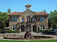 Sonoma Plaza |
April 3, 1975 (#75000489) |
Center of Sonoma; also the area south and east of the town plaza, along Broadway and the northern side of E. Napa St. 38°17′37″N 122°27′12″W |
Sonoma | Second set of boundaries represents a boundary increase of May 6, 1992 |
| 63 | Sonoma State Home-Main Building | 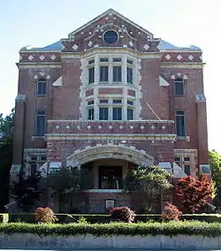 Sonoma State Home-Main Building |
October 6, 2000 (#00001180) |
15000 Arnold Dr. 38°20′51″N 122°31′06″W |
Eldridge | Also known as Sonoma Developmental Center |
| 64 | Sonoma Valley Woman's Club | 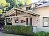 Sonoma Valley Woman's Club |
January 7, 2015 (#14001115) |
574 1st St., E. 38°17′26″N 122°27′25″W |
Sonoma | |
| 65 | SS POMONA (Shipwreck) | 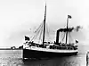 SS POMONA (Shipwreck) |
January 31, 2008 (#07000306) |
Fort Ross Cove, off Fort Ross Historic State Park 38°30′37″N 123°14′44″W |
Jenner | |
| 66 | George A. Strout House | 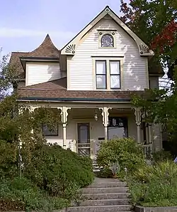 George A. Strout House |
June 17, 1980 (#80000870) |
253 Florence Ave. 38°24′11″N 122°49′40″W |
Sebastopol | |
| 67 | Philip Sweed House |  Philip Sweed House |
June 18, 1992 (#92000787) |
301 Keokuk St. 38°14′11″N 122°38′47″W |
Petaluma | |
| 68 | Sweet House | 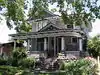 Sweet House |
January 14, 1988 (#87002415) |
607 Cherry St. 38°26′42″N 122°42′56″W |
Santa Rosa | |
| 69 | Temelec |  Temelec |
April 19, 2006 (#06000312) |
220 and 221 Temelec Circle 38°15′57″N 122°29′59″W |
Temelec | |
| 70 | US Post Office-Petaluma | 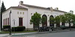 US Post Office-Petaluma |
January 11, 1985 (#85000140) |
120 4th St. 38°13′55″N 122°38′16″W |
Petaluma | |
| 71 | Vallejo Estate | 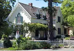 Vallejo Estate |
June 29, 1972 (#72000262) |
Corner of Spain and W. 3rd Sts. 38°17′56″N 122°27′46″W |
Sonoma | |
| 72 | Walters Ranch | 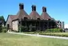 Walters Ranch |
October 7, 1977 (#77000351) |
6 mi. S of Healdsburg at 6050 Westside Rd. 38°32′16″N 122°52′05″W |
Healdsburg vicinity | |
| 73 | Wasserman House | 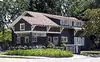 Wasserman House |
January 31, 1979 (#79000562) |
930 Mendocino Ave. 38°27′02″N 122°42′59″W |
Santa Rosa | |
| 74 | Watson School | 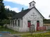 Watson School |
August 18, 1978 (#78000800) |
15000 Bodega Hwy. 38°21′21″N 122°56′16″W |
Bodega |
See also
Wikimedia Commons has media related to National Register of Historic Places in Sonoma County, California.
References
- The latitude and longitude information provided in this table was derived originally from the National Register Information System, which has been found to be fairly accurate for about 99% of listings. Some locations in this table may have been corrected to current GPS standards.
- National Park Service, United States Department of the Interior, "National Register of Historic Places: Weekly List Actions", retrieved October 20, 2023.
- Numbers represent an alphabetical ordering by significant words. Various colorings, defined here, differentiate National Historic Landmarks and historic districts from other NRHP buildings, structures, sites or objects.
- "National Register Information System". National Register of Historic Places. National Park Service. July 9, 2010.
- The eight-digit number below each date is the number assigned to each location in the National Register Information System database, which can be viewed by clicking the number.
- Hill, Gerald (September 15, 2011). "How Nick Carriger Came to Sonoma". Sonoma Index-Tribune. Sonoma, California. Archived from the original on December 7, 2011. Retrieved December 1, 2011.
- "Historic Depot consumed in morning blaze". Cloverdale Reveille. Cloverdale, California. September 25, 1991. p. 1. Retrieved April 11, 2013.
- https://ohp.parks.ca.gov/pages/1067/files/CA_Sonoma%20County_Doghole%20Ports%20MPS_Fort%20Ross%20Landing_REDACTED.pdf
- Hillenmeyer, Katy (April 1, 2004). "$2.5 Million Office-Retail Complex Proposed for Geyserville". The Press Democrat. Santa Rosa, CA. p. E.1.
| Topics | |
|---|---|
| Lists by state |
|
| Lists by insular areas | |
| Lists by associated state | |
| Other areas | |
| Related | |
This article is issued from Wikipedia. The text is licensed under Creative Commons - Attribution - Sharealike. Additional terms may apply for the media files.