National Register of Historic Places listings in Greene County, Missouri
This is a list of the National Register of Historic Places listings in Greene County, Missouri.
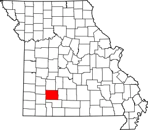
Location of Greene County in Missouri
This is intended to be a complete list of the properties and districts on the National Register of Historic Places in Greene County, Missouri, United States. Latitude and longitude coordinates are provided for many National Register properties and districts; these locations may be seen together in a map.[1]
There are 72 properties and districts listed on the National Register in the county. Another property was once listed but has been removed.
This National Park Service list is complete through NPS recent listings posted October 20, 2023.[2]
Current listings
| [3] | Name on the Register | Image | Date listed[4] | Location | City or town | Description |
|---|---|---|---|---|---|---|
| 1 | Abou Ben Adhem Shrine Mosque | 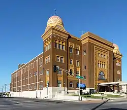 Abou Ben Adhem Shrine Mosque |
September 9, 1982 (#82003137) |
601 E. St. Louis 37°12′34″N 93°17′10″W |
Springfield | |
| 2 | Ambassador Apartments | 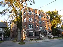 Ambassador Apartments |
October 29, 2008 (#08001023) |
1235 E. Elm St. 37°12′20″N 93°16′28″W |
Springfield | |
| 3 | Elijah Teague Anderson House |  Elijah Teague Anderson House |
November 14, 1980 (#80002353) |
406 N. Pine St. 37°07′22″N 93°28′44″W |
Republic | |
| 4 | Bailey School | 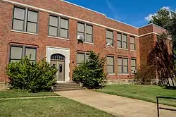 Bailey School |
November 2, 2016 (#16000749) |
501 W. Central St. 37°13′03″N 93°17′42″W |
Springfield | |
| 5 | Bentley House | 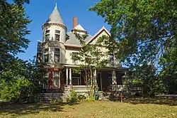 Bentley House |
November 14, 1980 (#80002354) |
603 E. Calhoun St. 37°13′21″N 93°17′06″W |
Springfield | |
| 6 | Benton Avenue AME Church | 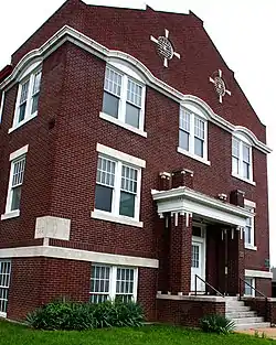 Benton Avenue AME Church |
October 14, 2001 (#01001109) |
830 N. Benton Ave. 37°13′02″N 93°17′14″W |
Springfield | |
| 7 | Berry Cemetery | 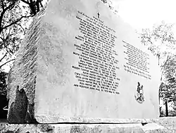 Berry Cemetery |
November 13, 2004 (#04001224) |
1431 W. Farm Road 74 37°19′26″N 93°36′00″W |
Ash Grove | |
| 8 | Beverly Apartments | July 10, 2017 (#100001299) |
529 Cherry St. 37°12′15″N 93°17′14″W |
Springfield | ||
| 9 | Boegel and Hine Flour Mill-Wommack Mill | 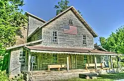 Boegel and Hine Flour Mill-Wommack Mill |
November 6, 1986 (#86003140) |
East side of N. Main St., south of its intersection with Route 125 37°22′59″N 93°09′01″W |
Fair Grove | |
| 10 | Nathan Boone House | October 1, 1969 (#69000103) |
1.75 miles (2.82 km) north of Ash Grove on Highway V 37°20′46″N 93°34′35″W |
Ash Grove | ||
| 11 | Camp Manor Apartments | 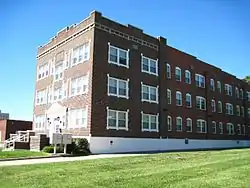 Camp Manor Apartments |
December 6, 2005 (#05001374) |
423 E. Elm St. 37°12′18″N 93°17′21″W |
Springfield | |
| 12 | Campbell Avenue Historic District | June 25, 1999 (#99000714) |
200 and 300 blocks of S. Campbell Ave. and the 300 block of Park Central West; also 318 and 322-326 S. Campbell Ave. 37°12′30″N 93°17′38″W |
Springfield | Second set of boundaries represents a boundary increase of December 23, 2005 | |
| 13 | Christ Episcopal Church | 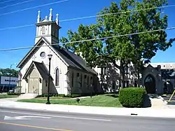 Christ Episcopal Church |
March 26, 1987 (#87000514) |
601 E. Walnut St.[5] 37°12′25″N 93°17′11″W |
Springfield | |
| 14 | College Apartments | 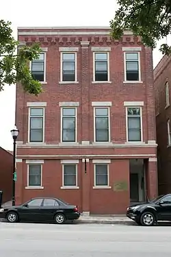 College Apartments |
May 1, 2003 (#03000319) |
408 E. Walnut St. 37°12′31″N 93°17′20″W |
Springfield | |
| 15 | Commercial Street Historic District | 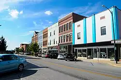 Commercial Street Historic District |
May 24, 1983 (#83000991) |
Commercial St. 37°13′47″N 93°17′23″W |
Springfield | |
| 16 | Day House |  Day House |
November 7, 1976 (#76001110) |
614 South St. 37°12′12″N 93°17′31″W |
Springfield | |
| 17 | Fallin Brothers Building |  Fallin Brothers Building |
July 25, 2012 (#12000435) |
211-229 S. Market Ave. 37°12′30″N 93°17′44″W |
Springfield | part of the Springfield Multiple Property Submission |
| 18 | Fallin Garage | September 15, 2023 (#100009384) |
423 West Olive St. 37°12′35″N 93°17′43″W |
Springfield | ||
| 19 | Finkbiner Building |  Finkbiner Building |
May 25, 2005 (#05000469) |
509-513 W. Olive St. 37°12′43″N 93°17′46″W |
Springfield | |
| 20 | Franklin Springfield Motor Co. Building |  Franklin Springfield Motor Co. Building |
November 15, 2006 (#06001027) |
312-314 E. Olive St. 37°12′40″N 93°17′26″W |
Springfield | |
| 21 | Gillioz Theater | 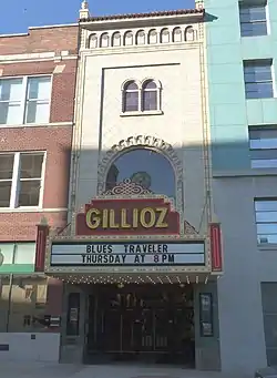 Gillioz Theater |
July 9, 1991 (#91000887) |
325 Park Central E. 37°12′30″N 93°17′20″W |
Springfield | |
| 22 | Gilmore Barn | 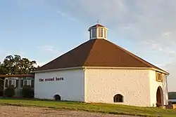 Gilmore Barn |
April 8, 1994 (#94000316) |
U.S. Route 160, 3.5 miles (5.6 km) east of Ash Grove 37°19′24″N 93°30′43″W |
Ash Grove | |
| 23 | Gottfried Furniture Company Building | 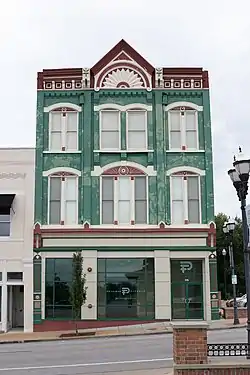 Gottfried Furniture Company Building |
December 18, 2007 (#07001289) |
326 Boonville Ave. 37°12′45″N 93°17′31″W |
Springfield | |
| 24 | Greene County Courthouse | Greene County Courthouse |
November 14, 2007 (#07001185) |
940 Boonville Ave. 37°13′12″N 93°17′31″W |
Springfield | |
| 25 | Heer's Department Store | 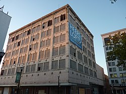 Heer's Department Store |
October 24, 2002 (#02001207) |
138 Park Central Square 37°12′33″N 93°17′34″W |
Springfield | |
| 26 | Heercleff | November 7, 2016 (#16000763) |
6405 S. Campbell Ave. 37°05′55″N 93°17′52″W |
Springfield | ||
| 27 | Holland Building | 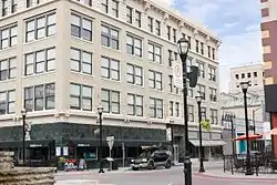 Holland Building |
November 15, 2000 (#00001373) |
205 Park Central East 37°12′33″N 93°17′28″W |
Springfield | |
| 28 | Hotel Sansone | May 5, 2000 (#00000430) |
312 Park Central East 37°12′32″N 93°17′25″W |
Springfield | ||
| 29 | Jefferson Street Footbridge | 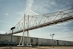 Jefferson Street Footbridge |
September 2, 2003 (#03000865) |
Jefferson Ave. between Commercial and Chase Sts. 37°13′58″N 93°17′21″W |
Springfield | |
| 30 | Keet-McElhany House | 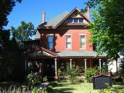 Keet-McElhany House |
March 22, 1984 (#84002545) |
435 E. Walnut St. 37°12′24″N 93°17′20″W |
Springfield | |
| 31 | J.E. King Manufacturing Company | 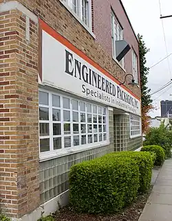 J.E. King Manufacturing Company |
July 27, 2005 (#05000751) |
1350 St. Louis St. 37°12′07″N 93°17′57″W |
Springfield | |
| 32 | Robert B. and Vitae A. Kite Apartment Building | 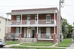 Robert B. and Vitae A. Kite Apartment Building |
January 28, 2004 (#03001504) |
769-771 South Ave. 37°12′09″N 93°17′34″W |
Springfield | |
| 33 | Landers Theater | 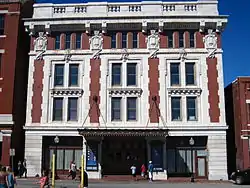 Landers Theater |
August 12, 1977 (#77000806) |
311 E. Walnut 37°12′26″N 93°17′27″W |
Springfield | |
| 34 | Lincoln School |  Lincoln School |
May 31, 2000 (#00000508) |
815 N. Sherman Ave. 37°13′00″N 93°16′53″W |
Springfield | |
| 35 | Marquette Hotel | 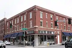 Marquette Hotel |
May 5, 2000 (#00000431) |
400 East Walnut 37°12′25″N 93°17′21″W |
Springfield | |
| 36 | Marx-Hurlburt Building | September 2, 2003 (#03000864) |
311-315 E. Park Central Sq. 37°12′40″N 93°17′26″W |
Springfield | ||
| 37 | McDaniel Building | October 22, 2014 (#14000871) |
316 Park Central E. 37°12′33″N 93°17′28″W |
Springfield | ||
| 38 | Mid-Town Historic District | July 13, 1989 (#89000938) |
Roughly bounded by Pacific, Clay, Pythian, Summit, Calhoun, Washington, Central, Benton, Division, and Jefferson; also roughly along N. Robberson Ave. and N. Jefferson Ave. 37°13′22″N 93°17′06″W |
Springfield | Second set of boundaries represents a boundary increase of August 9, 2002 | |
| 39 | Netter-Ullman Building | 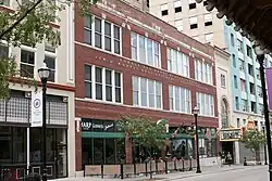 Netter-Ullman Building |
April 18, 2003 (#03000255) |
317 Park Central East 37°12′40″N 93°17′15″W |
Springfield | |
| 40 | D.M. Oberman Manufacturing Co. Building | 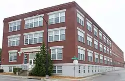 D.M. Oberman Manufacturing Co. Building |
April 18, 2002 (#02000379) |
600 N. Boonville Ave. 37°12′58″N 93°17′31″W |
Springfield | |
| 41 | Old Calaboose | 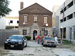 Old Calaboose |
November 14, 1980 (#80002355) |
409 W. McDaniel St. 37°12′30″N 93°17′40″W |
Springfield | |
| 42 | Palace Hotel | 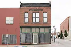 Palace Hotel |
November 27, 2002 (#02001419) |
501 College St. 37°12′40″N 93°17′44″W |
Springfield | |
| 43 | Pearl Apartments and Windsor Apartments | December 6, 2005 (#05001376) |
728 and 722 S. Jefferson St. 37°12′07″N 93°17′21″W |
Springfield | ||
| 44 | Pearson Creek Archeological District | October 11, 1978 (#78001647) |
Address Restricted |
Springfield | ||
| 45 | Producers Ice and Manufacturing Company | January 29, 2018 (#100002031) |
524 W Chase St. 37°13′51″N 93°17′47″W |
Springfield | ||
| 46 | Producers Produce Company Plant | April 12, 2010 (#10000181) |
501 N. Main Ave. 37°07′26″N 93°28′49″W |
Springfield | ||
| 47 | Pythian Home of Missouri | 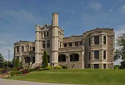 Pythian Home of Missouri |
October 7, 2009 (#09000812) |
1451 E. Pythian St. 37°13′17″N 93°16′07″W |
Springfield | |
| 48 | Rail Haven Motel | 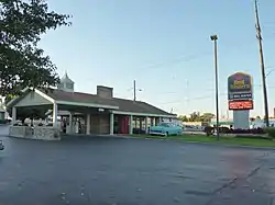 Rail Haven Motel |
May 10, 2010 (#10000245) |
203 S. Glenstone Ave. 37°12′30″N 93°15′46″W |
Springfield | |
| 49 | Rock Fountain Court Historic District | April 2, 2003 (#03000179) |
2400 W. College St. 37°12′31″N 93°19′28″W |
Springfield | ||
| 50 | Route 66 Steak 'n Shake | 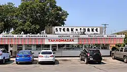 Route 66 Steak 'n Shake |
August 1, 2012 (#12000462) |
1158 E. St. Louis St. 37°12′34″N 93°16′35″W |
Springfield | part of the Route 66 in Missouri Multiple Property Submission |
| 51 | St. John's Mercy Hospital Building | September 2, 2003 (#03000867) |
620 W. Scott 37°13′17″N 93°17′49″W |
Springfield | ||
| 52 | St. Paul Block | January 15, 2009 (#08001322) |
401 South Ave. 37°12′26″N 93°17′32″W |
Springfield | ||
| 53 | Henry Schneider Building |  Henry Schneider Building |
August 24, 2006 (#06000535) |
600 College St.-219-231 S. Main Ave. 37°12′38″N 93°17′50″W |
Springfield | |
| 54 | South Avenue Commercial Historic District | June 25, 1999 (#99000713) |
Walnut and Pershing Sts., South and Robberson Aves. 37°12′23″N 93°17′30″W |
Springfield | ||
| 55 | South-McDaniel-Patton Commercial Historic District | March 7, 2003 (#03000088) |
Roughly bounded by S. Campbell Ave., W. McDaniel St., South Ave., and W. Walnut St. 37°12′34″N 93°17′35″W |
Springfield | ||
| 56 | Springfield Furniture Company | July 5, 2006 (#06000536) |
601 N. National 37°12′58″N 93°16′35″W |
Springfield | ||
| 57 | Springfield Grocer Company Warehouse | July 8, 2010 (#10000462) |
323 North Patton Ave. 37°12′38″N 93°17′37″W |
Springfield | ||
| 58 | Springfield National Cemetery | 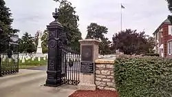 Springfield National Cemetery |
August 27, 1999 (#99001045) |
1702 E. Seminole St. 37°10′12″N 93°15′51″W |
Springfield | |
| 59 | Springfield Public Square Historic District |  Springfield Public Square Historic District |
May 5, 2006 (#06000331) |
149, 138, 137, 134, 127, 132, 124, and 122 Park Central Sq., and 219 and 221 South Ave.; also the eastern side of Public Square, part of the 300 block of Park Central E., and the northern side of the 200 block of W. Olive 37°12′40″N 93°17′34″W |
Springfield | Second set of boundaries represents a boundary increase of January 13, 2010 |
| 60 | Springfield Seed Co. Office and Warehouse |  Springfield Seed Co. Office and Warehouse |
September 14, 2006 (#06000863) |
319 N. Main Ave. 37°12′44″N 93°17′49″W |
Springfield | |
| 61 | Springfield Warehouse and Industrial Historic District | June 25, 1999 (#99000715) |
E. Water, W. Mill and W. Phelps Sts. and Boonville Ave. 37°12′41″N 93°17′30″W |
Springfield | ||
| 62 | Stone Chapel | 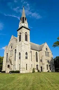 Stone Chapel |
October 21, 1982 (#82000583) |
Benton and Central Sts. 37°13′04″N 93°17′13″W |
Springfield | |
| 63 | Trail of Tears Roadbed Segment on Josiah Danforth Farm | July 23, 2018 (#16000342) |
Address Restricted |
Strafford vicinity | ||
| 64 | U.S. Customhouse and Post Office |  U.S. Customhouse and Post Office |
June 27, 1979 (#79001360) |
830 Boonville Ave. 37°12′57″N 93°17′31″W |
Springfield | |
| 65 | Walnut Street Commercial Historic District | June 25, 1999 (#99000717) |
Walnut St. 37°12′26″N 93°17′27″W |
Springfield | ||
| 66 | Walnut Street Historic District | March 21, 1985 (#85000623) |
Roughly bounded by McDaniel, Walnut, and Elm Sts. and the Sherman Parkway; also roughly along E. Walnut St. in the 700 and 800 blocks 37°12′24″N 93°15′59″W |
Springfield | Second set of boundaries represents a boundary increase of August 5, 2002 | |
| 67 | West Walnut Street Commercial Historic District | March 20, 2002 (#02000211) |
Roughly the 300 and 400 blocks of W. Walnut St., and the 300 and 400 blocks of S. Campbell Ave. 37°12′32″N 93°17′40″W |
Springfield | ||
| 68 | E. M. Wilhoit Building |  E. M. Wilhoit Building |
January 31, 2005 (#04001576) |
300-330 E. Pershing St. 37°12′29″N 93°17′25″W |
Springfield | |
| 69 | Edward M. and Della C. Wilhoit House | 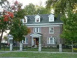 Edward M. and Della C. Wilhoit House |
December 23, 2004 (#04001384) |
903 S. Weller Ave. 37°12′00″N 93°16′07″W |
Springfield | |
| 70 | Wilson's Creek National Battlefield | 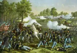 Wilson's Creek National Battlefield |
October 15, 1966 (#66000113) |
Southwest of Springfield on Route 174 37°06′06″N 93°24′31″W |
Springfield | |
| 71 | Wise Feed Company Building | 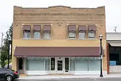 Wise Feed Company Building |
January 6, 2003 (#02001685) |
438-440 S. Campbell Ave. 37°12′20″N 93°17′34″W |
Springfield | |
| 72 | Woods-Evertz Stove Company Historic District | 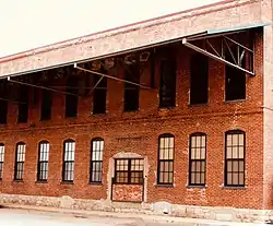 Woods-Evertz Stove Company Historic District |
October 23, 2003 (#03001071) |
Area bounded by N. Jefferson Ave., E Phelps St., N. Robberson Ave., and E. Tampa St. 37°12′55″N 93°17′26″W |
Springfield |
Former listing
| [3] | Name on the Register | Image | Date listed | Date removed | Location | City or town | Description |
|---|---|---|---|---|---|---|---|
| 1 | Second Baptist Church | December 22, 2000 (#00001620) | October 6, 2001 | 729 North Washington 37°12′57″N 93°17′11″W |
Springfield | Delisted when it was disassembled and moved 300 feet across the street in 2000.[6] |
See also
References
Wikimedia Commons has media related to National Register of Historic Places in Greene County, Missouri.
- The latitude and longitude information provided in this table was derived originally from the National Register Information System, which has been found to be fairly accurate for about 99% of listings. Some locations in this table may have been corrected to current GPS standards.
- National Park Service, United States Department of the Interior, "National Register of Historic Places: Weekly List Actions", retrieved October 20, 2023.
- Numbers represent an alphabetical ordering by significant words. Various colorings, defined here, differentiate National Historic Landmarks and historic districts from other NRHP buildings, structures, sites or objects.
- The eight-digit number below each date is the number assigned to each location in the National Register Information System database, which can be viewed by clicking the number.
- Location derived from About Us, Christ Episcopal Church, n.d. Accessed 2011-08-05. The NRIS lists the site as "Address Restricted".
- "Time's up". Springfield News-Leader. December 1, 2000. p. 1B. Retrieved August 3, 2022 – via Newspapers.com.
| Topics | |
|---|---|
| Lists by state |
|
| Lists by insular areas | |
| Lists by associated state | |
| Other areas | |
| Related | |

Municipalities and communities of Greene County, Missouri, United States | ||
|---|---|---|
| Cities | Map of Missouri highlighting Greene County | |
| Townships |
| |
| Unincorporated communities | ||
| Former settlement | ||
| Footnotes | ‡This populated place also has portions in an adjacent county or counties | |
This article is issued from Wikipedia. The text is licensed under Creative Commons - Attribution - Sharealike. Additional terms may apply for the media files.