National Register of Historic Places listings in Washington County, Rhode Island
This is a list of the National Register of Historic Places listings in Washington County, Rhode Island.

Location of Washington County in Rhode Island
This is intended to be a complete list of the properties and districts on the National Register of Historic Places in Washington County, Rhode Island, United States. Latitude and longitude coordinates are provided for many National Register properties and districts; these locations may be seen together in a map.[1]
There are 134 properties and districts listed on the National Register in the county, including 4 National Historic Landmarks.
This National Park Service list is complete through NPS recent listings posted October 20, 2023.[2]
Current listings
| [3] | Name on the Register[4] | Image | Date listed[5] | Location | City or town | Description |
|---|---|---|---|---|---|---|
| 1 | Allen-Madison House | 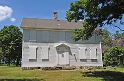 Allen-Madison House |
March 28, 1980 (#80000015) |
Post Rd. 41°37′06″N 71°25′16″W |
North Kingstown | |
| 2 | Anthony-Kinney Farm | 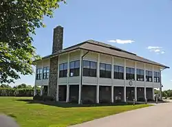 Anthony-Kinney Farm |
April 17, 2013 (#13000178) |
505 Point Judith Road 41°24′26″N 71°28′44″W |
Narragansett | |
| 3 | Austin Farm Road Agricultural Area | 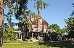 Austin Farm Road Agricultural Area |
August 16, 1977 (#77000009) |
6 mi (9.7 km) west of Exeter off Interstate 95 41°35′44″N 71°39′52″W |
Exeter | |
| 4 | Babcock House | 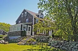 Babcock House |
January 1, 1976 (#76000008) |
Main St. 41°20′14″N 71°42′43″W |
Charlestown | |
| 5 | Babcock-Smith House |  Babcock-Smith House |
July 24, 1972 (#72000008) |
124 Granite St. 41°22′16″N 71°49′13″W |
Westerly | |
| 6 | David S. Baker Estate |  David S. Baker Estate |
August 4, 2011 (#11000512) |
51 & 67 Prospect Ave. 41°33′54″N 71°27′11″W |
North Kingstown | |
| 7 | Baptist Church in Exeter |  Baptist Church in Exeter |
November 21, 1978 (#78000014) |
North of Arcadia on RI 165 41°34′36″N 71°42′36″W |
Exeter | |
| 8 | Beaver River Road Historic District | October 25, 2021 (#100006693) |
Beaver River Rd., Beaver River Schoolhouse Rd. 41°28′45″N 71°37′35″W |
Richmond | ||
| 9 | Black Farm | November 7, 1995 (#95001268) |
Bounded by the Rockville-Alton Rd. (RI 112) and the Wood River 41°28′06″N 71°43′23″W |
Hopkinton | ||
| 10 | Block Island North Light | 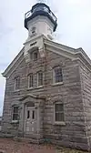 Block Island North Light |
May 23, 1974 (#74000008) |
Sandy Point, off the northern end of Corn Neck Rd. 41°13′39″N 71°34′34″W |
New Shoreham | Built in 1867; still in use with its original lens. |
| 11 | Block Island Southeast Light | 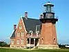 Block Island Southeast Light |
September 25, 1997 (#97001264) |
South East Light Rd. 41°09′11″N 71°32′53″W |
New Shoreham | Built in 1874; best surviving example of late 19th-century U.S. lighthouse construction. Still in use. |
| 12 | Bouchard Archeological Site, RI-1025 | November 1, 1984 (#84000370) |
Address Restricted |
South Kingstown | Listed in Usquepaug. | |
| 13 | Bradford Village Historic District | 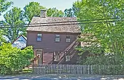 Bradford Village Historic District |
May 30, 1996 (#96000573) |
Roughly Bowling Ln. from the Pawcatuck River to Vars Ln. and Main St. from the Bradford Bridge to Church Ave. 41°24′08″N 71°45′06″W |
Hopkinton and Westerly | |
| 14 | Browning's Beach Historic District | 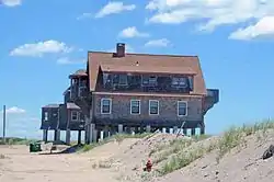 Browning's Beach Historic District |
September 5, 1997 (#97000952) |
Browning's Beach, 0.5 mi (0.80 km) west of the junction of Card Pond and Matunuck Beach Rds. 41°22′26″N 71°33′52″W |
South Kingstown | |
| 15 | Jireh Bull Blockhouse |  Jireh Bull Blockhouse |
November 3, 1983 (#83003869) |
Address Restricted |
South Kingstown | |
| 16 | Camp Endicott | 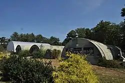 Camp Endicott |
October 19, 1978 (#78000015) |
Between 7th and 10th Sts. 41°36′10″N 71°25′59″W |
North Kingstown | Mostly demolished; some Quonset huts survive at the Seabee Museum and Memorial Park |
| 17 | Carolina Village Historic District | 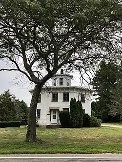 Carolina Village Historic District |
May 2, 1974 (#74000009) |
Charlestown 41°27′31″N 71°39′51″W |
Charlestown and Richmond | |
| 18 | Silas Casey Farm | 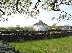 Silas Casey Farm |
August 14, 1973 (#73000006) |
Boston Neck Rd. 41°30′40″N 71°26′01″W |
North Kingstown | |
| 19 | Cedar Point Historic District | July 21, 2022 (#100007946) |
13, 21, 26, 31, and 49 Loop Dr. 41°33′56″N 71°27′24″W |
North Kingstown | ||
| 20 | Central Street Historic District | 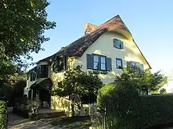 Central Street Historic District |
August 18, 1982 (#82000015) |
Both sides of Central Street from 5th Ave. to Boon St. 41°25′46″N 71°27′44″W |
Narragansett | |
| 21 | Peleg Champlin House | June 1, 1982 (#82000016) |
Rodman Pond Lane 41°11′24″N 71°35′38″W |
New Shoreham | ||
| 22 | Samuel Clarke Farm |  Samuel Clarke Farm |
February 4, 2019 (#100003413) |
106 Lewiston Ave. 41°27′39″N 71°37′26″W |
Richmond | |
| 23 | Cocumscossoc Archeological Site |  Cocumscossoc Archeological Site |
April 12, 1993 (#93000605) |
55 Richard Smith Drive 41°35′00″N 71°27′16″W |
North Kingstown | Area around one of state's oldest houses has yielded considerable information from digs |
| 24 | Cottrell House |  Cottrell House |
November 21, 1996 (#96001319) |
500 Waites Corner Rd. 41°29′22″N 71°33′55″W |
South Kingstown | |
| 25 | Crowfield Historic District |  Crowfield Historic District |
July 19, 1985 (#85001646) |
Boston Neck Rd. 41°32′00″N 71°25′27″W |
North Kingstown | |
| 26 | Davisville Historic District |  Davisville Historic District |
July 19, 1985 (#85001645) |
Davisville Rd. 41°37′17″N 71°28′52″W |
North Kingstown | |
| 27 | Devil's Foot Cemetery Archeological Site, RI-694 |  Devil's Foot Cemetery Archeological Site, RI-694 |
November 15, 1984 (#84000562) |
Address Restricted |
North Kingstown | |
| 28 | Dewey Cottage |  Dewey Cottage |
May 7, 1992 (#92000467) |
668 Matunuck Beach Rd. 41°22′42″N 71°32′56″W |
South Kingstown | |
| 29 | District Schoolhouse No. 2 |  District Schoolhouse No. 2 |
January 4, 1980 (#80000016) |
Old Post Rd. 41°23′07″N 71°39′04″W |
Charlestown | |
| 30 | George Douglas House |  George Douglas House |
October 10, 1975 (#75000006) |
South of Allenton at Tower Hill and Gilbert Stuart Rds. 41°31′18″N 71°27′46″W |
North Kingstown | |
| 31 | Druidsdream |  Druidsdream |
July 20, 1989 (#89000940) |
144 Gibson Ave. 41°25′02″N 71°27′46″W |
Narragansett | |
| 32 | The Dunes Club | .jpg.webp) The Dunes Club |
May 18, 2015 (#15000243) |
137 Boston Neck Rd. 41°26′23″N 71°26′56″W |
Narragansett | |
| 33 | Dunmere |  Dunmere |
September 23, 2005 (#05001061) |
560 Ocean Rd. 41°24′16″N 71°27′44″W |
Narragansett | |
| 34 | Earlscourt Historic District |  Earlscourt Historic District |
August 18, 1982 (#82000017) |
Roughly bounded by Westmoreland, Noble, Woodward Sts., and Gibson Ave.(both sides) 41°25′15″N 71°27′42″W |
Narragansett | |
| 35 | Henry Eldred Farm |  Henry Eldred Farm |
November 18, 1991 (#91001646) |
368 Old North Rd. 41°29′55″N 71°31′14″W |
South Kingstown | |
| 36 | George Fayerweather Blacksmith Shop |  George Fayerweather Blacksmith Shop |
November 29, 1984 (#84000470) |
Intersection RI 108 and 138 41°28′49″N 71°31′13″W |
South Kingstown | |
| 37 | Fernwood Archeological Site, RI-702 | September 12, 1985 (#85002364) |
Address Restricted |
South Kingstown | ||
| 38 | Fisherville Historic and Archeological District |  Fisherville Historic and Archeological District |
December 5, 1980 (#80000017) |
Address Restricted |
Exeter | |
| 39 | Flying Horse Carousel |  Flying Horse Carousel |
January 11, 1980 (#80000019) |
Bay St. 41°18′32″N 71°51′31″W |
Westerly | One of the earliest carousels still in use, dating to 1876. Horses suspended from chains rather than on poles, hence name. |
| 40 | Former Immaculate Conception Church |  Former Immaculate Conception Church |
April 24, 1973 (#73000007) |
119 High St. 41°22′55″N 71°49′32″W |
Westerly | |
| 41 | Fort Ninigret |  Fort Ninigret |
April 28, 1970 (#70000004) |
Fort Neck Rd. 41°22′52″N 71°38′54″W |
Charlestown | |
| 42 | Foster Cove Archeological Site |  Foster Cove Archeological Site |
May 6, 1980 (#80000018) |
Address Restricted |
Charlestown | |
| 43 | Gardencourt | 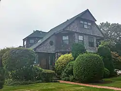 Gardencourt |
August 18, 1982 (#82000018) |
10 Gibson Ave. 41°25′21″N 71°27′39″W |
Narragansett | |
| 44 | Ezekial Gardner House | 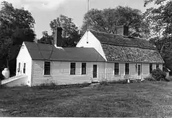 Ezekial Gardner House |
July 19, 1985 (#85001654) |
297 Pendar Rd. 41°31′47″N 71°28′35″W |
North Kingstown | |
| 45 | R. R. Gardner House | 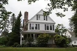 R. R. Gardner House |
November 21, 1996 (#96001320) |
700 Curtis Corner Rd. 41°27′10″N 71°31′54″W |
South Kingstown | |
| 46 | Gladstone Springhouse and Bottling Plant | 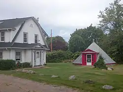 Gladstone Springhouse and Bottling Plant |
May 10, 1984 (#84002051) |
145A Boon St. 41°25′35″N 71°27′25″W |
Narragansett | |
| 47 | Great Salt Pond Archeological District | February 15, 1990 (#90000107) |
Address Restricted |
New Shoreham | ||
| 48 | Greene Inn | .jpg.webp) Greene Inn |
June 24, 1976 (#76000009) |
175 Ocean Rd. 41°25′23″N 71°27′23″W |
Narragansett | Burned down in 1980. |
| 49 | Hale House | 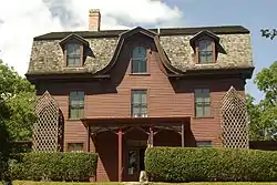 Hale House |
June 5, 2007 (#07000527) |
2625A Commodore Oliver Hazard Perry Highway 41°23′52″N 71°33′03″W |
South Kingstown | |
| 50 | Hallville Historic and Archeological District | 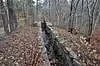 Hallville Historic and Archeological District |
December 5, 1980 (#80000020) |
Address Restricted |
Exeter | |
| 51 | Hamilton Mill Village Historic District | 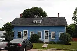 Hamilton Mill Village Historic District |
November 3, 1983 (#83003874) |
Boston Neck and Martha Rds., Salisbury and Web Aves. 41°32′56″N 71°26′19″W |
North Kingstown | |
| 52 | Hillsdale Historic and Archeological District | 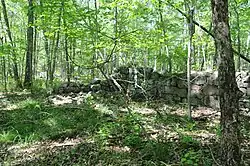 Hillsdale Historic and Archeological District |
November 24, 1980 (#80000021) |
Address Restricted |
Richmond | |
| 53 | Historic Village of the Narragansetts in Charlestown |  Historic Village of the Narragansetts in Charlestown |
May 7, 1973 (#73000008) |
Bounded by Route 112, U.S. Route 1, King's Factory Road (Bureau of Indian Affairs Route 411), and Route 91 41°24′37″N 71°40′03″W |
Charlestown | |
| 54 | Hope Valley Historic District |  Hope Valley Historic District |
July 3, 2004 (#04000654) |
Main Street 41°30′28″N 71°43′00″W |
Hopkinton | |
| 55 | Hopkinton City Historic District |  Hopkinton City Historic District |
May 1, 1974 (#74000010) |
Hopkinton 41°27′40″N 71°46′39″W |
Hopkinton | |
| 56 | John Hoxsie House |  John Hoxsie House |
May 5, 1978 (#78000016) |
East of RI 112 41°28′35″N 71°38′37″W |
Richmond | |
| 57 | Hygeia House | 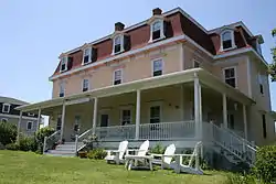 Hygeia House |
October 22, 2001 (#01001156) |
Beach Ave. 41°10′40″N 71°34′18″W |
New Shoreham | |
| 58 | Indian Burial Ground | 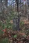 Indian Burial Ground |
April 28, 1970 (#70000005) |
Narrow Lane 41°23′48″N 71°38′00″W |
Charlestown | |
| 59 | Joseph Jeffrey House | 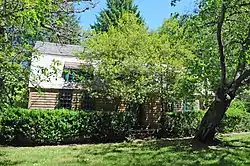 Joseph Jeffrey House |
March 8, 1978 (#78000017) |
Old Mill Road 41°25′47″N 71°39′54″W |
Charlestown | |
| 60 | Kenyon's Department Store | 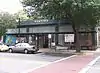 Kenyon's Department Store |
November 5, 1992 (#92001540) |
344 Main St. 41°26′17″N 71°29′59″W |
South Kingstown | |
| 61 | Kingston Hill Farm | 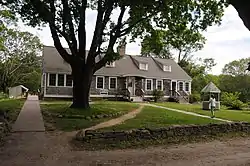 Kingston Hill Farm |
May 7, 1993 (#93000343) |
549 Old North Rd. 41°29′41″N 71°30′51″W |
South Kingstown | |
| 62 | Kingston Railroad Station | 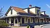 Kingston Railroad Station |
April 26, 1978 (#78000018) |
Kingston Rd. 41°29′03″N 71°33′39″W |
South Kingstown | Restored 1875 original station built by Providence and Stonington Railroad; still used today. |
| 63 | Kingston Village Historic District | 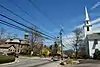 Kingston Village Historic District |
May 1, 1974 (#74000011) |
South Kingstown 41°28′48″N 71°31′29″W |
South Kingstown | |
| 64 | Lafayette Village |  Lafayette Village |
November 14, 1978 (#78000019) |
Ten Rod Road 41°34′24″N 71°28′59″W |
North Kingstown | |
| 65 | Lambda Chi Site, RI-704 | November 1, 1984 (#84000372) |
Address Restricted |
South Kingstown | ||
| 66 | Lawton's Mill | 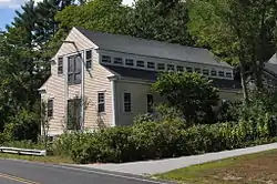 Lawton's Mill |
June 27, 1980 (#80000022) |
Ten Rod Rd. 41°34′54″N 71°34′13″W |
Exeter | |
| 67 | Lewis-Card-Perry House |  Lewis-Card-Perry House |
October 4, 2005 (#05001152) |
12 Margin St. 41°22′08″N 71°49′57″W |
Westerly | |
| 68 | Simon Lillibridge Farm |  Simon Lillibridge Farm |
November 28, 1978 (#78000020) |
Summit Rd. 41°34′16″N 71°42′47″W |
Exeter | |
| 69 | Main Street Historic District |  Main Street Historic District |
January 9, 1978 (#78000021) |
113-132 Main St., 8, 7-13 School St., 3-14 Maple St. 41°22′25″N 71°49′51″W |
Westerly | |
| 70 | Henry Marchant Farm |  Henry Marchant Farm |
August 16, 1979 (#79000009) |
S. County Trail 41°28′52″N 71°35′56″W |
South Kingstown | |
| 71 | William Davis Miller House |  William Davis Miller House |
March 21, 1985 (#85000627) |
130 Main St. 41°26′08″N 71°30′27″W |
South Kingstown | |
| 72 | Ministerial Rd. Site, RI-781 |  Ministerial Rd. Site, RI-781 |
November 15, 1984 (#84000565) |
Address Restricted |
South Kingstown | |
| 73 | Silas Mumford Site (Tappan Site RI-705) |  Silas Mumford Site (Tappan Site RI-705) |
November 1, 1984 (#84000382) |
Address Restricted |
South Kingstown | |
| 74 | Narragansett Baptist Church |  Narragansett Baptist Church |
November 25, 1977 (#77000010) |
S. Ferry Rd. 41°29′34″N 71°25′34″W |
Narragansett | |
| 75 | Narragansett Pier Life Saving Station |  Narragansett Pier Life Saving Station |
June 30, 1976 (#76000010) |
40 Ocean Rd. 41°25′48″N 71°27′20″W |
Narragansett | |
| 76 | North End Historic District |  North End Historic District |
April 20, 2006 (#06000298) |
Canal, Dayton, Friendship, High, Pearl, Pierce, Pleasant, Pond, West, Industrial Lila, Geranium, Marriott and Turano 41°23′16″N 71°49′38″W |
Westerly | |
| 77 | Stephen Northup House |  Stephen Northup House |
July 19, 1985 (#85001653) |
99 Featherbed Lane 41°33′05″N 71°26′52″W |
North Kingstown | Built by early Providence and Narragansett settler, Stephen Northup |
| 78 | Nursery Site, RI-273 | November 1, 1984 (#84000386) |
Address Restricted |
Westerly | ||
| 79 | Ocean Road Historic District |  Ocean Road Historic District |
August 18, 1982 (#82000019) |
Ocean and Wildfield Farm Rds., and Newton and Hazard Aves. 41°24′45″N 71°27′22″W |
Narragansett | |
| 80 | Old Harbor Historic District |  Old Harbor Historic District |
May 8, 1974 (#74000012) |
Roughly bounded by the Atlantic Ocean and Main St. (includes Spring and High Sts. and Main St.) 41°10′18″N 71°33′31″W |
New Shoreham | |
| 81 | Old Narragansett Cemetery |  Old Narragansett Cemetery |
July 19, 1985 (#85001655) |
Shermantown Rd. 41°31′08″N 71°28′42″W |
North Kingstown | |
| 82 | Old Narragansett Church |  Old Narragansett Church |
July 2, 1973 (#73000009) |
60 Church Lane, Wickford 41°34′21″N 71°26′59″W |
North Kingstown | |
| 83 | Palmer-Northrup House |  Palmer-Northrup House |
April 11, 1973 (#73000010) |
7919 Post Rd. 41°34′37″N 71°27′40″W |
North Kingstown | |
| 84 | Parris Brook Historic and Archeological District |  Parris Brook Historic and Archeological District |
December 5, 1980 (#80000023) |
Address Restricted |
Exeter | |
| 85 | Peace Dale Historic District | 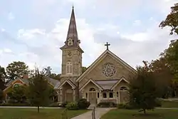 Peace Dale Historic District |
October 30, 1987 (#87000493) |
Roughly bounded by Kensey Rd., Oakwoods Dr., Kingstown Rd., School, Church and Railroad Sts. 41°27′04″N 71°29′42″W |
South Kingstown | |
| 86 | Commodore Oliver Perry Farm | 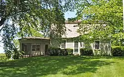 Commodore Oliver Perry Farm |
August 26, 1982 (#82000020) |
Commodore Perry Highway (US Route 1) 41°25′08″N 71°31′51″W |
South Kingstown | |
| 87 | Perry Homestead Historic District | 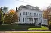 Perry Homestead Historic District |
March 15, 2016 (#16000089) |
2, 4, 8, 12, 16 Margin & 15, 17 Beach Sts. 41°22′09″N 71°49′54″W |
Westerly | |
| 88 | Perry-Carpenter Grist Mill | 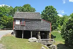 Perry-Carpenter Grist Mill |
February 22, 1990 (#90000106) |
364 Moonstone Beach Rd. 41°23′35″N 71°34′34″W |
South Kingstown | |
| 89 | Joseph Pierce Farm |  Joseph Pierce Farm |
July 19, 1985 (#85001652) |
933 Gilbert Stuart Rd. 41°31′22″N 71°26′42″W |
North Kingstown | |
| 90 | Plum Beach Lighthouse | 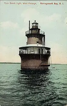 Plum Beach Lighthouse |
March 30, 1988 (#88000281) |
Off Plum Beach, western passage of Narragansett Bay 41°31′48″N 71°24′20″W |
North Kingstown | |
| 91 | Point Judith Lighthouse | 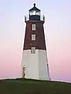 Point Judith Lighthouse |
March 30, 1988 (#88000279) |
1470 Ocean Rd. 41°21′39″N 71°28′55″W |
Narragansett | |
| 92 | Poplar Point Lighthouse | 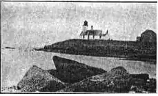 Poplar Point Lighthouse |
February 25, 1988 (#87001703) |
1 Poplar Ave. 41°34′15″N 71°26′23″W |
North Kingstown | |
| 93 | Potter Pond Archeological District | 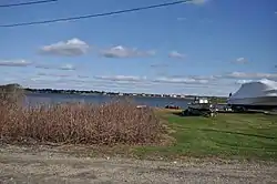 Potter Pond Archeological District |
December 8, 1987 (#87002102) |
Area surrounding Potter Pond 41°22′55″N 71°32′02″W |
South Kingstown | |
| 94 | Queen's Fort | 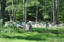 Queen's Fort |
November 26, 1980 (#80000024) |
Stony Lane 41°35′30″N 71°31′15″W |
Exeter | |
| 95 | Ram Point | November 24, 2015 (#15000831) |
77 Watch Hill Rd. 41°20′16″N 71°49′45″W |
Westerly | ||
| 96 | Rathbun House | 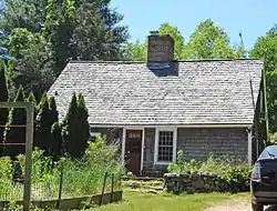 Rathbun House |
July 19, 1985 (#85001651) |
343 Beacon Dr. 41°34′20″N 71°30′20″W |
North Kingstown | |
| 97 | Red House | 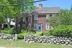 Red House |
November 21, 1996 (#96001323) |
2403 Post Rd. 41°24′02″N 71°34′15″W |
South Kingstown | |
| 98 | Gen. Isaac Peace Rodman House | 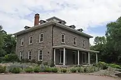 Gen. Isaac Peace Rodman House |
April 23, 1990 (#90000596) |
1789 Kingstown Rd. 41°27′48″N 71°30′33″W |
South Kingstown | |
| 99 | Benoni Ross House | 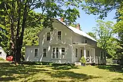 Benoni Ross House |
December 28, 2008 (#08000717) |
97 Lafayette Road 41°34′24″N 71°29′24″W |
North Kingstown | |
| 100 | St. Paul's Church | 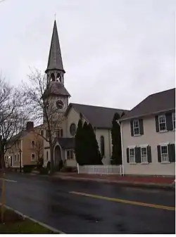 St. Paul's Church |
June 30, 1972 (#72000009) |
76 Main St. 41°34′17″N 71°27′01″W |
North Kingstown | |
| 101 | Esbon Sanford House | 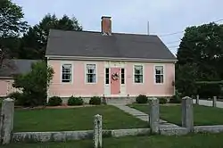 Esbon Sanford House |
July 19, 1985 (#85001649) |
88 Featherbed Lane 41°33′04″N 71°26′55″W |
North Kingstown | |
| 102 | Saunderstown Historic District |  Saunderstown Historic District |
July 19, 1985 (#85001647) |
Roughly bounded by Stillman, Waterway, Willet, Boston Neck & Ferry Rds. 41°30′28″N 71°25′21″W |
North Kingstown | |
| 103 | Scrabbletown Historic and Archeological District |  Scrabbletown Historic and Archeological District |
April 11, 1985 (#85000790) |
Address Restricted |
North Kingstown | |
| 104 | Shadow Farm |  Shadow Farm |
February 7, 1986 (#86000785) |
Kingstown Rd. 41°26′15″N 71°29′28″W |
South Kingstown | |
| 105 | Shady Lea Historic District |  Shady Lea Historic District |
July 19, 1985 (#85001644) |
Shady Lea and Tower Hill Rds. 41°32′07″N 71°27′56″W |
North Kingstown | |
| 106 | Shannock Historic District |  Shannock Historic District |
August 4, 1983 (#83000005) |
Main St., N. Shannock and W. Shannock Rds. 41°26′53″N 71°38′28″W |
Charlestown and Richmond | |
| 107 | Sheffield House |  Sheffield House |
January 1, 1976 (#76000011) |
Beach Rd. 41°20′09″N 71°42′32″W |
Charlestown | |
| 108 | Six Principle Baptist Church |  Six Principle Baptist Church |
November 21, 1978 (#78000022) |
85 Old Baptist Rd. 41°35′34″N 71°29′29″W |
North Kingstown | |
| 109 | Joseph Slocum House |  Joseph Slocum House |
July 19, 1985 (#85001648) |
Slocum Rd. 41°31′35″N 71°31′04″W |
North Kingstown | |
| 110 | Sodom Mill Historic and Archeological District | November 24, 1980 (#80000025) |
Address Restricted |
Exeter | ||
| 111 | Spink Farm |  Spink Farm |
July 19, 1985 (#85001650) |
1325 Shermantown Rd. 41°30′34″N 71°29′50″W |
North Kingstown | |
| 112 | Joseph Stanton House |  Joseph Stanton House |
January 11, 1980 (#80000026) |
U.S. Route 1 41°21′25″N 71°42′17″W |
Charlestown | |
| 113 | Gilbert Stuart Birthplace | 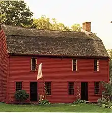 Gilbert Stuart Birthplace |
October 15, 1966 (#66000004) |
Gilbert Stuart Rd. 41°31′36″N 71°26′44″W |
North Kingstown | Birthplace of Gilbert Stuart, portraitist of George Washington and other Revolutionary figures. Preserved intact. |
| 114 | Theatre-By-the-Sea | 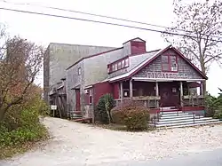 Theatre-By-the-Sea |
July 10, 1980 (#80004597) |
Card Ponds Rd. 41°22′37″N 71°33′46″W |
South Kingstown | |
| 115 | Tomaquag Rock Shelters |  Tomaquag Rock Shelters |
August 12, 1977 (#77000011) |
Maxson Hill Rd. 41°26′19″N 71°46′32″W |
Hopkinton | |
| 116 | Tootell House | 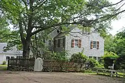 Tootell House |
May 26, 2000 (#00000552) |
1747 Mooresfield Rd. 41°28′51″N 71°31′02″W |
South Kingstown | |
| 117 | Towers Historic District | 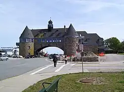 Towers Historic District |
August 18, 1982 (#82000021) |
Bounded by the Atlantic Ocean, Exchange Pl., and Mathewson and Taylor Sts. 41°25′48″N 71°27′23″W |
Narragansett | |
| 118 | The Towers | The Towers |
November 25, 1969 (#69000001) |
Ocean Rd. 41°25′50″N 71°27′22″W |
Narragansett | |
| 119 | Upper Rockville Mill | 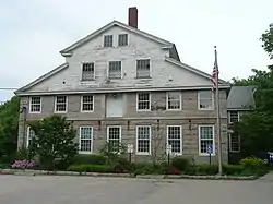 Upper Rockville Mill |
July 5, 2006 (#06000552) |
332 Canonchet Rd. 41°31′20″N 71°45′36″W |
Hopkinton | |
| 120 | US Post Office | US Post Office |
August 12, 1971 (#71000004) |
5 High St.[6] 41°22′40″N 71°49′49″W |
Westerly | |
| 121 | US Weather Bureau Station | 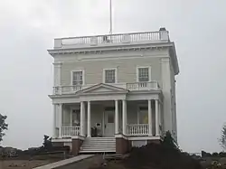 US Weather Bureau Station |
August 4, 1983 (#83000006) |
Beach Avenue 41°10′35″N 71°34′09″W |
New Shoreham | |
| 122 | University of Rhode Island Historic District | 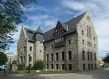 University of Rhode Island Historic District |
November 9, 2017 (#100001745) |
Campus & E. Alumni Aves., Farmhouse, Greenhouse, Lippitt, Lower College, Ranger & Upper College Rds. 41°29′10″N 71°31′38″W |
South Kingstown | |
| 123 | Usquepaug Road Historic District | 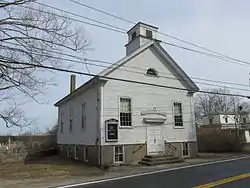 Usquepaug Road Historic District |
October 30, 1987 (#87001298) |
Usquepaug Rd. 41°30′14″N 71°36′01″W |
South Kingstown | |
| 124 | Wakefield Historic District | 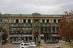 Wakefield Historic District |
May 30, 1996 (#96000572) |
Roughly, Main St. from Belmont Ave. to Columbia St.; also Main St., High St., Robinson St., Wright Ave.; also Main, High, and Robinson Sts., Wright Ave. 41°26′15″N 71°30′04″W |
South Kingstown | Second set of addresses represent a boundary increase approved December 19, 2019; third set represent a boundary increase approved August 1, 2022. |
| 125 | Washington County Court House | 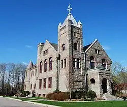 Washington County Court House |
November 5, 1992 (#92001542) |
3481 Kingstown Rd. 41°29′02″N 71°33′21″W |
South Kingstown | former county courthouse, now an arts center |
| 126 | Watch Hill Historic District | 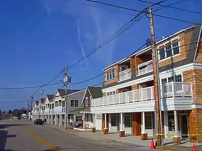 Watch Hill Historic District |
September 5, 1985 (#85001948) |
Roughly bounded by Breen, Watch Hill, and E. Hill Rds., Block Island Sound, Little Narragansett Bay, and the Pawtucket River 41°18′49″N 71°51′23″W |
Westerly | Well-preserved Victorian seaside resort area |
| 127 | Weekapaug Inn |  Weekapaug Inn |
January 25, 2007 (#06001305) |
25 Spray Rock Rd. 41°19′49″N 71°45′03″W |
Westerly | |
| 128 | Westerly Armory |  Westerly Armory |
November 7, 1996 (#96001322) |
Railroad Ave., west of downtown Westerly 41°22′55″N 71°49′40″W |
Westerly | |
| 129 | Westerly Downtown Historic District | 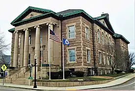 Westerly Downtown Historic District |
July 19, 1984 (#84002055) |
Railroad Ave., High, Canal, Broad, Union, and Main Sts. 41°22′45″N 71°49′49″W |
Westerly | |
| 130 | Wickford Historic District |  Wickford Historic District |
December 31, 1974 (#74000013) |
Roughly bounded by Tower Hill and Post Rds. as far N as Mill Cove and S to Lindley Ave 41°34′12″N 71°27′24″W |
North Kingstown | |
| 131 | Wilcox Park Historic District | _-_Westerly%252C_RI.JPG.webp) Wilcox Park Historic District |
May 7, 1973 (#73000011) |
Roughly bounded by Broad, Granite, High Sts. and Grove Ave. and running along Elm St. 41°22′36″N 71°49′43″W |
Westerly | |
| 132 | Willow Dell |  Willow Dell |
November 21, 1996 (#96001321) |
2700 Commodore Oliver Hazard Perry Highway 41°23′47″N 71°33′04″W |
South Kingstown | |
| 133 | Wyoming Village Historic District |  Wyoming Village Historic District |
May 2, 1974 (#74000014) |
Roughly bounded by RI 3, RI 138, Old Nooseneck Hill Rd., Bridge and Prospect Sts. 41°30′57″N 71°42′12″W |
Hopkinton and Richmond | |
| 134 | YWCA Site | November 20, 1980 (#80000027) |
Address Restricted |
North Kingstown |
Former listings
| [3] | Name on the Register | Image | Date listed | Date removed | Location | City or town | Description |
|---|---|---|---|---|---|---|---|
| 1 | Lischio Site, RI-1000 | June 7, 1983 (#83003431) | June 28, 1985 | Address Restricted |
North Kingstown vicinity | ||
| 2 | Dr. William G. Shaw House | January 13, 1972 (#72001575) | March 14, 1979 | 41 Brown St. |
North Kingstown | Relocated in 1973. |
See also
Wikimedia Commons has media related to National Register of Historic Places in Washington County, Rhode Island.
References
- The latitude and longitude information provided in this table was derived originally from the National Register Information System, which has been found to be fairly accurate for about 99% of listings. Some locations in this table may have been corrected to current GPS standards.
- National Park Service, United States Department of the Interior, "National Register of Historic Places: Weekly List Actions", retrieved October 20, 2023.
- Numbers represent an alphabetical ordering by significant words. Various colorings, defined here, differentiate National Historic Landmarks and historic districts from other NRHP buildings, structures, sites or objects.
- "National Register Information System". National Register of Historic Places. National Park Service. March 13, 2009.
- The eight-digit number below each date is the number assigned to each location in the National Register Information System database, which can be viewed by clicking the number.
- Address based on USPS website. Accessed April 8, 2016.
| Topics | _(extra_close)_(US48).svg.png.webp) | ||||||||||
|---|---|---|---|---|---|---|---|---|---|---|---|
| Lists by county | |||||||||||
| Lists by city |
| ||||||||||
| |||||||||||
Municipalities and communities of Washington County, Rhode Island, United States | ||
|---|---|---|
| Towns | Map of Rhode Island highlighting Washington County | |
| CDPs | ||
| Other villages | ||
| Indian reservation | ||
This article is issued from Wikipedia. The text is licensed under Creative Commons - Attribution - Sharealike. Additional terms may apply for the media files.