National Register of Historic Places listings in Weber County, Utah
This is a list of the National Register of Historic Places listings in Weber County, Utah.

Location of Weber County in Utah
This is intended to be a complete list of the properties and districts on the National Register of Historic Places in Weber County, Utah, United States. Latitude and longitude coordinates are provided for many National Register properties and districts; these locations may be seen together in a map.[1]
There are 66 properties and districts listed on the National Register in the county. Another 6 properties were once listed on the Register but have been removed.
This National Park Service list is complete through NPS recent listings posted October 20, 2023.[2]
Current listings
| [3] | Name on the Register[4] | Image | Date listed[5] | Location | City or town | Description |
|---|---|---|---|---|---|---|
| 1 | American Can Company of Utah Building Complex | 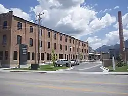 American Can Company of Utah Building Complex |
November 16, 2005 (#05001303) |
2030 Lincoln Ave. 41°13′49″N 111°58′28″W |
Ogden | |
| 2 | Arvondor Apartments | 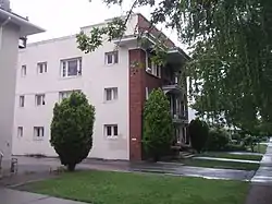 Arvondor Apartments |
December 31, 1987 (#87002156) |
823 23rd St. 41°13′28″N 111°57′27″W |
Ogden | |
| 3 | Aultorest Memorial Park Historic District | 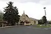 Aultorest Memorial Park Historic District |
April 10, 2023 (#100008813) |
836 36th St. 41°11′52″N 111°57′31″W |
Ogden | |
| 4 | Avelan Apartments | 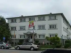 Avelan Apartments |
December 31, 1987 (#87002157) |
449 27th St. 41°12′58″N 111°58′07″W |
Ogden | |
| 5 | Avon Apartments | 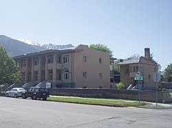 Avon Apartments |
December 31, 1987 (#87002158) |
961 25th St. 41°13′13″N 111°57′14″W |
Ogden | |
| 6 | Barnhart Apartments | 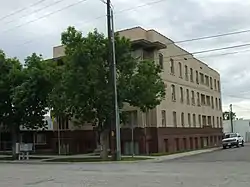 Barnhart Apartments |
December 31, 1987 (#87002159) |
336 27th St. 41°13′01″N 111°58′17″W |
Ogden | |
| 7 | Gustav Becker House | 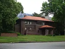 Gustav Becker House |
July 21, 1977 (#77001327) |
2408 Van Buren Ave. 41°13′21″N 111°57′00″W |
Ogden | |
| 8 | Ben Lomond Hotel Garage | 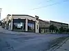 Ben Lomond Hotel Garage |
August 28, 2012 (#12000591) |
455 25th St. 41°13′14″N 111°58′08″W |
Ogden | |
| 9 | Bigelow-Ben Lomond Hotel | 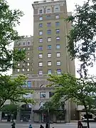 Bigelow-Ben Lomond Hotel |
April 19, 1990 (#90000637) |
2510 Washington Boulevard 41°13′14″N 111°58′10″W |
Ogden | |
| 10 | Browning Apartments | 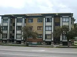 Browning Apartments |
December 19, 1985 (#85003200) |
2703 Washington Boulevard 41°12′58″N 111°58′13″W |
Ogden | |
| 11 | John Moses Browning House | 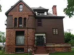 John Moses Browning House |
April 24, 1973 (#73001863) |
505 27th St. 41°12′58″N 111°58′00″W |
Ogden | Home of John Browning |
| 12 | Congregation B'rith Sholem Synagogue | 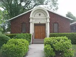 Congregation B'rith Sholem Synagogue |
June 27, 1985 (#85001394) |
2750 Grant Ave. 41°12′56″N 111°58′21″W |
Ogden | |
| 13 | Charles W. Cross House | 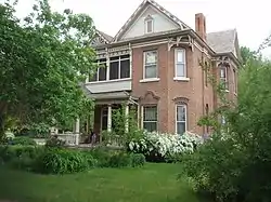 Charles W. Cross House |
July 12, 1984 (#84002434) |
451 17th St. 41°14′10″N 111°58′05″W |
Ogden | |
| 14 | John L. and Elizabeth Dalton House | 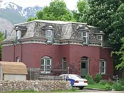 John L. and Elizabeth Dalton House |
March 11, 1987 (#86003659) |
2622 Madison Ave. 41°13′05″N 111°57′41″W |
Ogden | |
| 15 | Devil's Gate-Weber Hydroelectric Power Plant Historic District | 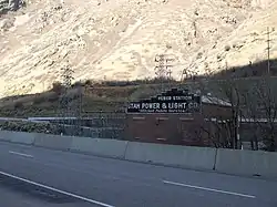 Devil's Gate-Weber Hydroelectric Power Plant Historic District |
April 20, 1989 (#89000276) |
I-84 east of its junction with US-89, in Weber Canyon 41°08′18″N 111°52′02″W |
Uintah | |
| 16 | John F. and Lillia Dumke House | 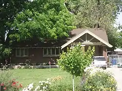 John F. and Lillia Dumke House |
February 14, 2007 (#07000078) |
1607 Kiesel Ave. 41°14′19″N 111°58′17″W |
Ogden | |
| 17 | Eccles Avenue Historic District |  Eccles Avenue Historic District |
December 12, 1976 (#76001840) |
Bounded by 25th and 26th Sts. and Van Buren and Jackson Aves. 41°13′10″N 111°57′05″W |
Ogden | |
| 18 | Eccles Building |  Eccles Building |
July 14, 1982 (#82004187) |
385 24th St. 41°13′22″N 111°58′10″W |
Ogden | |
| 19 | Bertha Eccles Community Art Center |  Bertha Eccles Community Art Center |
May 14, 1971 (#71000865) |
2580 Jefferson Ave. 41°13′07″N 111°57′50″W |
Ogden | |
| 20 | El Monte Golf Course Clubhouse |  El Monte Golf Course Clubhouse |
April 1, 1985 (#85000823) |
1300 Valley Dr. 41°14′01″N 111°56′40″W |
Ogden | |
| 21 | Episcopal Church of the Good Shepherd |  Episcopal Church of the Good Shepherd |
April 3, 1973 (#73001864) |
2374 Grant Ave. 41°13′23″N 111°58′19″W |
Ogden | |
| 22 | Fairview Apartments | 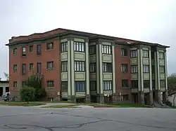 Fairview Apartments |
December 31, 1987 (#87002161) |
579–587 27th St. 41°12′58″N 111°57′55″W |
Ogden | |
| 23 | Farnsworth Apartments | 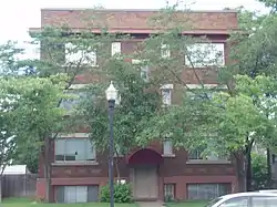 Farnsworth Apartments |
December 31, 1987 (#87002162) |
2539 Jefferson Ave. 41°13′11″N 111°57′54″W |
Ogden | |
| 24 | Valasco Farr House | 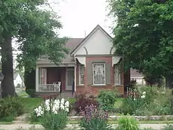 Valasco Farr House |
June 13, 1978 (#78002712) |
700 Canyon Rd. 41°14′17″N 111°57′40″W |
Ogden | |
| 25 | Fern-Marylyn Apartments | 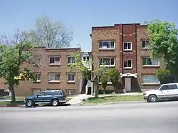 Fern-Marylyn Apartments |
December 31, 1987 (#87002163) |
2579 Adams Ave. 41°13′08″N 111°58′03″W |
Ogden | |
| 26 | Flowers Apartments |  Flowers Apartments |
December 31, 1987 (#87002166) |
2681 Madison Ave. 41°13′01″N 111°57′43″W |
Ogden | |
| 27 | Fontenelle Apartments | 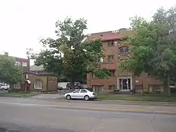 Fontenelle Apartments |
December 31, 1987 (#87002167) |
2465–2475 Monroe Ave. 41°13′16″N 111°57′32″W |
Ogden | |
| 28 | Geffas Apartments | 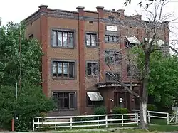 Geffas Apartments |
December 31, 1987 (#87002168) |
2675 Grant Ave. 41°13′01″N 111°58′23″W |
Ogden | |
| 29 | Miles Goodyear Cabin | 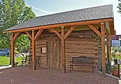 Miles Goodyear Cabin |
February 24, 1971 (#71000866) |
2104 Lincoln Ave. 41°13′44″N 111°58′32″W |
Ogden | The first known permanent home in Utah, built circa 1841 by Miles Goodyear. Previously at 2148 Grant Ave., moved in December 2012 |
| 30 | Grant Steam Locomotive No. 223 |  Grant Steam Locomotive No. 223 |
May 23, 1979 (#79002501) |
Union Station[6] 41°13′20″N 111°58′47″W |
Ogden | Moved from a previous location in Salt Lake City |
| 31 | Helms Apartments | 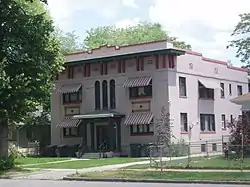 Helms Apartments |
December 31, 1987 (#87002169) |
2248–2250 Jefferson Ave. 41°13′33″N 111°57′50″W |
Ogden | |
| 32 | Hillcrest Apartments | 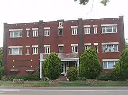 Hillcrest Apartments |
December 31, 1987 (#87002170) |
2485 Monroe Ave. 41°13′15″N 111°57′33″W |
Ogden | |
| 33 | Jefferson Avenue Historic District |  Jefferson Avenue Historic District |
September 25, 1998 (#98001214) |
Roughly along Jefferson Ave. between 25th and 27th Sts. 41°13′07″N 111°57′54″W |
Ogden | |
| 34 | La Frantz Apartments | 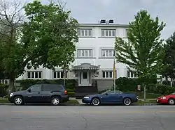 La Frantz Apartments |
December 31, 1987 (#87002172) |
461 27th St. 41°12′58″N 111°58′07″W |
Ogden | |
| 35 | Ladywood Apartments | 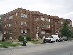 Ladywood Apartments |
December 31, 1987 (#87002171) |
670–690 26th St. 41°13′07″N 111°57′43″W |
Ogden | |
| 36 | Lower 25th Street Historic District |  Lower 25th Street Historic District |
January 31, 1978 (#78003260) |
25th St. between Wall and Grant Aves.; also 2522 Wall Ave.; also 2471 Grant Ave. 41°13′08″N 111°58′33″W |
Ogden | Second and third addresses represent separate boundary increases |
| 37 | Madison Elementary School | 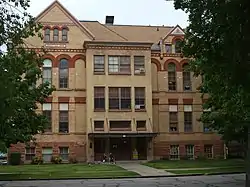 Madison Elementary School |
February 19, 1982 (#82004188) |
2434 Madison Ave. 41°13′18″N 111°57′38″W |
Ogden | |
| 38 | Don Maguire Duplex | 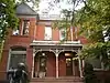 Don Maguire Duplex |
February 26, 1979 (#79002521) |
549–551 25th St. 41°13′14″N 111°57′58″W |
Ogden | |
| 39 | McGregor Apartments | 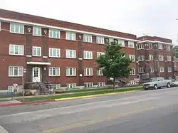 McGregor Apartments |
December 31, 1987 (#87002173) |
802–810 25th St. 41°13′16″N 111°57′30″W |
Ogden | |
| 40 | Mountain View Auto Court | 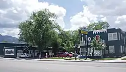 Mountain View Auto Court |
November 24, 1987 (#87002063) |
563 W. 24th St. 41°13′22″N 111°59′26″W |
Ogden | |
| 41 | New Brigham Hotel | 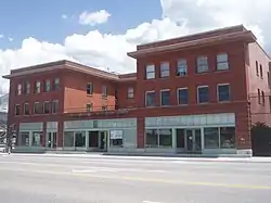 New Brigham Hotel |
June 14, 1979 (#79002522) |
2402–2410 Wall Ave. 41°13′21″N 111°58′41″W |
Ogden | |
| 42 | Ogden Central Bench Historic District |  Ogden Central Bench Historic District |
July 22, 2005 (#03000055) |
20th St to 30th St., Adams Ave. to Harrison Boulevard 41°13′07″N 111°57′30″W |
Ogden | |
| 43 | Ogden Fire Station No. 2 | 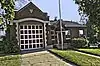 Ogden Fire Station No. 2 |
January 21, 2020 (#100004879) |
1585 25th St. 41°13′13″N 111°56′15″W |
Ogden | |
| 44 | Ogden High School | 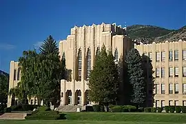 Ogden High School |
June 7, 1983 (#83003201) |
2828 Harrison Boulevard 41°12′47″N 111°56′46″W |
Ogden | |
| 45 | Ogden Union Station | 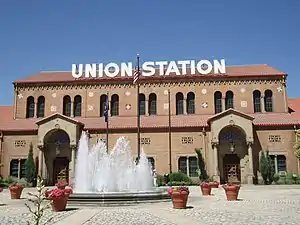 Ogden Union Station |
April 11, 1971 (#71000867) |
25th St. at Wall Ave.; also 2501 Wall Ave. 41°13′14″N 111°58′43″W |
Ogden | 2501 Wall Ave. represents a boundary increase |
| 46 | Ogden Union Stockyard Exchange Building | 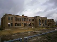 Ogden Union Stockyard Exchange Building |
July 21, 2015 (#15000452) |
600 W. Exchange Rd. 41°13′31″N 111°59′31″W |
Ogden | |
| 47 | Ogden/Weber Municipal Building | 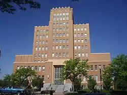 Ogden/Weber Municipal Building |
June 7, 1983 (#83003202) |
2541 Washington Boulevard 41°13′11″N 111°58′13″W |
Ogden | |
| 48 | Augustus B. Patton House | 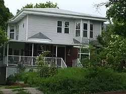 Augustus B. Patton House |
February 19, 1982 (#82004189) |
1506 24th St. 41°13′21″N 111°56′21″W |
Ogden | |
| 49 | Peery Apartments | 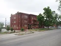 Peery Apartments |
December 31, 1987 (#87002174) |
2461 Adams Ave. 41°13′16″N 111°58′03″W |
Ogden | |
| 50 | Peery's Egyptian Theatre | 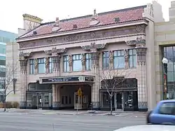 Peery's Egyptian Theatre |
December 12, 1978 (#78002714) |
2439 Washington Boulevard 41°13′19″N 111°58′15″W |
Ogden | |
| 51 | Pioneer Hydroelectric Power Plant Historic District | 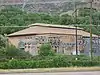 Pioneer Hydroelectric Power Plant Historic District |
April 21, 1989 (#89000275) |
12th St. at Canyon Rd. 41°14′38″N 111°56′46″W |
Ogden | |
| 52 | Rushmer Building | 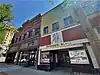 Rushmer Building |
June 13, 2022 (#100007109) |
2434–2436 Washington Blvd. 41°13′19″N 111°58′13″W |
Ogden | |
| 53 | Scowcroft Warehouse | 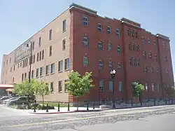 Scowcroft Warehouse |
November 30, 1978 (#78002715) |
105 23rd St. 41°13′29″N 111°58′39″W |
Ogden | |
| 54 | Heber Scowcroft House | 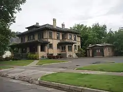 Heber Scowcroft House |
December 13, 1991 (#91001818) |
795 24th St. 41°13′18″N 111°57′31″W |
Ogden | |
| 55 | William D. Skeen House | 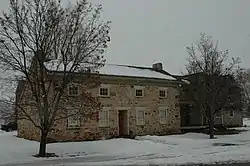 William D. Skeen House |
August 9, 1982 (#82004191) |
2419 N. 4500 West[7] 41°18′16″N 112°05′08″W |
Plain City | |
| 56 | Dennis A. Smyth House | 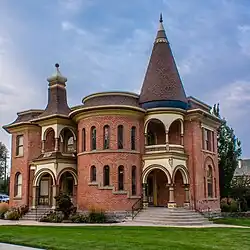 Dennis A. Smyth House |
February 11, 1982 (#82004190) |
635 25th St. 41°13′13″N 111°57′47″W |
Ogden | |
| 57 | Stone Farmstead | 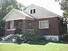 Stone Farmstead |
July 6, 2004 (#04000676) |
301 W. 2nd St. 41°15′33″N 111°59′01″W |
Ogden | |
| 58 | US Forest Service Building | 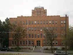 US Forest Service Building |
May 24, 2006 (#06000432) |
507 25th St. 41°13′13″N 111°58′00″W |
Ogden | |
| 59 | U.S. Post Office and Courthouse | 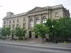 U.S. Post Office and Courthouse |
July 26, 1979 (#79002523) |
298 W. 24th St. 41°13′23″N 111°58′23″W |
Ogden | |
| 60 | Upton Apartments | 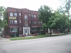 Upton Apartments |
December 31, 1987 (#87002176) |
2300–2314 Jefferson Ave. 41°13′28″N 111°57′50″W |
Ogden | |
| 61 | Utah School for the Deaf and Blind Boys' Dormitory | 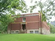 Utah School for the Deaf and Blind Boys' Dormitory |
April 1, 1985 (#85000824) |
846 20th St. 41°13′52″N 111°57′25″W |
Ogden | |
| 62 | Andrew J. Warner House | 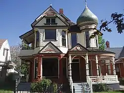 Andrew J. Warner House |
December 13, 1977 (#77001328) |
726 25th St. 41°13′16″N 111°57′37″W |
Ogden | |
| 63 | Weber County Main Library | 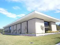 Weber County Main Library |
September 13, 2019 (#100004395) |
2464 Jefferson Ave. 41°13′16″N 111°57′54″W |
Ogden | |
| 64 | Weber River Railroad Bridge | 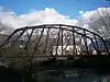 Weber River Railroad Bridge |
April 6, 2015 (#15000134) |
0.5 miles (0.80 km) west of Union Station along Exchange Rd. 41°13′24″N 111°59′18″W |
Ogden | |
| 65 | Weber Stake Relief Society Building | 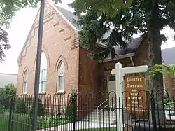 Weber Stake Relief Society Building |
February 13, 1989 (#88003438) |
2104 Lincoln Ave. 41°13′44″N 111°58′32″W |
Ogden | Houses the Weber County DUP Museum. Originally at 2148 Grant Ave., moved on January 24, 2012 |
| 66 | J.M. Wilbur Company Blacksmith Shop |  J.M. Wilbur Company Blacksmith Shop |
January 17, 2017 (#100000513) |
2145 N 5500 E 41°17′50″N 111°48′56″W |
Eden |
Former listings
| [3] | Name on the Register | Image | Date listed | Date removed | Location | City or town | Description |
|---|---|---|---|---|---|---|---|
| 1 | Burch-Taylor Mill | July 14, 1982 (#82004186) | May 15, 2001 | 4287 Riverdale Rd. |
Riverdale | ||
| 2 | Downing Apartments |  Downing Apartments |
December 31, 1987 (#87002160) | March 26, 2018 | 357–359 27th St. 41°12′58″N 111°58′15″W |
Ogden | Has been demolished |
| 3 | North Ogden Elementary School | 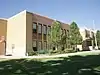 North Ogden Elementary School |
April 1, 1985 (#85000822) | March 26, 2018 | 474 E. 2650 North 41°18′29″N 111°57′55″W |
North Ogden | 1930s Art Deco building demolished in 2010 |
| 4 | Rose Apartments |  Rose Apartments |
December 31, 1987 (#87002175) | March 26, 2018 | 302–308 27th St. 41°13′01″N 111°58′20″W |
Ogden | Has been demolished |
| 5 | Shupe-Williams Candy Company Factory | March 30, 1978 (#78002716) | February 21, 2007 | 2606 Wall Ave. |
Ogden | Burned down March 11, 2006.[8] | |
| 6 | Sidney Stevens House | 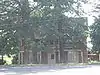 Sidney Stevens House |
December 2, 1977 (#77001326) | March 26, 2018 | 2593 N. 400 East 41°18′19″N 111°58′05″W |
North Ogden | Has been demolished |
See also
References
- The latitude and longitude information provided in this table was derived originally from the National Register Information System, which has been found to be fairly accurate for about 99% of listings. Some locations in this table may have been corrected to current GPS standards.
- National Park Service, United States Department of the Interior, "National Register of Historic Places: Weekly List Actions", retrieved October 20, 2023.
- Numbers represent an alphabetical ordering by significant words. Various colorings, defined here, differentiate National Historic Landmarks and historic districts from other NRHP buildings, structures, sites or objects.
- "National Register Information System". National Register of Historic Places. National Park Service. April 24, 2008.
- The eight-digit number below each date is the number assigned to each location in the National Register Information System database, which can be viewed by clicking the number.
- "D&RGW Steam Locomotive #223". Ogden Union Station. Archived from the original on 4 January 2010. Retrieved 28 January 2010.
- Location derived from this Archived 2012-02-19 at the Wayback Machine state website; the NRIS lists it as "Address Unknown".
- "Downtown Ogden building burns to the ground". The Daily Herald (Utah). March 13, 2006. p. D3. Retrieved August 31, 2022 – via Newspapers.com.
External links
 Media related to National Register of Historic Places in Weber County, Utah at Wikimedia Commons
 | |||
| Topics | |
|---|---|
| Lists by state |
|
| Lists by insular areas | |
| Lists by associated state | |
| Other areas | |
| Related | |
Municipalities and communities of Weber County, Utah, United States | ||
|---|---|---|
| Cities | Map of Utah highlighting Weber County | |
| Town | ||
| Townships | ||
| CDPs | ||
| Unincorporated communities | ||
This article is issued from Wikipedia. The text is licensed under Creative Commons - Attribution - Sharealike. Additional terms may apply for the media files.