National Register of Historic Places listings in Cass County, North Dakota
This is a list of the National Register of Historic Places listings in Cass County, North Dakota.

Location of Cass County in North Dakota
This is intended to be a complete list of the properties and districts on the National Register of Historic Places in Cass County, North Dakota, United States. The locations of National Register properties and districts for which the latitude and longitude coordinates are included below, may be seen in a map.[1]
There are 38 properties and districts listed on the National Register in the county. Another five properties were once listed but have been removed.
| Adams | Barnes | Benson | Billings | Bottineau | Bowman | Burke | Burleigh | Cass | Cavalier | Dickey | Divide | Dunn | Eddy | Emmons | Foster | Golden Valley | Grand Forks | Grant | Griggs | Hettinger | Kidder | LaMoure | Logan | McHenry | McIntosh | McKenzie | McLean | Mercer | Morton | Mountrail | Nelson | Oliver | Pembina | Pierce | Ramsey | Ransom | Renville | Richland | Rolette | Sargent | Sheridan | Sioux | Slope | Stark | Steele | Stutsman | Towner | Traill | Walsh | Ward | Wells | Williams |
This National Park Service list is complete through NPS recent listings posted October 20, 2023.[2]
Current listings
| [3] | Name on the Register[4] | Image | Date listed[5] | Location | City or town | Description |
|---|---|---|---|---|---|---|
| 1 | 1916 Buffalo High School | 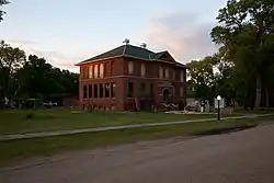 1916 Buffalo High School |
May 10, 2001 (#01000501) |
303 Pearl Street, North 46°55′16″N 97°32′59″W |
Buffalo | |
| 2 | George and Beth Anderson House | 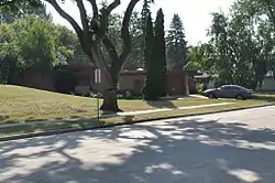 George and Beth Anderson House |
June 19, 2017 (#100001221) |
1458 South River Road 46°51′29″N 96°46′57″W |
Fargo | |
| 3 | Barrington Apartments | 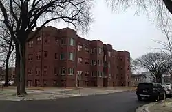 Barrington Apartments |
July 27, 1989 (#88000982) |
219 12th Street, South 46°52′19″N 96°47′51″W |
Fargo | |
| 4 | M.E. Beebe Historic District | 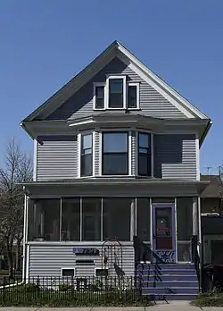 M.E. Beebe Historic District |
November 24, 2015 (#15000825) |
Northeastern corner of Third Avenue North and North 8th Street 46°52′47″N 96°47′30″W |
Fargo | |
| 5 | Black Building | 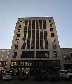 Black Building |
December 6, 2016 (#16000821) |
114 Broadway North 46°52′39″N 96°47′17″W |
Fargo | |
| 6 | Cass County Court House, Jail, and Sheriff's House |  Cass County Court House, Jail, and Sheriff's House |
December 22, 1983 (#83004062) |
S. 9th St. between S. 2nd and 3rd Aves. 46°52′19″N 96°47′35″W |
Fargo | |
| 7 | Casselton Commercial Historic District | 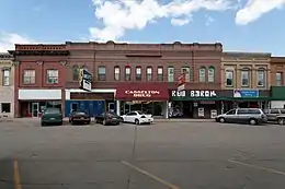 Casselton Commercial Historic District |
October 28, 1982 (#82001311) |
Roughly bounded by Front and 1st St. between 6th and 8th Aves. 46°54′03″N 97°12′38″W |
Casselton | |
| 8 | DeLendrecie's Department Store | 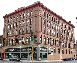 DeLendrecie's Department Store |
October 22, 1979 (#79003725) |
620-624 Main Street 46°52′27″N 96°47′20″W |
Fargo | |
| 9 | Dibley House | 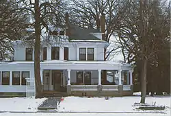 Dibley House |
November 25, 1980 (#80004282) |
331 8th Avenue, South 46°51′59″N 96°47′01″W |
Fargo | |
| 10 | Downtown Fargo District | 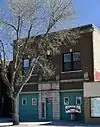 Downtown Fargo District |
October 13, 1983 (#83004064) |
Roughly Roberts Street from South First Avenue to Fifth Avenue North, and Main Avenue 46°52′41″N 96°47′24″W |
Fargo | |
| 11 | Fargo City Detention Hospital | 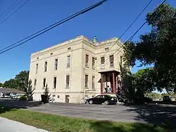 Fargo City Detention Hospital |
April 7, 1987 (#86003741) |
57 11th Avenue, North 46°53′21″N 96°46′37″W |
Fargo | |
| 12 | Fargo-Moorhead YMCA Sign | 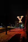 Fargo-Moorhead YMCA Sign |
March 17, 2022 (#100007495) |
400 1st Ave. South 46°52′24″N 96°47′11″W |
Fargo | |
| 13 | Fargo Oak Grove Residential Historic District |  Fargo Oak Grove Residential Historic District |
October 13, 2011 (#11000744) |
North & South Terrace Avenues, east of Elm Street, North 46°53′00″N 96°46′34″W |
Fargo | |
| 14 | Fargo South Residential District | 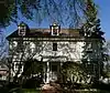 Fargo South Residential District |
September 19, 1983 (#83001929) |
Roughly bounded by 5th and 17th Avenues South, 7th and 9th Streets South 46°51′43″N 96°47′30″W |
Fargo | |
| 15 | Fargo Theatre |  Fargo Theatre |
October 21, 1982 (#82001312) |
314 Broadway 46°52′45″N 96°47′16″W |
Fargo | |
| 16 | Federal Building and U.S. Post Office | 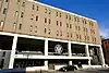 Federal Building and U.S. Post Office |
June 4, 2021 (#100006635) |
657 2nd Ave. North 46°52′42″N 96°47′24″W |
Fargo | |
| 17 | Grand Lodge of North Dakota, Ancient Order of United Workmen | 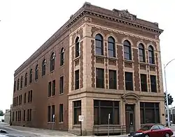 Grand Lodge of North Dakota, Ancient Order of United Workmen |
August 24, 1979 (#79001770) |
112-114 North Roberts Street 46°52′40″N 96°47′23″W |
Fargo | |
| 18 | Great Northern Freight Warehouse | 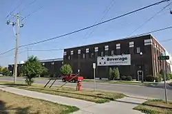 Great Northern Freight Warehouse |
November 21, 1990 (#90001749) |
420 North 7th Street 46°52′52″N 96°47′28″W |
Fargo | |
| 19 | James Holes House | 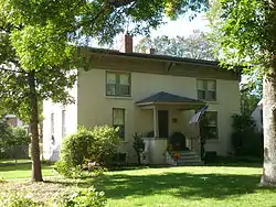 James Holes House |
April 7, 1987 (#86003740) |
1230 Fifth Street, North 46°53′29″N 96°47′10″W |
Fargo | |
| 20 | Knerr Block, Floyd Block, McHench Building and Webster and Cole Building |  Knerr Block, Floyd Block, McHench Building and Webster and Cole Building |
May 12, 1983 (#83001930) |
13, 15, 17-19, and 21-23 8th Street, South 46°52′26″N 96°47′27″W |
Fargo | |
| 21 | Lewis House | 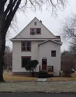 Lewis House |
October 18, 1979 (#79003726) |
1002 Third Avenue, South 46°52′17″N 96°47′46″W |
Fargo | |
| 22 | Robert Lindemann House | September 2, 1994 (#94001073) |
1.5 miles east and 2.75 miles north of Enderlin 46°40′08″N 97°34′32″W |
Enderlin | ||
| 23 | Masonic Block | 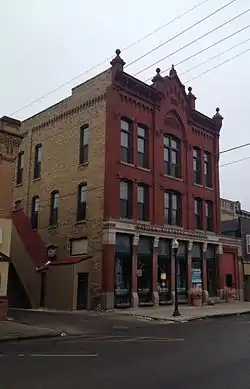 Masonic Block |
August 3, 1979 (#79001771) |
11 South 8th Street 46°51′55″N 96°47′29″W |
Fargo | |
| 24 | North Dakota State University District |  North Dakota State University District |
October 6, 1986 (#86003261) |
Roughly bounded by North University Drive, 12th Avenue, North, Service Drive, and Campus Avenue 46°53′34″N 96°48′00″W |
Fargo | |
| 25 | North Side Fargo Builder's Residential Historic District | 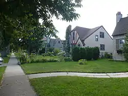 North Side Fargo Builder's Residential Historic District |
April 7, 1987 (#86003737) |
Roughly bounded by Benjamin Franklin School area and Golf Course, 1st St., 12th Ave., N, and 4th St. 46°53′33″N 96°47′00″W |
Fargo | |
| 26 | North Side Fargo High Style Residential Historic District | 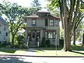 North Side Fargo High Style Residential Historic District |
April 7, 1987 (#86003739) |
Roughly bounded by 12th Ave. N, 4th St., 11th Ave., N, and 7th St. 46°53′22″N 96°47′11″W |
Fargo | |
| 27 | Northern Pacific Railway Depot | 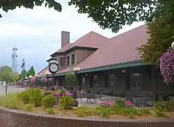 Northern Pacific Railway Depot |
February 13, 1975 (#75001304) |
701 Main Avenue 46°52′29″N 96°47′21″W |
Fargo | |
| 28 | Old Stone Church | 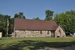 Old Stone Church |
March 29, 1996 (#96000311) |
206 North Wilcox Avenue 46°55′18″N 97°33′03″W |
Buffalo | |
| 29 | Pence Automobile Company Warehouse | 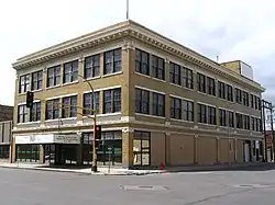 Pence Automobile Company Warehouse |
January 7, 1994 (#93001478) |
301 N. P Ave. 46°52′34″N 96°46′57″W |
Fargo | |
| 30 | Powers Hotel | 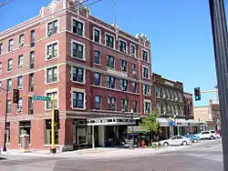 Powers Hotel |
May 12, 1983 (#83001931) |
400 Broadway 46°52′48″N 96°47′16″W |
Fargo | |
| 31 | Research Plot 2 | 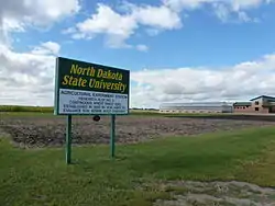 Research Plot 2 |
October 8, 1991 (#91001474) |
Near the junction of Centennial Ave. and 18th St., N. on the North Dakota State University campus 46°53′39″N 96°48′31″W |
Fargo | |
| 32 | Research Plot 30 | 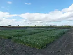 Research Plot 30 |
October 8, 1991 (#91001475) |
Near the junction of Centennial Ave. and 18th St., N. on the North Dakota State University campus 46°53′39″N 96°48′39″W |
Fargo | |
| 33 | Shea Site |  Shea Site |
July 25, 1996 (#96000817) |
Address Restricted |
Embden | |
| 34 | Sprunk Site (32CS04478) | Sprunk Site (32CS04478) |
January 9, 2007 (#06001226) |
Address Restricted |
Enderlin | |
| 35 | St. Stephen's Episcopal Church | 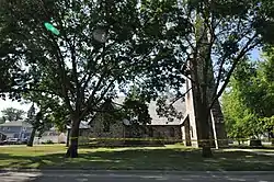 St. Stephen's Episcopal Church |
December 3, 1992 (#92001609) |
Southeastern corner of the junction of 3rd Ave. and 5th St. 46°54′13″N 97°12′39″W |
Casselton | |
| 36 | Union Storage & Transfer Cold Storage Warehouse and Armour Creamery Building | 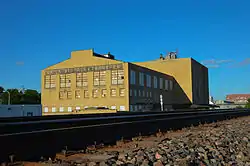 Union Storage & Transfer Cold Storage Warehouse and Armour Creamery Building |
February 9, 2007 (#07000016) |
1026-1032 Northern Pacific Ave. and 1034-1102 Northern Pacific Ave. 46°52′36″N 96°47′43″W |
Fargo | |
| 37 | Watts Free Library | 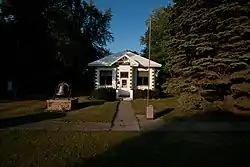 Watts Free Library |
May 31, 1990 (#89002304) |
101 Third Street, North 46°39′12″N 97°14′45″W |
Leonard | |
| 38 | Woodrow Wilson School | 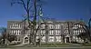 Woodrow Wilson School |
October 24, 2012 (#12000881) |
315 North University Drive 46°52′48″N 96°47′51″W |
Fargo | Now known as "Dakota High School" |
Former listings
| [3] | Name on the Register | Image | Date listed | Date removed | Location | City or town | Description |
|---|---|---|---|---|---|---|---|
| 1 | Burlington Northern Depot | August 29, 1977 (#77001024) | December 6, 2016 | Woodard Avenue 47°00′17″N 97°13′09″W |
Amenia | ||
| 2 | Cole Hotel | May 9, 1983 (#83001928) | October 21, 2009 | 401-407 Northern Pacific Ave. 46°52′34″N 97°47′03″W |
Fargo | Demolished on April 25, 1991. | |
| 3 | Fargo and Southern Depot | April 14, 1975 (#75001303) | May 27, 1980 | 1101 2nd Ave. N. |
Fargo | Destroyed by fire on December 23, 1974.[6] | |
| 4 | Gethsemane Episcopal Cathedral | 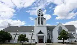 Gethsemane Episcopal Cathedral |
February 19, 1980 (#80002909) | February 25, 1991 | 204 S. 9th St. |
Fargo | Destroyed by fire on September 12, 1989.[7] |
| 5 | Chesebro Smith House | 1986 (#86003744) | September 23, 2004 | 1337 Broadway |
Fargo | Demolished on May 17, 2003.[8] |
See also
Wikimedia Commons has media related to National Register of Historic Places in Cass County, North Dakota.
References
- The latitude and longitude information provided in this table was derived originally from the National Register Information System, which has been found to be fairly accurate for about 99% of listings. Some locations in this table may have been corrected to current GPS standards.
- National Park Service, United States Department of the Interior, "National Register of Historic Places: Weekly List Actions", retrieved October 20, 2023.
- Numbers represent an alphabetical ordering by significant words. Various colorings, defined here, differentiate National Historic Landmarks and historic districts from other NRHP buildings, structures, sites or objects.
- "National Register Information System". National Register of Historic Places. National Park Service. April 24, 2008.
- The eight-digit number below each date is the number assigned to each location in the National Register Information System database, which can be viewed by clicking the number.
- "Fargo Train Depot Damaged by Fire". The Bismarck Tribune. December 24, 1974. p. 7. Retrieved August 11, 2022 – via Newspapers.com.
- "Fargo blaze guts cathedral's history". The Bismarck Tribune. September 16, 1989. p. 2B. Retrieved August 11, 2022 – via Newspapers.com.
- "House demolished". The Fargo Forum. May 18, 2003.

Municipalities and communities of Cass County, North Dakota, United States | ||
|---|---|---|
| Cities | Map of North Dakota highlighting Cass County | |
| Townships |
| |
| CDPs | ||
| Unincorporated communities | ||
| Footnotes | ‡This populated place also has portions in an adjacent county or counties | |
This article is issued from Wikipedia. The text is licensed under Creative Commons - Attribution - Sharealike. Additional terms may apply for the media files.