National Register of Historic Places listings in Flathead County, Montana
This is a list of the National Register of Historic Places listings in Flathead County, Montana.
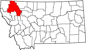
Location of Flathead County in Montana
This is intended to be a complete list of the properties and districts on the National Register of Historic Places in Flathead County, Montana, United States. The locations of National Register properties and districts for which the latitude and longitude coordinates are included below, may be seen in a map.[1]
There are 148 properties and districts listed on the National Register in the county, including 3 National Historic Landmarks.
This National Park Service list is complete through NPS recent listings posted October 20, 2023.[2]
Current listings
| [3] | Name on the Register | Image | Date listed[4] | Location | City or town | Description |
|---|---|---|---|---|---|---|
| 1 | W.L. Adair General Mercantile Historic District |  W.L. Adair General Mercantile Historic District |
February 6, 1986 (#86000155) |
On Polebridge Loop Rd., 0.25 miles (0.40 km) east of its intersection with North Fork Road 48°45′43″N 114°17′01″W |
Polebridge | |
| 2 | Alexander and Busey Houses | 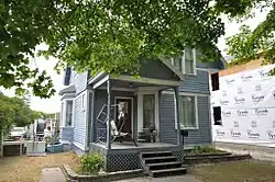 Alexander and Busey Houses |
August 24, 1994 (#94000869) |
106 and 112 5th Ave., W. 48°11′45″N 114°19′18″W |
Kalispell | #106 has been demolished. |
| 3 | Anderson Style Shop |  Anderson Style Shop |
August 24, 1994 (#94000870) |
222 Main St. 48°11′46″N 114°18′44″W |
Kalispell | |
| 4 | Apgar Fire Lookout | 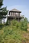 Apgar Fire Lookout |
December 16, 1986 (#86003695) |
Near Lake McDonald 48°31′05″N 114°01′10″W |
West Glacier | |
| 5 | Bader-Jaquette and Westwang Houses and Rental Property |  Bader-Jaquette and Westwang Houses and Rental Property |
August 24, 1994 (#94000871) |
46 and 36 5th Ave. W. 48°11′48″N 114°19′14″W |
Kalispell | |
| 6 | Beaman House |  Beaman House |
August 24, 1994 (#94000872) |
230 4th Ave., W. 48°11′43″N 114°19′05″W |
Kalispell | |
| 7 | Alice Beck Cabin | December 26, 2008 (#08001219) |
South of Kelly's Camp Rd. and east of McDonald Creek in Glacier National Park 48°37′51″N 113°52′05″W |
Lake McDonald | ||
| 8 | Belton Chalets |  Belton Chalets |
November 15, 1978 (#78001685) |
U.S. Route 2 48°29′48″N 113°58′32″W |
West Glacier | |
| 9 | Big Creek Ranger Station Historic District | January 7, 2015 (#14001126) |
North Fork Rd. 48°36′06″N 114°09′58″W |
Polebridge | Flathead National Forest | |
| 10 | Billsborough House |  Billsborough House |
August 24, 1994 (#94000873) |
376 6th Ave., E., N. 48°12′19″N 114°18′22″W |
Kalispell | |
| 11 | Charles Boles House |  Charles Boles House |
February 14, 2006 (#06000041) |
40 Appleway Dr. 48°11′50″N 114°20′05″W |
Kalispell | |
| 12 | Bowman Lake Patrol Cabin | 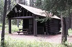 Bowman Lake Patrol Cabin |
February 14, 1986 (#86000340) |
Lower end of Bowman Lake, 0.5 miles (0.80 km) east of the Bowman Lake Ranger Station 48°49′40″N 114°11′31″W |
West Glacier | |
| 13 | Bowman Lake Road |  Bowman Lake Road |
January 19, 1996 (#95001565) |
North Fork drainage between Polebridge and Bowman ranger stations in Glacier National Park 48°49′39″N 114°12′08″W |
West Glacier | |
| 14 | Boyd's Shop | 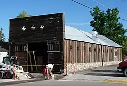 Boyd's Shop |
August 24, 1994 (#94000874) |
227 1st. St., W. 48°11′50″N 114°18′58″W |
Kalispell | Established as a blacksmith shop in the 1910s. Later shifted to welding.[5] |
| 15 | Brice Apartments | 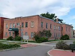 Brice Apartments |
August 24, 1994 (#94000875) |
228 2nd Ave., E. 48°11′47″N 114°18′38″W |
Kalispell | |
| 16 | Bruyer Granary | 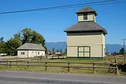 Bruyer Granary |
October 12, 2006 (#06000937) |
1355 Whitefish Stage Rd. 48°13′41″N 114°18′23″W |
Kalispell | |
| 17 | Bull Head Lodge and Studio | February 6, 1984 (#84002465) |
Off Going-to-the-Sun Road 48°31′58″N 113°59′45″W |
Glacier National Park | Summer home of artist Charles M. Russell | |
| 18 | Camas Creek Cutoff Road |  Camas Creek Cutoff Road |
July 11, 2014 (#14000393) |
Glacier National Park 48°32′26″N 114°00′01″W |
West Glacier | |
| 19 | Cattle Queen Snowshoe Cabin | July 1, 1999 (#99000778) |
McDonald Subdistrict 48°48′38″N 113°49′15″W |
West Glacier | ||
| 20 | City Water Department |  City Water Department |
August 24, 1994 (#94000876) |
336 1st Ave., E. 48°11′44″N 114°18′37″W |
Kalispell | 1927 Georgian Revival office building, designed by Kalispell architect Fred Brinkman. |
| 21 | Coal Creek Patrol Cabin | 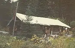 Coal Creek Patrol Cabin |
July 1, 1999 (#99000777) |
U.S. Route 2 48°25′00″N 113°38′56″W |
West Glacier | |
| 22 | C. E. Conrad Memorial Cemetery | 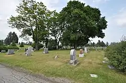 C. E. Conrad Memorial Cemetery |
December 5, 2012 (#12000995) |
641 Conrad Dr. 48°12′12″N 114°17′20″W |
Kalispell | |
| 23 | Charles E. Conrad Mansion | 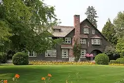 Charles E. Conrad Mansion |
February 20, 1975 (#75001083) |
313 6th Ave., E. 48°11′49″N 114°18′08″W |
Kalispell | The Shingle-styled mansion was designed by Kirtland Cutter and built in 1895 for businessman Conrad.[6] |
| 24 | Continental Oil Company Filling Station | August 24, 1994 (#94000877) |
35 1st Ave., N. 48°11′53″N 114°18′39″W |
Kalispell | Demolished | |
| 25 | Continental Oil Company Warehouse and Garage |  Continental Oil Company Warehouse and Garage |
August 24, 1994 (#94000878) |
51 1st Ave., W., N. 48°12′00″N 114°18′53″W |
Kalispell | |
| 26 | Courthouse Historic District | 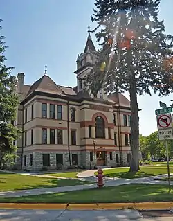 Courthouse Historic District |
August 24, 1994 (#94000879) |
500-800 blocks of Main St. 48°11′29″N 114°18′37″W |
Kalispell | |
| 27 | A. J. Dean House | 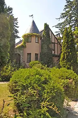 A. J. Dean House |
August 11, 1980 (#80002415) |
244 Woodland Ave. 48°11′46″N 114°18′12″W |
Kalispell | |
| 28 | DESMET (Boat) | 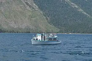 DESMET (Boat) |
December 14, 2017 (#100001896) |
Lake McDonald, Glacier National Park 48°37′04″N 113°52′47″W |
West Glacier | |
| 29 | East Side Historic District | 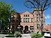 East Side Historic District |
August 24, 1994 (#94000880) |
Roughly bounded by Central St., E., Woodland Park, Woodland Ave., 13th St., E., and 1st Ave., E. 48°11′43″N 114°18′16″W |
Kalispell | Various businesses, institutions and residences built as early as the 1890s.;[7] |
| 30 | Equity Supply Company Elevator and Creamery | August 24, 1994 (#94000881) |
50 1st Ave., W., N. 48°12′00″N 114°18′57″W |
Kalispell | Demolished | |
| 31 | Federal Building |  Federal Building |
August 24, 1994 (#94000882) |
247 1st Ave., E. 48°11′47″N 114°18′36″W |
Kalispell | Now the local library |
| 32 | Ferguson House | 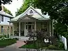 Ferguson House |
August 24, 1994 (#94000883) |
320 4th Ave., W. 48°12′19″N 114°19′02″W |
Kalispell | The Ferguson House is an American Foursquare cottage with Queen Anne stylings, built in 1897 by Ferguson, a boilermaker for the Great Northern Railway.[8] |
| 33 | Fielding Snowshoe Patrol Cabin |  Fielding Snowshoe Patrol Cabin |
February 14, 1986 (#86000341) |
Off U.S. Route 2 48°17′11″N 113°27′22″W |
West Glacier | |
| 34 | First Presbyterian Church of Whitefish |  First Presbyterian Church of Whitefish |
October 1, 2004 (#04001085) |
301 Central Ave. 48°24′33″N 114°20′08″W |
Whitefish | |
| 35 | Fish Creek Bay Boathouse |  Fish Creek Bay Boathouse |
January 19, 1996 (#95001567) |
Fish Creek Campground on the western shore of Lake McDonald in Glacier National Park 48°33′04″N 113°58′48″W |
West Glacier | |
| 36 | Fisher House |  Fisher House |
August 25, 1994 (#94000884) |
441 2nd St., W. 48°11′45″N 114°19′05″W |
Kalispell | |
| 37 | Flathead National Forest Backcountry Administrative Facilities | December 17, 2014 (#14001047) |
Flathead National Forest 48°09′25″N 113°40′09″W |
Hungry Horse | Discontiguous district encompassing backcountry ranger stations and other infrastructure in the Great Bear Wilderness and Bob Marshall Wilderness | |
| 38 | Flathead River Bridge |  Flathead River Bridge |
June 17, 2010 (#10000183) |
South end of 4th Ave. 48°21′43″N 114°11′02″W |
Columbia Falls | |
| 39 | Flathead Wholesale Grocery | August 22, 1994 (#94000885) |
5 1st Ave., E. 48°11′57″N 114°18′40″W |
Kalispell | ||
| 40 | Ford Creek Patrol Cabin |  Ford Creek Patrol Cabin |
February 14, 1986 (#86000342) |
Glacier Route 7 48°37′33″N 113°56′36″W |
West Glacier | |
| 41 | Ford Schoolhouse | August 23, 2022 (#100008041) |
North Fork Flathead Rd. just over nine miles northwest of Polebridge Coordinates missing |
Polebridge vicinity | ||
| 42 | Edward Gay House |  Edward Gay House |
August 24, 1994 (#94000886) |
236 5th Ave., W. 48°11′41″N 114°19′11″W |
Kalispell | |
| 43 | Gibson-Lebert House |  Gibson-Lebert House |
August 24, 1994 (#94000887) |
461 E. California St. 48°12′23″N 114°18′34″W |
Kalispell | |
| 44 | Going-to-the-Sun Road | 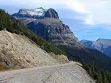 Going-to-the-Sun Road |
June 16, 1983 (#83001070) |
Glacier Route 1 48°38′48″N 113°46′48″W |
West Glacier | |
| 45 | Going-to-the-Sun Road |  Going-to-the-Sun Road |
February 18, 1997 (#97000345) |
Glacier National Park 48°38′01″N 113°47′15″W |
West Glacier | Extends into Glacier County |
| 46 | Graham House |  Graham House |
August 24, 1994 (#94000888) |
825 6th Ave., E. 48°11′31″N 114°18′03″W |
Kalispell | |
| 47 | Granite Park Chalet | 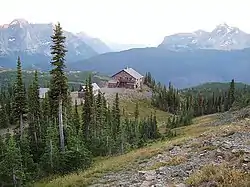 Granite Park Chalet |
June 27, 1983 (#83001060) |
Glacier National Park 48°46′12″N 113°46′11″W |
West Glacier | |
| 48 | Great Northern Railway Buildings |  Great Northern Railway Buildings |
May 28, 1987 (#87001453) |
Glacier National Park 48°38′29″N 113°32′17″W |
Glacier National Park | |
| 49 | Great Northern Railway Depot |  Great Northern Railway Depot |
August 24, 1994 (#94000889) |
15 Depot Loop 48°11′58″N 114°18′44″W |
Kalispell | |
| 50 | Great Northern Railway Passenger and Freight Depot and Division Office | Great Northern Railway Passenger and Freight Depot and Division Office |
July 11, 2002 (#02000766) |
500 Depot St. 48°24′48″N 114°20′04″W |
Whitefish | |
| 51 | Gregg-Moses House |  Gregg-Moses House |
August 24, 1994 (#94000890) |
27 8th Ave., W. 48°11′46″N 114°19′19″W |
Kalispell | |
| 52 | Greve's Tourist Cabins | 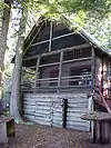 Greve's Tourist Cabins |
December 26, 2008 (#08001222) |
Western side of Going-to-the-Sun Road in Glacier National Park 48°37′25″N 113°52′16″W |
Lake McDonald | |
| 53 | Gunsight Pass Shelter | 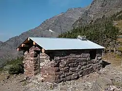 Gunsight Pass Shelter |
February 14, 1986 (#86000344) |
Junction of Gunsight Pass Trail and the Continental Divide 48°36′34″N 113°44′16″W |
West Glacier | |
| 54 | Harrison Lake Patrol Cabin | 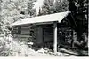 Harrison Lake Patrol Cabin |
February 16, 2001 (#01000116) |
U.S. Route 2 48°31′39″N 113°45′18″W |
Glacier National Park | |
| 55 | Headquarters Historic District |  Headquarters Historic District |
January 19, 1996 (#95001569) |
East of Glacier Route 1 at the crossing of the Middle Fork of the Flathead River in Glacier National Park 48°30′06″N 113°58′47″W |
West Glacier | |
| 56 | Heaven's Peak Fire Lookout |  Heaven's Peak Fire Lookout |
December 19, 1986 (#86003688) |
Mount Cannon 48°31′05″N 114°01′10″W |
West Glacier | |
| 57 | Cornelius Hedges Elementary School |  Cornelius Hedges Elementary School |
June 29, 1989 (#89000765) |
827 4th Ave., E. 48°11′30″N 114°18′10″W |
Kalispell | |
| 58 | Heller Building |  Heller Building |
March 22, 1991 (#91000332) |
140 Main St. 48°11′50″N 114°18′45″W |
Kalispell | |
| 59 | Hodgson House |  Hodgson House |
August 24, 1994 (#94000891) |
314 9th Ave., W. 48°11′41″N 114°19′30″W |
Kalispell | |
| 60 | Hornet Lookout | 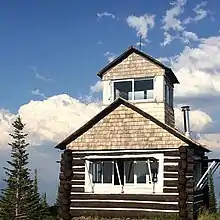 Hornet Lookout |
August 19, 1983 (#83001061) |
Hornet Mountain 48°52′47″N 114°30′42″W |
Flathead National Forest | |
| 61 | Hotel Norden |  Hotel Norden |
August 24, 1994 (#94000892) |
24 1st Ave., W. 48°11′52″N 114°18′52″W |
Kalispell | |
| 62 | Houtz House |  Houtz House |
August 24, 1994 (#94000893) |
822 5th Ave., W. 48°11′21″N 114°19′03″W |
Kalispell | |
| 63 | Howes' Lake McDonald Cottage Sites Historic District |  Howes' Lake McDonald Cottage Sites Historic District |
December 26, 2008 (#08001223) |
Northern side of Apgar Loop Rd. in Glacier National Park 48°31′39″N 113°59′17″W |
West Glacier | |
| 64 | Huckleberry Fire Outlook | 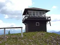 Huckleberry Fire Outlook |
February 14, 1986 (#86000346) |
Summit of Huckleberry Mountain 48°36′01″N 114°08′01″W |
West Glacier | |
| 65 | Izaak Walton Inn |  Izaak Walton Inn |
October 18, 1985 (#85003235) |
Off U.S. Route 2 adjacent to the railroad line in Essex 48°16′43″N 113°36′41″W |
Essex | |
| 66 | Johnson-Lee House |  Johnson-Lee House |
August 24, 1994 (#94000894) |
651 2nd Ave., W., N. 48°12′20″N 114°19′06″W |
Kalispell | |
| 67 | Kalispell Flour Mill |  Kalispell Flour Mill |
August 24, 1994 (#94000896) |
506 W. Center St. 48°11′51″N 114°19′20″W |
Kalispell | |
| 68 | Kalispell Main Street Historic District |  Kalispell Main Street Historic District |
August 24, 1994 (#94000904) |
34-343 Main St. and 116-142 1st Ave., E.; also roughly bounded by Center St. to the north, 5th St. to the south, and the north and south running alleys to the west of Main St. 48°11′48″N 114°18′42″W |
Kalispell | Second set of boundaries represents a boundary increase of September 3, 2010 |
| 69 | Kalispell Monumental Company | 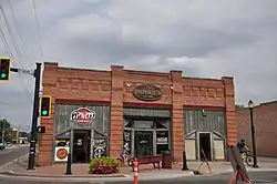 Kalispell Monumental Company |
August 24, 1994 (#94000898) |
7 1st Ave., E. 48°11′55″N 114°18′40″W |
Kalispell | |
| 70 | Kalispell-American Laundry |  Kalispell-American Laundry |
August 24, 1994 (#94000895) |
121 1st Ave., E. 48°11′51″N 114°18′38″W |
Kalispell | |
| 71 | Kearney Rapids Bridge | July 22, 1994 (#94000734) |
Bigfork Canyon Rd. 48°03′22″N 114°01′43″W |
Bigfork | Replaced | |
| 72 | Harry C. Keith House | 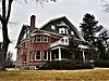 Harry C. Keith House |
July 16, 1987 (#87001198) |
538 5th Ave., E 48°11′40″N 114°18′14″W |
Kalispell | |
| 73 | Kelly's Camp Historic District |  Kelly's Camp Historic District |
December 23, 2009 (#08001224) |
South of Kelly's Camp Rd. between Kelly's Creek and south of cabins in Glacier National Park 48°37′37″N 113°54′09″W |
Lake McDonald | |
| 74 | Kerr House |  Kerr House |
August 24, 1994 (#94000899) |
136 5th Ave., W. 48°11′41″N 114°19′12″W |
Kalispell | |
| 75 | Kintla Lake Ranger Station | 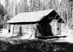 Kintla Lake Ranger Station |
February 14, 1986 (#86000332) |
Southern shore of Kintla Lake 48°56′04″N 114°20′25″W |
West Glacier | |
| 76 | Kishenehn Ranger Station Historic District |  Kishenehn Ranger Station Historic District |
February 14, 1986 (#86000335) |
3 miles (4.8 km) south of the Canada–US border near the confluence of the northern fork of the Flathead River and Kishenehn Creek 48°57′37″N 114°25′14″W |
West Glacier | |
| 77 | Billy Kruse Cabin | October 28, 2021 (#100007131) |
15920 North Fork Rd. 48°56′38″N 114°27′18″W |
Polebridge vicinity | ||
| 78 | Lake McDonald Lodge Coffee Shop |  Lake McDonald Lodge Coffee Shop |
October 14, 2008 (#08001014) |
Lake McDonald Lodge Boulevard 48°37′04″N 113°52′35″W |
Lake McDonald | |
| 79 | Lake McDonald Lodge | 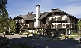 Lake McDonald Lodge |
May 22, 1978 (#78000280) |
Off Going-to-the-Sun Road 48°37′02″N 113°52′41″W |
West Glacier | Designated a National Historic Landmark District in 1987 |
| 80 | Leibig House |  Leibig House |
August 24, 1994 (#94000900) |
396 4th Ave., E., N. 48°12′17″N 114°18′32″W |
Kalispell | |
| 81 | Lincoln Creek Snowshoe Cabin | February 2, 2001 (#01000037) |
U.S. Route 2 48°29′53″N 113°52′41″W |
West Glacier | ||
| 82 | Lockridge Medical Clinic | %252C_October_2011.jpg.webp) Lockridge Medical Clinic |
August 14, 2012 (#12000789) |
341 Central Ave. 48°43′25″N 113°45′48″W |
Whitefish | designed by Frank Lloyd Wright in 1958[9] |
| 83 | Logan Creek Patrol Cabin |  Logan Creek Patrol Cabin |
February 14, 1986 (#86000348) |
Eastern side of Going-to-the-Sun Road at the crossing of Logan Creek 48°43′25″N 113°45′48″W |
West Glacier | |
| 84 | Logging Creek Ranger Station Historic District | 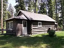 Logging Creek Ranger Station Historic District |
December 16, 1986 (#86003697) |
Glacier Route 7 near Logging Creek 48°41′51″N 114°11′34″W |
West Glacier | |
| 85 | Loneman Fire Lookout | 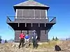 Loneman Fire Lookout |
February 14, 1986 (#86000353) |
Access via Loneman Mountain Trail 48°29′21″N 113°46′04″W |
West Glacier | |
| 86 | Long House |  Long House |
August 24, 1994 (#94000901) |
393 8th Ave., E., N. 48°12′21″N 114°18′10″W |
Kalispell | |
| 87 | Lower Logging Lake Snowshoe Cabin and Boathouse | 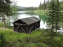 Lower Logging Lake Snowshoe Cabin and Boathouse |
December 16, 1986 (#86003692) |
Near the foot of Logging Lake 48°44′26″N 114°07′46″W |
West Glacier | |
| 88 | Lower Nyack Snowshoe Cabin |  Lower Nyack Snowshoe Cabin |
February 14, 1986 (#86000356) |
Western side of Nyack Creek Trail 48°29′47″N 113°41′16″W |
West Glacier | |
| 89 | Lower Park Creek Patrol Cabin | 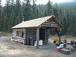 Lower Park Creek Patrol Cabin |
December 16, 1986 (#86003701) |
Eastern side of Park Creek Trail past the crossing of Fielding-Coal Creek Trail 48°20′08″N 113°32′37″W |
West Glacier | |
| 90 | McCarthy-Pederson Farm Historic District | December 18, 2006 (#06001188) |
820 Riverside Rd. 48°09′48″N 114°08′07″W |
Kalispell | ||
| 91 | McCarthy Homestead Cabin |  McCarthy Homestead Cabin |
December 16, 1986 (#86003691) |
On the northern fork of the Flathead River 48°48′27″N 114°19′21″W |
West Glacier | Duplicate of Margaret McCarthy Homestead |
| 92 | Margaret McCarthy Homestead | Margaret McCarthy Homestead |
July 21, 1988 (#88001095) |
Glacier National Park 48°48′27″N 114°19′20″W |
Big Prairie | Duplicate of McCarthy Homestead Cabin |
| 93 | McGee House |  McGee House |
August 24, 1994 (#94000903) |
454 1st Ave., E., N. 48°12′16″N 114°18′48″W |
Kalispell | |
| 94 | McMannamy House and Rental Properties |  McMannamy House and Rental Properties |
August 24, 1994 (#94000902) |
1020 5th Ave., W., 1004, 1012 and 1020½ 5th Ave. W., and 508 and 516 10th St., W. 48°11′14″N 114°19′00″W |
Kalispell | |
| 95 | J.K. Miller Homestead |  J.K. Miller Homestead |
July 21, 1988 (#88001092) |
Glacier National Park 48°50′11″N 114°19′44″W |
Big Prairie | |
| 96 | Mount Brown Fire Lookout |  Mount Brown Fire Lookout |
December 16, 1986 (#86003693) |
Off Route 1 near Snyder Lake 48°37′44″N 113°49′58″W |
West Glacier | |
| 97 | North Fork Road |  North Fork Road |
January 19, 1996 (#95001572) |
North Fork drainage, Fish Creek to Kintla Lake in Glacier National Park 48°32′53″N 113°59′11″W |
West Glacier | |
| 98 | Norwegian Evangelical Lutheran Church and Parsonage |  Norwegian Evangelical Lutheran Church and Parsonage |
August 17, 1994 (#94000905) |
344 and 332 5th Ave., W. 48°11′37″N 114°19′09″W |
Kalispell | |
| 99 | Numa Ridge Fire Lookout | 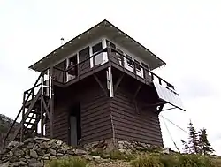 Numa Ridge Fire Lookout |
February 14, 1986 (#86000357) |
Near Bowman Lake 48°53′01″N 114°10′43″W |
West Glacier | |
| 100 | Nyack Ranger Station Historic District |  Nyack Ranger Station Historic District |
February 14, 1986 (#86000359) |
Nyack Ranger Station 48°26′24″N 113°47′43″W |
West Glacier | |
| 101 | O'Neil Lumber Company Office |  O'Neil Lumber Company Office |
August 24, 1994 (#94000906) |
424 Main St. 48°11′39″N 114°18′41″W |
Kalispell | |
| 102 | Polebridge Ranger Station Historic District | 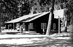 Polebridge Ranger Station Historic District |
February 14, 1986 (#86000337) |
Near the northeastern end of Henshaw Bridge on Route 7 48°46′56″N 114°16′43″W |
West Glacier | |
| 103 | Polebridge to Numa Ridge Phoneline |  Polebridge to Numa Ridge Phoneline |
April 4, 1996 (#95001573) |
North Fork drainage, Polebridge to Numa Ridge in Glacier National Park 48°49′59″N 114°13′10″W |
West Glacier | |
| 104 | Porter Ranch Barn |  Porter Ranch Barn |
April 15, 1999 (#99000458) |
North Somers Rd. 48°06′42″N 114°12′34″W |
Kalispell | |
| 105 | Quartz Lake Patrol Cabin |  Quartz Lake Patrol Cabin |
February 14, 1986 (#86000361) |
Foot of Quartz Lake 48°49′19″N 114°08′05″W |
West Glacier | |
| 106 | William Raftery Homestead | July 21, 1988 (#88001099) |
Glacier National Park 48°48′34″N 114°17′30″W |
Big Prairie | ||
| 107 | Reid-Kent House | August 24, 1994 (#94000907) |
246 8th Ave., W. 48°11′39″N 114°19′26″W |
Kalispell | ||
| 108 | Cornelius Ringleberg House |  Cornelius Ringleberg House |
January 22, 1987 (#86003673) |
1028 3rd Ave., W. 48°11′16″N 114°18′50″W |
Kalispell | |
| 109 | Rogers House |  Rogers House |
August 24, 1994 (#94000908) |
380 5th Ave., E., N. 48°12′18″N 114°18′28″W |
Kalispell | |
| 110 | Roose-Eckelberry House |  Roose-Eckelberry House |
August 24, 1994 (#94000909) |
146 3rd Ave., W. 48°11′46″N 114°19′01″W |
Kalispell | |
| 111 | Russell School | 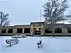 Russell School |
August 24, 1994 (#94000910) |
227 W. Nevada St. 48°12′21″N 114°19′10″W |
Kalispell | |
| 112 | St. Richard's Church | 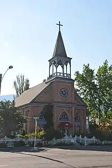 St. Richard's Church |
March 19, 1980 (#80002414) |
505 W. 4th Ave. 48°22′25″N 114°11′08″W |
Columbia Falls | |
| 113 | Sauser-Mercord Building |  Sauser-Mercord Building |
August 24, 1994 (#94000911) |
223-240 Main St. 48°11′42″N 114°18′42″W |
Kalispell | |
| 114 | Scalplock Mountain Fire Lookout | February 14, 1986 (#86000363) |
Accessible by trail connecting to Boundary Trail near the Walton Ranger Station 48°18′01″N 113°34′24″W |
West Glacier | ||
| 115 | Scandinavian Methodist Church | 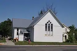 Scandinavian Methodist Church |
August 24, 1994 (#94000912) |
203 5th Ave., W. 48°11′43″N 114°19′09″W |
Kalispell | |
| 116 | Anton Schoenberger Homestead | July 21, 1988 (#88001094) |
Glacier National Park 48°48′34″N 114°17′30″W |
Big Prairie | ||
| 117 | Charlie Schoenberger Homestead | July 21, 1988 (#88001093) |
Glacier National Park 48°48′31″N 114°19′23″W |
Big Prairie | ||
| 118 | Scott-Forhan House | 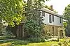 Scott-Forhan House |
August 24, 1994 (#94000913) |
326 4th Ave., W. 48°11′39″N 114°19′03″W |
Kalispell | |
| 119 | Sherwood Lodge | December 26, 2008 (#08001226) |
Grist Rd. in Glacier National Park 48°32′11″N 113°59′45″W |
West Glacier | ||
| 120 | Skyland Camp-Bowman Lake Ranger Station | 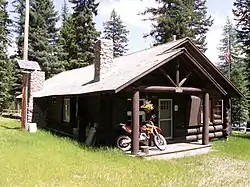 Skyland Camp-Bowman Lake Ranger Station |
February 14, 1986 (#86000365) |
Southwestern shore of Bowman Lake 48°49′44″N 114°12′13″W |
West Glacier | |
| 121 | Smith House | 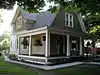 Smith House |
August 24, 1994 (#94000915) |
476 4th Ave., E., N. 48°12′20″N 114°18′33″W |
Kalispell | |
| 122 | Snyder House | 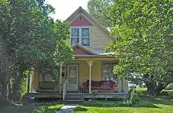 Snyder House |
August 24, 1994 (#94000916) |
514 8th Ave., W. 48°11′30″N 114°19′23″W |
Kalispell | |
| 123 | Soldiers' Home Historic District | 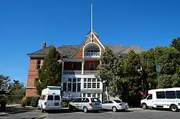 Soldiers' Home Historic District |
April 21, 1994 (#94000385) |
Veterans Dr. 48°21′27″N 114°12′37″W |
Columbia Falls | |
| 124 | Sperry Chalet | 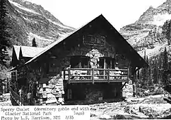 Sperry Chalet |
August 2, 1977 (#77000115) |
East of West Glacier 48°36′16″N 113°47′03″W |
West Glacier | |
| 125 | Stillwater Ranger Station Historic District | Stillwater Ranger Station Historic District |
July 8, 1981 (#81000340) |
U.S. Route 93 48°32′33″N 114°34′03″W |
Olney | |
| 126 | Swan River Bridge | Swan River Bridge |
August 3, 2015 (#15000484) |
Bridge St. 48°03′33″N 114°04′22″W |
Bigfork | |
| 127 | Swan River Community Hall | Swan River Community Hall |
May 30, 2002 (#02000567) |
115 Swan River Rd. 48°05′42″N 114°01′40″W |
Swan River | |
| 128 | Swiftcurrent Fire Lookout | 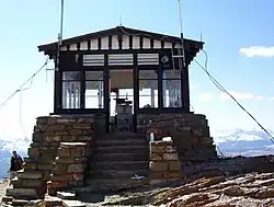 Swiftcurrent Fire Lookout |
December 16, 1986 (#86003694) |
Near the Continental Garden Wall in the vicinity of Swiftcurrent Mountain 48°47′08″N 113°45′58″W |
West Glacier | |
| 129 | Ray E. Taylor House |  Ray E. Taylor House |
August 10, 1990 (#90001204) |
900 S. Baker Ave. 48°24′09″N 114°20′18″W |
Whitefish | |
| 130 | Thibodeau Electric Shop |  Thibodeau Electric Shop |
August 24, 1994 (#94000917) |
313 2nd Ave., W. 48°11′41″N 114°18′52″W |
Kalispell | |
| 131 | Thierwechter House |  Thierwechter House |
August 24, 1994 (#94000918) |
305 4th Ave., W. 48°11′40″N 114°19′03″W |
Kalispell | |
| 132 | Upper Kintla Lake Patrol Cabin | 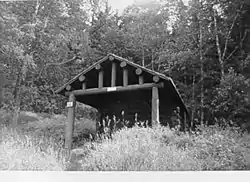 Upper Kintla Lake Patrol Cabin |
February 14, 1986 (#86000374) |
Head of Kintla Lake 48°58′38″N 114°14′47″W |
West Glacier | |
| 133 | Upper Lake McDonald Ranger Station Historic District |  Upper Lake McDonald Ranger Station Historic District |
December 16, 1986 (#86003699) |
Northern shore of Lake McDonald 48°38′23″N 113°52′21″W |
West Glacier | |
| 134 | Upper Logging Lake Snowshoe Cabin |  Upper Logging Lake Snowshoe Cabin |
February 14, 1986 (#86000376) |
Near the head of Logging Lake 48°46′36″N 114°01′22″W |
West Glacier | |
| 135 | Upper Nyack Snowshoe Cabin |  Upper Nyack Snowshoe Cabin |
February 14, 1986 (#86000377) |
Northern side of Nyack Creek 48°32′52″N 113°34′00″W |
West Glacier | |
| 136 | Upper Park Creek Patrol Cabin |  Upper Park Creek Patrol Cabin |
December 16, 1986 (#86003702) |
Junction of Park Creek and Two Medicine Pass Trails 48°24′54″N 113°27′34″W |
West Glacier | |
| 137 | Vance Lodge |  Vance Lodge |
December 29, 1994 (#94001505) |
Northern side of Polebridge Loop Rd., about 0.5 miles (0.80 km) northwest of Polebridge 48°46′38″N 114°17′31″W |
Polebridge | |
| 138 | Waggener & Campbell Funeral Home |  Waggener & Campbell Funeral Home |
August 24, 1994 (#94000919) |
228 2nd St., W. 48°11′45″N 114°18′57″W |
Kalispell | |
| 139 | Walker House |  Walker House |
August 24, 1994 (#94000920) |
1122 1st Ave. W. 48°11′14″N 114°18′38″W |
Kalispell | |
| 140 | Johnnie Walsh's Guest Lodge | July 21, 1988 (#88001096) |
Glacier National Park 48°48′14″N 114°19′02″W |
Big Prairie | ||
| 141 | Johnnie Walsh Homestead | July 21, 1988 (#88001098) |
Glacier National Park 48°48′29″N 114°18′26″W |
Big Prairie | ||
| 142 | Thomas J. Walsh Lodge | November 12, 1998 (#98001365) |
Upper Lake McDonald 48°38′23″N 113°51′22″W |
Apgar | ||
| 143 | Walton Ranger Station Historic District | 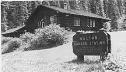 Walton Ranger Station Historic District |
December 16, 1986 (#86003700) |
U.S. Route 2 near Essex 48°16′25″N 113°36′08″W |
West Glacier | |
| 144 | West Entrance Station |  West Entrance Station |
April 4, 1996 (#95001581) |
Going-to-the-Sun Road, near West Glacier in Glacier National Park 48°30′23″N 113°59′12″W |
West Glacier | |
| 145 | West Side Historic District |  West Side Historic District |
August 24, 1994 (#94000921) |
Roughly bounded by 4th St., W., Main St., 10th St., W., and 4th Ave., W. 48°11′29″N 114°18′48″W |
Kalispell | |
| 146 | Burton and Lulu Wheeler Cabin |  Burton and Lulu Wheeler Cabin |
November 27, 1998 (#98001527) |
Northern end of Lake McDonald 48°38′25″N 113°53′00″W |
Apgar | Boundary increase listed October 24, 2008 |
| 147 | Woll House | 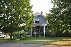 Woll House |
August 24, 1994 (#94000922) |
905 4th Ave., W. 48°11′20″N 114°18′55″W |
Kalispell | |
| 148 | Wurtz Homestead |  Wurtz Homestead |
June 19, 1996 (#96000661) |
North Fork Road, 2 miles (3.2 km) north of Ford in the Flathead National Forest 48°53′55″N 114°23′19″W |
Polebridge |
See also
Wikimedia Commons has media related to National Register of Historic Places in Flathead County, Montana.
References
- The latitude and longitude information provided in this table was derived originally from the National Register Information System, which has been found to be fairly accurate for about 99% of listings. Some locations in this table may have been corrected to current GPS standards.
- National Park Service, United States Department of the Interior, "National Register of Historic Places: Weekly List Actions", retrieved October 20, 2023.
- Numbers represent an alphabetical ordering by significant words. Various colorings, defined here, differentiate National Historic Landmarks and historic districts from other NRHP buildings, structures, sites or objects.
- The eight-digit number below each date is the number assigned to each location in the National Register Information System database, which can be viewed by clicking the number.
- McKay, Kathryn L. (2001). Kathryn L. McKay. Helena, Montana: Montana Historical Society Press. p. 25. ISBN 0-917298-70-5.
- "Conrad Mansion Museum". Conrad Mansion Museum. Archived from the original on 2011-09-07. Retrieved 2011-09-03.
- "Kalispell East Side - Contributing Properties". Montana History Wiki. Archived from the original on 2011-08-10. Retrieved 2011-09-02.
- Marker in front of Ferguson House, 8/1/2011
- "Frank Lloyd Wright". Steinerag.com. Retrieved 2017-09-17.
| Lists by county |
|  |
|---|---|---|
| Other lists |
| |
Municipalities and communities of Flathead County, Montana, United States | ||
|---|---|---|
| Cities | Flathead County map | |
| CDPs | ||
| Other communities | ||
| Indian reservation | ||
| Ghost town | ||
| Footnotes | ‡This populated place also has portions in an adjacent county or counties | |
This article is issued from Wikipedia. The text is licensed under Creative Commons - Attribution - Sharealike. Additional terms may apply for the media files.