National Register of Historic Places listings in King George County, Virginia
This is a list of the National Register of Historic Places listings in King George County, Virginia.

Location of King George County in Virginia
This is intended to be a complete list of the properties and districts on the National Register of Historic Places in King George County, Virginia, United States. The locations of National Register properties and districts for which the latitude and longitude coordinates are included below, may be seen in a Google map.[1]
There are 15 properties and districts listed on the National Register in the county. Another property was once listed but has been removed.
This National Park Service list is complete through NPS recent listings posted October 20, 2023.[2]
Current listings
| [3] | Name on the Register[4] | Image | Date listed[5] | Location | City or town | Description |
|---|---|---|---|---|---|---|
| 1 | Belle Grove | 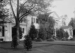 Belle Grove |
April 11, 1973 (#73002029) |
On U.S. Route 301 38°10′45″N 77°11′18″W |
Port Conway | Birthplace of President James Madison |
| 2 | Ralph Bunche High School | Ralph Bunche High School |
May 1, 2006 (#06000353) |
10139 U.S. Route 301 38°16′18″N 77°08′14″W |
King George | |
| 3 | Cleydael | 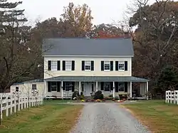 Cleydael |
December 18, 1986 (#86003495) |
Off State Route 206 38°18′47″N 77°08′01″W |
Weedonville | |
| 4 | Eagle's Nest | 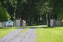 Eagle's Nest |
October 29, 1992 (#90002160) |
Eagles Nest Lane, north of its junction with State Route 218 38°19′38″N 77°12′04″W |
Ambar | |
| 5 | Emmanuel Church | 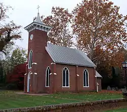 Emmanuel Church |
January 7, 1987 (#86003593) |
U.S. Route 301 38°10′46″N 77°11′09″W |
Port Conway | Built 1860 as the church for Belle Grove |
| 6 | Lamb's Creek Church | 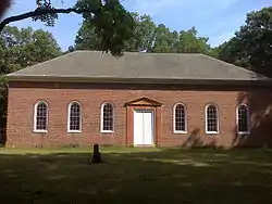 Lamb's Creek Church |
September 22, 1972 (#72001403) |
Lambs Creek Church Rd. 38°15′51″N 77°16′08″W |
Sealston | |
| 7 | Marmion | .jpg.webp) Marmion |
February 26, 1970 (#70000804) |
Northeast of the junction of Comorn Rd. and Marmion Ln. 38°18′32″N 77°12′44″W |
Comorn | |
| 8 | Millbank | 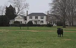 Millbank |
July 10, 2005 (#04000845) |
Millbank Rd., northwest of Port Conway[6] 38°11′25″N 77°12′00″W |
Port Conway | |
| 9 | Nanzatico | 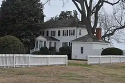 Nanzatico |
November 12, 1969 (#69000250) |
South of the junction of Welcome and Salem Church Rds. 38°10′18″N 77°07′30″W |
King George | |
| 10 | Office Hall | 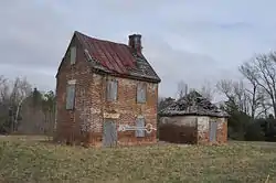 Office Hall |
January 24, 1991 (#90002164) |
Junction of U.S. Route 301 and State Route 3 38°14′21″N 77°08′58″W |
King George | |
| 11 | Powhatan Rural Historic District | 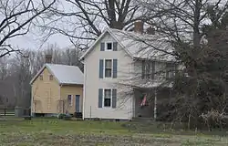 Powhatan Rural Historic District |
February 20, 1992 (#92000020) |
Junction of Powhatan and Port Conway Rds. 38°15′03″N 77°12′37″W |
King George | |
| 12 | Rokeby | 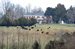 Rokeby |
January 20, 2005 (#04001544) |
5447 State Route 3 38°16′25″N 77°14′51″W |
King George | |
| 13 | St. Paul's Church | 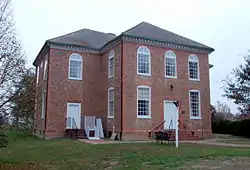 St. Paul's Church |
May 25, 1973 (#73002028) |
West of Owens off State Route 206 38°19′57″N 77°07′29″W |
Owens | |
| 14 | White Plains | 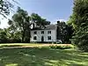 White Plains |
October 15, 2019 (#100003542) |
On U.S. Route 301. 38°12′06″N 77°09′58″W |
King George | |
| 15 | Woodlawn Historic and Archeological District | 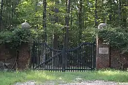 Woodlawn Historic and Archeological District |
January 3, 1991 (#90002012) |
Between Salem Church Rd. and the Rappahannock River, east of U.S. Route 301 38°10′42″N 77°09′51″W |
Port Conway |
Former listing
| [3] | Name on the Register | Image | Date listed | Date removed | Location | City or town | Description |
|---|---|---|---|---|---|---|---|
| 1 | Nanzattico Archeological Site | October 23, 2003 (#03001091) | November 10, 2003 | Address Restricted |
Index |
See also
Wikimedia Commons has media related to National Register of Historic Places in King George County, Virginia.
References
- The latitude and longitude information provided in this table was derived originally from the National Register Information System, which has been found to be fairly accurate for about 99% of listings. Some locations in this table may have been corrected to current GPS standards.
- National Park Service, United States Department of the Interior, "National Register of Historic Places: Weekly List Actions", retrieved October 20, 2023.
- Numbers represent an alphabetical ordering by significant words. Various colorings, defined here, differentiate National Historic Landmarks and historic districts from other NRHP buildings, structures, sites or objects.
- "National Register Information System". National Register of Historic Places. National Park Service. April 24, 2008.
- The eight-digit number below each date is the number assigned to each location in the National Register Information System database, which can be viewed by clicking the number.
- Location derived from its coordinates; the NRIS lists the site as "Address Restricted" but provides coordinates

Municipalities and communities of King George County, Virginia, United States | ||
|---|---|---|
| CDPs | Map of Virginia highlighting King George County | |
| Unincorporated communities | ||
This article is issued from Wikipedia. The text is licensed under Creative Commons - Attribution - Sharealike. Additional terms may apply for the media files.