National Register of Historic Places listings in Salt Lake County, Utah
This is a list of the National Register of Historic Places listings in Salt Lake County, Utah, except those in Salt Lake City. Listings for Salt Lake City can be found here.
This is intended to be a complete list of the properties and districts on the National Register of Historic Places in Salt Lake County, Utah, United States. Latitude and longitude coordinates are provided for many National Register properties and districts; these locations may be seen together in a map.[1]
There are more than 350 properties and districts listed on the National Register in the county, including six National Historic Landmarks. More than 200 of these sites, including four National Historic Landmarks, are located in Salt Lake City, and are listed separately; the 147 sites outside the city, including two National Historic Landmarks, are listed here. Six other sites in the county outside of Salt Lake City were once listed on the Register, but have been removed.
This National Park Service list is complete through NPS recent listings posted October 20, 2023.[2]
Current listings
| [3] | Name on the Register[4] | Image | Date listed[5] | Location | City or town | Description |
|---|---|---|---|---|---|---|
| 1 | J. R. Allen House |  J. R. Allen House |
August 28, 1980 (#80003912) |
1047 E. 13200 South 40°30′44″N 111°51′41″W |
Draper | |
| 2 | Allsop-Jensen House |  Allsop-Jensen House |
August 8, 1996 (#96000885) |
8829 S. 400 East 40°35′29″N 111°52′48″W |
Sandy | House and log barn behind |
| 3 | Dyre and Maria Amundsen House | April 6, 2015 (#15000131) |
307 E. Winchester St. 40°38′00″N 111°52′54″W |
Murray | ||
| 4 | Thomas and Beda Anderberg House | .jpg.webp) Thomas and Beda Anderberg House |
December 30, 2004 (#04001420) |
28 E. Pioneer Ave. (8530 South) 40°35′46″N 111°53′24″W |
Sandy | |
| 5 | Alfred C. and Annie L. Olsen Anderson House |  Alfred C. and Annie L. Olsen Anderson House |
December 9, 1999 (#99001556) |
8850 S. 60 East 40°35′27″N 111°53′17″W |
Sandy | |
| 6 | Charles M. and Fannie M. Allsop Anderson House | 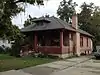 Charles M. and Fannie M. Allsop Anderson House |
December 9, 1999 (#99001558) |
498 E. Locust St. 40°35′24″N 111°52′43″W |
Sandy | |
| 7 | Frederick C. and Anna Anderson House | 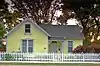 Frederick C. and Anna Anderson House |
July 9, 1997 (#97000641) |
8650 S. Center St. 40°35′38″N 111°53′06″W |
Sandy | |
| 8 | John A. Anderson House | 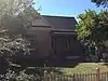 John A. Anderson House |
August 28, 1992 (#92001066) |
510 E. 8800 South 40°35′29″N 111°52′34″W |
Sandy | |
| 9 | Y. Martin and Hannah Nelson Anderson House | 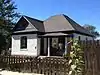 Y. Martin and Hannah Nelson Anderson House |
December 9, 1999 (#99001549) |
8832 S. 90 East 40°35′28″N 111°53′11″W |
Sandy | |
| 10 | Nathaniel Baldwin House | 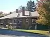 Nathaniel Baldwin House |
May 9, 1985 (#85000963) |
2374 E. Evergreen Ave. 40°41′47″N 111°49′20″W |
Millcreek | |
| 11 | Bateman Agriculture and Development Company | 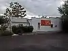 Bateman Agriculture and Development Company |
August 8, 1996 (#96000888) |
198 E. 8760 South 40°35′31″N 111°53′00″W |
Sandy | |
| 12 | Burtch W. Jr. and Susan Beall House | April 12, 2021 (#100006366) |
4644 South Brookwood Cir. 40°40′10″N 111°51′32″W |
Millcreek | ||
| 13 | Reid Beck House | 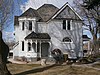 Reid Beck House |
January 27, 2012 (#11001067) |
12542 S. 900 East 40°31′22″N 111°52′01″W |
Draper | part of the Draper, Utah Multiple Property Submission |
| 14 | Beckstead-Butterfield House | 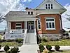 Beckstead-Butterfield House |
April 12, 2021 (#100006389) |
13032 South Redwood Rd. 40°30′51″N 111°56′19″W |
Riverton | |
| 15 | Amanda Conk Best House | 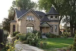 Amanda Conk Best House |
December 4, 2008 (#08001154) |
3622 S. 1100 East 40°41′33″N 111°51′36″W |
Millcreek | |
| 16 | Bingham Canyon Open Pit Copper Mine | 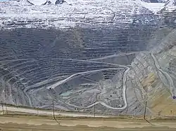 Bingham Canyon Open Pit Copper Mine |
November 13, 1966 (#66000736) |
16 miles (26 km) southwest of Salt Lake City on State Route 48 40°31′21″N 112°09′07″W |
Copperton | |
| 17 | Black Rock Site | .jpg.webp) Black Rock Site |
March 24, 2021 (#100006332) |
2.5 miles (4.0 km) west of jct. UT 202 and I 80 40°43′30″N 112°13′40″W |
Lake Point vicinity | Black Rock and the foundation ruins of Black Rock Resort. Extends into Tooele County. |
| 18 | Ernie and Irmgard Bourne House |  Ernie and Irmgard Bourne House |
June 28, 2016 (#16000418) |
3460 E. Ranch View Dr. 40°40′45″N 111°47′48″W |
Millcreek | |
| 19 | Rawsel and Jane Bradford House |  Rawsel and Jane Bradford House |
January 7, 2015 (#14001137) |
570 E. 4800 South 40°39′55″N 111°52′29″W |
Murray | |
| 20 | Brady-Brady House |  Brady-Brady House |
December 30, 2004 (#04001419) |
8395 S. 1000 East 40°35′56″N 111°51′42″W |
Sandy | |
| 21 | Brinton-Dahl House |  Brinton-Dahl House |
February 14, 1980 (#80003917) |
1501 E. Spring Lane 40°39′28″N 111°50′47″W |
Holladay | |
| 22 | David B. Brinton House |  David B. Brinton House |
May 22, 1978 (#78002665) |
1981 E. Murray–Holladay Road 40°39′58″N 111°50′03″W |
Holladay | |
| 23 | Harold W. and Evelyn Burton House |  Harold W. and Evelyn Burton House |
August 7, 2017 (#100001440) |
2195 E. Walker Ln. 40°39′10″N 111°49′46″W |
Holladay | |
| 24 | Butler School Teachers Dormitory | March 15, 2023 (#100008743) |
2680 East Fort Union Blvd. 40°37′26″N 111°48′59″W |
Cottonwood Heights | ||
| 25 | Butler-Wallin House | June 10, 2005 (#05000593) |
1045 E. 4500 South 40°40′29″N 111°51′38″W |
Millcreek | ||
| 26 | John P. Cahoon House | 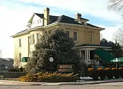 John P. Cahoon House |
March 3, 1983 (#83003186) |
4872 S. Poplar St. 40°39′56″N 111°53′22″W |
Murray | |
| 27 | Santa Anna Casto House | 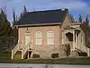 Santa Anna Casto House |
February 3, 1983 (#83004422) |
Approximately 4555 S. Holladay Blvd. 40°40′18″N 111°49′39″W |
Holladay | Originally located at 2731 E. Casto Ln., moved in 2002 to 2210 E. Murray-Holladay Rd., moved again on Oct 20, 2012 |
| 28 | Morton A. Cheesman House | July 23, 1982 (#82004137) |
2320 E. Walker Ln. 40°38′56″N 111°49′19″W |
Holladay | ||
| 29 | William Christopherson House | .jpg.webp) William Christopherson House |
December 9, 1999 (#99001554) |
8847 S. 360 East 40°35′27″N 111°52′46″W |
Sandy | |
| 30 | Copperton Community Methodist Church | 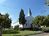 Copperton Community Methodist Church |
February 21, 2007 (#07000080) |
410 E. Hillcrest St. 40°33′45″N 112°05′46″W |
Copperton | |
| 31 | Copperton Historic District | 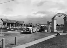 Copperton Historic District |
August 14, 1986 (#86002642) |
Roughly bounded by State Route 48, 5 East, Hillcrest, and 2 West Sts. 40°33′56″N 112°05′55″W |
Copperton | |
| 32 | Crescent Elementary School | 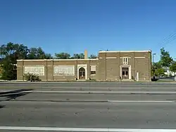 Crescent Elementary School |
November 22, 2000 (#00001303) |
11020 S. State St. 40°33′05″N 111°53′27″W |
Sandy | |
| 33 | Crossgrove House | 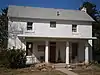 Crossgrove House |
January 27, 2012 (#11001068) |
12736 S. Boulter St. 40°31′14″N 111°50′57″W |
Draper | part of the Draper, Utah Multiple Property Submission |
| 34 | Arthur and Ellen Cushing House |  Arthur and Ellen Cushing House |
November 6, 2000 (#00001304) |
123 E. Pioneer Ave. (8530 South) 40°35′48″N 111°53′09″W |
Sandy | |
| 35 | Ernest and Sadie Cushing House | .jpg.webp) Ernest and Sadie Cushing House |
August 8, 1996 (#96000887) |
60 E. Pioneer Ave. (8530 South) 40°35′46″N 111°53′19″W |
Sandy | |
| 36 | James and Maria Long Cushing House | 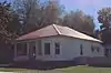 James and Maria Long Cushing House |
December 9, 1999 (#99001546) |
68 E. Pioneer Ave. (8530 South) 40°35′46″N 111°53′18″W |
Sandy | |
| 37 | Emma Olive Dobbs House | 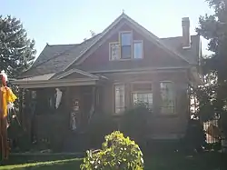 Emma Olive Dobbs House |
August 8, 1996 (#96000889) |
578 E. Locust St. 40°35′31″N 111°52′25″W |
Sandy | |
| 38 | Hannah Nash Dowding House | 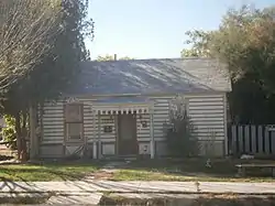 Hannah Nash Dowding House |
November 6, 2000 (#00001305) |
8830 S. 60 East 40°35′28″N 111°53′20″W |
Sandy | A hall-parlor plan cottage |
| 39 | Dowding-Rasmussen House | .jpg.webp) Dowding-Rasmussen House |
November 6, 2000 (#00001306) |
98 E. Main St. (8720 South) 40°35′35″N 111°53′20″W |
Sandy | |
| 40 | Draper Park School | Draper Park School |
May 7, 1980 (#80003913) |
12441 S. 900 East 40°31′29″N 111°51′53″W |
Draper | |
| 41 | Draper Poultrymen and Egg Producers' Plant | 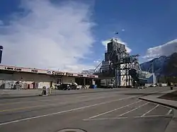 Draper Poultrymen and Egg Producers' Plant |
May 6, 2004 (#04000403) |
1071 E. Pioneer Rd. (12400 South) 40°31′33″N 111°51′42″W |
Draper | |
| 42 | Draper-Steadman House | 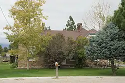 Draper-Steadman House |
August 21, 1992 (#92001057) |
13518 S. 1700 West 40°30′19″N 111°56′18″W |
Riverton | |
| 43 | Emigration Canyon | 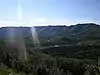 Emigration Canyon |
October 15, 1966 (#66000737) |
Eastern edge of Salt Lake City on former State Route 65 40°45′03″N 111°49′04″W |
Emigration Canyon | |
| 44 | Empress Theatre | 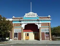 Empress Theatre |
May 9, 1985 (#85000962) |
9104 W. 2700 South (Main Street) 40°42′40″N 112°06′27″W |
Magna | |
| 45 | Evergreen Avenue Historic District |  Evergreen Avenue Historic District |
February 14, 2007 (#07000081) |
Roughly bounded by Evergreen Ave., 2300 East, 3300 South, and 2700 East 40°41′55″N 111°49′10″W |
Millcreek | |
| 46 | Benjamin and Jane Cook Farrer House | 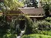 Benjamin and Jane Cook Farrer House |
August 28, 1992 (#92001065) |
530 E. 8800 South 40°35′29″N 111°52′32″W |
Sandy | |
| 47 | John William Farrer House | 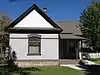 John William Farrer House |
August 28, 1992 (#92001064) |
39 E. Pioneer Ave. (8530 South) 40°35′47″N 111°53′19″W |
Sandy | |
| 48 | Fish-Baughman House | June 28, 2016 (#16000420) |
3436 E. Ranch View Dr. 40°40′45″N 111°47′50″W |
Millcreek | ||
| 49 | Fitzgerald House | 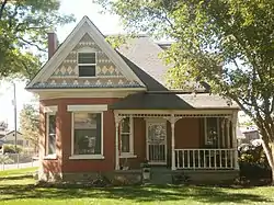 Fitzgerald House |
January 5, 2017 (#16000679) |
12934 S. Fort St. 40°30′59″N 111°51′55″W |
Draper | |
| 50 | Perry and Agnes Wadsworth Fitzgerald House and Cabin | 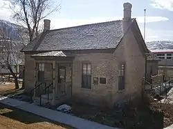 Perry and Agnes Wadsworth Fitzgerald House and Cabin |
May 6, 2004 (#04000404) |
1160 E. Pioneer Rd. (12400 South) 40°31′30″N 111°51′22″W |
Draper | A boundary decrease was approved July 10, 2023. |
| 51 | Gardner Mill |  Gardner Mill |
September 29, 1982 (#82004153) |
1050 W. 7800 South 40°36′33″N 111°55′21″W |
West Jordan | |
| 52 | Archibald R. and Violet Clark Gardner House |  Archibald R. and Violet Clark Gardner House |
July 9, 1997 (#97000642) |
31 E. Pioneer Ave. (8530 South) 40°35′48″N 111°53′16″W |
Sandy | |
| 53 | Robert Gardner Jr. House | January 18, 2018 (#100001441) |
1475 E. Murphy's Ln. 40°41′35″N 111°50′57″W |
Millcreek | Oldest standing structure in Utah? What does the interpretative display at site say? | |
| 54 | Garside-McMullin House | December 17, 1982 (#82004852) |
10481 S. 1300 West 40°33′38″N 111°55′48″W |
South Jordan | 1898 Queen Anne style house | |
| 55 | John and Jennette Gerrard House | October 17, 2022 (#100008273) |
1488 West 4800 South 40°39′51″N 111°56′00″W |
Taylorsville | ||
| 56 | Granite Hydroelectric Power Plant Historic District | 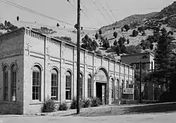 Granite Hydroelectric Power Plant Historic District |
April 20, 1989 (#89000283) |
State Route 190 (previously State Route 152) 40°37′09″N 111°46′53″W |
Cottonwood Heights | |
| 57 | Granite LDS Ward Chapel-Avard Fairbanks Studio | 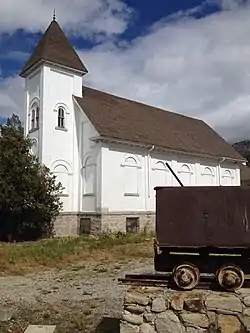 Granite LDS Ward Chapel-Avard Fairbanks Studio |
December 30, 2005 (#05000364) |
9800 S. 3100 East 40°34′25″N 111°48′16″W |
Sandy | |
| 58 | Granite Paper Mill | 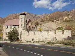 Granite Paper Mill |
April 16, 1971 (#71000848) |
6900 S. Big Cottonwood Canyon Rd. 40°37′37″N 111°47′57″W |
Cottonwood Heights | |
| 59 | Riley H. and Sarah Ann Russell Graves House |  Riley H. and Sarah Ann Russell Graves House |
December 9, 1999 (#99001559) |
8585 S. 100 East 40°35′44″N 111°52′56″W |
Sandy | |
| 60 | Alvin and Annie Green House | April 6, 2000 (#00000356) |
8400 Danish Rd. 40°35′55″N 111°48′04″W |
Cottonwood Heights | ||
| 61 | Orlando H. and Emma H. Hardcastle House | December 9, 1999 (#99001560) |
8751 S. 40 East 40°35′33″N 111°53′22″W |
Sandy | One-story cross-wing frame house, built c.1893 | |
| 62 | Hawarden |  Hawarden |
February 14, 1980 (#80003924) |
4396 S. 3200 West 40°40′30″N 111°58′05″W |
West Valley City | |
| 63 | Anders Hintze House |  Anders Hintze House |
February 1, 1983 (#83004424) |
4249 S. 2300 East 40°40′48″N 111°49′25″W |
Holladay | |
| 64 | Edward and Irene Hobbs House | July 23, 2018 (#100002702) |
487 E Vine St. 40°39′36″N 111°52′40″W |
Murray | ||
| 65 | Abba R. Holman Block | Abba R. Holman Block |
August 28, 1992 (#92001063) |
142 E. Main St. (8720 South) 40°35′34″N 111°53′06″W |
Sandy | |
| 66 | Samuel and Geneva Holt Farmstead | September 7, 2001 (#01000963) |
10317 S. 1300 West 40°33′50″N 111°55′34″W |
South Jordan | ||
| 67 | Alfred and Hennie Huetter House | September 30, 2019 (#100004477) |
187 E. 5600 South 40°38′57″N 111°53′10″W |
Murray | ||
| 68 | Iris Theater, Apartments and Commercial Building |  Iris Theater, Apartments and Commercial Building |
September 7, 2001 (#01000959) |
4861 S. State St. 40°39′58″N 111°53′13″W |
Murray | |
| 69 | Hyrum and Selma Erickson Jacobson House |  Hyrum and Selma Erickson Jacobson House |
December 9, 1999 (#99001550) |
8908 S. 220 East 40°35′24″N 111°53′00″W |
Sandy | |
| 70 | Amos and Ida Jensen House |  Amos and Ida Jensen House |
November 6, 2000 (#00001307) |
387 E. 8800 South 40°35′31″N 111°52′43″W |
Sandy | |
| 71 | James B. and Ellen May Cushing Jensen House |  James B. and Ellen May Cushing Jensen House |
July 9, 1997 (#97000635) |
95 E. Pioneer Ave. (8530 South) 40°35′48″N 111°53′10″W |
Sandy | |
| 72 | Joseph F. and Isabelle Jensen House |  Joseph F. and Isabelle Jensen House |
June 11, 1998 (#98000640) |
428 E. 8800 South 40°35′31″N 111°52′44″W |
Sandy | |
| 73 | Michael Jensen House |  Michael Jensen House |
December 9, 1999 (#99001557) |
565 E. 8800 South 40°35′30″N 111°52′32″W |
Sandy | |
| 74 | Jensen-Clark House | November 6, 2000 (#00001298) |
32 E. Main St. (8720 South) 40°35′35″N 111°53′22″W |
Sandy | ||
| 75 | Jensen-Jensen House |  Jensen-Jensen House |
November 6, 2000 (#00001299) |
55 E. Pioneer Ave. (8530 South) 40°35′48″N 111°53′19″W |
Sandy | |
| 76 | David and Hattie S. Rasmuson Johnson House |  David and Hattie S. Rasmuson Johnson House |
December 9, 1999 (#99001553) |
8649 S. 90 East 40°35′39″N 111°53′11″W |
Sandy | |
| 77 | John A. and Annie C. Olsen Johnson House | 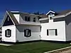 John A. and Annie C. Olsen Johnson House |
December 9, 1999 (#99001547) |
21 E. Pioneer Ave. (8530 South) 40°35′48″N 111°53′20″W |
Sandy | |
| 78 | Jordan School District Administration Building | April 1, 1985 (#85000810) |
9361 S. 400 East 40°34′54″N 111°52′49″W |
Sandy | PWA Moderne-style building, built in 1935 as a Public Works Administration project. May have been demolished. | |
| 79 | Kearns-St. Ann's Orphanage | 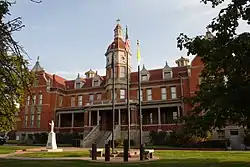 Kearns-St. Ann's Orphanage |
October 3, 1980 (#80003925) |
430 E. 2100 South 40°43′30″N 111°52′41″W |
South Salt Lake | |
| 80 | William D. Kuhre House | July 6, 1987 (#87001175) |
8586 S. 150 East 40°35′44″N 111°53′07″W |
Sandy | ||
| 81 | Little Dell Station | 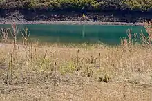 Little Dell Station |
August 12, 1971 (#71000850) |
East of Salt Lake City in Mountain Dell Canyon, near the junction of State Route 65 and the road to Emigration Canyon (see Utah State Route 239 (1947-1969)) 40°46′40″N 111°41′09″W |
Wasatch-Cache National Forest | |
| 82 | William and Annie Livingston House | October 16, 2002 (#02001182) |
2491 E. Valley View Ave. 40°39′51″N 111°49′07″W |
Holladay | ||
| 83 | Albert and Celestine Mabey House | August 27, 2013 (#13000641) |
10201 S. 1300 West 40°33′58″N 111°55′43″W |
South Jordan | Part of the South Jordan, Utah MPS | |
| 84 | Magna Commercial Downtown Historic District | January 4, 2021 (#100006004) |
Along West Main St. 40°42′40″N 112°05′43″W |
Magna | ||
| 85 | Magna Community Baptist Church | 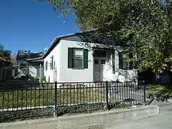 Magna Community Baptist Church |
June 5, 1986 (#86001233) |
2916 S. 8900 West 40°42′26″N 112°06′13″W |
Magna | |
| 86 | Anne P. Marriott House | .jpg.webp) Anne P. Marriott House |
November 6, 2000 (#00001300) |
8543 S. 100 East 40°35′46″N 111°53′14″W |
Sandy | |
| 87 | John and Mary Mattson House | 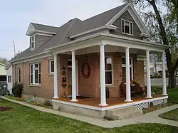 John and Mary Mattson House |
August 8, 1996 (#96000886) |
239 E. Main St. (8720 South) 40°35′36″N 111°52′56″W |
Sandy | |
| 88 | David McDonald House | 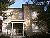 David McDonald House |
May 29, 1980 (#80003927) |
4659 S. Highland Dr. 40°40′10″N 111°50′20″W |
Holladay | |
| 89 | William McLachlan Farmhouse | February 14, 1980 (#80003928) |
4499 S. 3200 West 40°40′23″N 111°57′58″W |
West Valley City | ||
| 90 | Benjamin and Olivia Meek House | 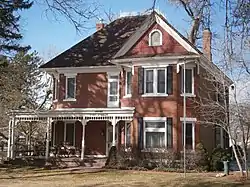 Benjamin and Olivia Meek House |
November 29, 2001 (#01001282) |
12782 S. Fort St. 40°31′09″N 111°51′52″W |
Draper | |
| 91 | Joseph E. and Mina W. Mickelsen House | 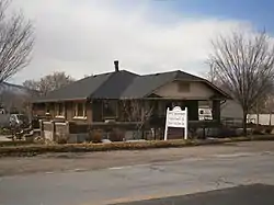 Joseph E. and Mina W. Mickelsen House |
May 6, 2004 (#04000405) |
782 E. Pioneer Rd. (12400 South) 40°31′30″N 111°52′09″W |
Draper | |
| 92 | S.J. Mickelsen Hardware Store and Lumber Yard | 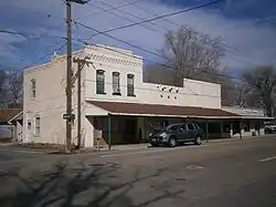 S.J. Mickelsen Hardware Store and Lumber Yard |
May 6, 2004 (#04000406) |
12580-12582 S. Fort St. 40°31′22″N 111°51′51″W |
Draper | |
| 93 | Hyrum and Mary A. Terry Peterson Mickelson House | 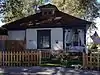 Hyrum and Mary A. Terry Peterson Mickelson House |
December 9, 1999 (#99001551) |
8850 S. 120 East 40°35′26″N 111°53′09″W |
Sandy | |
| 94 | Midvale City Hall | 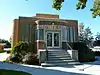 Midvale City Hall |
April 7, 1994 (#94000293) |
695 W. Center St. 40°36′37″N 111°54′33″W |
Midvale | Now the Midvale Community Building, used as an auditorium |
| 95 | Mountain Dell Dam | 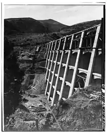 Mountain Dell Dam |
June 20, 1980 (#80003930) |
East of Salt Lake City on Interstate 80 40°45′06″N 111°43′12″W |
Wasatch-Cache National Forest | A multiple arch with buttress dam of reinforced concrete in Parley's Canyon constructed between 1914 and 1925 |
| 96 | Mountair Canyon Historic District | August 2, 2023 (#100009201) |
East Mt. Aire Rd., South Mt. Aire Rd., and Maple Fork Way 40°43′41″N 111°43′02″W |
Millcreek vicinity | ||
| 97 | James A. and Janet Muir House | October 22, 2018 (#100003042) |
2940 E Mount Jordan Rd. 40°34′16″N 111°48′30″W |
Sandy | ||
| 98 | Murray City Diesel Power Plant | 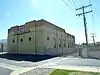 Murray City Diesel Power Plant |
January 7, 2015 (#14001139) |
157 W. 4800 South 40°40′03″N 111°53′43″W |
Murray | |
| 99 | Murray Downtown Historic District |  Murray Downtown Historic District |
September 26, 2006 (#06000928) |
Roughly bounded by 4800 South, Poplar St., Vine St., and Center St.; also roughly bounded by 4600 South, Meadowview Rd., 4800 South, Brown St. 40°40′04″N 111°53′18″W |
Murray | Second set of boundaries represent a boundary increase approved November 5, 2020 |
| 100 | Murray Downtown Residential Historic District | January 26, 2005 (#04001566) |
Roughly bounded by 4800 South, Clark St., Vine St., and Center St. 40°39′53″N 111°52′59″W |
Murray | ||
| 101 | Murray Hillside Historic District | October 15, 2014 (#14000863) |
Roughly bounded by 5300 South, Kenwood Dr., 5600 South & 235 East 40°39′10″N 111°52′54″W |
Murray | ||
| 102 | Murray LDS Second Ward Meetinghouse | 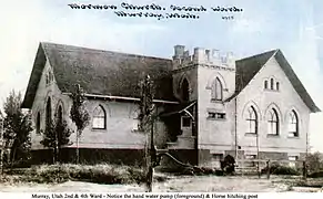 Murray LDS Second Ward Meetinghouse |
May 8, 2001 (#01000475) |
5056 S. Commerce Dr. (300 West) 40°39′43″N 111°53′55″W |
Murray | |
| 103 | Murray Theater | 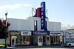 Murray Theater |
May 8, 2001 (#01000476) |
4961 S. State St. 40°39′50″N 111°53′17″W |
Murray | |
| 104 | August M. and Mabel Jensen Nelson House | 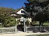 August M. and Mabel Jensen Nelson House |
July 9, 1997 (#97000643) |
427 E. 8800 South 40°35′31″N 111°52′39″W |
Sandy | |
| 105 | Nels A. Nelson House | August 28, 1992 (#92001062) |
8840 S. 90 East 40°35′26″N 111°53′10″W |
Sandy | ||
| 106 | Nielsen-Sanderson House | 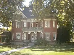 Nielsen-Sanderson House |
October 22, 2018 (#100003043) |
12758 S Fort St. 40°31′11″N 111°51′53″W |
Draper | |
| 107 | Oakwood | November 16, 1979 (#79002503) |
2610 E. Evergreen Ave. 40°41′47″N 111°48′57″W |
Millcreek | ||
| 108 | John and Elizabeth Brown Oldham House | 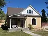 John and Elizabeth Brown Oldham House |
July 9, 1997 (#97000636) |
511 E. 8800 South 40°35′31″N 111°52′32″W |
Sandy | |
| 109 | Orton-Malstrom House | 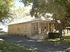 Orton-Malstrom House |
July 9, 1997 (#97000640) |
9325 S. 700 East 40°34′55″N 111°52′15″W |
Sandy | |
| 110 | John Thomas and Myrtle Bodell Ostler House | December 9, 1999 (#99001552) |
589 E. 8800 South 40°35′31″N 111°52′31″W |
Sandy | ||
| 111 | Parade of Homes Lakewood Site Historic District | April 11, 2022 (#100007561) |
East Lone Peak and South Fairoaks Drs. 40°39′06″N 111°50′39″W |
Holladay | ||
| 112 | Mary Ellen Parmley House | 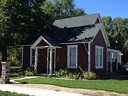 Mary Ellen Parmley House |
November 6, 2000 (#00001301) |
8850 S. 220 East 40°35′29″N 111°53′40″W |
Sandy | |
| 113 | Charles Peterson House | 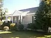 Charles Peterson House |
August 28, 1992 (#92001061) |
82 E. 8880 South 40°35′30″N 111°53′13″W |
Sandy | |
| 114 | Peter and Ingrid C. Larson Pierson House | December 9, 1999 (#99001548) |
31 E. 8680 South 40°35′38″N 111°53′19″W |
Sandy | ||
| 115 | Edward Pugh House | 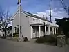 Edward Pugh House |
August 31, 1978 (#78002680) |
1299 E. 4500 South 40°40′28″N 111°51′13″W |
Millcreek | |
| 116 | Riverton Elementary School | 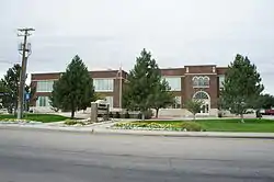 Riverton Elementary School |
August 8, 1996 (#96000872) |
12830 S. Redwood Rd. 40°31′06″N 111°56′22″W |
Riverton | Now houses the Riverton City Office |
| 117 | Riverton Historic District | January 21, 2004 (#03001484) |
Roughly 12300 S. Redwood Rd. to 12600 S. Redwood Rd. 40°31′39″N 111°56′17″W |
Riverton | ||
| 118 | Ross Hame | July 23, 2018 (#100002703) |
4769 S Holladay Blvd. 40°39′58″N 111°49′18″W |
Holladay | ||
| 119 | Matthew and Johanna Rowan House | September 30, 2019 (#100004478) |
198 W. Winchester St. 40°37′58″N 111°53′48″W |
Murray | ||
| 120 | Salt Lake County Library | 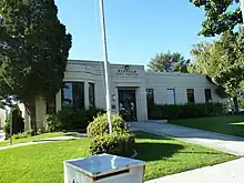 Salt Lake County Library |
July 26, 1982 (#82004129) |
665 W. Center St. 40°36′37″N 111°54′28″W |
Midvale | Now the Midvale city hall |
| 121 | Sandy City Bank | 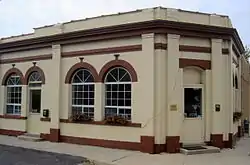 Sandy City Bank |
July 9, 1997 (#97000637) |
212 E. Main St. (8720 South) 40°35′33″N 111°52′55″W |
Sandy | |
| 122 | Sandy Co-Op Block | 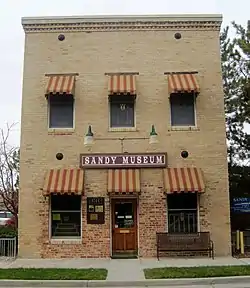 Sandy Co-Op Block |
August 28, 1992 (#92001060) |
8744 S. Center St. (150 East) 40°35′33″N 111°53′05″W |
Sandy | |
| 123 | Sandy Historic District | .jpg.webp) Sandy Historic District |
April 20, 2007 (#07000084) |
Roughly bounded by State St., 9000 South, 700 East, and Pioneer Ave. (8530 South) 40°35′34″N 111°52′51″W |
Sandy | |
| 124 | Sandy LDS Stake Recreational Hall |  Sandy LDS Stake Recreational Hall |
November 6, 2000 (#00001316) |
295 E. 8800 South 40°35′32″N 111°52′51″W |
Sandy | |
| 125 | Sandy Second Ward Chapel | 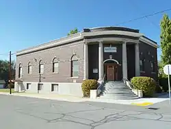 Sandy Second Ward Chapel |
July 9, 1997 (#97000638) |
8630 S. 60 East 40°35′41″N 111°53′20″W |
Sandy | |
| 126 | Sandy Tithing Office | 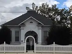 Sandy Tithing Office |
January 25, 1985 (#85000279) |
8845 S. 280 East 40°35′27″N 111°52′53″W |
Sandy | |
| 127 | Joseph M. and Celestia Smith House | 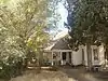 Joseph M. and Celestia Smith House |
April 7, 1994 (#94000291) |
12373 S. Relation St. (1565 East) 40°31′31″N 111°50′46″W |
Draper | |
| 128 | Lauritz H. and Emma Smith House | 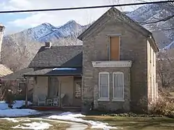 Lauritz H. and Emma Smith House |
February 1, 2006 (#05001633) |
12423 S. Relation St. 40°31′32″N 111°50′48″W |
Draper | |
| 129 | Lauritz Smith House | 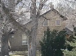 Lauritz Smith House |
June 24, 1983 (#83003179) |
1350 E. Pioneer Rd. (12400 South) 40°31′29″N 111°51′02″W |
Draper | |
| 130 | Mary Smith House | 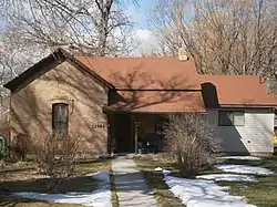 Mary Smith House |
April 15, 1994 (#94000292) |
12544 S. Relation St. (1565 East) 40°31′24″N 111°50′49″W |
Draper | |
| 131 | Ray F. and Ethel Smith House | 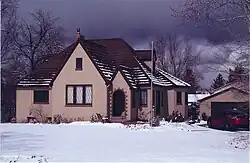 Ray F. and Ethel Smith House |
September 30, 2019 (#100004479) |
1697 E. Vine St. 40°38′29″N 111°50′34″W |
Murray | |
| 132 | Spencer Homestead Site | October 17, 2022 (#100008270) |
2591 East Dimple Dell Rd. 40°33′22″N 111°49′03″W |
Sandy | ||
| 133 | Stairs Station Hydroelectric Power Plant Historic District | 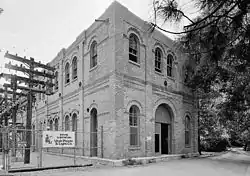 Stairs Station Hydroelectric Power Plant Historic District |
April 20, 1989 (#89000284) |
State Route 190 (former State Route 152) 40°37′31″N 111°44′39″W |
Big Cottonwood Canyon | |
| 134 | Roberta Sugden House | March 22, 2016 (#16000124) |
1810 E. Orchard Dr. 40°41′25″N 111°50′24″W |
Millcreek | ||
| 135 | Thomas & Margaret Taylor House | September 9, 2020 (#100005545) |
604 East Taylor Ln. 40°39′07″N 111°52′27″W |
Murray | ||
| 136 | Taylorsville LDS Ward Meetinghouse | March 24, 2022 (#100007527) |
1247 West 4800 South 40°39′50″N 111°55′39″W |
Taylorsville | ||
| 137 | Niels and Mary Ann Fitzgerald Thompson House | 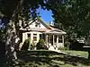 Niels and Mary Ann Fitzgerald Thompson House |
July 9, 1997 (#97000639) |
485 E. 8800 South 40°35′31″N 111°52′36″W |
Sandy | |
| 138 | Utah Copper Company Mine Superintendent's House | October 31, 1985 (#85003422) |
104 E. State Highway 40°33′56″N 112°05′53″W |
Copperton | ||
| 139 | Louis E. and Florence Jensen Van Dam House |  Louis E. and Florence Jensen Van Dam House |
December 9, 1999 (#99001555) |
407 E. 8800 South 40°35′31″N 111°52′43″W |
Sandy | |
| 140 | William Tyler and Amorilla Gammet Vincent House |  William Tyler and Amorilla Gammet Vincent House |
July 9, 1997 (#97000644) |
92 E. Pioneer Ave. (8530 South) 40°35′45″N 111°53′11″W |
Sandy | |
| 141 | Glen M. and Roxie Walbeck House |  Glen M. and Roxie Walbeck House |
February 1, 2006 (#05001630) |
12875 S. Boulter St. 40°31′04″N 111°50′55″W |
Draper | |
| 142 | Wesley and Frances Walton House | August 4, 1995 (#95000983) |
5197 S. Wesley Rd. 40°39′24″N 111°51′26″W |
Murray | ||
| 143 | Warenski-Duvall Commercial Building and Apartments |  Warenski-Duvall Commercial Building and Apartments |
May 19, 2000 (#00000521) |
4867 S. State St. 40°39′57″N 111°53′12″W |
Murray | |
| 144 | Wasatch Mountain Club Lodge | November 10, 1980 (#80003935) |
Southeast of Salt Lake City 40°35′46″N 111°35′05″W |
Brighton | Log cabin built 1929-30 | |
| 145 | West Jordan Ward Meetinghouse | 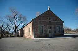 West Jordan Ward Meetinghouse |
April 14, 1995 (#95000415) |
1140 W. 7800 South 40°36′28″N 111°55′27″W |
West Jordan | |
| 146 | Henry J. Wheeler Farm | 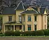 Henry J. Wheeler Farm |
May 4, 1976 (#76001832) |
6343 S. 900 East 40°38′03″N 111°51′42″W |
Murray | |
| 147 | William W. and Christene Wilson House | December 30, 2004 (#04001421) |
113 E. 8680 South 40°35′45″N 111°53′16″W |
Sandy |
Former listings
| [3] | Name on the Register | Image | Date listed | Date removed | Location | City or town | Description |
|---|---|---|---|---|---|---|---|
| 1 | Bonnyview Elementary School | May 8, 2001 (#01000473) | February 21, 2007 | 4984 S. 300 West |
Murray | ||
| 2 | George Henry Dansie Farmstead | September 27, 1979 (#79002498) | February 21, 2007 | 12494 S. 1700 West |
Riverton | ||
| 3 | Erickson Artillo Dairy Farmhouse | September 29, 2015 (#15000677) | March 26, 2018 | 5419 S. 900 E. 40°39′14″N 111°51′53″W |
Murray | ||
| 4 | Jordan High School | Jordan High School |
May 17, 1984 (#84002203) | May 15, 2001 | 9351 S. State St. |
Sandy | Demolished in 1997.[6] |
| 5 | Utah-Idaho Sugar Factory | February 13, 2009 (#09000018) | June 15, 2015 | 2140 W. Sugar Factory Rd. 40°36′07″N 111°56′45″W |
West Jordan | Demolished in January 2011 | |
| 6 | Webster School | December 28, 2000 (#00001585) | April 28, 2005 | 2700 S. 9180 West |
Magna | Destroyed by fire on June 22, 2004.[7] |
See also
References
- The latitude and longitude information provided in this table was derived originally from the National Register Information System, which has been found to be fairly accurate for about 99% of listings. Some locations in this table may have been corrected to current GPS standards.
- National Park Service, United States Department of the Interior, "National Register of Historic Places: Weekly List Actions", retrieved October 20, 2023.
- Numbers represent an alphabetical ordering by significant words. Various colorings, defined here, differentiate National Historic Landmarks and historic districts from other NRHP buildings, structures, sites or objects.
- "National Register Information System". National Register of Historic Places. National Park Service. April 24, 2008.
- The eight-digit number below each date is the number assigned to each location in the National Register Information System database, which can be viewed by clicking the number.
- "Jazz owner buys old Jordan High". The Park Record. January 8, 1997. p. A7. Retrieved August 31, 2022 – via Newspapers.com.
- "Webster". The Magna Times. July 1, 2004. p. 4. Retrieved August 31, 2022 – via Newspapers.com.
External links
![]() Media related to National Register of Historic Places in Salt Lake County, Utah at Wikimedia Commons
Media related to National Register of Historic Places in Salt Lake County, Utah at Wikimedia Commons
 | |||
| Topics | |
|---|---|
| Lists by state |
|
| Lists by insular areas | |
| Lists by associated state | |
| Other areas | |
| Related | |
Municipalities and communities of Salt Lake County, Utah, United States | ||
|---|---|---|
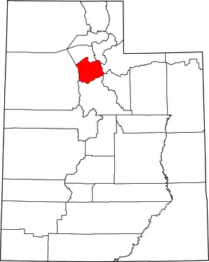
| Cities | Map of Utah highlighting Salt Lake County | |
| Towns | ||
| Metro townships | ||
| CDPs | ||
| Unincorporated communities | ||
| Ghost towns | ||
| Footnotes | ‡This populated place also has portions in an adjacent county or counties | |