National Register of Historic Places listings in Tunica County, Mississippi
This is a list of the National Register of Historic Places listings in Tunica County, Mississippi.
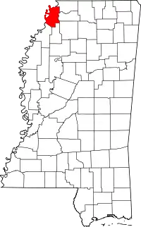
Location of Tunica County in Mississippi
This is intended to be a complete list of the properties and districts on the National Register of Historic Places in Tunica County, Mississippi, United States. Latitude and longitude coordinates are provided for many National Register properties and districts; these locations may be seen together in a map.[1]
There are 8 properties and districts listed on the National Register in the county.
This National Park Service list is complete through NPS recent listings posted October 20, 2023.[2]
Current listings
| [3] | Name on the Register | Image | Date listed[4] | Location | City or town | Description |
|---|---|---|---|---|---|---|
| 1 | Beaverdam Site | August 31, 1978 (#78001631) |
Southeastern quarter of the southeastern quarter of Section 19, Township 5 South, Range 11 West[5] 34°37′43″N 90°23′38″W |
Evansville | ||
| 2 | Canon Site (22-Tu-523) | January 7, 1987 (#86003635) |
Southeastern quarter of the southeastern quarter of Section 17, Township 6 South, Range 10 West[5] 34°33′27″N 90°16′15″W |
Crenshaw | ||
| 3 | Dundee Site (22TU501) | January 7, 1987 (#86003655) |
Northwestern quarter of the northwestern quarter of Section 34, Township 6 South, Range 12 West[5] 34°31′24″N 90°27′40″W |
Dundee | ||
| 4 | Evansville Mounds (22TU502) | January 7, 1987 (#86003632) |
Northwestern quarter of the northwestern quarter of Section 20, Township 5 South, Range 11 West[5] 34°38′18″N 90°23′33″W |
Evansville | ||
| 5 | Hollywood Site | May 19, 1972 (#72000701) |
Southeastern quarter of the southwestern quarter of Section 33, Township 3 South, Range 11 West[5] 34°46′39″N 90°22′14″W |
Tunica | ||
| 6 | Johnson Cemetery Site (22TU516) | January 7, 1987 (#86003633) |
Northwestern quarter of the northeastern quarter of Section 16, Township 4 South, Range 11 West[5] 34°43′51″N 90°21′57″W |
Hollywood | ||
| 7 | Owens Site (22TU512) | January 7, 1987 (#86003657) |
Northwestern quarter of the southeastern quarter of Section 25, Township 5 South, Range 12 West[5] 34°37′02″N 90°25′01″W |
Evansville | ||
| 8 | Tunica Historic District |  Tunica Historic District |
March 17, 2006 (#06000194) |
Roughly bounded by Kestevan Alley, Mockingbird St., Cummins Ave., and the Tunica School 34°41′12″N 90°22′28″W |
Tunica |
See also
Wikimedia Commons has media related to National Register of Historic Places in Tunica County, Mississippi.
References
- The latitude and longitude information provided in this table was derived originally from the National Register Information System, which has been found to be fairly accurate for about 99% of listings. Some locations in this table may have been corrected to current GPS standards.
- National Park Service, United States Department of the Interior, "National Register of Historic Places: Weekly List Actions", retrieved October 20, 2023.
- Numbers represent an alphabetical ordering by significant words. Various colorings, defined here, differentiate National Historic Landmarks and historic districts from other NRHP buildings, structures, sites or objects.
- The eight-digit number below each date is the number assigned to each location in the National Register Information System database, which can be viewed by clicking the number.
- Phillips, Philip, et al. Archaeological Survey in the Lower Mississippi Alluvial Valley 1940-1947. Reprint ed. Tuscaloosa: U of Alabama P, 2003.
Municipalities and communities of Tunica County, Mississippi, United States | ||
|---|---|---|
| Town | Map of Mississippi highlighting Tunica County | |
| CDPs | ||
| Other communities | ||
| Ghost towns | ||
| Topics | |
|---|---|
| Lists by state |
|
| Lists by insular areas | |
| Lists by associated state | |
| Other areas | |
| Related | |
This article is issued from Wikipedia. The text is licensed under Creative Commons - Attribution - Sharealike. Additional terms may apply for the media files.