Nnywane Dam
The Nnywane Dam is a dam on the Nnywane River in Botswana. The reservoir provides a water supply to Lobatse, a town 70 kilometres (43 mi) south of Gaborone.[1] Water from the reservoir may also be transferred to Gaborone if needed.[2]
| Nnywane Dam | |
|---|---|
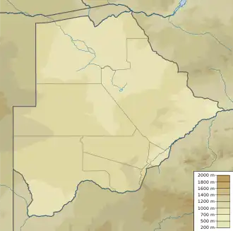
 Location of Nnywane Dam in Botswana | |
| Country | Botswana |
| Location | South-East District |
| Coordinates | 25.115399°S 25.689567°E |
| Purpose | Urban water supply |
| Opening date | 1970 |
| Reservoir | |
| Total capacity | 2,300,000 cubic metres (81,000,000 cu ft) |
| Catchment area | 238 square kilometres (92 sq mi) |
| Surface area | 1.65 square kilometres (0.64 sq mi) |
Construction
Nnywane Dam is the smallest of the reservoirs managed by the Water Utilities Corporation.[3] The dam was built in 1970 with an earthcore fill structure. It has a catchment area of 238 square kilometres (92 sq mi). The surface area of the reservoir is 1.65 square kilometres (0.64 sq mi).[4] The reservoir has a capacity of 2,300,000 cubic metres (81,000,000 cu ft).[5] It is fed by the ephemeral Nnywane River, which runs only in the rainy season.[6] Below the dam the Nnywane flows into the Ngotwane River, which flows into Ngotwane Dam in South Africa. The Ngotwane then forms the border between Botswana and South Africa before flowing into the Gaborone Dam.[7]
Supply fluctuations
Due to the hot, dry climate, about 2.3% of the stored water in Nnywane Dam is lost through evaporation in a typical year.[8] Rainfall is unreliable. The 1978–79 rainy season was the start of a dry spell. The reservoir was depleted in 1982 and the public water supply forced to shift to pumping groundwater.[9] Between 1998 and 2008 the percentage of the reservoir's capacity that was filled ranged from 39.1% in 2003 to 100% in 2006.[10] In June 2012, during an exceptionally dry winter, the dam fell to 52% capacity fill.[11]
References
Citations
- Mwakikagile 2009, p. 65.
- Prommer 2001, p. 11.
- Department of Environmental Affairs 2006, p. 27.
- Water Utilities Corporation 2010.
- Central Statistics Office 2009, p. 3.
- De Vrces & Gieske 1990, p. 84.
- Ngwanaamotho 2011.
- Department of Environmental Affairs 2006, p. 26.
- De Vrces & Gieske 1990, p. 86.
- Central Statistics Office 2009, p. 4.
- Morewagae 2012.
Sources
- Central Statistics Office (October 2009). "BOTSWANA WATER STATISTICS" (PDF). Archived from the original on 7 July 2010. Retrieved 18 September 2012.
{{cite web}}: CS1 maint: unfit URL (link) - Department of Environmental Affairs (July 2006). "Water accounts of Botswana (1992-2003)" (PDF). Retrieved 19 September 2012.
- De Vrces, J. J.; Gieske, A. (1990). "A simple chloride balance routing method to regionalize groundwater recharge: a case study in semiarid Botswana" (PDF). Regionalization in Hydrology (Proceedings of the Ljubljana Symposium, April 1990). IAHS. Retrieved 18 September 2012.
- Morewagae, Isiah (12 June 2012). "Severe water shortage looms". Mmegi Online. Retrieved 18 September 2012.
- Mwakikagile, Godfrey (31 October 2009). Botswana Since Independence. Godfrey Mwakikagile. ISBN 978-0-9802587-8-3. Retrieved 18 September 2012.
- Ngwanaamotho, Maranyane (20 January 2011). "Floods cause chaos". Mmegi Online. Retrieved 19 September 2012.
- Prommer, Isolde (March 2001). "Botswana, Mozambique, Namibia: Modeling Population and Sustainable Development Challenges in the Era of HIV/AIDS" (PDF). International Institute for Applied Systems Analysis. Retrieved 19 September 2012.
- Water Utilities Corporation (2010). "Dam Parameters". Retrieved 19 September 2012.