North Danville Historic District
North Danville Historic District is a national historic district located at Danville, Virginia. The district includes 426 contributing buildings in a primarily residential area of Danville. The district also includes three blocks of primarily two-story, brick commercial buildings. Buildings within the district were constructed from about 1880 to about 1955 and reflect a wide variety of architectural styles including vernacular Victorian, Italianate, Queen Ann, Colonial Revival, Tudor Revival, and Bungalow designs. Many of these buildings were built by Dan River Cotton Mills founder T.B. Fitzgerald. Notable buildings include the Calvary United Methodist Church (1886), Shelton Memorial Presbyterian Church (1889), Bellevue Public School (1898), Washington Street Methodist Episcopal Church (1910), Keen Street Baptist Church (1927), and Woodrow Wilson High School (1926).[3]
North Danville Historic District | |
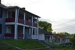 Houses on Walker Street | |
  | |
| Location | Roughly bounded by N. Main, Worsham, Claiborne, Keister, and W. James Sts. in Danville, Virginia |
|---|---|
| Coordinates | 36°35′51″N 79°23′05″W |
| Area | 142.8 acres (57.8 ha) |
| Architectural style | Late Victorian, Late 19th And 20th Century Revivals |
| NRHP reference No. | 03001432[1] |
| VLR No. | 108-0113 |
| Significant dates | |
| Added to NRHP | January 15, 2004 |
| Designated VLR | January 15, 2004[2] |
It was listed on the National Register of Historic Places in 2004.[1]
- North Danville Contributing Buildings
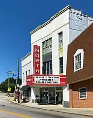 North Danville 1947 Movie Theater in an 1880s building that had a grocery store on the first floor and a Masonic Lodge on the third floor.
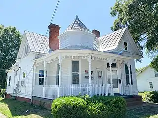 Danville North two story 1895 frame home built with other identical homes. It has a two-story full-width porch and dual entrances.
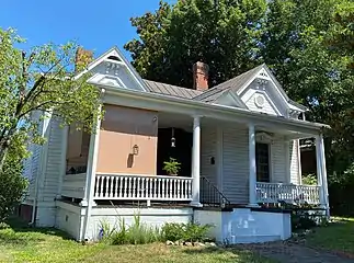 Danville North Queen Ann style home built in a gabled ell form during the late eighteen hundreds. It has original weatherboard siding. The veranda has spindle balusters and the window hoods have brackets.
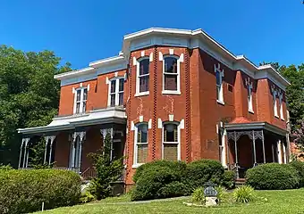 North Danville Italianate style Home. This two-story brick dwelling has an original veranda, two-story bay, arched windows with keystones, and rectangular wood panels at the cornice.
References
- "National Register Information System". National Register of Historic Places. National Park Service. July 9, 2010.
- "Virginia Landmarks Register". Virginia Department of Historic Resources. Retrieved June 5, 2013.
- Teresa Douglass; Peggy Nickell; Phil Thomason (June 2003). "National Register of Historic Places Inventory/Nomination: North Danville Historic District" (PDF). Virginia Department of Historic Resources. and Accompanying four photos and Accompanying map Archived 2013-10-21 at the Wayback Machine

