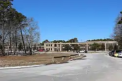
North Eastham, Massachusetts
North Eastham is a census-designated place (CDP) in the town of Eastham in Barnstable County, Massachusetts, United States. The population was 1,806 at the 2010 census.[2]
North Eastham, Massachusetts | |
|---|---|
 Location in Barnstable County and the state of Massachusetts. | |
| Coordinates: 41°51′5″N 70°00′00″W | |
| Country | United States |
| State | Massachusetts |
| County | Barnstable |
| Town | Eastham |
| Area | |
| • Total | 11.95 sq mi (30.96 km2) |
| • Land | 3.44 sq mi (8.92 km2) |
| • Water | 8.51 sq mi (22.04 km2) |
| Elevation | 39 ft (12 m) |
| Population (2020) | |
| • Total | 2,296 |
| • Density | 666.86/sq mi (257.50/km2) |
| Time zone | UTC-5 (Eastern (EST)) |
| • Summer (DST) | UTC-4 (EDT) |
| ZIP code | 02651 |
| Area code | 508 |
| FIPS code | 25-47590 |
| GNIS feature ID | 0616892 |
The main visitor center of the Cape Cod National Seashore is located in North Eastham.
Geography
North Eastham is located within the northwestern part of the Town of Eastham at 41°51′05″N 70°00′00″W (41.851349, −69.999928).[3] It is bordered to the west by Cape Cod Bay, to the north by the town of Wellfleet, to the east by U.S. Route 6 and Great Pond Road, and to the south by Great Pond, Herring Brook Road, and Samoset Road.
According to the United States Census Bureau, the CDP has a total area of 11.9 square miles (30.9 km2). 3.4 square miles (8.9 km2) of it is land, and 8.5 square miles (22.0 km2) of it (71.24%) is water.[2]
Demographics
| Census | Pop. | Note | %± |
|---|---|---|---|
| 2020 | 2,296 | — | |
| U.S. Decennial Census[4] | |||
At the 2000 census there were 1,915 people, 881 households, and 570 families in the CDP. The population density was 217.5/km2 (562.4/mi2). There were 2,656 housing units at an average density of 301.6/km2 (780.1/mi2). The racial makeup of the CDP was 98.12% White, 0.26% African American, 0.16% Native American, 0.42% Asian, 0.05% Pacific Islander, 0.05% from other races, and 0.94% from two or more races. Hispanic or Latino of any race were 0.84%.[5]
Education
Nauset Public Schools serves the community.
Nauset Regional High School is the area high school.
See also
References
- "2020 U.S. Gazetteer Files". United States Census Bureau. Retrieved May 21, 2022.
- "Geographic Identifiers: 2010 Demographic Profile Data (G001): North Eastham CDP, Massachusetts". U.S. Census Bureau, American Factfinder. Archived from the original on February 12, 2020. Retrieved December 10, 2013.
- "US Gazetteer files: 2010, 2000, and 1990". United States Census Bureau. February 12, 2011. Retrieved April 23, 2011.
- "Census of Population and Housing". Census.gov. Retrieved June 4, 2016.
- "U.S. Census website". United States Census Bureau. Retrieved January 31, 2008.

