Nuozhadu
Nuozhadu (simplified Chinese: 糯扎渡镇; traditional Chinese: 糯扎渡鎮; pinyin: Nuòzhādù Zhèn) is a town in Lancang Lahu Autonomous County, Yunnan, China. As of the 2017 census it had a population of 30,419 and an area of 937-square-kilometre (362 sq mi).
Nuozhadu Town
糯扎渡镇 | |
|---|---|
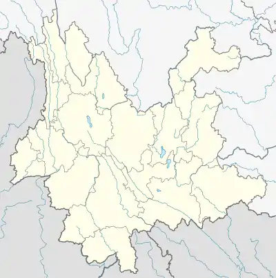
 Nuozhadu Town Location in Yunnan. | |
| Coordinates: 22°34′47″N 100°32′07″E | |
| Country | People's Republic of China |
| Province | Yunnan |
| Prefecture-level city | Pu'er City |
| Autonomous county | Lancang Lahu Autonomous County |
| Incorporated (township) | 1940 |
| Designated (town) | 2006 |
| Area | |
| • Total | 937 km2 (362 sq mi) |
| Elevation | 1,120 m (3,670 ft) |
| Population (2017) | |
| • Total | 30,419 |
| • Density | 32/km2 (84/sq mi) |
| Time zone | UTC+08:00 (China Standard) |
| Postal code | 665614 |
| Area code | 0879 |
Administrative division
As of 2016, the town is divided into ten villages:
- Yaofangba (窑房坝村)
- Yakou (雅口村)
- Nanxian (南现村)
- Huangbahe (荒坝河村)
- Mengkuang (勐矿村)
- Xiangshuihe (响水河村)
- Biandanshan (扁担山村)
- Longshan (龙山村)
- Luoshuidong (落水洞村)
- Qianmai (谦迈村)
History
In the Qing dynasty (1644–1911), it came under the jurisdiction of Dayakou Tusi (大雅口土司).
In 1940, it belonged to the 3rd District. That same year, the 3rd District was revoked and it belonged to Xinya Township (新雅乡).
In 1949, it came under the jurisdiction of Ningjiang County (宁江县). In 1953, Ningjiang County was revoked and Yakou District (雅口区) was set up. In 1969 it was renamed "Xianfeng Commune" (先锋公社) and then "Yakou Commune" (雅口公社) in 1971. In 1988, Yakou Township (雅口乡) was incorporated. In 1998, China and the Netherlands have set up "Nuozhadu Provincial Nature Reserve" in the region to protect wild animal.[1] In January 2006, the villages of Longshan (竜山村), Qianmai (谦迈村) and Luoshuidong (落水洞村) were merged into Nuozhadu and it was upgraded to a town.
Geography
The town is situated at eastern Lancang Lahu Autonomous County. It borders Nanling Township and Qianliu Yi Ethnic Township in the north, Simaogang Town in the east, Fazhanhe Hani Ethnic Township and Menghai County in the south, and Menglang Town in the west.[1]
The town experiences a subtropical mountain monsoon climate, with an average annual temperature of 38 °C (100 °F), total annual rainfall of 1,500-to-2,000-millimetre (59 to 79 in), a frost-free period of 326 days, and annual average sunshine hours in 2100 hours.
There are nine rivers and streams in the town, such as the Black River (黑河), Qianmai River (谦迈河), Nanting River (南汀河), and Xiangshui River (响水河).[1]
Economy
The economy of the town has a predominantly agricultural orientation, including farming and pig-breeding. Economic crops are mainly peanut, sugarcane, natural rubber, Lanxangia tsaoko, and sweet potato.[1]
Demographics
| Year | Pop. | ±% |
|---|---|---|
| 2004 | 20,829 | — |
| 2017 | 30,419 | +46.0% |
| Source: [1] | ||
As of 2017, the National Bureau of Statistics of China estimates the town's population now to be 30,419.
| Ethnic groups in 2004[1] | ||
|---|---|---|
| Ethnicity | Population | Percentage |
| Hani | 2662 | 12.8% |
| Lahu | 7098 | 34.1% |
| Han | 4974 | 23.9% |
| Wa | 426 | 2.0% |
| Yi | 4530 | 21.7% |
| Dai | 551 | 2.6% |
| Blang | 541 | 2.6% |
| Other | 47 | 0.2% |
Tourist attractions
Mengkuang Cliff Carvings of the Yuan dynasty (1271–1368) (勐矿元代摩崖) is a provincial cultural relic preservation organ.[2] And Yakou Government Site (雅口新政权遗址) is a county level cultural relic preservation organ.[2]
Transportation
The National Highway G214 passes across the town east to west.
References
- Shi Chunyun 2007, p. 53.
- Shi Chunyun 2007, p. 54.
Bibliography
- Shi Chunyun, ed. (2007). "Administrative divisions" 行政区划. 《澜沧拉祜族自治县概况》 [General Situation of Lancang Lahu Autonomous County] (in Chinese). Beijing: Nationalities Publishing House. ISBN 978-7-105-08556-9.