Odenthal
Odenthal is a municipality in the Rheinisch-Bergischer Kreis, in North Rhine-Westphalia, Germany.
Odenthal | |
|---|---|
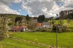 View of Odenthal-Selbach | |
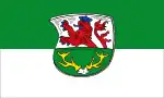 Flag  Coat of arms | |
Location of Odenthal within Rheinisch-Bergischer Kreis district 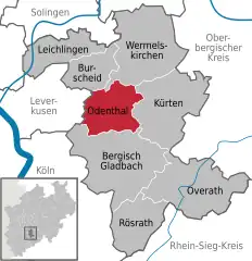 | |
 Odenthal 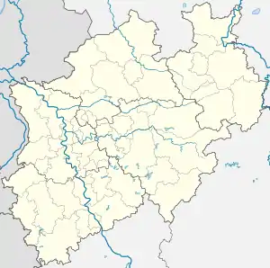 Odenthal | |
| Coordinates: 51°2′N 7°7′E | |
| Country | Germany |
| State | North Rhine-Westphalia |
| Admin. region | Köln |
| District | Rheinisch-Bergischer Kreis |
| Subdivisions | 32 |
| Government | |
| • Mayor (2020–25) | Robert Lennerts[1] (Ind.) |
| Area | |
| • Total | 39.97 km2 (15.43 sq mi) |
| Elevation | 149 m (489 ft) |
| Population (2021-12-31)[2] | |
| • Total | 15,063 |
| • Density | 380/km2 (980/sq mi) |
| Time zone | UTC+01:00 (CET) |
| • Summer (DST) | UTC+02:00 (CEST) |
| Postal codes | 51519 |
| Dialling codes | 02202, 02207, 02174 |
| Vehicle registration | GL |
| Website | www.odenthal.de |
Geography
Odenthal is situated approximately 5 km north of Bergisch Gladbach and 15 km north-east of Cologne.
Neighbouring places
Nearby cities are Leverkusen, Burscheid, Wermelskirchen, and Bergisch Gladbach. Neighboring municipalities include Kürten.

Division of the town
The municipality includes 32 districts (Ortsteile):
Altehufe - Altenberg - Blecher - Busch - Bülsberg - Bömberg - Bömerich - Eikamp - Erberich - Feld - Glöbusch - Grimberg - Großgrimberg - Hahnenberg - Holz - Höffe - Hüttchen - Klasmühle - Küchenberg - Kümps - Landwehr - Menrath - Neschen - Oberscheid - Osenau - Pistershausen - Schallemich - Scheuren - Schmeisig - Schwarzbroich - Selbach - Voiswinkel.
Twin towns
 Cernay la Ville (France), since 1996
 Paimio (Finland), since 2011
References
- Wahlergebnisse in NRW Kommunalwahlen 2020, Land Nordrhein-Westfalen, accessed 29 June 2021.
- "Bevölkerung der Gemeinden Nordrhein-Westfalens am 31. Dezember 2021" (in German). Landesbetrieb Information und Technik NRW. Retrieved 20 June 2022.
External links
- Official website (in German)
Cities and municipalities in Rheinisch-Bergischer Kreis | ||
|---|---|---|
Coat of arms of Rheinisch-Bergischer Kreis district | ||
This article is issued from Wikipedia. The text is licensed under Creative Commons - Attribution - Sharealike. Additional terms may apply for the media files.