Oerle
Oerle is a village in the Dutch province of North Brabant. It is located in the municipality of Veldhoven, about 7 km west of Eindhoven.
Oerle | |
|---|---|
Village | |
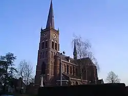 St John, the Baptist Church | |
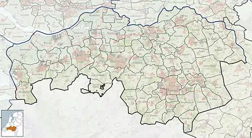 Oerle Location in the province of North Brabant in the Netherlands  Oerle Oerle (Netherlands) | |
| Coordinates: 51°25′20″N 5°22′14″E | |
| Country | Netherlands |
| Province | North Brabant |
| Municipality | Veldhoven |
| Area | |
| • Total | 2.07 km2 (0.80 sq mi) |
| Elevation | 23 m (75 ft) |
| Population (2021)[1] | |
| • Total | 2,940 |
| • Density | 1,400/km2 (3,700/sq mi) |
| Time zone | UTC+1 (CET) |
| • Summer (DST) | UTC+2 (CEST) |
| Postal code | 5507[1] |
| Dialing code | 040 |
The village was first mentioned in 1249 Oerle, and is a combination of "open forest" and "sand".[3]
Oerle was home to 152 people in 1840.[4] Oerle was a separate municipality until 1921, when it became part of Veldhoven.[5]
The grist mill Sint Jan is reasonably new wind mill. It was constructed in 1987 from parts of demolished wind mills. The grain which is milled is sold by the miller.[6] In the early 21st century, the village started to grow, and it is planned to grow to about 4,000 people.[4]
Gallery
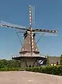 Oerle, windmill: korenmolen Sint Jan
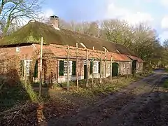 Farm in Oerle
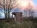 Derelict little tower
References
- "Kerncijfers wijken en buurten 2021". Central Bureau of Statistics. Retrieved 18 April 2022.
- "Postcodetool for 5507KB". Actueel Hoogtebestand Nederland (in Dutch). Het Waterschapshuis. Retrieved 18 April 2022.
- "Oerle - (geografische naam)". Etymologiebank (in Dutch). Retrieved 18 April 2022.
- "Oerle". Plaatsengids (in Dutch). Retrieved 18 April 2022.
- Ad van der Meer and Onno Boonstra, Repertorium van Nederlandse gemeenten, KNAW, 2011.
- "Sint Jan". Molen database (in Dutch). Retrieved 18 April 2022.
This article is issued from Wikipedia. The text is licensed under Creative Commons - Attribution - Sharealike. Additional terms may apply for the media files.