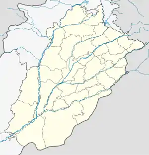
Okara, Pakistan
Okara (Punjabi, Urdu: اوکاڑہ), is the capital city of Okara District in the Punjab province of Pakistan.[4] The name Okara is derived from Okaan, which is the name of a type of tree.[2][5] It is the 23rd largest city of Pakistan by population.[6] The city is located southwest of the city of Lahore and Faisalabad is 100 km bypassing away Ravi River. It is known for its agriculture-based economy and cotton mills. The nearest major city to Okara is Sahiwal, which was formerly known as Montgomery. Kasur is also located in the east of the city. Pakistan military dairy farms, known for their cheese, are situated in Okara. Pul Dhool near Abdulla Sugar Mill is a town in the Okara district. Pul Dhool is on Hujra Chunian road. From Hujra Shah Muqeem 9KM and from Chunian 17KM.These farms were established before the creation of Pakistan in 1947.
Okara
اوکاڑہ | |
|---|---|
  The shrine of Khoo Pak, Company Bagh | |
 Okara  Okara | |
| Coordinates: 30°48′33″N 73°27′13″E | |
| Country | |
| Province | |
| Division | Sahiwal |
| District | Okara |
| Government | |
| • Deputy Commissioner | Doctor Zeeshan Hanif[1] |
| Area | |
| • Metro | 4,377 km2 (1,690 sq mi) |
| Elevation | 105 m (344 ft) |
| Population | |
| • City | 357,935 |
| • Rank | 25th, Pakistan |
| Time zone | UTC+5 (PST) |
| Postal code | 56300 |
| Area code | 044 |
| Highways | |
| Number of Union councils | 10 |
| Website | okara |
Climate
The climate of Okara is usually warm and dry. The coldest months are December to February, when temperatures may drop to 3 °C (37 °F), with moderate rainfall. The hottest months are May to July, when temperatures may reach 45 °C (113 °F). The annual average rainfall in the city is approximately 548 millimetres (21.6 in).[2]
History
Okara is a relatively new agricultural city; during the period of British rule there was a forest of Okaan where the city has been rebuilt, and from this, the name of the city was derived.[2] During British rule, the area was part of Montgomery District and contained a large saltpeter refinery.[7] There are many textile mills in Okara. The predominantly Muslim population supported the Muslim League and the Pakistan Movement. After the independence of Pakistan in 1947, the Muslim refugees settled in the Okara District. In 1982, the city became the headquarters of the newly created Okara District. Okara has had a railway line since 1892.
Okara is known for its cattle breed known as Sahiwal and a water buffalo breed known as Niliravi. It is very rich in livestock population and production. Livestock Production Research Institute Bahadar Nagar Farm is a very large government farm near Okara. The farm has many cows, buffalo, bulls (for reproduction), goats, and sheep.
Administration
The city of Okara serves as district and tehsil capital and is itself administratively subdivided into ten Union councils.[4]
Politics
Political leaders
- NA-147 Mian Manzoor Ahmad Wattoo
- NA-142 Chaudhry Riaz-ul-Haq[8]
- PP-188 Mian Yawar Zaman[9]
- PP-189 Muneeb-ul-Haq[10]
- NA-143 Ch Nadeem Abbas Raber
References
- "Punjab CM appoints juniors as DCs in 22 districts". Pakistan Observer (newspaper). 6 January 2022. Retrieved 8 January 2022.
- Okara on Punjab Portal, Government of Punjab website Archived 2022-09-26 at the Wayback Machine Retrieved 11 April 2021
- City population of Okara listed Retrieved 11 April 2021
- "Tehsils & Unions in the District of Okara". Government of Pakistan website. 27 November 2011. Archived from the original on 9 February 2012. Retrieved 11 April 2021.
- (Ikram Junaidi) Okara farms dispute nearing 'amicable solution' Dawn (newspaper), Published 14 February 2017, Retrieved 11 April 2021
- "Pakistan City & Town Population List". Tageo.com website. Retrieved 11 April 2021.
- Punjab - Imperial Gazetteer of India, v. 20, p. 312.
- "National Assembly of Pakistan".
- "Punjab Assembly | Members - Members' Directory".
- Profile of Muneeb-ul-Haq on Provincial Assembly Of The Punjab website Retrieved 11 April 2021